The best cycling routes around Storekrækkja
4.9
(25)
342
riders
1
ride
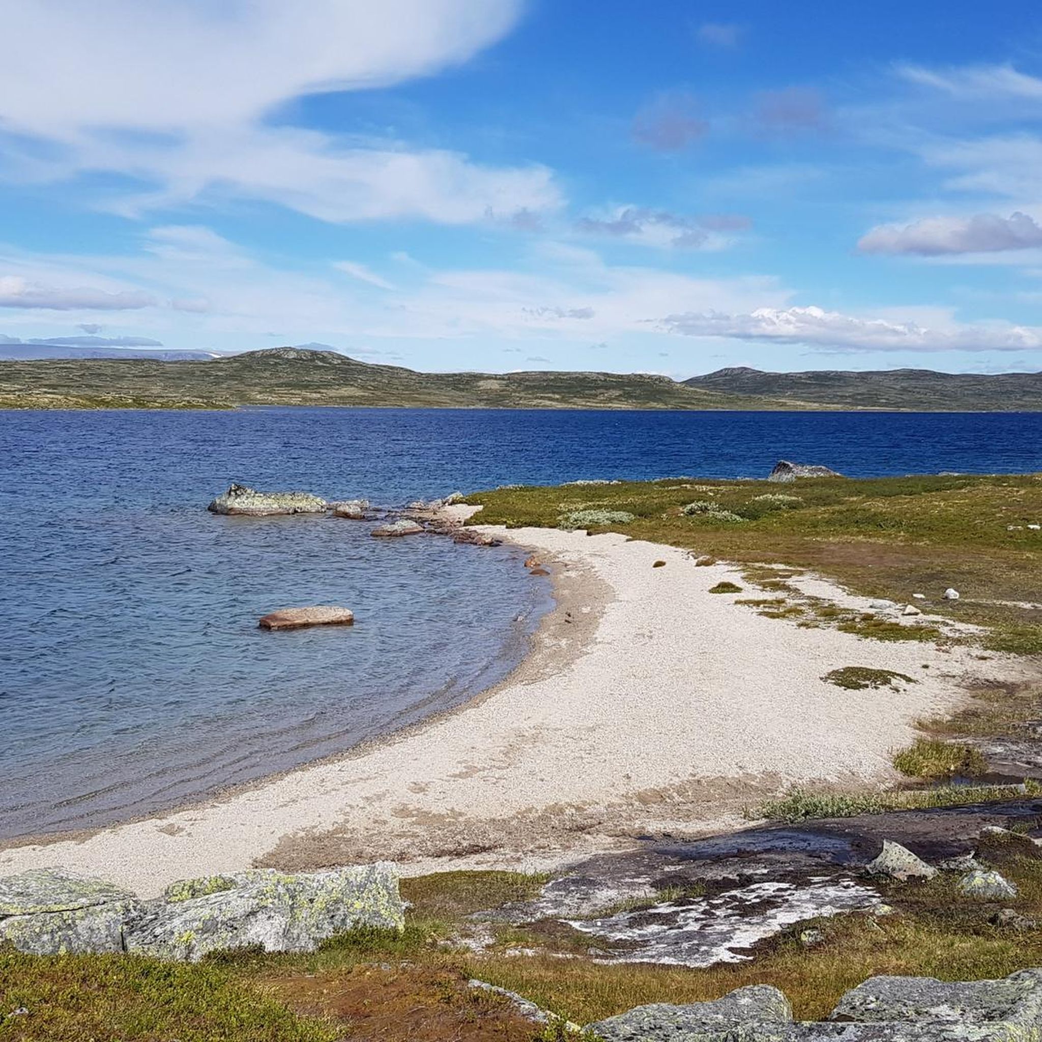
Touring cycling around Storekrækkja, situated within Hardangervidda National Park, offers routes across a vast mountain plateau characterized by open fells and numerous bodies of water. While the immediate area around Storekrækkja Lake features terrain that can be rocky and wet, the broader Hardangervidda region provides excellent touring cycling opportunities with gently rolling landscapes. The region's visual palette often includes a dull greenish beige landscape with light gray hills and rocks.
Best touring cycling routes around Storekrækkja
- The most popular touring…
Last updated: July 1, 2026
5.0
(5)
211
riders
81.9km
06:26
790m
1,770m
Hard bike ride. Very good fitness required. Mostly paved surfaces. Suitable for all skill levels.
5.0
(4)
59
riders
Hard bike ride. Very good fitness required. Mostly paved surfaces. Suitable for all skill levels.

Sign up for free
4.8
(13)
56
riders
33.7km
02:12
250m
250m
Moderate bike ride. Good fitness required. Mostly paved surfaces. Suitable for all skill levels.
5.0
(3)
16
riders
111km
06:52
1,100m
1,100m
Hard bike ride. Very good fitness required. Mostly paved surfaces. Suitable for all skill levels.
Our route recommendations are based on thousands of hikes, rides, and runs completed by other people on komoot.
Start today with a free account
Your next adventure awaits.
Login or Signup
Popular around Storekrækkja

Other adventures around Storekrækkja

Tips from the Community

The gravel track along Nedsta Storurevatnet is one of the most scenic stretches of the route. It hugs the shoreline closely, with shimmering water on one side and steep mountainsides on the other. The surface is generally good, though it can be loose and stony in places.
1
0

Peace, space, beautiful view
1
0

Very beautiful elevated road, but quite busy.
0
0

Small church with an adjacent cemetery. Easily accessible from the fjord.
0
0

Standing on the bridge, you can hear the sound of the river rushing beneath you. A beautiful spot in the magnificent natural surroundings.
0
0

typical Norwegian chapel with "god's acre"
2
0

Finse is a remote mountain village in Norway, situated at an elevation of 1,222 meters (4,009 feet) above sea level. Known for its stunning glacial surroundings, it’s a popular destination for hikers and nature enthusiasts. The village is a stop along the scenic Bergen Line railway, offering access to pristine wilderness and remarkable high-altitude landscapes.
1
0
Rallarvegen, or the Navvies’ Road, is a historic and scenic cycling route in Norway. Originally built for the construction of the Bergen Line railway, it now offers a picturesque journey through diverse landscapes, including mountains, valleys, and waterfalls. The route spans from Haugastøl to Flåm, providing cyclists with a unique and immersive experience of Norway’s natural beauty and railroad history.
1
1
Frequently Asked Questions
What is the typical terrain and difficulty for touring cycling around Storekrækkja?
The broader Hardangervidda region, which encompasses Storekrækkja, offers excellent touring cycling opportunities with gently rolling landscapes. While the immediate area around Storekrækkja Lake can feature rocky and wet terrain more suited for hiking, the designated cycling routes often combine paved roads, gravel sections, and natural terrain. Routes range from moderate to difficult, with options like Rallarvegen: Haugastøl to Flåm being classified as difficult due to its length and elevation changes.
When is the best time of year to go touring cycling in the Storekrækkja region?
The best time for touring cycling in the Hardangervidda region is typically from early to mid-June until the first snowfall in late autumn. Many mountain roads and cycling routes are subject to seasonal closures due to snow outside of this period. It's important to be prepared for unpredictable weather conditions, even in summer, as the plateau can experience rapid changes.
Are there family-friendly touring cycling routes available near Storekrækkja?
While the guide highlights more challenging routes, the Hardangervidda region generally offers diverse cycling experiences. For family-friendly options, look for routes with gentler gradients and shorter distances. It's advisable to check specific route details for elevation and surface type to ensure suitability for all family members. The Rallarvegen Riverside Path – Hardanger Glacier loop from Haugastøl is a moderate option that might be suitable for families with some cycling experience.
Can I bring my dog on touring cycling routes in the Storekrækkja area?
Hardangervidda National Park is home to the world's largest wild reindeer herds, and visitors are encouraged to follow guidelines to respect wildlife. While specific rules for dogs on cycling routes vary, it's generally recommended to keep dogs on a leash, especially in national park areas, to protect wildlife and ensure a safe experience for everyone. Always check local regulations for the specific route you plan to take.
Are there any specific rules or regulations for cycling in Hardangervidda National Park?
Yes, as part of Hardangervidda National Park, there are rules to protect the natural environment and wildlife. These include staying on marked trails, maintaining distance from wild reindeer, and being prepared for unpredictable weather. Some sections, like the Måbødalen valley, are closed to cyclists due to tunnels, requiring bus transfers. Always respect signage and local guidelines. For more detailed information on cycling in the broader Hardangervidda area, you can visit Visit Rjukan's cycling guide.
Where can I rent a touring bike near Storekrækkja or in the Hardangervidda region?
Bike rentals are available in key access points to the Hardangervidda plateau, such as Haugastøl, which is a popular starting point for routes like the Rallarvegen. While specific rental options directly at Storekrækkja might be limited, nearby mountain huts like Fagerheim Fjellstugu and Krækkja serve as full-service lodges and can be good places to inquire about local services or transport options to rental locations.
What kind of natural features and landmarks can I expect to see along the touring cycling routes?
Touring cycling routes in the Storekrækkja region traverse the vast Hardangervidda plateau, characterized by open fells, numerous small and large bodies of water, and a 'dull greenish beige' landscape with 'splashes of light gray color' from hills and rocks. You'll encounter scenic picnic spots, fishing lakes, and potentially cultural heritage sites like ancient hunting pits. Routes like Rallarvegen Riverside Path – Path by the Lake Near Finse loop from Haugastøl offer scenic riverside sections and lake views, while the Rallarvegen Riverside Path – Hardanger Glacier loop from Haugastøl provides views towards the Hardanger Glacier.
Are there any circular touring cycling routes in the Storekrækkja area?
Yes, the Hardangervidda region offers loop options for touring cyclists. For instance, the Rallarvegen Riverside Path – Path by the Lake Near Finse loop from Haugastøl is a difficult 89.8 km loop that features scenic riverside sections and views of lakes. Another loop option is the Rallarvegen Riverside Path – Hardanger Glacier loop from Haugastøl, a moderate 33.7 km trail.
What do other touring cyclists enjoy the most about touring cycling in Storekrækkja?
The touring cycling routes in Storekrækkja are highly rated by the komoot community, with an average score of 4.9 stars from over 25 reviews. Cyclists often praise the sense of wild, endless expanse, the unique landscapes of the Hardangervidda plateau, and the panoramic views offered by routes like Rallarvegen: Haugastøl to Flåm.
How many touring cycling routes are available in the Storekrækkja region?
While this guide highlights a selection of top routes, the broader Hardangervidda region offers a comprehensive network of trails. Over 325 touring cyclists have used komoot to explore the varied terrain, indicating a good number of options for different ability levels.
Are there places to eat or stay overnight near the touring cycling routes?
Yes, the Hardangervidda region has mountain huts and lodges that serve as excellent spots for rest and refueling. Notable options include Fagerheim Fjellstugu and Krækkja, which are full-service lodges. These can provide accommodation, meals, and a chance to experience traditional Norwegian mountain hospitality along your cycling journey.
Is it possible to use public transport to access cycling routes in Hardangervidda?
Yes, public transport can be used to access some cycling routes. For example, the Krossobanen cable car can transport cyclists and their bikes, offering panoramic views before starting a ride. Additionally, some sections of routes, particularly where tunnels close off paths for cyclists (like in Måbødalen valley), may require bus transfers. It's advisable to check specific public transport options and schedules when planning your trip.
What is the longest touring cycling route mentioned in the Storekrækkja area?
The longest route highlighted in this guide is Geilo Beach – Ustevatn Lake loop from Geilo, which is a difficult 111.3 km (69.2 miles) trail. This route offers an extensive journey through the Hardangervidda landscape.
Most popular routes around Storekrækkja

Get inspired with the komoot mobile app


Explore more
Browse the best Cycling routes in other regions.
