The best walks and hikes around Le nord-est de Manitoulin et les îles
4.8
(74)
547
hikers
7
hikes
Hiking trails around Le nord-est de Manitoulin et les îles traverse a landscape characterized by diverse natural features, including the shores of Lake Huron, sandy beaches, and significant cliff formations. The region encompasses Manitoulin Island, the world's largest freshwater island, known for its preserved natural environment. Notable geological features include parts of the Niagara Escarpment, which form dramatic cliffs and offer panoramic views.
Best hiking trails around Le nord-est de Manitoulin et les îles
- The most popular hiking route is…
Last updated: August 24, 2026
4.7
(33)
208
hikers
8.92km
02:23
100m
100m
Moderate hike. Good fitness required. Easily-accessible paths. Suitable for all skill levels.
4.7
(7)
30
hikers
4.52km
01:23
30m
30m
Moderate hike. Great for any fitness level. Mostly accessible paths. Sure-footedness required.

Sign up for free
5.0
(2)
21
hikers
11.7km
03:01
40m
40m
Moderate hike. Good fitness required. Easily-accessible paths. Suitable for all skill levels.
4.9
(26)
242
hikers
Easy hike. Great for any fitness level. Easily-accessible paths. Suitable for all skill levels.
5.0
(2)
22
hikers
5.48km
01:32
30m
30m
Moderate hike. Great for any fitness level. Mostly accessible paths. Sure-footedness required.
Get access to more routes and recommendations from other explorers.
Sign up for free
Already have an account?
Our route recommendations are based on thousands of hikes, rides, and runs completed by other people on komoot.
Start today with a free account
Your next adventure awaits.
Login or Signup
Popular around Le nord-est de Manitoulin et les îles
Other adventures around Le nord-est de Manitoulin et les îles

Tips from the Community

The Coastal Alvar Trail, a circular route, is approximately 12 kilometers long. The tour starts at the visitor center, leads over rock slabs across several steps down to the beach and along the Alvar coast on a unique flat limestone rock slab, which is partly covered with washed-up pebbles. At low tide, you can walk about 4.5 kilometers on these rock slabs - to the shelter at Saunder's Cove and further to the turn-off of the Mac's Bay Trail - otherwise you have to walk on the Inland Alvar Trail. The way back to the visitor center runs inland through a cedar forest - on a path that can be muddy depending on the season and rainfall. (Visit on May 22, 2026) https://miserybay.ca/trail-maps-%26-hotspots
0
0
The Mac's Bay Trail extends through a cedar forest for just over a kilometer from the shore of Lake Huron to the bay, which is surrounded by a wetland. During our visit on May 22, 2026, the forest path was heavily waterlogged and muddy due to the rain of the past few days – requiring extra time. On the coast, there is a viewpoint that offers views over the wetland and waters. https://miserybay.ca/trail-maps-%26-hotspots
0
0
The coast of Misery Bay presents itself as a wide, flat limestone rock plate with specialized vegetation, flowering plants in crevices in late spring and late summer - a so-called Alvar coast. The Alvars are known as unique habitats; the Alvars on Manitoulin Island are the most significant Alvars found in the world, and the only ones in North America. Likewise, the most significant wetland on Manitoulin Island is located in Misery Bay Provincial Park. (Visit on May 22, 2026) https://miserybay.ca/description
0
0
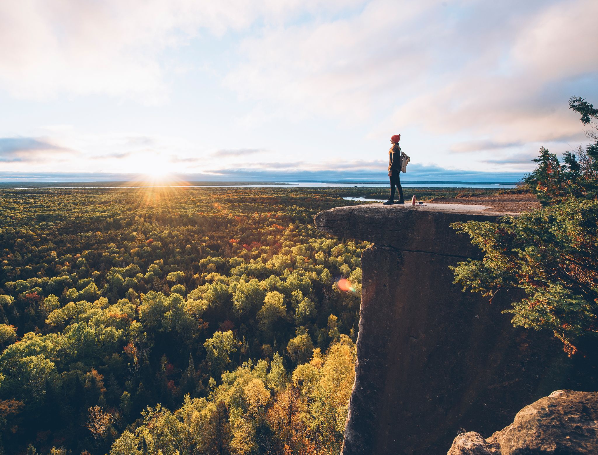
The lookout on the protruding rock to the east allows a view over the forests and Lake Manitou in the distance. The view of the spectacular rock face becomes the highlight of the hike. (Visit on May 21, 2026)
0
0
The trailhead of the Cup and Saucer Trail is located on Highway 540 a few kilometers north of M’Chigeeng. The gravel parking lot can accommodate numerous vehicles. Parking is free of charge; a voluntary contribution is requested. (Visit on May 21, 2026) At the end of May / beginning of June 2017, the trailhead of the Michigiwadinong - Cup and Saucer Trail was relocated; this can be read at: https://escarpment.ca/files/saving-the-cup-and-saucer-trail-2017-pdf.pdf
0
0
From the Cup and Saucer Red Trail on the western rock formation of the Niagara Escarpment, you have a magnificent view over the forests and up to the North Channel. Below the rocks, south of the confluence of Bidwell Road with Highway 540, lies the quarry of a private company. (Visit on May 21, 2026)
0
0
The South Loop runs along the cliff for about 2.5 kilometers to the south. Along the way, there are several opportunities to step out to the rock edge with views to the east over the extensive mixed forest and Lake Manitou in the distance. (Visit on May 21, 2026)
0
0
The Cup and Saucer Adventure Trail is described in detail on the "Wandering Wagars" website. We did not walk the trail. https://wanderingwagars.com/cup-and-saucer-trail-manitoulin/
0
0
Frequently Asked Questions
How challenging are the hiking trails in Le nord-est de Manitoulin et les îles?
The region offers a mix of trails suitable for various fitness levels. You'll find easy loops, such as the Cup and Saucer Trail Entrance – View from the East Overlook loop, which is 5.1 km long. There are also moderate ascents, like the main Cup and Saucer Trail, which includes sections of rock climbing and leads to spectacular viewpoints.
What natural features or landmarks can I expect to see while hiking?
Le nord-est de Manitoulin et les îles is renowned for its diverse natural beauty. You can explore dramatic cliffs that are part of the Niagara Escarpment, offering panoramic views over Lake Huron, especially from the View from the East Overlook. The region also features sandy beaches, deciduous forests, and clear lake waters. Don't miss the opportunity to visit Bridal Veil Falls, where you can walk behind the curtain of water.
Are there family-friendly hiking trails in the area?
Yes, there are several trails suitable for families. The Cup and Saucer Trail Entrance – View from the East Overlook loop is an easy 5.1 km path that provides expansive vistas without being overly strenuous. Another accessible option is the Nahdweh Lookout – North Channel Lookout loop from Wikwemikong Hill, which is 5.4 km and also rated easy.
Can I hike with my dog in Le nord-est de Manitoulin et les îles?
While specific regulations for each trail may vary, many outdoor areas in the region are generally dog-friendly, especially if dogs are kept on a leash. It's always best to check local signage at trailheads for any specific restrictions or requirements before heading out with your pet.
Are there any circular hiking routes available?
Yes, several routes in the region are designed as loops, allowing you to start and end at the same point. Examples include the easy Cup and Saucer Trail Entrance – View from the East Overlook loop and the moderate Granite Rocks loop from Killarney, which takes you through unique rock formations.
What is the best time of year to go hiking in Le nord-est de Manitoulin et les îles?
The warmer months, from late spring to early autumn, are generally the most popular for hiking. During this time, the weather is pleasant, and the deciduous forests are lush. Fall offers spectacular foliage. While winter hiking is possible, some trails may be less accessible or require specialized gear due to snow and ice.
What do other hikers enjoy most about the trails here?
The hiking experiences in Le nord-est de Manitoulin et les îles are highly rated by the komoot community, with an average score of 4.8 stars from over 50 reviews. Hikers frequently praise the stunning panoramic views from cliffside lookouts, the diverse terrain ranging from forests to rock formations, and the well-maintained paths that offer options for various skill levels.
Are there any waterfalls to visit while hiking?
Yes, one of the notable natural attractions in the region is Bridal Veil Falls. This 11-meter (or 34-meter) waterfall is a popular spot where visitors can even walk behind the curtain of water, offering a unique and refreshing experience.
What are some longer, more challenging hikes in the area?
For those seeking a longer and more challenging experience, the main Cup and Saucer Trail is a moderate 8.9 km route that includes sections of rock climbing. Another moderate option is the Cape Smith lookout – North Channel Lookout loop from Wikwemikong Hill, which spans 9.3 km and offers impressive views.
Are there opportunities to learn about local culture during a hiking trip?
Manitoulin Island has a rich Anishnaabek Indigenous culture. While hiking, you might encounter areas of cultural significance. The Great Spirit Circle Trail offers guided experiences, including medicinal walks and purification ceremonies, providing insights into living in harmony with Mother Earth. The Wiikwemkoong territory is also a significant cultural site.
What kind of wildlife might I encounter on the trails?
The preserved natural environment of Manitoulin Island, with its forests and proximity to Lake Huron, supports diverse wildlife. Hikers might spot various bird species, including waterfowl near the lake shores, and potentially deer or smaller mammals in the forested areas. The region's commitment to conservation, including the Manitoulin Eco Park, helps protect these habitats.
Are there any trails that offer views of the North Channel?
Absolutely. The Cape Smith lookout – North Channel Lookout loop from Wikwemikong Hill is a moderate 9.3 km trail specifically designed to provide stunning vistas of the North Channel. Another route, the Nahdweh Lookout – North Channel Lookout loop from Wikwemikong Hill, also offers views of this beautiful waterway.
Most popular attractions around Le nord-est de Manitoulin et les îles

Get inspired with the komoot mobile app


Explore more
Browse the best Hikes in other regions.
