The best walks and hikes around Blandford-Blenheim
4.8
(5)
83
hikers
23
hikes
Hiking around Blandford-Blenheim offers diverse natural features and dedicated trail systems within Oxford County, Ontario. The region is characterized by scenic rural landscapes, including the Nith River Valley and significant natural areas like the Chesney Wilderness Area. Trails traverse varied environments, from Carolinian forests to open meadows, providing a range of experiences for outdoor enthusiasts.
Best hiking trails around Blandford-Blenheim
- The most popular hiking route is Homer Watson and Tilt's Trail Loop, a 3.3 miles (5.3 km) trail that…
Last updated: October 5, 2026
6
hikers
3.70km
00:57
10m
10m
Easy hike. Great for any fitness level. Easily-accessible paths. Suitable for all skill levels.
4
hikers
5.73km
01:28
30m
30m
Easy hike. Great for any fitness level. Easily-accessible paths. Suitable for all skill levels.

4
hikers
4.28km
01:07
30m
30m
Easy hike. Great for any fitness level. Easily-accessible paths. Suitable for all skill levels.
3
hikers
2.07km
00:32
0m
0m
Easy hike. Great for any fitness level. Easily-accessible paths. Suitable for all skill levels.
2
hikers
9.33km
02:22
30m
30m
Moderate hike. Good fitness required. Easily-accessible paths. Suitable for all skill levels.
Get access to more routes and recommendations from other explorers.
Already have an account?
Our route recommendations are based on thousands of hikes, rides, and runs completed by other people on komoot.
Start today with a free account
Your next adventure awaits.
Popular around Blandford-Blenheim

Tips from the Community

The new Silver Trail is just over 5 km (3 miles) although you can cut it short in several places. The trail loops an area of wild ground between the Pittock Reservoir and the northern sector of Woodstock. The area has been landscaped and rejuvenated as wetland habitat with plenty of trees. Over time it should become a thriving wildlife area.
0
0

A scenic natural trail and environmental education area. It's open to the public after 3pm on weekdays and all day on weekends and public holidays.
0
0

You'll find over 10 kilometres of multi-use trails within the Standard Tube Burgess Park system, most of them at or near the Thames River. The river itself is a "no-wake" zone in this area, making it popular for kayaking, canoeing, and paddle boarding.
0
0
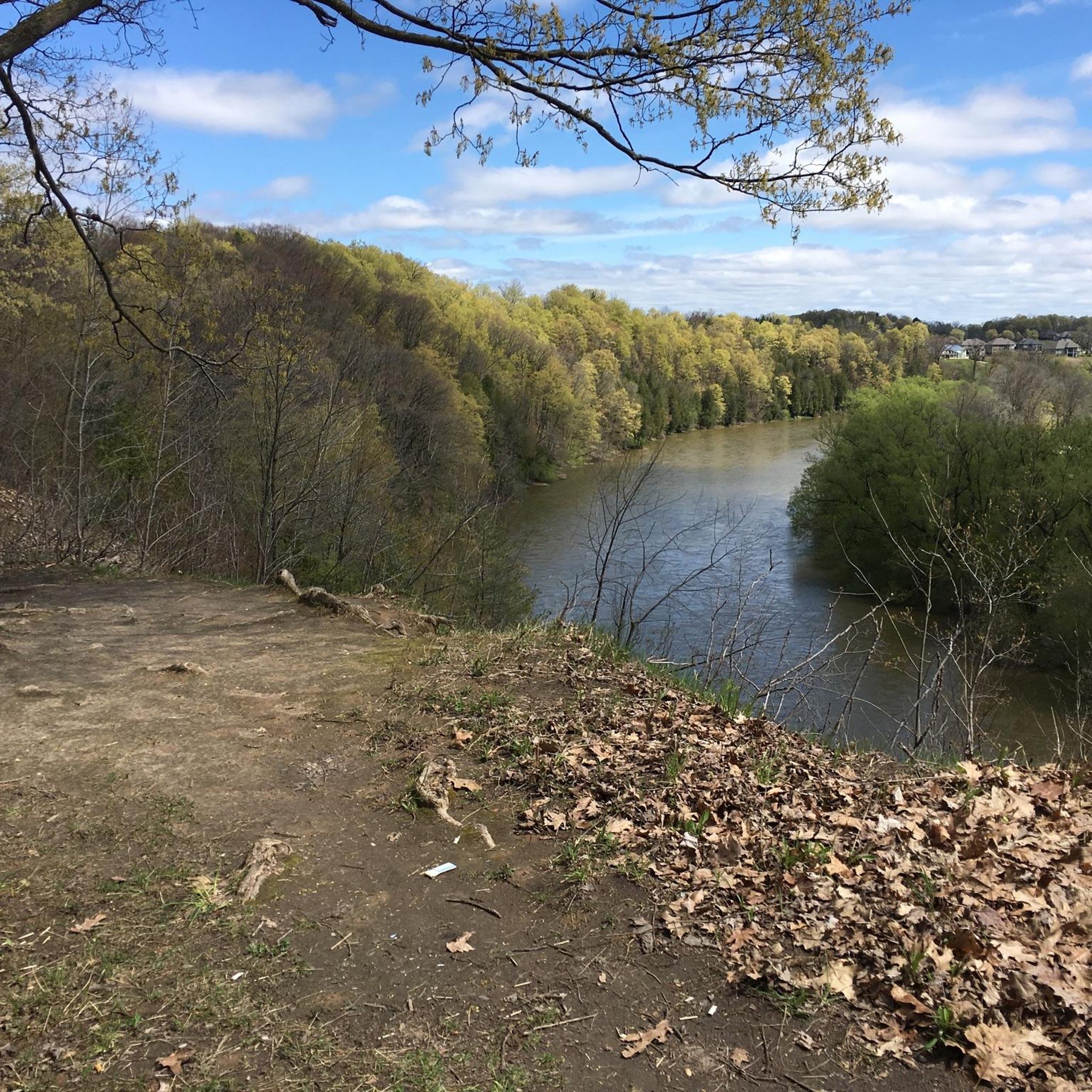
Known as as Deshkan Ziibi (Antler RIver) in Ojibwe, The Thames River winds more than 270 kilometres through southwestern Ontario, shifting from quiet rural bends to broad urban stretches as it flows toward Lake St. Clair. Here, near Woodstock, the slow river meanders through forests and meadows, creating a peaceful escape.
0
0

Thames River Trail is a relatively flat, easy route that runs through wooded sections along the river’s shoreline, with beautiful views along the way. The trail passes through a mix of forest and open areas, with plenty of opportunities to spot waterfowl and other wildlife along the shoreline, making it a lovely route for a peaceful riverside stroll.
0
0
The Thames River flows for about 273 kilometres through southwestern Ontario, winding from its headwaters near Thamesford through farmland, forests, and communities before emptying into Lake St. Clair. In this section, the river widens into calmer waters bordered by wooded shorelines, wetlands, and open countryside, creating a quieter setting than the faster-flowing sections downstream. This is a great spot to do some birdwatching, and the peaceful views across the water and the surrounding landscape feel more like a rural setting despite being on the edge of the city.
0
0

As you walk along the south side of the river, you will notice the railway tracks cutting through the conservation land. You can watch as the trains move slowly through the area, carrying goods like grain or car parts to nearby towns. It is a unique experience because most parks are quiet, but here, the rumble of the engine and the sound of the horn remind you of the region's active industrial roots.
0
0
The main walkway is a great place for you to enjoy a breath of fresh air while looking out over the water. As you move along the path, you will notice that the terrain is mostly flat and easy to walk, making it perfect for a relaxed afternoon with your friends or family.
0
0
Frequently Asked Questions
How many hiking trails are available in Blandford-Blenheim?
Blandford-Blenheim offers a good selection of hiking opportunities, with over 10 routes listed in this guide. These trails cater to various preferences, from easy strolls to more moderate excursions through the region's diverse landscapes.
What kind of terrain can I expect on hikes in Blandford-Blenheim?
The trails in Blandford-Blenheim traverse a variety of scenic rural landscapes. You can expect to find paths through river valleys, natural areas, Carolinian forests, and open meadows. Some trails, like those in the Chesney Wilderness Area, feature hard earth surfaces with occasional tree roots and sections of boardwalk.
Are there options for different hiking skill levels?
Yes, Blandford-Blenheim provides hiking options for various skill levels. The majority of routes in this guide, 12 out of 13, are rated as easy, making them suitable for casual walkers and beginners. There is also 1 moderate route for those seeking a bit more challenge.
What do other hikers say about the trails in Blandford-Blenheim?
The trails in Blandford-Blenheim are highly regarded by the komoot community, with an average rating of 4.7 stars from 4 reviews. Hikers often praise the peaceful rural landscapes and the variety of natural features encountered along the routes.
Are there any significant natural areas to explore?
Absolutely. A prominent natural area is the Chesney Wilderness Area, spanning 93 hectares (230 acres) with a dedicated trail system. The Nith River Valley also offers opportunities to explore Carolinian forests and observe local wildlife.
What natural features or landmarks can I see along the trails?
Along the trails, you can discover various natural features and points of interest. The Homer Watson Park offers beautiful forest scenery, while the SC Johnson Rail Trail Along the Nith River provides riverside views. The Nith River itself is a significant natural landmark, winding through the countryside.
Are there any trails that are part of the Bruce Trail?
Yes, several trails near Blandford-Blenheim are part of or connect to the renowned Bruce Trail, specifically sections like the Iroquoia. These sections offer varying difficulties and lengths, providing access to one of Canada's longest and oldest marked footpaths.
Are there family-friendly hiking options?
Many of the trails in Blandford-Blenheim are suitable for families, particularly the 12 easy routes available. The Chesney Wilderness Area, with its well-maintained trails like the Maple Trail loop and Hemlock Trail loop, is a great option for walks with children.
Can I bring my dog on the trails?
While specific regulations vary by trail, many natural areas and rural trails in Blandford-Blenheim are generally dog-friendly, especially if your dog is kept on a leash. It's always best to check local signage at the trailhead for any specific restrictions.
Are there circular hiking routes available?
Yes, Blandford-Blenheim features several excellent circular routes. Popular options include the Homer Watson and Tilt's Trail Loop, the Burgess Park loop via Meadow Trail, and the Pine Grove Trail loop. These loops offer convenient ways to explore the scenery and return to your starting point.
Where can I find parking for trailheads?
Parking is typically available at the main access points for popular trail systems. For instance, the Chesney Wilderness Area has an information kiosk and parking lot. For other trails, access points often have designated parking areas, though it's advisable to check specific route details before you go.
What is the best time of year to go hiking in Blandford-Blenheim?
Blandford-Blenheim offers beautiful hiking experiences throughout the year. Spring brings magnificent blooms, summer provides lush green landscapes, and autumn transforms the region with vibrant colors. Even winter offers opportunities for snowy walks, particularly on trails like those in the Chesney Wilderness Area which are suitable for skiing.
Are there any longer, more challenging routes for experienced hikers?
While most routes in this guide are easy, there is one moderate option: the Grand River loop from Steckle Woods. This 5.6-mile (9.0 km) trail leads through riverside landscapes and woodlands, offering a longer excursion for those looking for more distance.
Most popular attractions around Blandford-Blenheim

Get inspired with the komoot mobile app


Explore more
Browse the best Hikes in other regions.
