The best walks and hikes around Thorold
4.7
(101)
2,239
hikers
53
hikes
Hiking around Thorold features a landscape shaped by the Niagara Escarpment, offering varied terrain for outdoor activities. The region is characterized by its conservation areas, provincial parks, and numerous creeks and waterfalls. Hikers can expect to find trails winding through woodlands, alongside water features, and across gentle elevations. These natural features provide a diverse environment for walking and exploring.
Best hiking trails around Thorold
- The most popular hiking route is Fifteen Mile Creek and Lower Rockaway Falls loop — Rockway…
Last updated: July 5, 2026
5
hikers
5.38km
01:22
20m
20m
Easy hike. Great for any fitness level. Easily-accessible paths. Suitable for all skill levels.
4
hikers
12.5km
03:17
100m
100m
Moderate hike. Good fitness required. Easily-accessible paths. Suitable for all skill levels.

Sign up for free
1
hikers
Easy hike. Great for any fitness level. Easily-accessible paths. Suitable for all skill levels.
4.5
(2)
34
hikers
6.46km
01:43
70m
70m
Easy hike. Great for any fitness level. Easily-accessible paths. Suitable for all skill levels.
5.0
(2)
31
hikers
5.21km
01:25
80m
80m
Easy hike. Great for any fitness level. Easily-accessible paths. Suitable for all skill levels.
Get access to more routes and recommendations from other explorers.
Sign up for free
Already have an account?
Our route recommendations are based on thousands of hikes, rides, and runs completed by other people on komoot.
Start today with a free account
Your next adventure awaits.
Login or Signup
Popular around Thorold

Tips from the Community

The Participark Trail is a packed gravel trail that traces the western bank of Twelve Mile Creek. For 2 kilometres this trail is wide and flat, and drains well after rain and snow, making it the dryer choice for muddy winter, spring, and fall seasons. Along the trail, there are eight exercise stations for the public to do body weight workouts.
0
0
The Twelve Trail East spans 5.5 kilometres along the eastern bank of Twelve Mile Creek. It's popular with hikers, runners, and bikers for good reason, with constant river views, well-maintained packed gravel trail and easy access from multiple entry points. The trail has pretty minimal elevation gain and a decent amount of sun exposure, with occasional trees to take shelter under. At its northern tip, it connects to the Merritt Trail, joins the Bruce Trail near Brock University, and also can be linked with Participark Trail to create a loop.
0
0
This scenic pedestrian bridge provides a safe place for runners, bikers and hikers to cross Twelve Mile Creek, totally separated from the busy Glendale Avenue that parallels this bridge. The bridge has an arc shape, and has great views of the turquoise blue river flowing below.
0
0
The Bridge at Laura's Crossing, also known as the Laura Secord Heritage Trail Suspension Bridge, spans 20 meters across Twelve Mile Creek, and is part of the Laura Secord Legacy Trail. This bridge marks the supposed location where Laura Secord is believed to have waded across the creek in 1813 during her trek to warn British troops of an American invasion. The bridge's design was modeled after eco-friendly New Zealand bridges, where the "Zero Instream Footprint" does not disrupt river habitats below.
1
0
Twelve Mile Creek has headwaters with cold and clear water, important for the habitat of native Brook Trout. Local conservationists work hard to prevent sediment erosion and protect these sensitive spawning grounds. With a valid Ontario Fishing License, fishing is allowed in Twelve Mile Creek. This river was historically used during the War of 1812 and built the First and Second Welland Canals. Today the river is best explored via the many trails that follow its borders in St. Catharines, like the Twelve Trail, Participark Trail and the Merritt Trail.
0
0
The First Nations Peace Monument and DeCou House Monument are located in DeCew House Heritage Park, on the Laura Secord Trail. The First Nations Peace Monument sits a few meters east, while the DeCou House Monument sits a few meters to the west. The First Nations Peace Monument was created by celebrated Indigenous architect Douglas Cardinal, and is a curved limestone structure with a bronze sunflame centrepiece. The monument honours the First Nations role in Canada's history and is a reminder of peace, reconciliation, and truth. The DeCou House Monument is what remains of a Georgian style house built by Captain John DeCou early when in 1813. There was a meeting between Laura Secord and Mohawk warriors who brought her to warn British Lieutenant FitzGibbon during the War of 1812.
0
0

Fifteen Mile Creek runs through the Rockway Conservation Area near St. Catharines, and is the source of the impressive Rockway Falls. The creek feeds a striking “ramp” waterfall that plunges into a deep gorge, creating one of the area’s most dramatic natural features. Trails wind along the creek's gorge, offering hikers forested paths, scenic lookouts, and access to the waterfalls. The creek and conservation area it flows through, blend natural beauty with convenience, making it a popular destination for exploring the stunning landscapes.
0
0
Rockway Conservation Area, located along the Niagara Escarpment, offers up dramatic scenery and rich history. The site features two waterfalls plunging 19.5 and 12.2 meters, as well as trails that wind through mature forests of basswood, sugar maple, walnut, and sycamore. Hikers can explore the Fifteen Mile Creek valley, discover remnants of historic salt springs dating back to 1792, and enjoy new accessible trails and lookouts that make the escarpment views easier to reach.
0
0
Frequently Asked Questions
How many hiking trails are available in Thorold?
Thorold offers a wide variety of hiking experiences, with over 45 routes documented on komoot. These range from easy strolls to more challenging paths, catering to different fitness levels.
Are there easy hiking trails in Thorold suitable for beginners or families?
Yes, Thorold has many easy trails perfect for beginners and families. A great option is the Fifteen Mile Creek and Lower Rockaway Falls loop — Rockway Conservation Area, which is an easy 2.5-mile (4.1 km) trail exploring waterfalls and creek views. Another family-friendly choice is the Terrace Falls loop from Short Hills Provincial Park, offering varied forest and ravine landscapes.
Can I bring my dog on the hiking trails in Thorold?
Many of Thorold's conservation areas and provincial parks, such as Rockway Conservation Area and Short Hills Provincial Park, generally permit dogs on leash. It's always best to check specific park regulations before your visit to ensure a pleasant experience for everyone.
Are there any hiking trails in Thorold that feature waterfalls?
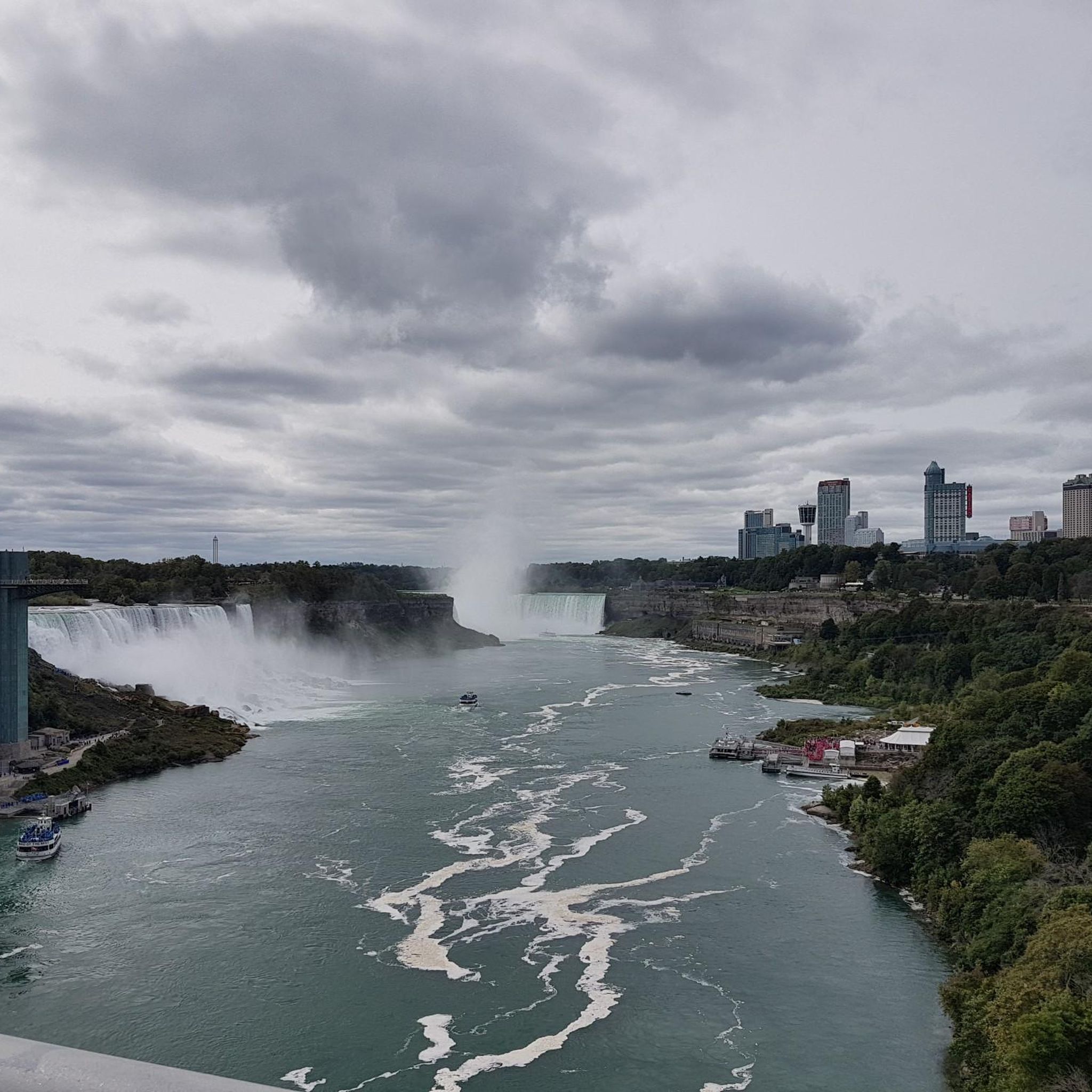
Absolutely! Thorold is known for its waterfalls. The Fifteen Mile Creek and Lower Rockaway Falls loop takes you past Lower Rockaway Falls. Another popular route, the Swayze Falls loop from Short Hills Provincial Park, leads directly to the notable Swayze Falls. You can also explore other waterfalls like Horseshoe Falls or Bridal Veil Falls nearby.
What are the typical distances and durations for hikes in Thorold?
Hiking trails in Thorold vary in length and duration. Easy routes, like the Fifteen Mile Creek and Lower Rockaway Falls loop, are around 2.5 miles (4.1 km) and take about an hour. Longer, more challenging hikes, such as the Upper Ball's Falls loop, can extend over 12 miles (20 km) and require several hours to complete.
When is the best time of year to go hiking in Thorold?
Thorold offers beautiful hiking experiences year-round. Spring is ideal for viewing vibrant wildflowers and full waterfalls. Summer provides lush green landscapes, while autumn showcases stunning fall foliage. Winter hiking is also possible, with trails offering a serene, snow-covered beauty, though proper gear is essential.
Are there any circular hiking routes in Thorold?
Yes, many of Thorold's trails are designed as loops, offering convenient circular routes. Examples include the Fifteen Mile Creek and Lower Rockaway Falls loop, the Swayze Falls loop, and the Woodend Conservation Area loop, all providing varied scenery.
What do other hikers enjoy the most about hiking in Thorold?
The hiking trails in Thorold are highly rated by the komoot community, with an average score of 4.7 stars from over 80 reviews. Hikers frequently praise the diverse natural features, including the numerous waterfalls and creeks, as well as the well-maintained paths through conservation areas and provincial parks.
Are there any viewpoints or scenic overlooks along Thorold's hiking trails?
While specific named viewpoints might not be abundant on every trail, the region's location along the Niagara Escarpment means many routes offer elevated sections with scenic vistas, especially within areas like Short Hills Provincial Park and Rockway Conservation Area, providing glimpses of the surrounding natural beauty.
What kind of terrain can I expect on Thorold's hiking trails?
Thorold's hiking trails feature varied terrain, largely shaped by the Niagara Escarpment. You can expect paths winding through woodlands, alongside creeks and ravines, and across gentle elevations. Surfaces can range from well-trodden earth to rocky sections, especially near waterfalls, so appropriate footwear is recommended.
Are there any hidden gem hiking spots in Thorold?
While popular spots like Rockway Conservation Area and Short Hills Provincial Park are well-loved, exploring the lesser-known sections of these parks or smaller local conservation areas can reveal quieter, equally beautiful trails. The extensive network means there's always a new path to discover away from the main crowds.
Is public transport available to reach Thorold's trailheads?
Public transport options directly to all trailheads in Thorold may be limited. It is advisable to check local transit schedules and routes for the Niagara Region or consider driving, as many conservation areas and provincial parks offer parking facilities.
Most popular routes around Thorold
Most popular attractions around Thorold

Get inspired with the komoot mobile app


Explore more
Browse the best Hikes in other regions.
