The best cycling routes around Vaughan
4.5
(247)
1,566
riders
94
rides
Touring cycling around Vaughan features a diverse landscape, including extensive conservation areas, river valleys, and sections of the Oak Ridges Moraine. The region offers a network of trails that traverse woodlands, open green spaces, and follow waterways like the Humber River and West Don River. Elevations are generally gentle, with hills under 200m, making it suitable for various cycling experiences. The city's commitment to cycling infrastructure provides both paved paths and more natural routes.
Best touring cycling routes around Vaughan
…Last updated: October 5, 2026
4.7
(26)
140
riders
94.8km
05:43
460m
460m
Hard bike ride. Very good fitness required. Mostly paved surfaces. Suitable for all skill levels.
5.0
(3)
27
riders
20.1km
01:37
130m
130m
Easy bike ride. Great for any fitness level. Mostly paved surfaces. Suitable for all skill levels.

5.0
(1)
22
riders
17.9km
01:28
120m
120m
Easy bike ride. Great for any fitness level. Mostly paved surfaces. Suitable for all skill levels.
5.0
(6)
24
riders
30.4km
02:01
140m
140m
Moderate bike ride. Good fitness required. Mostly paved surfaces. Suitable for all skill levels.
4.0
(3)
15
riders
35.0km
02:06
200m
200m
Moderate bike ride. Good fitness required. Mostly paved surfaces. Suitable for all skill levels.
Get access to more routes and recommendations from other explorers.
Already have an account?
Our route recommendations are based on thousands of hikes, rides, and runs completed by other people on komoot.
Start today with a free account
Your next adventure awaits.
Tips from the Community

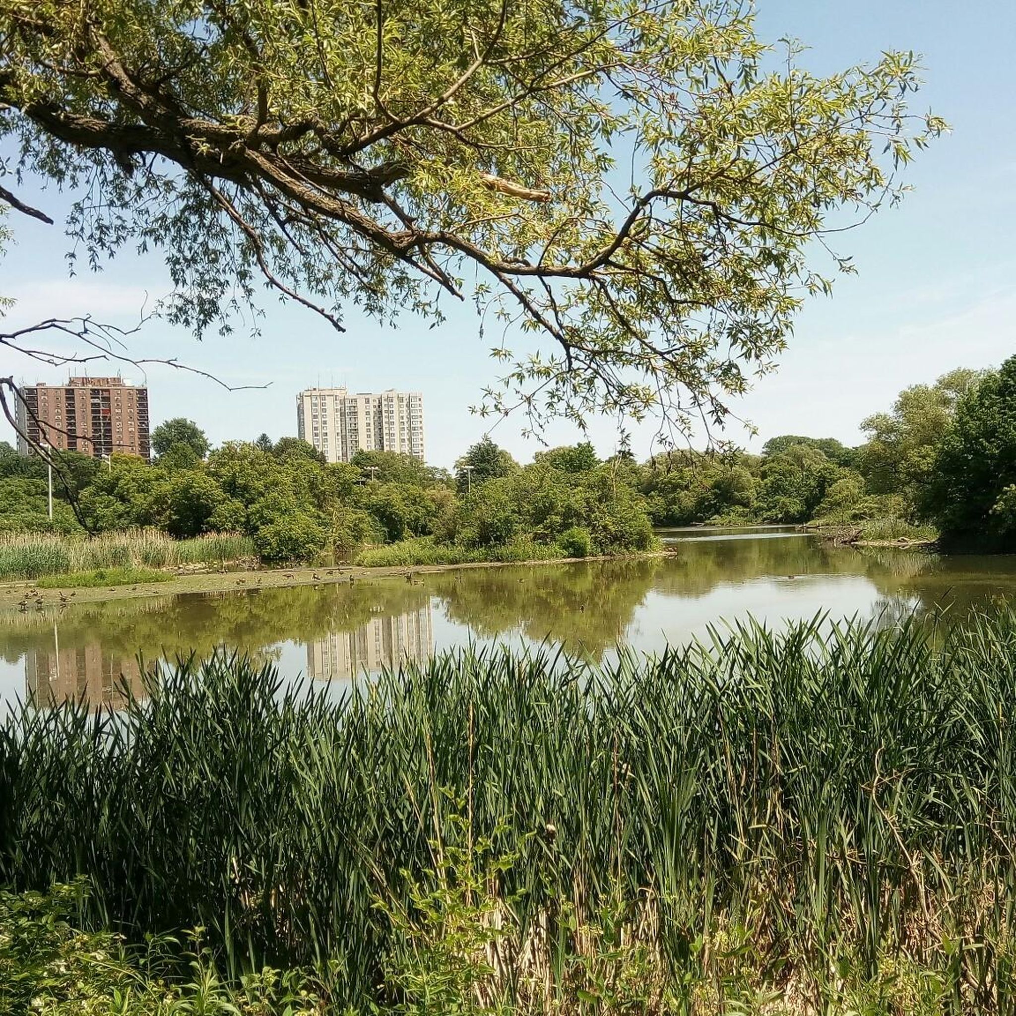
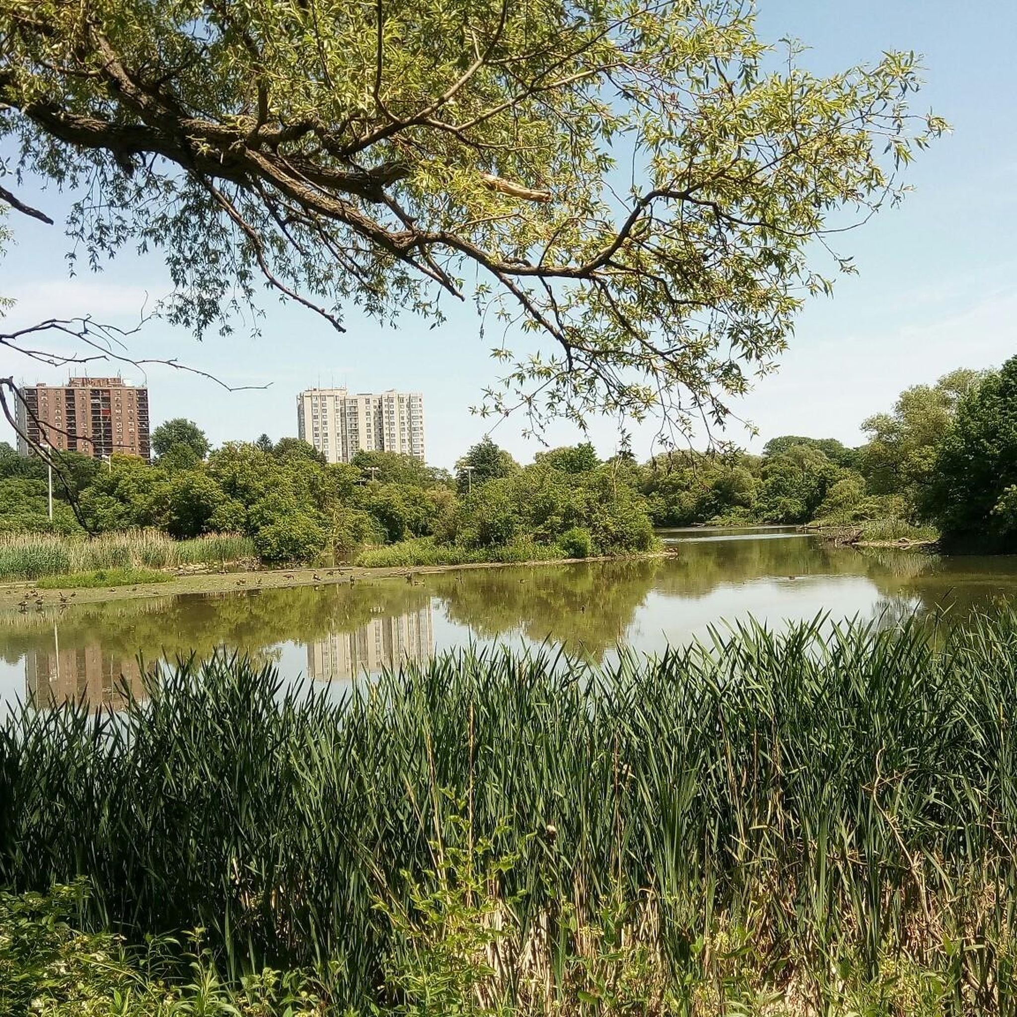
The Marita Payne Pond was named in honour of the Canadian sprinter and Olympic medallist, Marita Payne. This is small but scenic little pond is nestled at the south end of David Lewis Park and along the paths of Bartley Smith Greenway, making it the perfect spot for families, joggers, walkers, bikers and anyone seeking a break from the city’s hustle and bustle.
0
0
The Keffer Marsh is home to a variety of flora and fauna, such as rare plant species, amphibians, and migratory birds. Sitting on the Rouge River, this marsh assists in filtering water, preventing erosion, and supporting biodiversity. The marsh is not only pretty but also a commitment to preserving urban green spaces for both ecological and recreational purposes.
1
0

Standing 30 feet tall with a 15-foot arm span, the Toronto Inukshuk was built from about 50 tonnes of mountain rose granite by Inuit artist Kellypalik Qimirpik of Cape Dorset, Nunavut. Created in 2002 as a legacy project commemorating World Youth Day and the visit of Pope John Paul II, it’s one of the largest structures of its kind in North America. Sitting just west of Coronation Park in what’s now known as Toronto Inukshuk Park, it looks out across Lake Ontario and the harbour. There is a granite slab beside it that includes part of then-mayor Mel Lastman’s unveiling speech, describing the Inukshuk as an invitation to “become beacons of light and hope, striving for justice and peace in this world.”
0
0
Jefferson Forest Trails form an informal network of natural-surface paths in the Jefferson Forest area of Richmond Hill. The system includes winding singletrack routes through mixed woodland, with sandy sections, tree roots and gentle elevation changes. Popular with hikers, trail runners, and mountain bikers, the trails are not formally signed, so local knowledge and/or your offline komoot GPS route are best for navigation.
0
0

This trail is wide, fully paved, and completely separated from car traffic, making it incredibly safe for kids and strollers. As you walk, you will pass through beautifully restored meadows filled with native wildflowers, which attract colorful butterflies and local birds.
0
0

comfortable armchairs for a short rest and to enjoy the great view
0
0

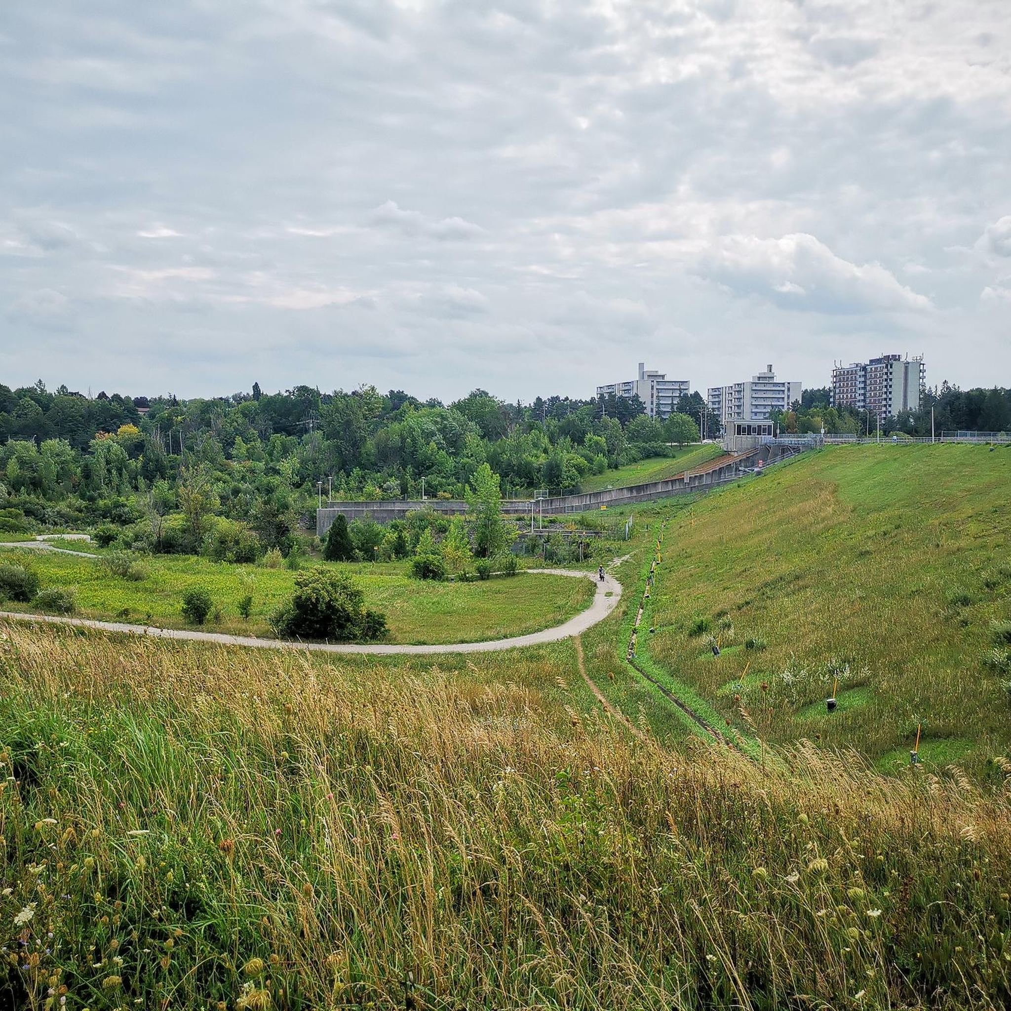
The Don River Valley cuts through Toronto in a surprisingly wild stretch of forested ravines, wetlands and multi-use trails just beyond the downtown core. Shaped by the Don River flowing through it, the valley is one of the city’s largest natural corridors, with paved and dirt paths passing beneath bridges, alongside marshes and through dense tree cover that feels far removed from the surrounding city.
0
0

This is an easy, shady singletrack that you can use to connect the upper and lower trail networks of Jefferson Forest.
0
0
Frequently Asked Questions
What types of landscapes can I expect to cycle through in Vaughan?
Vaughan offers a diverse range of natural settings for touring cyclists. You can explore extensive conservation areas like Boyd Conservation Park and Kortright Centre for Conservation, which feature woodlands, open grass, and gentle slopes. The region also includes river valleys such as the Humber River Valley and the West Don River, providing scenic routes through forest habitats. Additionally, parts of the Oak Ridges Moraine, with its mature pine and hardwood groves, kettle lakes, wetlands, and meadows, are accessible via trails like those in the Oak Ridges Corridor Conservation Reserve.
Are there cycling routes suitable for beginners or families in Vaughan?
Yes, Vaughan has a good selection of routes suitable for various skill levels, including easy options. For instance, the Forest Trail – Lake Wilcox loop from Bathurst Street Stop #6682 is an easy 22.7 km route. Another accessible option is the Sand Hill – Forest Trail loop from Bathurst Street / King-Vaughan Road, which is 17.7 km and also rated easy. The city's commitment to cycling infrastructure includes many paved paths and multi-use trails, making them ideal for a relaxed family outing.
What kind of cycling infrastructure does Vaughan offer?
Vaughan is actively expanding its cycling network. The city features a large network of sidewalks, cycle tracks, bike lanes, and multi-use paths. This includes in-boulevard cycle tracks separated from traffic, on-road bike lanes, and shared-use pathways. A significant initiative is the Vaughan Super Trail, an ambitious project aiming to create a 100-kilometer city-wide loop system connecting communities with natural, cultural, and heritage sites. Recent developments include new cycle tracks and multi-use pathways, with over 345 identified cycle routes in the area.
Are there any challenging touring cycling routes in Vaughan?
Yes, for experienced touring cyclists seeking a challenge, Vaughan offers more difficult routes. The Don River Valley – Humber Bay Arch Bridge loop from Rutherford is a difficult 94.9 km trail that takes approximately 5 hours 39 minutes to complete. This route connects the Don River Valley to the Humber Bay Arch Bridge, offering a long-distance ride with notable elevation changes.
What are some natural features or landmarks I can see along the cycling routes?
Vaughan's cycling routes often pass by or connect to various natural features and points of interest. You can encounter tranquil settings like Napa Valley Pond and Barrhill Pond, or enjoy broad open views at the North Richmond Hill Reservoir. The Humber River Trail (Humber River Trail) and the Kay Gardner Beltline Trail (Kay Gardner Beltline Trail) are notable trails that offer scenic views. Additionally, you might pass by lakes such as Wilcox Lake Promenade (Wilcox Lake Promenade) and Lake Claireville Conservation Area (Lake Claireville Conservation Area).
What is the best time of year to go touring cycling in Vaughan?
The most popular times for cycling in Vaughan are typically July and August, when the weather is warm and trails are in prime condition. The city also celebrates Bike Month annually in June, which includes events and guided rides, making it another excellent time to explore. While specific winter conditions are not detailed, the warmer months offer the most comfortable and accessible cycling experience across the diverse trail network.
Are there any circular touring cycling routes in Vaughan?
Yes, many touring cycling routes in Vaughan are designed as loops, offering convenient starting and ending points. Examples include the Wilket Creek Trail – Wilket Creek Trail loop from Langstaff, a moderate 63.4 km path, and the Humber River Rail Bridge – Humber River Bridge loop from Humber Summit, a 36.0 km moderate trail. These circular routes allow cyclists to experience varied scenery without retracing their steps.
How long are the touring cycling routes in Vaughan?
The touring cycling routes in Vaughan vary significantly in length to accommodate different preferences and fitness levels. You can find shorter, easy routes around 17-22 km, such as the Sand Hill – Forest Trail loop. Moderate routes typically range from 36 km to over 63 km, like the Wilket Creek Trail loop. For longer rides, there are difficult routes extending up to 95 km, such as the Don River Valley – Humber Bay Arch Bridge loop.
What do other touring cyclists say about cycling in Vaughan?
The touring cycling routes in Vaughan are highly rated by the komoot community, with an average score of 4.6 stars from over 250 reviews. Cyclists often praise the region's diverse terrain, which includes conservation areas and river valleys, and appreciate the network of trails that cater to different ability levels, from easy paved paths to more challenging routes through forests. Over 1900 touring cyclists have used komoot to explore Vaughan's varied landscapes.
Are there specific parks or conservation areas ideal for cycling in Vaughan?
Several parks and conservation areas in Vaughan are excellent for cycling. Boyd Conservation Park offers peaceful trails and picnic areas. The Kortright Centre for Conservation provides extensive trails through unspoiled woodlands. North Maple Regional Park features trails ranging from easy paved paths to more challenging routes. Additionally, the Oak Ridges Corridor Conservation Reserve offers a network of trails through diverse natural habitats, including pine and hardwood groves, wetlands, and meadows.
How can I find parking near the cycling trails in Vaughan?
While specific parking details for every trail access point are not provided, Vaughan's commitment to its cycling network often includes considerations for accessibility. Many regional parks and conservation areas typically offer designated parking facilities for visitors. For specific routes, it's advisable to check the start point of the tour on komoot, as route descriptions often include information about nearby parking options or access points.
Can I access Vaughan's cycling trails using public transport?
Vaughan is actively developing its transportation infrastructure, which includes improving access to its trail network. While specific public transport connections to every trail are not detailed, the city's focus on active transportation and connecting communities suggests that many trails are integrated within urban areas or accessible via local transit routes. For detailed public transport information to specific trailheads, it is recommended to consult local transit authority websites or mapping services.
Most popular routes around Vaughan
Most popular attractions around Vaughan

Get inspired with the komoot mobile app


Explore more
Browse the best Cycling routes in other regions.
