The best road cycling routes around Wilmot
4.3
(28)
662
riders
74
rides
Road cycling routes around Wilmot traverse a landscape characterized by quiet countrysides, rolling hills, and the Glacial Lakes region. The area features a mix of flat stretches and varied terrain, often with low traffic, providing an enjoyable experience for cyclists. Numerous paved trails and multi-use pathways are available, offering diverse settings from open meadows to scenic riverfronts. This region provides a range of routes suitable for different preferences and skill levels.
Best road cycling routes around Wilmot
- The most popular…
Last updated: October 5, 2026
5.0
(1)
19
riders
39.0km
01:50
260m
260m
Moderate road ride. Great for any fitness level. Some segments of this route may be unpaved and difficult to ride.
21
riders
27.5km
01:09
140m
140m
Easy road ride. Great for any fitness level. Mostly well-paved surfaces and easy to ride.

6
riders
Moderate road ride. Good fitness required. Some segments of this route may be unpaved and difficult to ride.
6
riders
26.7km
01:10
160m
160m
Easy road ride. Great for any fitness level. Mostly well-paved surfaces and easy to ride.
4.0
(1)
12
riders
14.5km
00:38
60m
60m
Moderate road ride. Great for any fitness level. Some segments of this route may be unpaved and difficult to ride.
Get access to more routes and recommendations from other explorers.
Already have an account?
Our route recommendations are based on thousands of hikes, rides, and runs completed by other people on komoot.
Start today with a free account
Your next adventure awaits.

Tips from the Community

This forest trail passes through one of Laurel Creek Conservation Area's woodland habitats, offering a quieter alternative to the nearby reservoir and meadow trails. The dense canopy provides shade through much of the route, while seasonal changes make this section particularly attractive in autumn when the leaves begin to change colour.
0
0

The monument does more than just show off old European design. It sits at the center of modern community conversations. As you walk by, you might notice how it serves as a powerful reminder of Canada's complex colonial past. In fact, local groups are working to add new Indigenous artwork nearby to give you a fuller look at the area's diverse history.
0
0
Officially named Otis Little Lake but known by locals simply as the lake at Victoria Park, this man-made gem has been a community hub since 1896.
0
0
Built back in 1896, this rare, iron-and-steel cantilever truss bridge is one of the oldest of its kind in Canada.
1
0
This is the north end of RIM Park and the end of the Walter Bean Grand River Trail section, but there’s no parking available here. If you’re planning to walk this route, you’ll need to park at the main RIM Park parking area that is located on Park Road. It’s a common point of confusion, so it’s worth planning ahead.
0
0
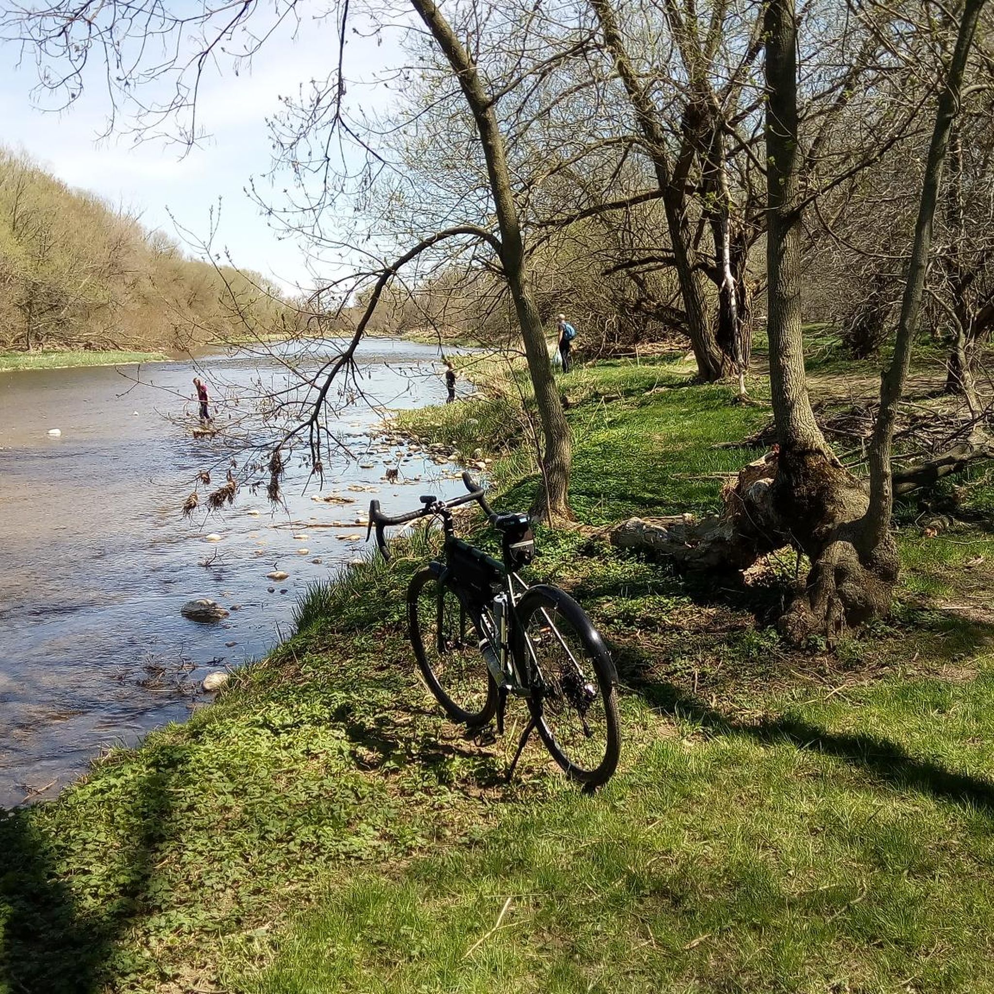
Running alongside the trail, the Grand River is the main backdrop for this entire section. For much of the route, you’re walking right beside the water, with open views in some areas and more filtered glimpses through trees in others. The river moves steadily here, and you’ll often see birds along the banks or on the water. It’s part of a much larger river system that flows south across the region toward Lake Erie, adding a quiet sense of scale to an otherwise easy, local walk.
0
0
This section of the Walter Bean Grand River Trail follows a wide, easy path alongside the Grand River, making it more of a relaxed walk or run than a traditional hike. The trail is mostly flat, with a mix of paved and gravel surfaces, and stays close to the water for much of the route. You’ll move between open parkland and shaded sections through trees, with occasional views of the river. It’s part of a much longer trail system that runs through the region, but this stretch is especially accessible and easy to follow.
0
0

Formerly known as the River Ouse, the Grand River flows through Ontario before emptying into Lake Erie's northern shore. Here, on the edge of Kitchener, its riparian area is full of wildlife, including a wide array of birds that can be quite active, thus making it a great bird watching spot.
0
0
Frequently Asked Questions
How many road cycling routes are available around Wilmot?
There are over 80 road cycling routes available around Wilmot, offering a wide range of options for different skill levels and preferences.
What kind of terrain can I expect on road cycling routes in Wilmot?
Road cycling routes in Wilmot feature a diverse landscape, including quiet countrysides, rolling hills, and the Glacial Lakes region. You'll find a mix of flat stretches and varied terrain, often with low traffic, making for an enjoyable experience. Many routes utilize paved trails and multi-use pathways.
Are there routes suitable for beginners or families in Wilmot?
Yes, Wilmot offers several routes suitable for beginners and families. There are 25 easy routes available, often on paved surfaces and multi-use pathways, providing a comfortable experience for all skill levels. For example, the Waterloo Park – City Cafe Bakery loop from Detweiler Park Natural Area is an easy option.
What are the difficulty levels of road cycling routes in Wilmot?
The road cycling routes in Wilmot cater to various difficulty levels. You'll find 25 easy routes, 57 moderate routes, and 1 difficult route, ensuring options for casual riders and those seeking more challenging rides with varying elevation gains.
Are there any circular road cycling routes in Wilmot?
Yes, many of the road cycling routes in Wilmot are designed as loops, allowing you to start and end at the same point. A popular example is the West Montrose Covered Bridge – West Montrose Covered Bridge loop from University of Waterloo, which offers a scenic journey through the countryside.
What natural features or landmarks can I see along road cycling routes in Wilmot?
While cycling around Wilmot, you can explore various natural features and landmarks. Routes often pass by areas like Waterloo Park, which features Silver Lake, and offer views of the Grand River. You might also encounter trails like the Conestogo River Trails or the Grand River Trail.
Where can I find parking for road cycling routes in Wilmot?
Many road cycling routes in Wilmot start from locations with accessible parking. For instance, routes originating from the University of Waterloo or Laurier - Waterloo Park often have parking facilities nearby, making it convenient to begin your ride.
Is public transport available to access road cycling routes in Wilmot?
Public transport options are available in the broader region, particularly around urban centers like Waterloo, which can provide access points to some of the cycling routes. It's advisable to check local transit schedules and bicycle policies for specific routes.
Are there cafes or places to stop for refreshments along the routes?
Yes, several routes in Wilmot pass through or near areas with cafes and other establishments where you can stop for refreshments. For example, the Waterloo Park – City Cafe Bakery loop explicitly mentions a bakery, and routes starting from urban parks often have amenities nearby.
What do other road cyclists enjoy most about road cycling in Wilmot?
The road cycling experience in Wilmot is highly rated by the komoot community, with an average score of 4.2 stars from over 26 reviews. Cyclists often praise the quiet countrysides, rolling hills, and the well-maintained paved multi-use pathways that define the region's routes.
What is the longest road cycling route in Wilmot?
One of the longer road cycling routes in Wilmot is the West Montrose Covered Bridge – West Montrose Covered Bridge loop from University of Waterloo, which spans approximately 41.0 miles (66.0 km) and takes around 2 hours 47 minutes to complete.
Can I find routes that offer views of lakes or rivers?
Absolutely. Routes like the Memorial Boulder – Columbia Lake loop from Laurier - Waterloo Park provide scenic views of Columbia Lake. Additionally, the region's proximity to the Grand River means many routes offer glimpses or follow sections of the river, such as those near the Grand River Trail.
Most popular attractions around Wilmot

Get inspired with the komoot mobile app


Explore more
Browse the best Road cycling routes in other regions.
