The best running trails around Lautersee
4.4
(241)
7,989
runners
191
runs
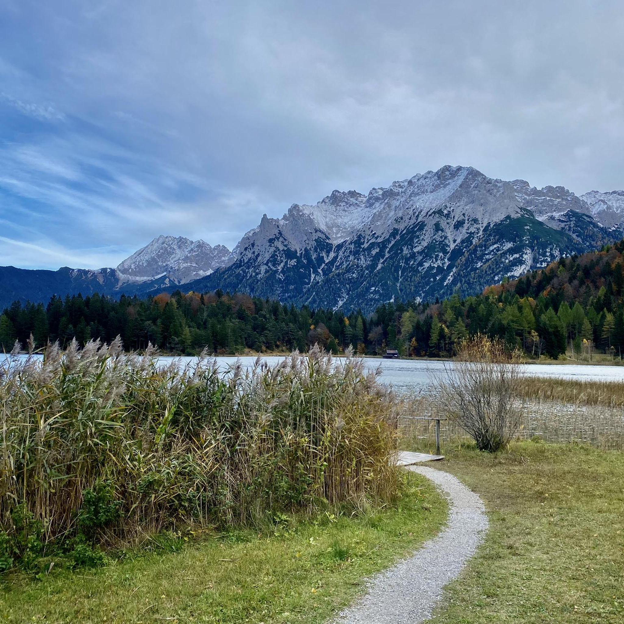
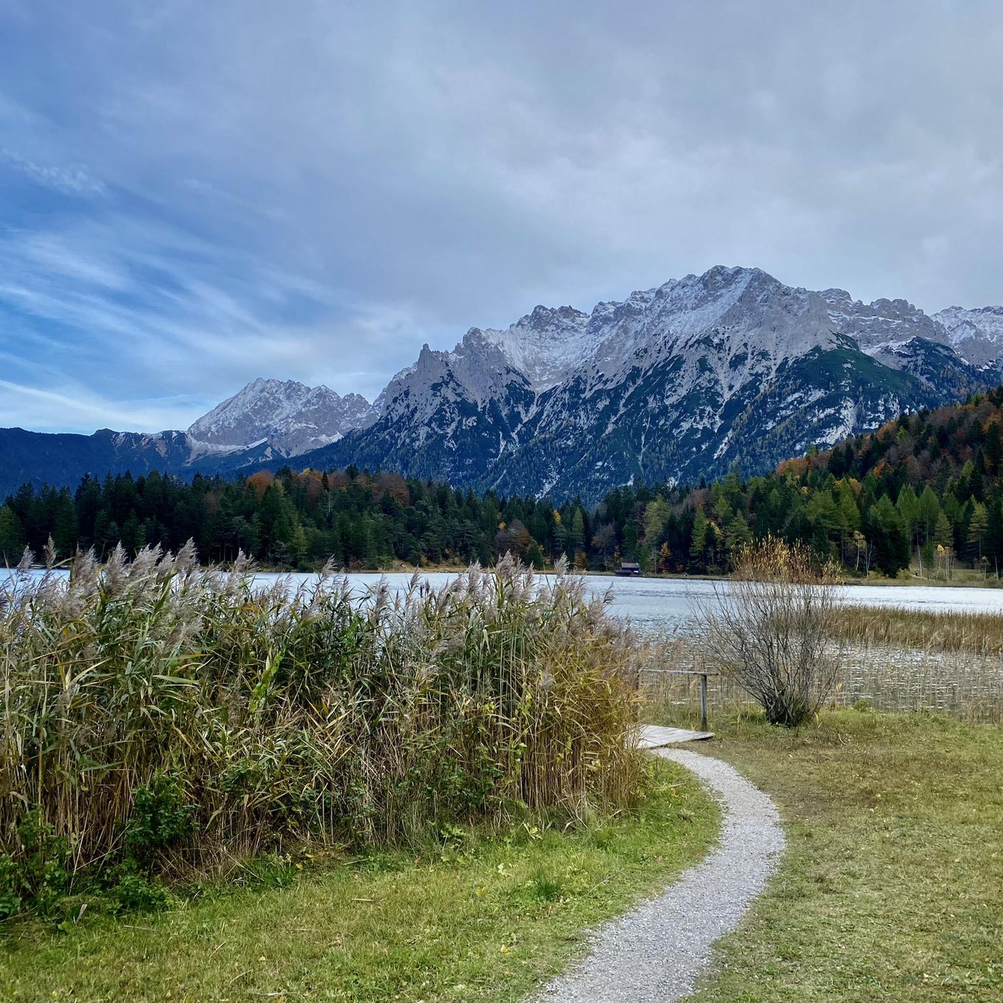
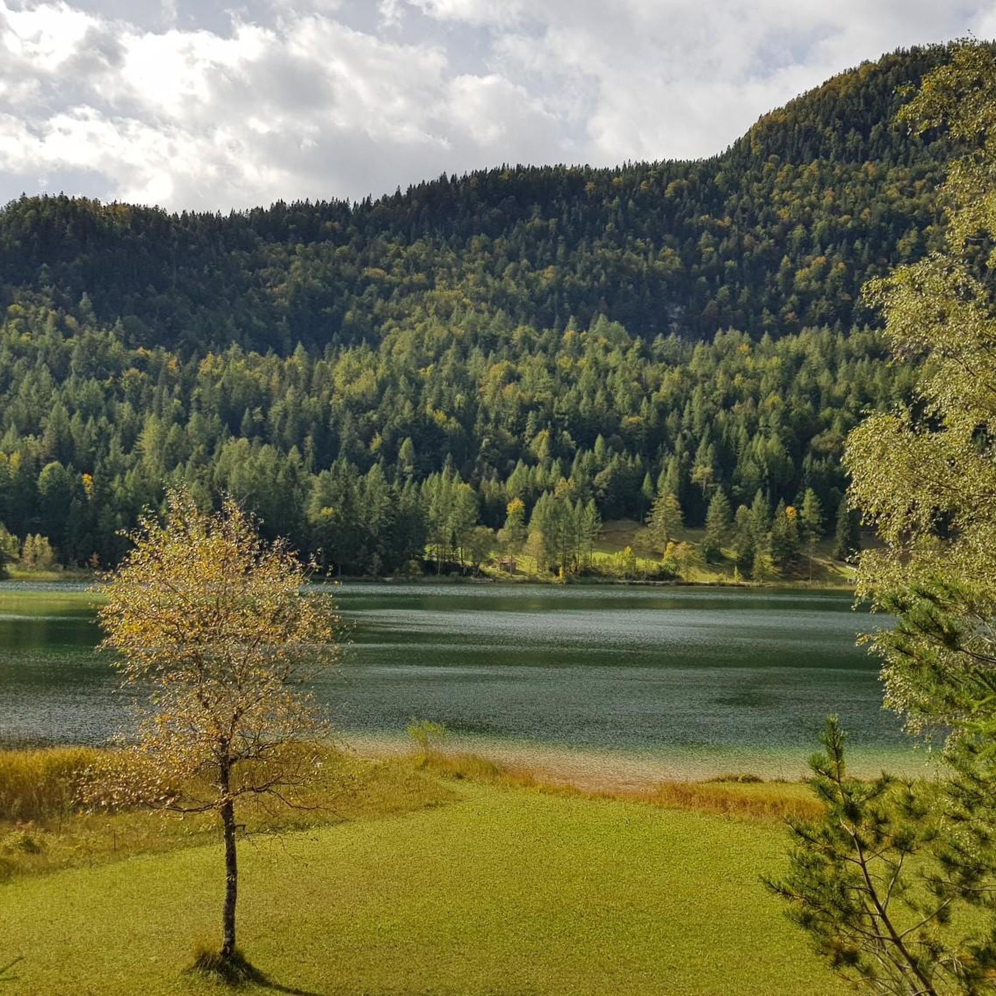
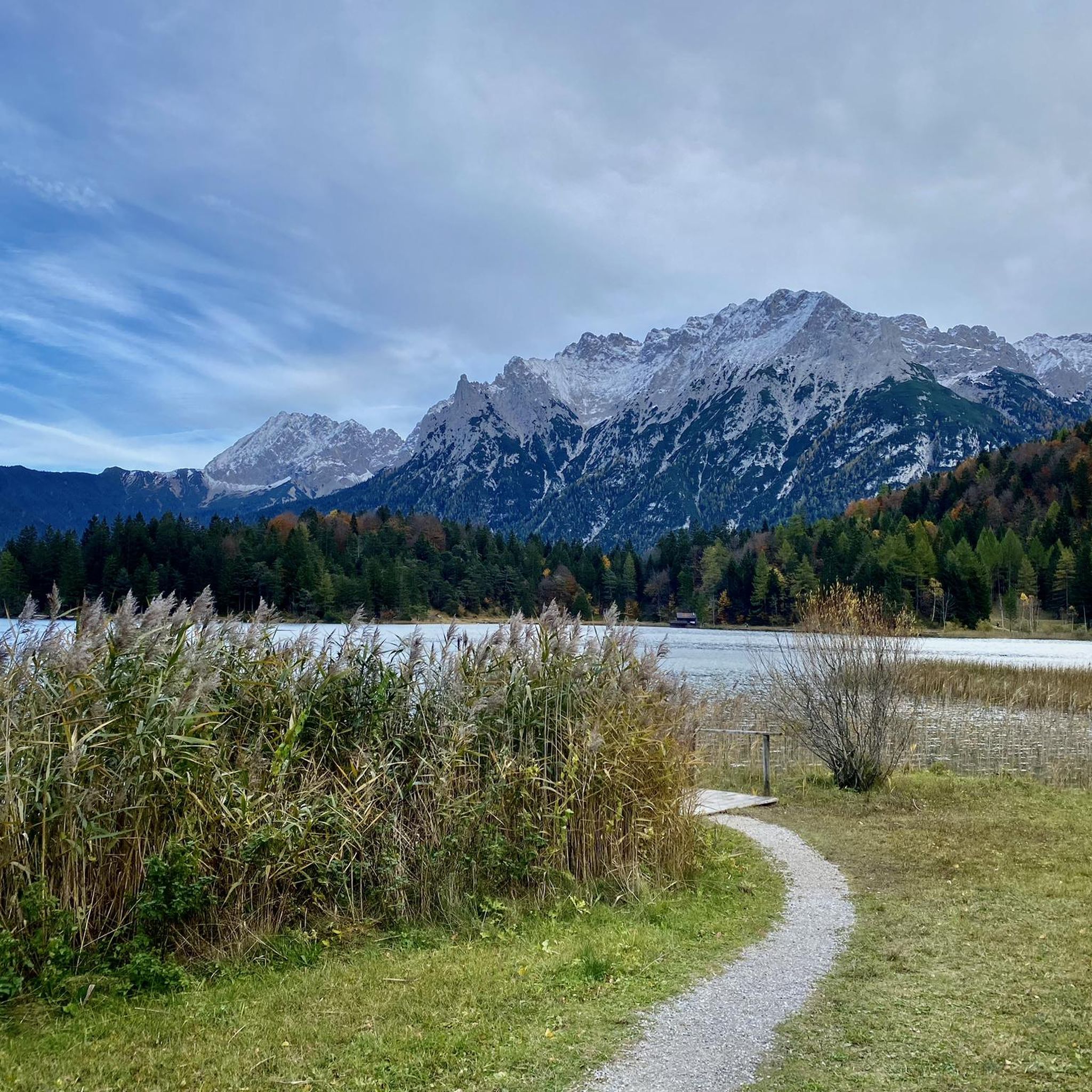
Jogging routes around Lautersee are set in the Bavarian Alps, offering a diverse landscape for runners. The region is characterized by the clear waters of Lautersee itself, surrounded by dense forests and the imposing peaks of the Karwendel and Wetterstein mountain ranges. Situated at an elevation of approximately 1,013 meters, the area provides varied terrain, including gravel, paved paths, and natural surfaces. This natural setting creates a picturesque backdrop for running activities.
Best jogging routes around Lautersee
- The most popular jogging route is Lautersee Chapel – Lainbach Creek loop from Mittenwald, a 3.6 miles (5.9 km) trail that takes about 42 minutes to complete. This route leads through the Laintal valley, featuring a waterfall, and circles Lautersee.
- Another top favourite among local runners is Western Shore of Lautersee – Lake Ferchensee loop from Schanz, a difficult 10.6 miles (17.0 km) path. This route connects Lautersee with the nearby Ferchensee, offering diverse natural scenery.
- Local runners also love the Leutascher Ache Riverside Path – Leutascher Ache loop from Burggraben, an 8.3 miles (13.4 km) trail leading through riverside paths, often completed in about 1 hour 24 minutes.
- Jogging around Lautersee is defined by alpine lakes, dense forests, and mountain backdrops, with well-maintained trails offering options for different ability levels.
- The routes in Lautersee are highly rated by the komoot community with an average score of 4.5 stars from over 240 reviews. More than 7,000 runners have used komoot to explore Lautersee's varied terrain.
Last updated: July 1, 2026
5.0
(1)
25
runners
17.0km
02:00
460m
460m
Hard run. Very good fitness required. Mostly paved surfaces. Suitable for all skill levels.
4.8
(4)
192
runners
8.12km
00:51
60m
60m
Moderate run. Good fitness required. Mostly paved surfaces. Suitable for all skill levels.

Sign up for free
5.0
(2)
69
runners
13.4km
01:24
110m
110m
Moderate run. Good fitness required. Mostly paved surfaces. Suitable for all skill levels.
4.5
(2)
124
runners
7.82km
00:49
30m
30m
Moderate run. Good fitness required. Mostly paved surfaces. Suitable for all skill levels.
24
runners
Moderate run. Good fitness required. Mostly paved surfaces. Suitable for all skill levels.
Get access to more routes and recommendations from other explorers.
Sign up for free
Already have an account?
Our route recommendations are based on thousands of hikes, rides, and runs completed by other people on komoot.
Start today with a free account
Your next adventure awaits.
Login or Signup


Tips from the Community

-Rafting in Mittenwald- On the Isar, a lively raft traffic developed as early as the 12th century through the founding of the Isar towns of Munich and Landshut, which partly led as far as Vienna. As early as 1450, there was a raft harbor below St. Nicholas' Church (at the present-day cemetery) with a market landing for stacking goods. From this point on, a water traffic ordinance regulated issues of freight transport and wages. Goods from the south and products from our homeland were transported on rafts: wood, coal, stones, lime, chalk, and later also the products of the violin makers. From the mid-16th century, transport was increasingly shifted to land routes. In 1905, the last raft sailed from Mittenwald to Munich.
0
0
The Isar is a river approximately 292 km long in Austria and Germany. It originates in the Karwendel mountains in Tyrol, flows through Bavaria, passing through Munich among other places, and flows into the Danube near Deggendorf. The Isar is an important river for nature, animals, and recreation in Bavaria.
0
0

"Enjoyment by the River" is the motto of the Gasthaus zur Brücke (Inn at the Bridge). Hot meals served from 11:30 am to 9:00 pm (limited menu from 2:00 pm to 5:30 pm) Closed: Tuesdays & Wednesdays Seating: approx. 50 indoors, approx. 60 outdoors Other: Cash only! https://www.seefeld.com/de/infrastrukturen/bruecke-gasthaus-restaurant-caf.html
0
0
The larger of the two spa parks in Mittenwald, also known as Max Kraus Park. It is named after a wealthy paper manufacturer who built his Art Nouveau country estate in the upper part of the park. After Kraus's death, the municipality acquired the park. The country estate was renovated in the 1980s.
0
0


Here, you'll find easier routes than at the Great Wall of China across the street. There's a handy topo map available at the parking lot.
3
0
Easy to reach by bike, with plenty of space at the base of the wall and even a place to sit – it's actually the perfect climbing garden by fair means. The view of the Great Wall of China opposite is a bonus.
3
0

Located directly on the bridge over the Isar Innsbrucker Straße.
0
0
Frequently Asked Questions
How many running routes are available around Lautersee?
There are nearly 200 running routes available around Lautersee, offering a wide variety of options for all skill levels. The komoot community has explored over 7,000 of these routes.
Are there easy running routes suitable for beginners around Lautersee?
Yes, Lautersee offers several easy running routes perfect for beginners. While many trails have varied terrain, you can find options that are less challenging. For a generally easy to moderate experience, consider the Laintal-Lautersee Loop, which is about 6.9 km (4.3 miles) and takes you through the scenic Laintal valley and around the lake.
What kind of natural landmarks or attractions can I see along the running trails?
The running trails around Lautersee are rich with natural beauty and interesting sights. You can expect to see the stunning clear waters of Western Shore of Lautersee, dense forests, and the imposing peaks of the Karwendel and Wetterstein mountain ranges. Many routes, like the Laintal-Lautersee Loop, pass by the Lainbach Waterfalls in the Lain Valley. The Lautersee and lakeside restaurants also offer picturesque views.
Are there any circular running routes around Lautersee?
Yes, many of the running routes around Lautersee are circular, allowing you to start and end at the same point. A popular example is the Lautersee Chapel – Lainbach Creek loop from Mittenwald, which is about 5.9 km (3.6 miles) and takes you through the Laintal valley and around Lautersee.
Can I bring my dog on the running trails around Lautersee?
Yes, the Lautersee area is generally dog-friendly, and many trails are suitable for running with your canine companion. Always ensure your dog is on a leash where required and that you clean up after them. The natural surfaces and varied terrain offer a great experience for both you and your dog.
Are there family-friendly running options near Lautersee?
Absolutely. The area around Lautersee offers several family-friendly running options. The Lautersee Chapel – Lainbach Creek loop from Mittenwald is a popular choice, and the Wasserweg am Lautersee is an informative and family-friendly themed trail on the west shore, providing continuous scenic views.
What do other runners enjoy most about jogging in Lautersee?
The komoot community highly rates the running experience around Lautersee, with an average score of 4.5 stars from over 240 reviews. Runners often praise the stunning alpine lake scenery, the diverse terrain including gravel and natural paths, and the well-maintained trails that offer options for various ability levels. The serene atmosphere and picturesque backdrop of the Karwendel and Wetterstein mountains are frequently highlighted.
Are there any cafes or places to rest near the running routes?
Yes, there are cozy inns and huts around Lautersee where you can take a break and enjoy Bavarian specialties. Places like Korbinianhütte offer opportunities to relax and soak in the picturesque views after your run. The Lautersee and lakeside restaurants are also great spots.
What is the best time of year for running around Lautersee?
The Lautersee area offers beautiful running conditions throughout much of the year. Spring and autumn provide pleasant temperatures and vibrant scenery, while summer is ideal for combining a run with a refreshing dip in the lake. Even in winter, some trails may be accessible for running, though conditions can vary and require appropriate gear.
How can I get to the Lautersee running routes by public transport?
Lautersee is located near Mittenwald, which is accessible by public transport. From Mittenwald, you can often find local bus services or walking paths that lead to the lake and its surrounding trails. It's advisable to check local transport schedules for the most current information on connections to Lautersee.
Is there parking available for runners near Lautersee?
Yes, parking facilities are generally available near Lautersee, especially in the vicinity of Mittenwald, which serves as a common starting point for many routes. Specific parking areas may be designated for visitors accessing the lake and its trails, though fees may apply.
Are there any longer, more challenging running routes in the area?
For those seeking a greater challenge, Lautersee offers more difficult and longer running routes. An example is the Western Shore of Lautersee – Lake Ferchensee loop from Schanz, which is a difficult 17.0 km (10.6 miles) path connecting Lautersee with the nearby Ferchensee, offering diverse natural scenery and more significant elevation changes.
Most popular routes around Lautersee
Most popular attractions around Lautersee

Get inspired with the komoot mobile app


Explore more
Browse the best Running Trails & Routes in other regions.
