The best walks and hikes around Petite-Rivière-Saint-François
4.6
(12)
468
hikers
10
hikes
Hiking around Petite-Rivière-Saint-François offers a variety of trails that explore coastal areas, forested hills, and scenic viewpoints. The region is characterized by its proximity to the Saint Lawrence River, providing opportunities for routes along the shoreline and paths ascending to elevated perspectives. Terrain includes gentle coastal loops and more challenging ascents through wooded areas, catering to different hiking preferences.
Best hiking trails around Petite-Rivière-Saint-François
- The most popular hiking route is Beach loop from Baie Saint Paul, a 4.5 miles (7.2 km) trail that takes about 1 hour 50 minutes to complete, offering views of the coastline.
- Another top favourite among local hikers is Le Buton Viewpoint – View of Cap Maillard loop from École de Glisse du Massif, an easy 2.6 miles (4.2 km) path. This route provides panoramic views from the viewpoint.
- Local hikers also love the Mont Gabrielle-Roy, loop from La Pointue, a 3.6 miles (5.9 km) trail leading through varied terrain with an ascent to Mont Gabrielle-Roy, often completed in about 1 hour 55 minutes.
- Hiking around Petite-Rivière-Saint-François is defined by coastal paths, forested hills, and scenic viewpoints. The network offers options for easy hikes and more moderate challenges.
- The routes in Petite-Rivière-Saint-François are highly rated by the komoot community with an average score of 4.7 stars from more than 10 reviews. More than 300 hikers have used komoot to explore Petite-Rivière-Saint-François's varied terrain.
Last updated: July 21, 2026
4.0
(1)
53
hikers
14.6km
05:05
780m
780m
Hard hike. Very good fitness required. Easily-accessible paths. Suitable for all skill levels.
50
hikers
12.8km
04:32
710m
710m
Moderate hike. Good fitness required. Easily-accessible paths. Suitable for all skill levels.

Sign up for free
4.7
(3)
58
hikers
Easy hike. Great for any fitness level. Easily-accessible paths. Suitable for all skill levels.
5.0
(1)
46
hikers
5.86km
01:55
270m
270m
Easy hike. Great for any fitness level. Easily-accessible paths. Suitable for all skill levels.
5.0
(1)
44
hikers
6.02km
01:58
250m
250m
Easy hike. Great for any fitness level. Easily-accessible paths. Suitable for all skill levels.
Get access to more routes and recommendations from other explorers.
Sign up for free
Already have an account?
Our route recommendations are based on thousands of hikes, rides, and runs completed by other people on komoot.
Start today with a free account
Your next adventure awaits.
Login or Signup
Popular around Petite-Rivière-Saint-François
Tips from the Community

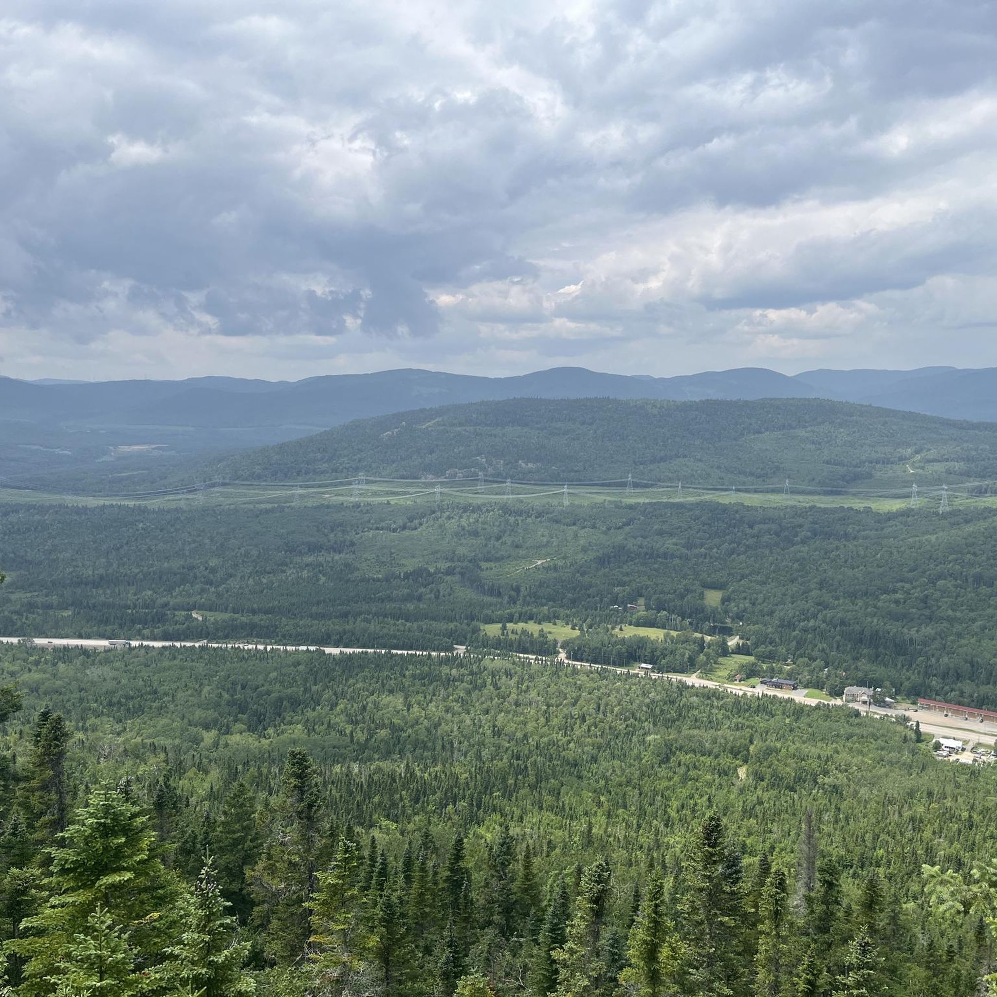
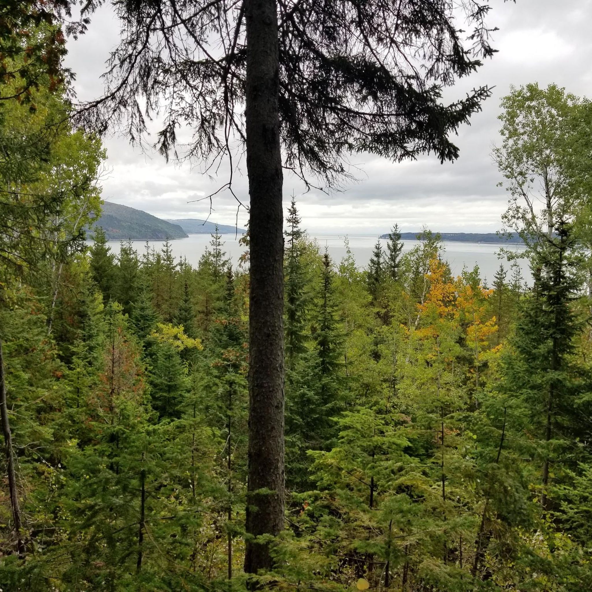
Cap Maillard rises above the St. Lawrence River and forms one of the defining high points of Le Massif de Charlevoix. From here, the steep mountainsides of Charlevoix plunge toward the river, creating one of the most dramatic landscapes in eastern Canada.
0
0
Le Buton is Le Massif's signature lookout, offering sweeping views over the Charlevoix region and the St. Lawrence River. The viewpoint sits on a man-made promontory near the summit and provides an unusually open panorama, allowing you to take in the river, surrounding mountains, and the dramatic drop from the ski slopes to the shoreline below. On a clear day, the scale of the landscape is impressive in every direction.
0
0
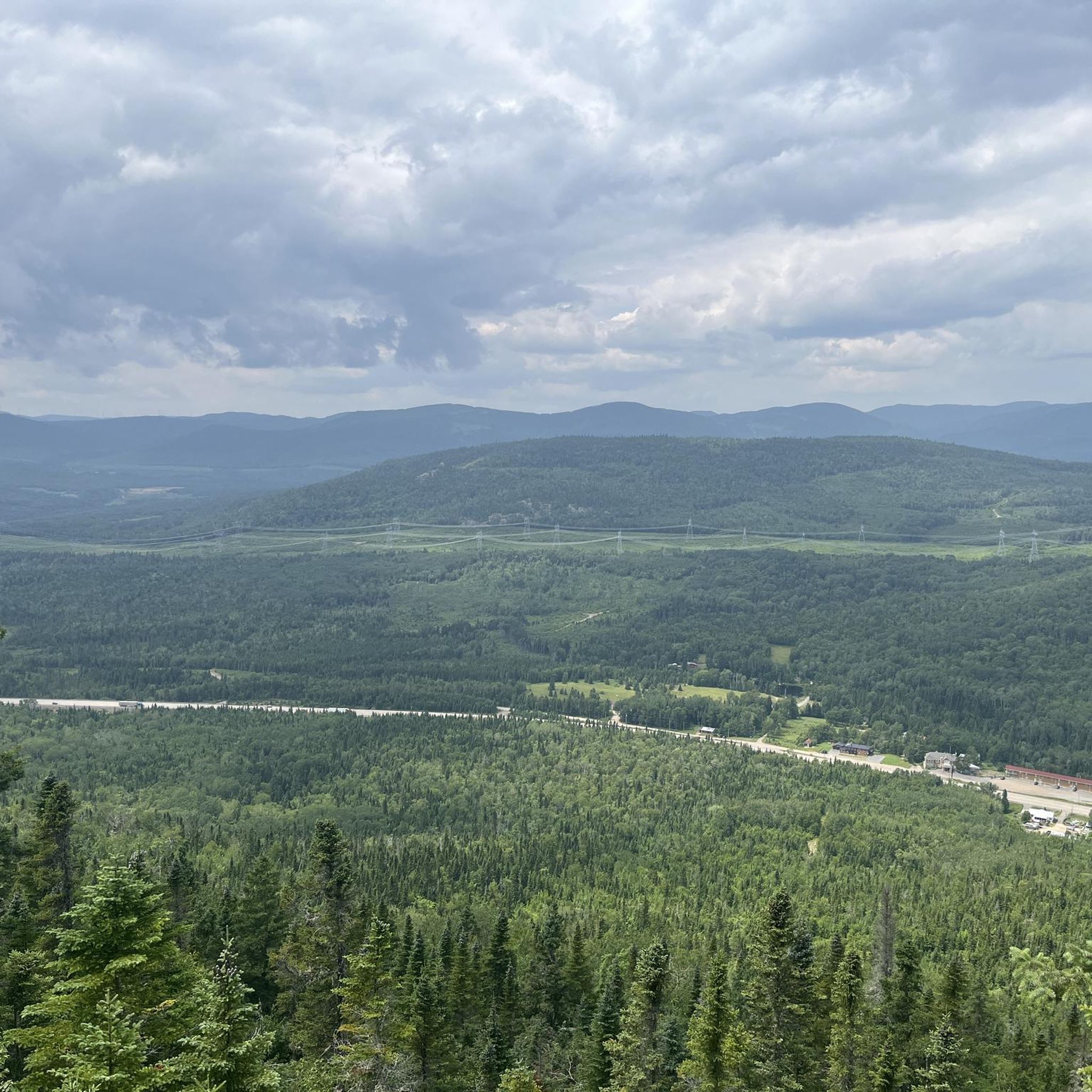
La Promenade starts as the more approachable section of the Les Crêtes Trail, following a maintained dirt path up from the base of Le Massif toward the Petite Butte Ronde viewpoint. From there, the character changes as the route links into Les Crêtes, a steeper and narrower trail with roots, rocks, and more sustained climbing. The reward is the view over the St. Lawrence River and the forested slopes of Charlevoix, but this is definitely more than a casual riverside walk.
0
0

The trail to the summit is well-marked, and from the peak you can see clearly out past Isle-aux-Coudres. There are a few refuges nearby where you can stay the night before hiking back down toward the St. Lawrence.
0
0
The trail takes you steadily up to Liguori Mountain, and some of the views from the climb are better than at the summit. The trail crisscrosses an exposed dirt road that winds up the summit in parallel as you mirror the creek.
0
0
You can stay at the youth hostel and campsites at the base of the mountain with access to the hiking, mountain biking, and ski trails above.
0
0
Frequently Asked Questions
How many hiking trails are available in Petite-Rivière-Saint-François?
There are over 10 hiking routes recorded in Petite-Rivière-Saint-François on komoot, offering a variety of experiences from coastal walks to forest ascents. The region is known for its diverse terrain near the Saint Lawrence River.
Are there easy hiking trails suitable for beginners or families?
Yes, the majority of trails in Petite-Rivière-Saint-François are rated as easy. For a gentle introduction, consider the Le Buton Viewpoint – View of Cap Maillard loop from École de Glisse du Massif, which is 2.6 miles (4.2 km) and offers panoramic views without significant challenge.
Can I bring my dog on the hiking trails in Petite-Rivière-Saint-François?
Policies regarding dogs can vary by specific trail or park management. While many natural areas in Quebec are dog-friendly, it's always best to check local signage or the specific trail's regulations before heading out. Generally, dogs should be kept on a leash.
What is the best time of year to go hiking in Petite-Rivière-Saint-François?
The best time to hike is typically from late spring to early fall (May to October). Summer offers lush greenery and warmer temperatures, while autumn provides spectacular fall foliage. Some trails may also be accessible for snowshoeing or winter hiking, but conditions can be challenging.
Are there any circular hiking routes in the area?
Yes, many of the trails in Petite-Rivière-Saint-François are designed as loops, allowing you to start and end at the same point. An example is the Mont Gabrielle-Roy, loop from La Pointue, which is a 3.6 miles (5.9 km) trail offering varied terrain.
What are the typical lengths and durations of hikes in Petite-Rivière-Saint-François?
Hikes in the region vary, but many fall within the 2.5 to 4.5 miles (4 to 7 km) range, taking approximately 1.5 to 2.5 hours to complete. For instance, the Beach loop from Baie Saint Paul is 4.5 miles (7.2 km) and takes about 1 hour 50 minutes.
Are there any trails with significant viewpoints or scenic overlooks?
Absolutely. The region is known for its scenic vistas over the Saint Lawrence River and surrounding landscapes. The Le Buton Viewpoint trail, for example, offers panoramic views of Cap Maillard and the river.
Is parking available at the trailheads?
Most established hiking trails and parks in the Petite-Rivière-Saint-François area provide designated parking facilities. It's advisable to check specific trail information or park websites for details on parking availability and any potential fees before your visit.
What do other hikers say about the trails in Petite-Rivière-Saint-François?
The trails in Petite-Rivière-Saint-François are highly regarded by the komoot community, with an average rating of 4.7 stars from over 10 reviews. Hikers often praise the beautiful coastal views, well-maintained paths, and the peaceful atmosphere of the forested sections.
Are there any moderate or challenging hikes for more experienced hikers?
While most trails are easy, there are options for those seeking a bit more challenge. The Alt 790 – Montagne à Liguori loop from École de Glisse du Massif is a moderate 4.6 miles (7.4 km) route with more significant elevation gain, offering a good workout and rewarding views.
Are permits required to hike in Petite-Rivière-Saint-François?
Generally, permits are not required for public access trails in Petite-Rivière-Saint-François. However, if you plan to hike within a provincial park or a managed natural reserve, there might be entrance fees or specific regulations. Always check with the local park authority if you are unsure.
Can I access hiking trails using public transport?
Public transport options directly to trailheads in Petite-Rivière-Saint-François can be limited, as is common in many rural Quebec regions. It is generally recommended to have a car for convenient access to most hiking starting points. Some trails might be accessible via local taxi services from the village.
Most popular routes around Petite-Rivière-Saint-François

Get inspired with the komoot mobile app


Explore more
Browse the best Hikes in other regions.
