The best walks and hikes around Beaumont
4.7
(35)
775
hikers
10
hikes
Hiking around Beaumont, QC, offers a variety of trails, many of which are situated near the St. Lawrence River. The region features riverfront paths, areas with waterfalls, and urban green spaces. These trails provide opportunities to experience the local landscape, including views of the river and surrounding natural features.
Best hiking trails around Beaumont
- The most popular hiking route is Parcours des Anses, a 12.4 miles (19.9 km) trail that takes 5 hours 13 minutes to complete. This route offers extensive views along the waterfront.
- Another top favourite among local hikers is Montmorency Falls – Montmorency Mansion loop from Quebéc Chutes-Montmorency, an easy 3.2 miles (5.1 km) path. This trail explores the area around the Montmorency Falls.
- Local hikers also love the Montmorency Mansion – Montmorency Falls loop from Boischatel, a 1.9 miles (3.0 km) trail leading through the vicinity of the Montmorency Falls and Mansion, often completed in about 58 minutes.
- Hiking around Beaumont is defined by riverfront paths, waterfalls, and urban green spaces. The network offers options for easy, moderate, and difficult ability levels.
- The routes in Beaumont are highly rated by the komoot community with an average score of 4.7 stars from over 20 reviews. More than 600 hikers have used komoot to explore Beaumont's varied terrain.
Last updated: October 7, 2026
12
hikers
28.5km
07:20
140m
140m
Hard hike. Very good fitness required. Easily-accessible paths. Suitable for all skill levels.
4
hikers
19.9km
05:14
160m
160m
Hard hike. Very good fitness required. Easily-accessible paths. Suitable for all skill levels.

4.8
(13)
228
hikers
Easy hike. Great for any fitness level. Easily-accessible paths. Suitable for all skill levels.
4.8
(11)
231
hikers
Easy hike. Great for any fitness level. Easily-accessible paths. Suitable for all skill levels.
4.5
(10)
274
hikers
3.86km
01:13
140m
140m
Easy hike. Great for any fitness level. Easily-accessible paths. Suitable for all skill levels.
Get access to more routes and recommendations from other explorers.
Already have an account?
Our route recommendations are based on thousands of hikes, rides, and runs completed by other people on komoot.
Start today with a free account
Your next adventure awaits.
Popular around Beaumont
Tips from the Community

From this high viewpoint near the historic Montmorency Falls, you can see the stunning blue waters of the St. Lawrence River stretching out before you. If you look closely across the river, you can spot the famous skyline of Old Québec, including the towering, castle-like Château Frontenac sitting proudly on the cliffs.
0
0
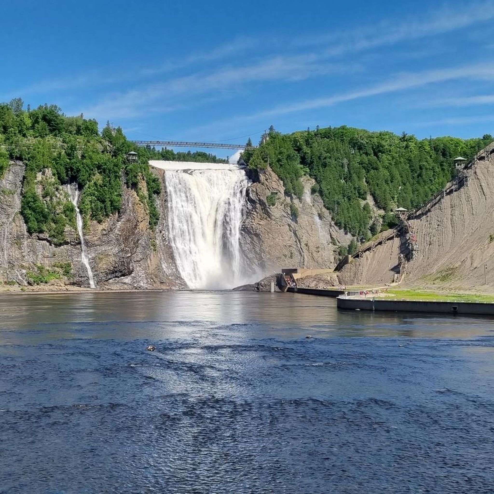
As you walk across, you are treated to a wonderful vantage point of the local landscape, where the river carves its way through the rocky terrain before heading toward the St. Lawrence River. The bridge is famously positioned just upstream from the spectacular Montmorency Falls, which are actually higher than Niagara Falls.
0
0
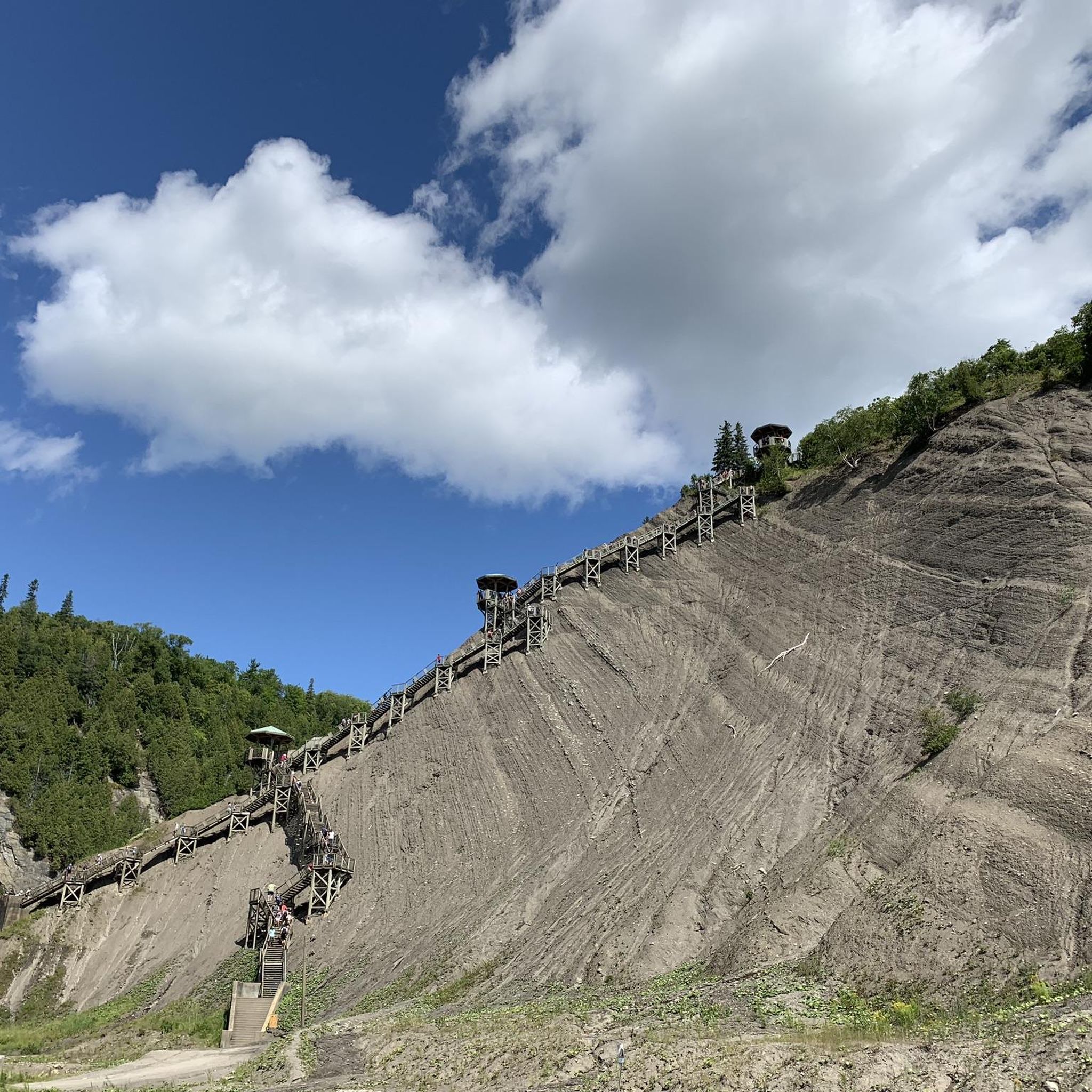
A great way to explore is by walking across the suspension bridge that hangs directly over the crest of the falls. From there, you can look straight down into the tumbling white water. If you enjoy a challenge, you can climb the panoramic staircase with its 487 steps to get incredible views from different heights. For a more relaxing ride, you can take the cable car up the cliff face.
2
0

The Parcours des Anses crosses the Etchemin River on a dedicated pedestrian and cycling bridge just before the river meets the St. Lawrence. It’s a pleasant crossing with views along the river and toward the waterfront. After crossing to the southwest side, you’ll reach Parc Aline-Welsh-Murphy, a convenient stop along the trail with useful facilities including public toilets, a water fountain, and picnic areas.
0
0
This viewpoint along the Parcours des Anses offers one of the best views across the St. Lawrence River toward Quebec City. From here you can clearly see the skyline of Old Québec, including the Château Frontenac rising above the historic fortifications. The wide river in the foreground and ships passing along the channel add to the scene, making this a great place to pause along the trail and take in one of the most iconic views in the region.
0
0
The Parcours des Anses is a nearly 15 kilometre paved multi-use trail that follows the south shore of the St. Lawrence River in Lévis. Built on a former railway corridor, the route is wide and mostly flat, making it ideal for walking and cycling. Along the way, the trail passes green spaces, historic sites such as the former A.C. Davie Shipyard, and several viewpoints overlooking the river. The views across the water toward Quebec City, including the Château Frontenac and the bridges, are a highlight throughout the route.
0
0

Very nice cycle path with very little elevation gain
1
0

amazing
0
0
Frequently Asked Questions
How many hiking trails are available in Beaumont?
There are over 10 hiking trails around Beaumont, offering a variety of experiences. These routes are rated by the komoot community with an average score of 4.7 stars.
Are there easy hiking trails in Beaumont, and how long are they?
Yes, Beaumont offers several easy hiking trails. For example, the Montmorency Falls – Montmorency Mansion loop from Quebéc Chutes-Montmorency is an easy 3.2 miles (5.1 km) path, and the Montmorency Mansion – Montmorency Falls loop from Boischatel is a shorter 1.9 miles (3.0 km) trail.
What is the typical length of hikes around Beaumont?
Hikes around Beaumont vary in length. You can find shorter routes like the Montmorency Falls – Montmorency Falls loop from Quebéc Chutes-Montmorency at 2.8 miles (4.5 km), up to longer, more challenging trails such as Parcours des Anses, which is 12.4 miles (19.9 km).
Are there family-friendly hiking options in Beaumont?
Many of the easier trails around Beaumont are suitable for families. The paths around Montmorency Falls, such as the Montmorency Falls – Montmorency Mansion loop from Quebéc Chutes-Montmorency, are generally accessible and offer engaging sights.
Can I bring my dog on the hiking trails in Beaumont?
Many trails in the Beaumont area are dog-friendly, but it's always best to check specific trail regulations before heading out. Generally, dogs are welcome on leash in most natural areas.
What natural attractions can I see while hiking in Beaumont?
The Beaumont area is known for its riverfront paths and waterfalls. A prominent natural attraction is Montmorency Falls, which can be explored via several hiking routes. You can also experience the Montmorency Falls Suspension Bridge and the Boardwalk to the Montmorency Falls Bridge.
Are there good circular hiking routes in Beaumont?
Yes, Beaumont offers several circular routes. Examples include the Montmorency Falls – Montmorency Mansion loop from Quebéc Chutes-Montmorency and the Red Stairs Lévis – Quai Paquet, Lévis loop from Cégep de Lévis, which provides river views.
What is the best time of year to go hiking in Beaumont?
The best time for hiking in Beaumont is typically from late spring to early autumn (May to October), when the weather is mild and trails are clear. Fall offers beautiful foliage, especially along the riverfront.
Can I hike in Beaumont during winter?
Winter hiking is possible in Beaumont, but conditions can vary. Trails may be covered in snow or ice, requiring appropriate gear like microspikes or snowshoes. Always check local conditions and trail accessibility before heading out in winter.
What should I pack for a hike in Beaumont?
For hiking in Beaumont, it's advisable to pack layers of clothing, sturdy hiking shoes, water, snacks, and sun protection. Depending on the season, insect repellent can also be useful. For longer routes, a map or GPS device is recommended.
Is parking available at the trailheads in Beaumont?
Many popular trailheads and parks in the Beaumont area, especially those near attractions like Montmorency Falls, offer designated parking facilities. It's always a good idea to check specific location details before your visit.
Can I reach the hiking trails in Beaumont using public transport?
Given Beaumont's proximity to Quebec City, some trails, particularly those closer to urban areas or major attractions like Montmorency Falls, may be accessible via public transport. Checking local bus routes is recommended for specific access points.
How can I find less crowded hiking trails in Beaumont?
To find less crowded trails, consider hiking during off-peak hours (early mornings or late afternoons) or on weekdays. Exploring some of the lesser-known paths away from major attractions can also offer a more tranquil experience.
Most popular routes around Beaumont
Most popular attractions around Beaumont

Get inspired with the komoot mobile app


Explore more
Browse the best Hikes in other regions.
