The best walks and hikes around Black Canyon City
4.8
(6)
24
hikers
11
hikes
Hiking around Black Canyon City offers access to the Sonoran Desert environment, characterized by saguaro forests and rugged canyons. The region's trails often follow the Agua Fria River, providing natural resting spots. At an elevation of approximately 2,000 feet, the area provides panoramic mountain views and classic Arizona trails lined with desert plants.
Best hiking trails around Black Canyon City
- The most popular hiking route is Black Canyon Trail: Bumble Bee to Rock Springs, a 21.6 miles (34.7 km) trail that takes 9 hours 39 minutes to complete. This difficult section of the Black Canyon Trail offers a challenging experience with varied elevation changes within a desert climate.
- Another top favourite among local hikers is Black Canyon Trail: Rock Springs to W Carefree Highway, a difficult 30.5 miles (49.1 km) path. This extensive route features rugged canyons and panoramic mountain views across the Sonoran Desert.
- Local hikers also love the High Desert Park Trail, a 1.0 mile (1.7 km) trail leading through accessible nature trails and desert plants, often completed in about 26 minutes.
- Hiking around Black Canyon City is defined by its Sonoran Desert landscape, rugged canyons, and the Agua Fria River. The network offers options for different ability levels, from easy loops to challenging long-distance routes.
- The routes in Black Canyon City are highly rated by the komoot community with an average score of 5.0 stars from over 3 reviews. More than 17 hikers have used komoot to explore Black Canyon City's varied terrain.
Last updated: October 11, 2026
2.90km
00:50
70m
60m
Embark on an easy desert hike along the Agua Fria Trail, a rugged and scenic route that takes you through diverse landscapes. You will experience desert grasslands, expansive mesas, and deep canyon walls carved by the Agua Fria River. This trail covers 1.8 miles (2.9 km) with a gentle elevation gain of 241 feet (74 metres), making it a quick adventure you can complete in about 49 minutes. Keep an eye out for ancient petroglyphs near the confluence of the Agua Fria River and Badger Springs Wash, adding a historical touch to your journey. The atmosphere is one of quiet wilderness, perfect for a refreshing escape.
The Agua Fria Trail is situated within Lake Pleasant Regional Park, offering straightforward access for your hike. While this specific route is easy, be aware that much of the surrounding Agua Fria National Monument features more challenging, undeveloped paths. The Bureau of Land Management advises proper preparation if you plan to explore beyond the main trail, as facilities are minimal. It is crucial to avoid hiking during the summer months due to dangerously high temperatures, ensuring a safer and more enjoyable experience.
This trail provides a unique glimpse into the natural and historical richness of the Agua Fria National Monument. Beyond the striking geological formations, the area is home to abundant wildlife; you might spot coyotes, mule deer, or various bird species during your visit. The presence of ancient petroglyphs highlights the long human history of this landscape, offering a connection to past cultures. This route serves as an excellent introduction to the desert's rugged beauty and its hidden stories.
8.30km
02:13
50m
160m
Embark on the West Table Mesa Road Trail for a moderate hike through the vibrant Sonoran Desert. This route spans 5.2 miles (8.3 km) with a gentle elevation gain of 176 feet (54 metres), typically taking around 2 hours and 13 minutes to complete. You'll encounter classic desert plants like saguaro, prickly pear, and cholla, set against a backdrop of rolling hills. Keep an eye out for the distinctive lone tower perched on Table Mesa, a prominent landmark visible from the trailhead. The trail offers peaceful scenic viewpoints of this unique desert landscape, providing a true immersion into central Arizona's natural beauty.
The route follows a wide dirt access road, which is generally smooth but can be affected by weather. Always check conditions before you go, as rain can lead to washouts or ruts. This is a multi-use trail, so you might share it with mountain bikers and off-roaders. Plan your visit during cooler months for the most comfortable hiking experience. If you are considering an overnight stay, there are opportunities for dispersed camping in the surrounding area.
This trail provides an excellent opportunity to experience the rich biodiversity of the Sonoran Desert. You will see iconic desert flora, which thrives in this arid environment. The area is known for its unique geological formations, including the mesas and rolling hills that define the landscape. The West Table Mesa Road Trail stands out as an accessible way to explore this distinctive central Arizona wilderness.

34.7km
09:33
500m
700m
Embark on a challenging hike along the Black Canyon Trail from Bumble Bee to Rock Springs, a difficult route stretching 21.6 miles (34.7 km). You will gain 1637 feet (499 metres) in elevation, requiring an estimated 9 hours and 33 minutes to complete. As you traverse this segment, expect to immerse yourself in the Sonoran Desert's varied landscape, navigating through saguaro forests and rugged canyons. Keep an eye out for vast vistas of the desert and the striking views of Sunset Point, a notable gorge along the way.
Planning your visit requires preparation for a remote experience, despite the trail's proximity to Interstate 17. While no specific permits or fees are mentioned, general parking is available at trailheads like Bumble Bee. This route offers backcountry solitude, so ensure you carry enough water and supplies. A popular stop along the way is the well-known Rock Springs Cafe, famous for its pie, which can serve as a convenient resupply point.
This section is part of the larger Black Canyon National Recreation Trail, offering a unique journey through the Sonoran Desert. You will encounter a diverse environment, occasionally crossing the Agua Fria River. The trail is framed by the rough-cut, mineral-rich peaks of the Bradshaw Mountains to the west and the stream-chiseled gullies of the Black Canyon, showcasing the region's distinct geology and natural beauty.
1.67km
00:27
10m
30m
Embark on an easy hike along the High Desert Park Trail, a gentle route spanning 1.0 miles (1.7 km) with a minimal elevation gain of 45 feet (14 metres). You can expect to complete this pleasant walk in about 26 minutes. As you follow the path, you'll find yourself amidst classic desert flora, with some plants helpfully labeled for identification. The trail offers serene views, framed by the distant Bradshaw and New River Mountains, providing a true sense of the high desert landscape.
The High Desert Park Trail is easily accessible, situated within High Desert Park itself. You'll find ample parking available directly at the park, making your arrival straightforward. Along the route, look for occasional benches where you can pause and rest. The park also provides picnic areas, perfect for enjoying a meal before or after your hike.
This trail is an excellent way to experience the unique beauty of the desert ecosystem. It's particularly well-suited for families looking to enjoy the natural surroundings. Furthermore, the High Desert Park Trail serves as a convenient starting point if you are considering exploring sections of the much longer Black Canyon Trail.
49.1km
13:25
700m
830m
Embark on a difficult hiking adventure along the Black Canyon Trail, stretching 30.5 miles (49.1 km) from Rock Springs to W Carefree Highway. You will gain 2292 feet (699 metres) in elevation, requiring an estimated 13 hours and 25 minutes to complete. This challenging route takes you through rugged desert landscapes, past rocky outcrops, and across steep switchbacks, showcasing the classic Sonoran Desert with its saguaro forests and the notable Agua Fria River.
For the best experience, plan your visit between November and April, as summer temperatures can be extremely hot and demanding. The trailhead at Rock Springs offers convenient parking and restroom facilities, making it an ideal starting point for your journey. Be sure to prepare adequately for this long and strenuous hike, carrying plenty of water and supplies.
This section of the Black Canyon National Recreation Trail provides a demanding yet rewarding exploration of the Arizona desert. As you traverse the varied terrain, keep an eye out for local wildlife such as mule deer, javelina, and various bird species. The trail's diverse ecosystem and challenging nature make it a standout option for experienced hikers seeking a true desert immersion.
Get access to more routes and recommendations from other explorers.
Already have an account?
Our route recommendations are based on thousands of hikes, rides, and runs completed by other people on komoot.
Start today with a free account
Your next adventure awaits.
Popular around Black Canyon City
Tips from the Community

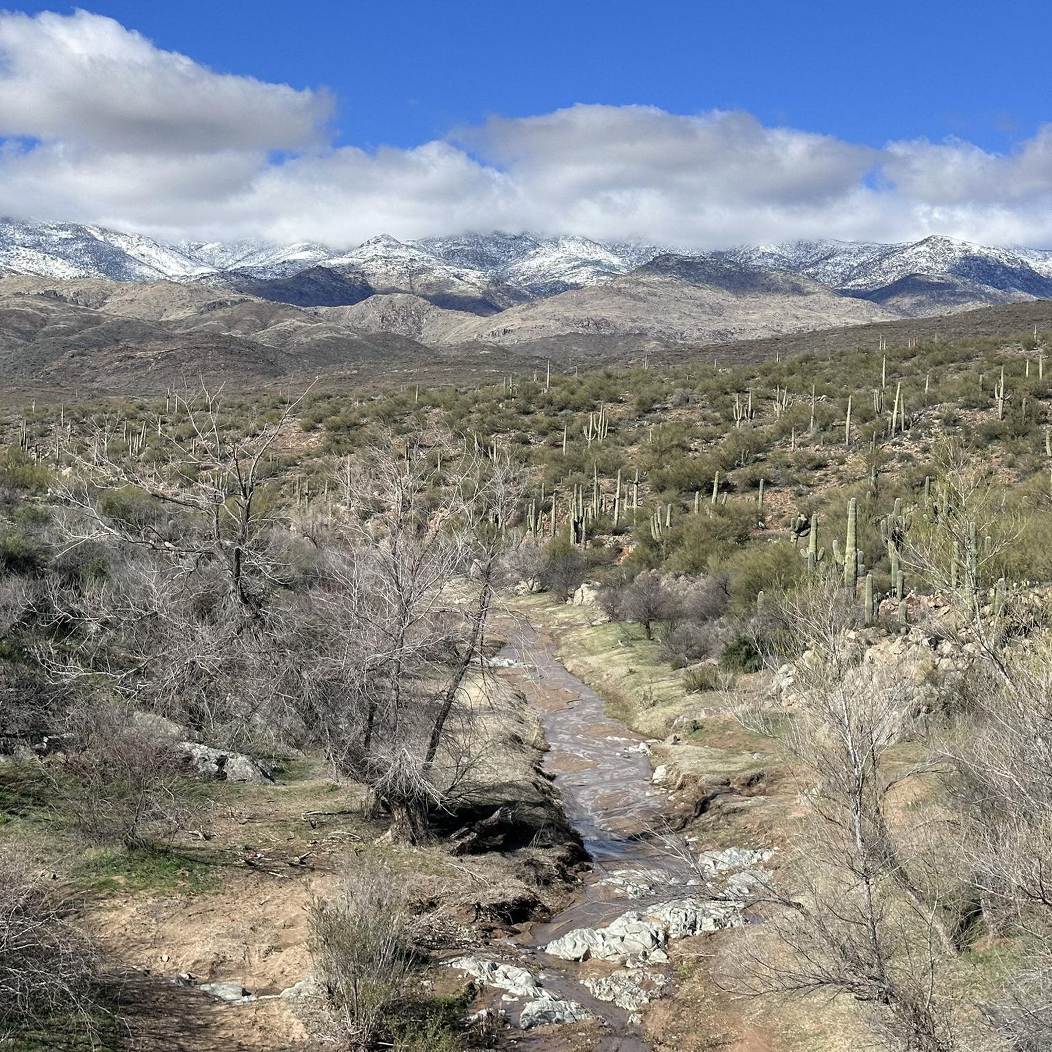
The Black Canyon trail segments Hidden Treasure, American Gulch, and Bumble Bee, when hiked or traveled Southbound descend into the Sonoran Desert from the more arrid desert North of it in the highcountry. Many beautiful cacti can be found here, which makes it appear much lusher than people often imagine desert to be. 🏜 The Encyclopaedia Britannica describes it as follows: "The Sonoran Desert has a subtropical climate and receives 3 to 15 inches (75 to 380 mm) of rain per year. Most of it falls during the monsoon season (July–September), when strong, brief thunderstorms bring heavy rain. Lighter winter rainfall occurs in December and January. Frosts are rare. The hottest and driest part of the desert is near the lower Colorado River, where summer temperatures can reach more than 120 °F (49 °C) and rainfall is less than three inches." https://www.britannica.com/place/Sonoran-Desert
0
0

The water level of this creek is dependent on the time of year. Like a lot of the water crossings along the Black Canyon Trail, there are a bunch of shade trees down next to the water that serve as a great resting spot if you're in need.
0
0
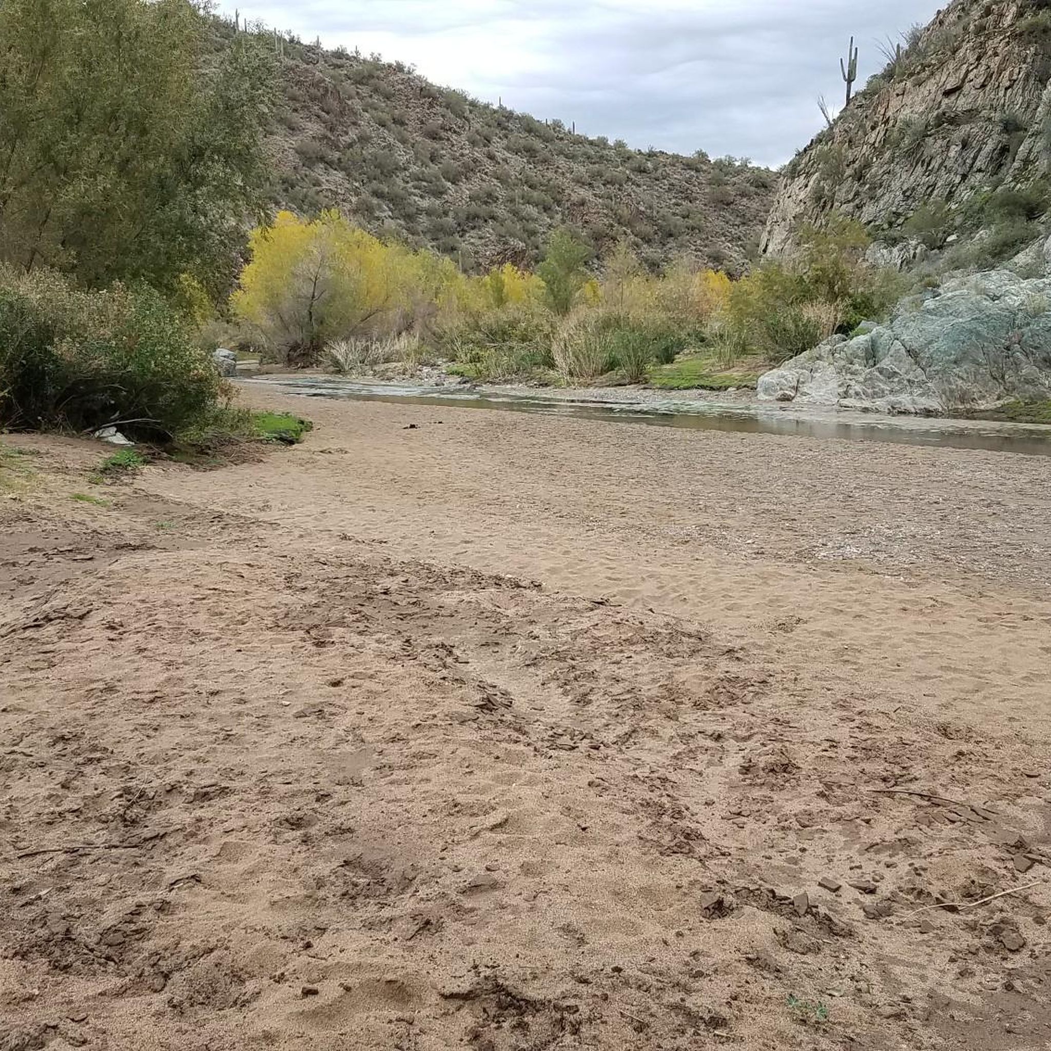
The water level within the Agua Fria River fluctuates depending on the time of year and the amount of recent precipitation. That being said, there is almost always some sort of flow in the riverbed. This is a popular resting point along the Black Canyon Trail since there are some shade trees down next to the water.
0
0
The water level within the Agua Fria River fluctuates depending on the time of year and the amount of recent precipitation. That being said, there is almost always some sort of flow in the riverbed. This is a popular resting point along the Black Canyon Trail since there are some shade trees down next to the water.
0
0
A beautiful surprise awaits the desert hiker
1
0

You come down off the hills and come to a gorgeous water crossing. The river had to be 50 yards wide. During the rain and snow melt season the river has to be flowing pretty good. Great place to stop, have a snack, and soak in the views.
0
0
Frequently Asked Questions
How many hiking trails are available around Black Canyon City?
There are 10 hiking trails available around Black Canyon City, offering a range of experiences from easy strolls to challenging treks through the Sonoran Desert landscape.
What is the best time of year to go hiking in Black Canyon City?
The cooler months, from November to April, are ideal for hiking in Black Canyon City. During the warmer months, early mornings are recommended to enjoy the trails peacefully and avoid the heat.
Are there any easy or beginner-friendly hikes in Black Canyon City?
Yes, there are several easy trails perfect for beginners or a relaxed outing. The Agua Fria Trail is a great option, offering a pleasant 2.9 km walk. Another accessible choice is the High Desert Park Trail, which is 1.7 km long and provides scenic views within High Desert Park.
What kind of terrain can I expect on the Black Canyon Trail?
The Black Canyon Trail is known for its challenging and varied terrain. Hikers can expect rough, unstable soils, rocks, and significant elevation changes as it traverses the rugged Sonoran Desert. It follows historic routes, offering a true desert adventure.
Are there any trails that follow the Agua Fria River?
Yes, the Agua Fria Trail directly follows the Agua Fria River, providing a chance to experience this vital natural feature. The river's water levels can fluctuate, and its banks often offer welcome shade, making it a popular resting spot.
What are some notable natural features or attractions to see while hiking?
Hikers can explore several natural attractions. The High Desert Park offers expansive mountain and canyon views. You'll also encounter the iconic Sonoran Desert landscape with its saguaro forests and dramatic canyons. The Black Canyon Trail itself is a major highlight, and you might even spot the Agua Fria River or Slate Creek Crossing.
Are there any long-distance or difficult hikes for experienced trekkers?
Absolutely. For experienced trekkers, the Black Canyon Trail offers challenging segments. Consider the Black Canyon Trail: Bumble Bee to Rock Springs, a difficult 34.7 km route with significant elevation changes. Another demanding option is the Black Canyon Trail: Rock Springs to W Carefree Highway, which spans 49.1 km.
What do other hikers enjoy most about the trails in Black Canyon City?
The trails in Black Canyon City are highly rated by the komoot community, with an average score of 5.0 stars. Reviewers often praise the stunning Sonoran Desert scenery, the panoramic mountain views, and the diverse range of trails suitable for various skill levels.
Are there any parks or community areas with hiking trails in Black Canyon City?
Yes, High Desert Park is an 89-acre community park that offers accessible nature trails with expansive mountain and canyon views. It also provides amenities like restrooms and picnic tables, making it a great spot for a family-friendly outing.
Can I find trails that offer a sense of history or cultural significance?
The Black Canyon Trail is a historic National Recreation Trail that follows routes used by prehistoric Native American travelers and traders. Additionally, just north of Black Canyon City, the Agua Fria National Monument features ancient Pueblo sites and fascinating petroglyphs along the Agua Fria River, offering a glimpse into the region's past.
Are there any trails that are particularly good for scenic views?
Many trails in the area offer stunning views of the Sonoran Desert and surrounding mountains. The High Desert Park trails are known for their expansive mountain and canyon vistas. The overall elevation of Black Canyon City, around 2,000 feet, ensures panoramic views across the rugged landscape.
Most popular routes around Black Canyon City
Most popular attractions around Black Canyon City

Get inspired with the komoot mobile app


Explore more
Browse the best Hikes in other regions.
