The best walks and hikes around Flachwasserzone Mannhausen
4.5
(188)
605
hikers
57
hikes
Hiking around Flachwasserzone Mannhausen offers accessible trails within the Ohre-Drömling area, likely part of the Drömling Nature Park. This region is characterized by its shallow water zones, which serve as crucial resting areas for migratory birds, and a generally flat terrain. The landscape provides a serene environment for outdoor activities, with minimal elevation changes across its routes.
Best hiking trails around Flachwasserzone Mannhausen
- The most popular hiking route is Drömling Nature Park – Weir on the Aller Canal loop from…
Last updated: September 30, 2026
4.9
(36)
107
hikers
7.84km
01:58
10m
10m
Easy hike. Great for any fitness level. Easily-accessible paths. Suitable for all skill levels.
4.8
(31)
107
hikers
Easy hike. Great for any fitness level. Easily-accessible paths. Suitable for all skill levels.

4.8
(6)
27
hikers
Moderate hike. Good fitness required. Easily-accessible paths. Suitable for all skill levels.
4.8
(6)
18
hikers
15.1km
03:48
10m
10m
Moderate hike. Good fitness required. Easily-accessible paths. Suitable for all skill levels.
3.0
(1)
7
hikers
Moderate hike. Good fitness required. Easily-accessible paths. Suitable for all skill levels.
Get access to more routes and recommendations from other explorers.
Already have an account?
Our route recommendations are based on thousands of hikes, rides, and runs completed by other people on komoot.
Start today with a free account
Your next adventure awaits.
Tips from the Community

At the Deutsches Eck, the Friedrichskanal flows into the Ohre here
0
0

Nice to see that the beaver is at home here!
0
0

Here a lot is explained about the origin
0
0

Benches are also available.
1
0
At certain times you can see a lot of birds from here, and if they are startled it can be quite loud.
1
0

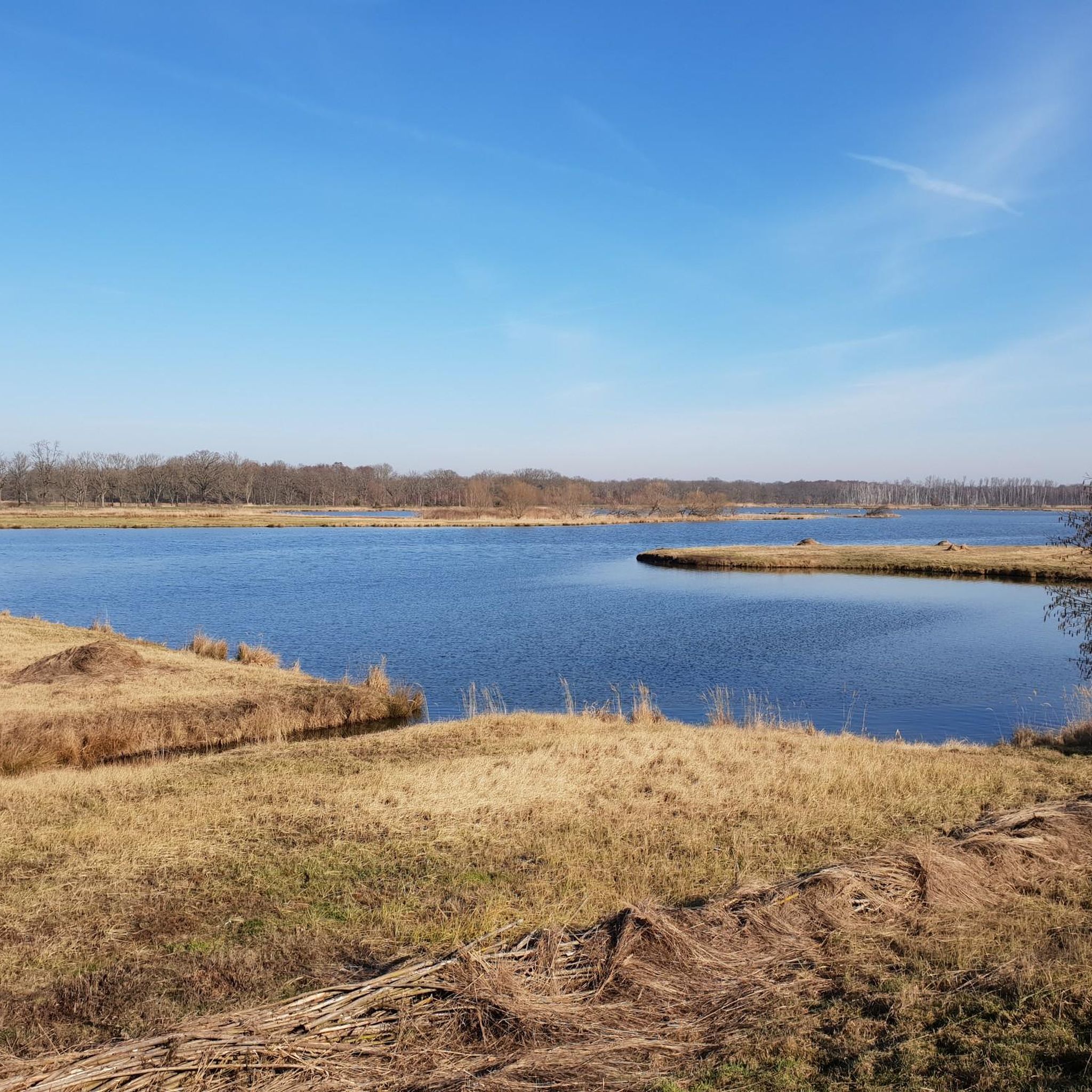
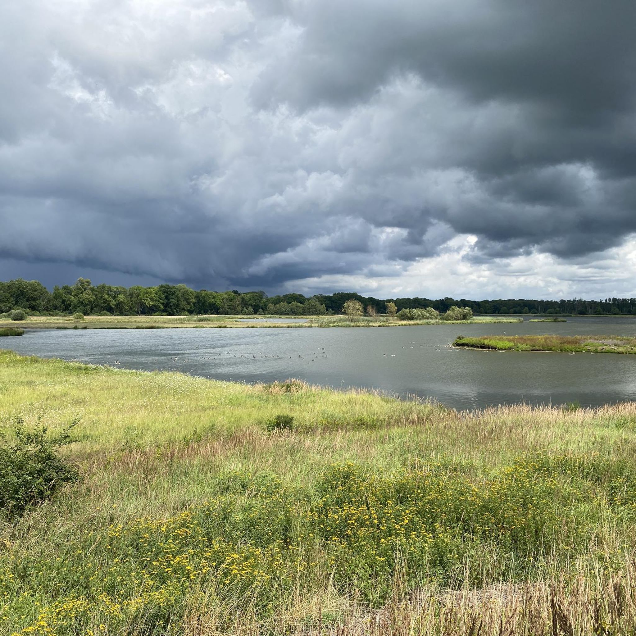
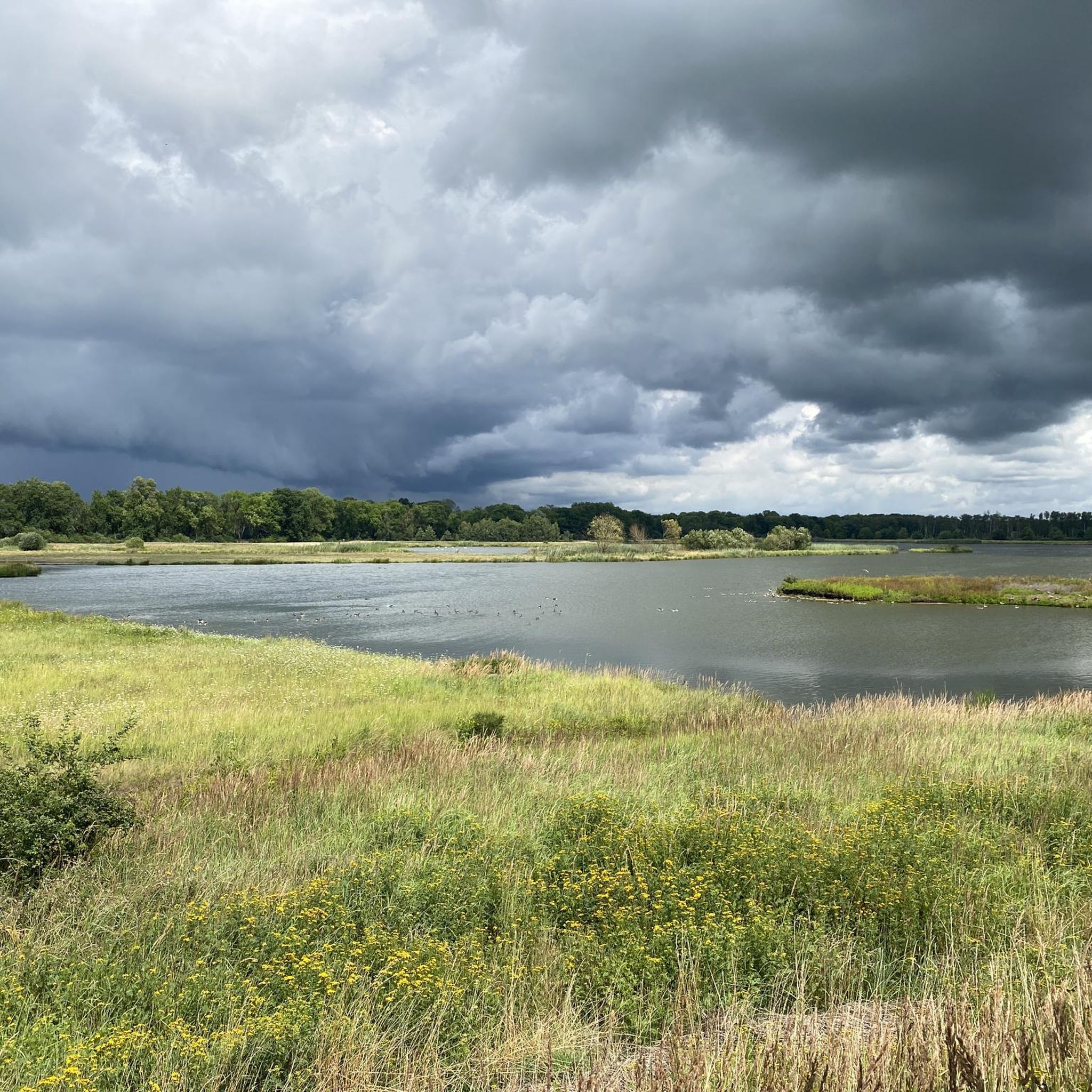
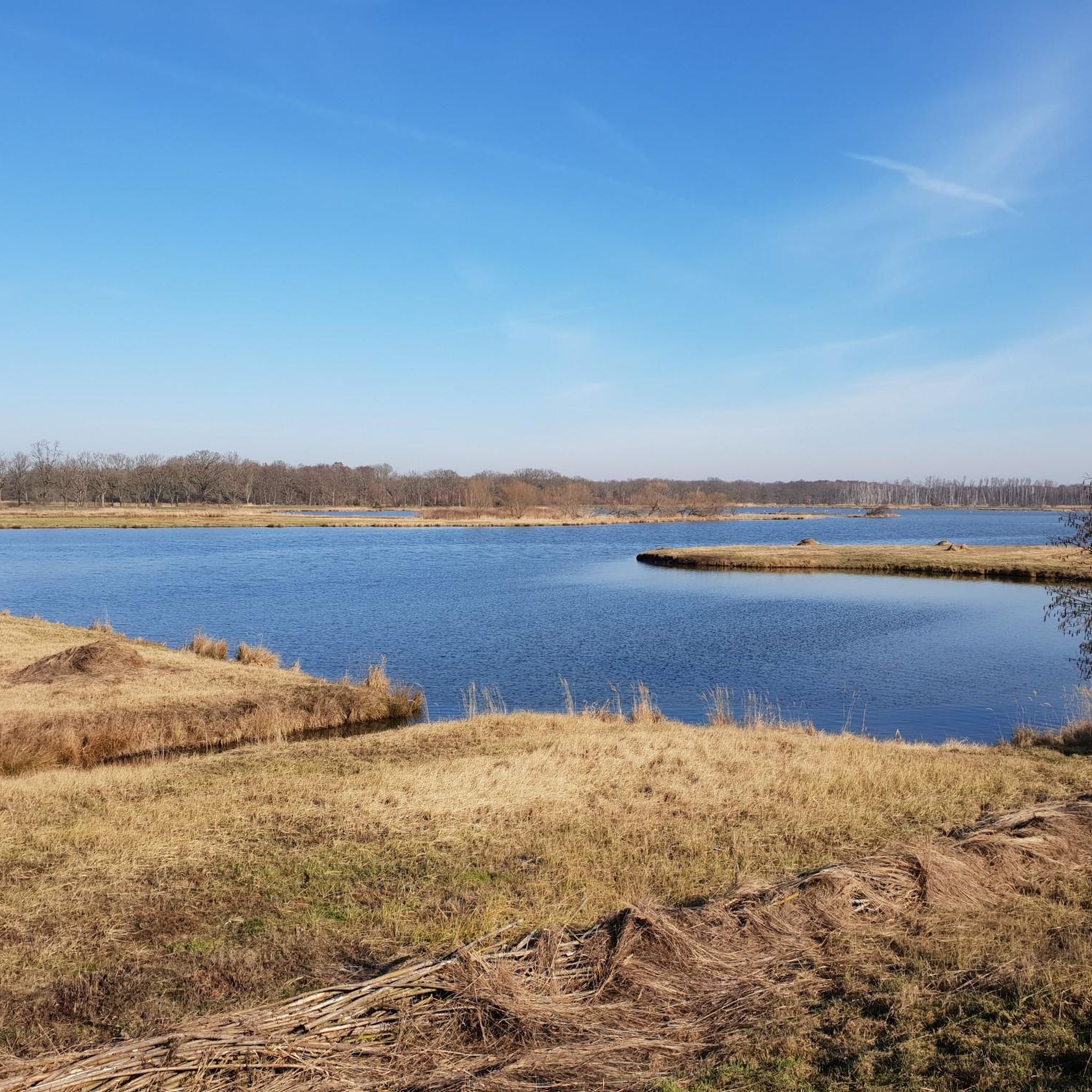
There is a lot to see and hear here. As a resting area for many migratory birds, the shallow water zone is an ideal observation and photo spot!
1
0

Excellent view over the shallow water zone and in particular over the birds that live there. Good position for taking photos.
1
1
An absolute MUST for landscape and animal lovers. Here you can observe nature almost completely undisturbed and - if you have a soft spot for photography - with a little patience you can take great pictures.
1
0
Frequently Asked Questions
How many hiking trails are available around Flachwasserzone Mannhausen?
There are over 50 hiking routes in the Flachwasserzone Mannhausen area, offering a variety of options for exploring the unique landscape of the Ohre-Drömling region.
What is the general difficulty level of hikes in Flachwasserzone Mannhausen?
The hiking trails around Flachwasserzone Mannhausen are predominantly easy to moderate. You'll find 27 easy routes and 30 moderate routes, making the area accessible for various fitness levels, including families and casual walkers.
What makes hiking around Flachwasserzone Mannhausen unique?
Flachwasserzone Mannhausen is a birdwatcher's paradise, recognized as a crucial resting area for numerous migratory birds. The unique shallow water zones and strategically placed bird observation huts offer an immersive experience for nature and animal lovers, allowing for undisturbed observation of wildlife amidst a serene landscape.
What do other hikers say about the trails in Flachwasserzone Mannhausen?
The trails in Flachwasserzone Mannhausen are highly rated by the komoot community, with an average score of 4.5 stars from over 120 reviews. Hikers often praise the tranquil environment, the opportunities for birdwatching, and the accessible paths within the Drömling Nature Park.
Are there any circular hiking routes in Flachwasserzone Mannhausen?
Yes, many routes in the area are circular. For example, the Drömling Nature Park – Weir on the Aller Canal loop from Mannhausen is an easy 6.1 km loop, and the Haupt-Hoffmann Lock loop from Mannhausen offers a moderate 15.1 km circular path.
Can I go birdwatching while hiking in Flachwasserzone Mannhausen?
Absolutely! Flachwasserzone Mannhausen is an exceptional spot for bird observation. Several bird observation huts, such as the Bird Observation Hut at the Shallow Water Zone, Ohre-Drömling, are strategically placed to offer excellent views over the shallow water zone and its avian inhabitants.
Are the hiking trails in Flachwasserzone Mannhausen suitable for families with children?
Yes, many routes are categorized as easy hikes with easily-accessible paths, making them suitable for all skill levels and ideal for families or casual walkers. The generally flat terrain and opportunities for wildlife observation add to the family-friendly appeal.
Are dogs allowed on the hiking trails in Flachwasserzone Mannhausen?
While the Drömling Nature Park generally welcomes visitors, specific regulations regarding dogs may apply, especially in sensitive wildlife areas like the Flachwasserzone. It's always best to keep dogs on a leash and respect any posted signage to protect the local fauna, particularly migratory birds.
What kind of landscape can I expect on the hikes?
You can expect a tranquil and engaging outdoor experience characterized by shallow water zones, open landscapes, and the flat, accessible paths of the Drömling Nature Park. The terrain has minimal elevation changes, offering serene walks amidst a well-preserved natural environment.
Are there any specific points of interest or attractions to see along the trails?
Beyond the natural beauty, you can explore highlights like the Mannhausen Shallow-Water Zone, Drömling Nature Reserve itself, and various birdwatching shelters such as the Birdwatching Shelter at Ohre-Drömling. These spots offer excellent opportunities to observe the local wildlife.
Is there parking available near the hiking trails?
Yes, parking is generally available at common starting points for trails within the Drömling Nature Park and near Flachwasserzone Mannhausen. Look for designated parking areas, especially near popular access points or information centers.
How can I reach Flachwasserzone Mannhausen using public transport?
Access to Flachwasserzone Mannhausen by public transport can be limited. It's advisable to check local bus schedules for routes connecting to nearby towns like Mannhausen or Calvörde, from where you might need to walk or arrange further transport to reach the trailheads.
Are there any regulations or permits required for hiking in the Drömling Nature Park?
Generally, no specific permits are required for hiking on designated trails within the Drömling Nature Park. However, it's important to respect nature reserve rules, stay on marked paths, and avoid disturbing wildlife, especially in sensitive areas like the Flachwasserzone Mannhausen.
Are there places to eat or stay overnight near Flachwasserzone Mannhausen?
While Flachwasserzone Mannhausen itself is a natural area, nearby villages and towns such as Mannhausen and Calvörde offer options for dining and accommodation. You can find local guesthouses, restaurants, and cafes to refresh and rest after your hike.
Most popular routes around Flachwasserzone Mannhausen
Most popular attractions around Flachwasserzone Mannhausen

Get inspired with the komoot mobile app


Explore more
Browse the best Hikes in other regions.
