The best running trails around San Rafael
4.2
(7)
776
runners
15
runs
Jogging around San Rafael offers access to a diverse range of natural landscapes, from flat shoreline paths to challenging hilly trails. The region features extensive open spaces, including oak-bay woodlands, savannas, grasslands, and tidal wetlands, providing varied terrain for running. Numerous parks and trail systems ensure a wide selection of routes for different fitness levels. The area's commitment to preserving natural environments creates a scenic backdrop for outdoor activities.
Best jogging routes around San Rafael
- The most popular jogging route is Shoreline and Bay View Trail Loop, a 9.1 miles (14.7 km) trail that takes 1 hour 43 minutes to complete. This route offers picturesque bay views and sections through wooded areas.
- Another top favourite among local runners is San Francisco Bay Trail: Hamilton Wetlands, a moderate 6.8 miles (11.0 km) path. This trail provides flat terrain with views of San Pablo Bay and opportunities to observe local wildlife.
- Local runners also love the Bay Area Ridge Trailhead – Big Rock Ridge loop from Marin Civic Center, a 19.9 miles (32.1 km) trail leading through varied terrain with panoramic views of Marin County, often completed in about 4 hours 13 minutes.
- Jogging around San Rafael is defined by shoreline paths, extensive trail networks, and diverse ecosystems including wetlands and woodlands. The network offers options for different ability levels, from easy flat runs to more challenging hilly routes.
- The routes in San Rafael are highly rated by the komoot community with an average score of 3.9 stars from over 11 reviews. More than 1000 runners have used komoot to explore San Rafael's varied terrain.
Last updated: July 7, 2026
22
runners
14.7km
01:43
260m
260m
The Shoreline and Bay View Trail Loop offers a moderate jogging experience through a diverse wooded landscape. You will encounter bay laurel groves and stands of second-growth redwoods, creating a refreshing atmosphere for your run. Be ready for a significant climb at the start as you ascend the Bay View Trail, where you can catch glimpses of San Pablo Bay and even views of the Richmond Bridge through the trees from higher points. This route covers 9.1 miles (14.7 km) with an elevation gain of 863 feet (263 metres), typically taking around 1 hour and 43 minutes to complete.
When planning your visit, it is important to know that dogs are not allowed on the Shoreline Trail within China Camp State Park. There might also be a small trail-use fee required to access the park, so be prepared for that possibility. Parking is generally available right at the starting point, conveniently located near McNears Beach County Park, making access straightforward for your outing.
This trail is notable for its varied terrain and the unique blend of forest and bay views it provides within China Camp State Park. The initial climb on the Bay View Trail rewards you with expansive vistas, contrasting nicely with the more sheltered sections through the groves. It offers a great opportunity to immerse yourself in the natural beauty of the area while getting a good workout.
14
runners
11.0km
01:15
20m
20m
Jog along the San Francisco Bay Trail: Hamilton Wetlands for a moderate 6.8-mile (11.0 km) route that takes about 1 hour and 15 minutes. You will experience the open expanse of the San Pablo Bay and the restored wetlands, gaining only 63 feet (19 metres) in elevation. The flat terrain makes for an easy jogging experience, offering wide-open views. Keep an eye out for the Hamilton Wetlands viewpoint, a great spot to observe various bird species. On clear days, you can even see Mount Tamalpais and Mount Diablo in the distance.
When planning your visit to the Hamilton Wetlands trail, remember there is no shade along the route. It is best to jog during the cooler morning or evening hours to avoid direct sun exposure. The trail is welcoming for dogs, but they must be kept on a leash at all times. This route is also very accommodating for cyclists and those with strollers, making it a versatile option for various outdoor activities.
This trail offers a unique perspective on a thriving ecosystem, transformed from its past as an army airfield. Informative placards are placed along the route, providing details about the wetlands' restoration and wildlife. Stationary binoculars at various lookout points enhance your chances of spotting diverse bird species. The Hamilton Wetlands trail provides a valuable opportunity to connect with nature and observe a successful ecological transformation.

Sign up for free
14
runners
51.6km
06:48
1,820m
1,820m
Hard run. Very good fitness required. Mostly paved surfaces. Suitable for all skill levels.
3.0
(1)
9
runners
5.64km
00:35
20m
20m
Moderate run. Good fitness required. Mostly paved surfaces. Suitable for all skill levels.
10
runners
Hard run. Very good fitness required. Mostly paved surfaces. Suitable for all skill levels.
Get access to more routes and recommendations from other explorers.
Sign up for free
Already have an account?
Our route recommendations are based on thousands of hikes, rides, and runs completed by other people on komoot.
Start today with a free account
Your next adventure awaits.
Login or Signup

Tips from the Community

This is the largest indoor auditorium in the county, and hosts a wide variety of performing arts acts. You get a nice view of the architecture over the duck pond from Cavaliere Island.
1
0

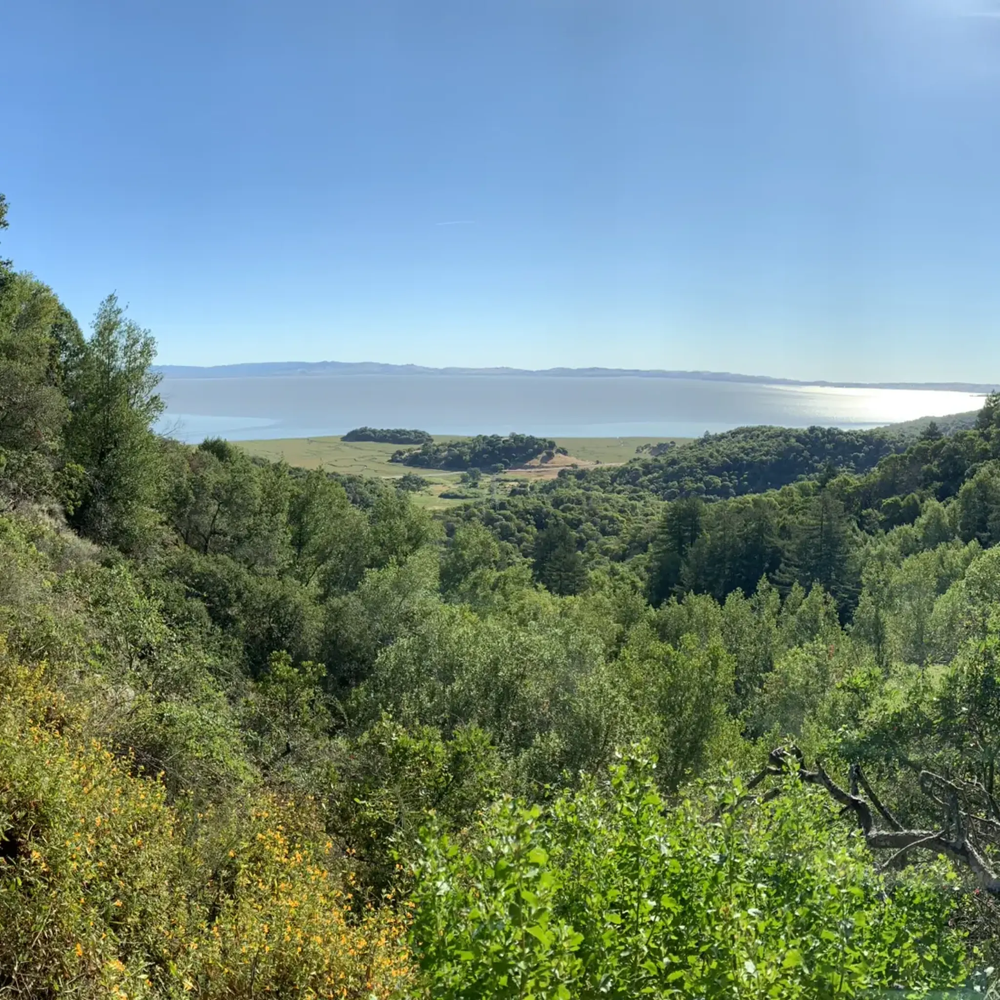
This area features a well-maintained trail that encircles Turtle Back, offering panoramic views of the San Pablo Bay area through grasslands, salt marsh, and shady oak. Abundant wildlife inhabits the surroundings, so keep a lookout for various animals in the area.
0
0

This multi-use trail winds through switchbacks, coastal hills and woodlands throughout the park. Several wildflower varieties line the path through madrone and coast live oak with great views of San Pablo Bay. Many trails connect to this route, offering multiple options for a short loop or an extended hike to explore the beautiful grounds.
0
0
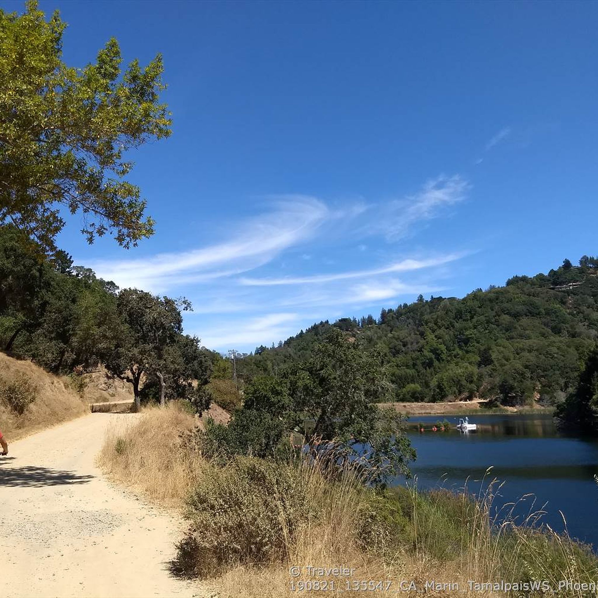
This trail runs most of the park's length near the San Pablo Bay shoreline and winds through its interior, with various options for short or long loops with plenty of connecting trails. If you are relatively quiet, you will see plenty of wildlife throughout the beautiful grounds, such as deer and turkeys. There are plenty of opportunities on the route to capture some photos of the gorgeous redwoods and excellent views of the Bay.
0
0

Big Rock Trail cuts through Lucas Valley Open Space to reach the 2nd highest point in Marin County. From later winter through early summer the hills are verdant green and often covered in wildflowers. Bring plenty of water and a wide brimmed hat if it's a warm day as there is little shade, but this means the views are wide open and beautiful.
0
0

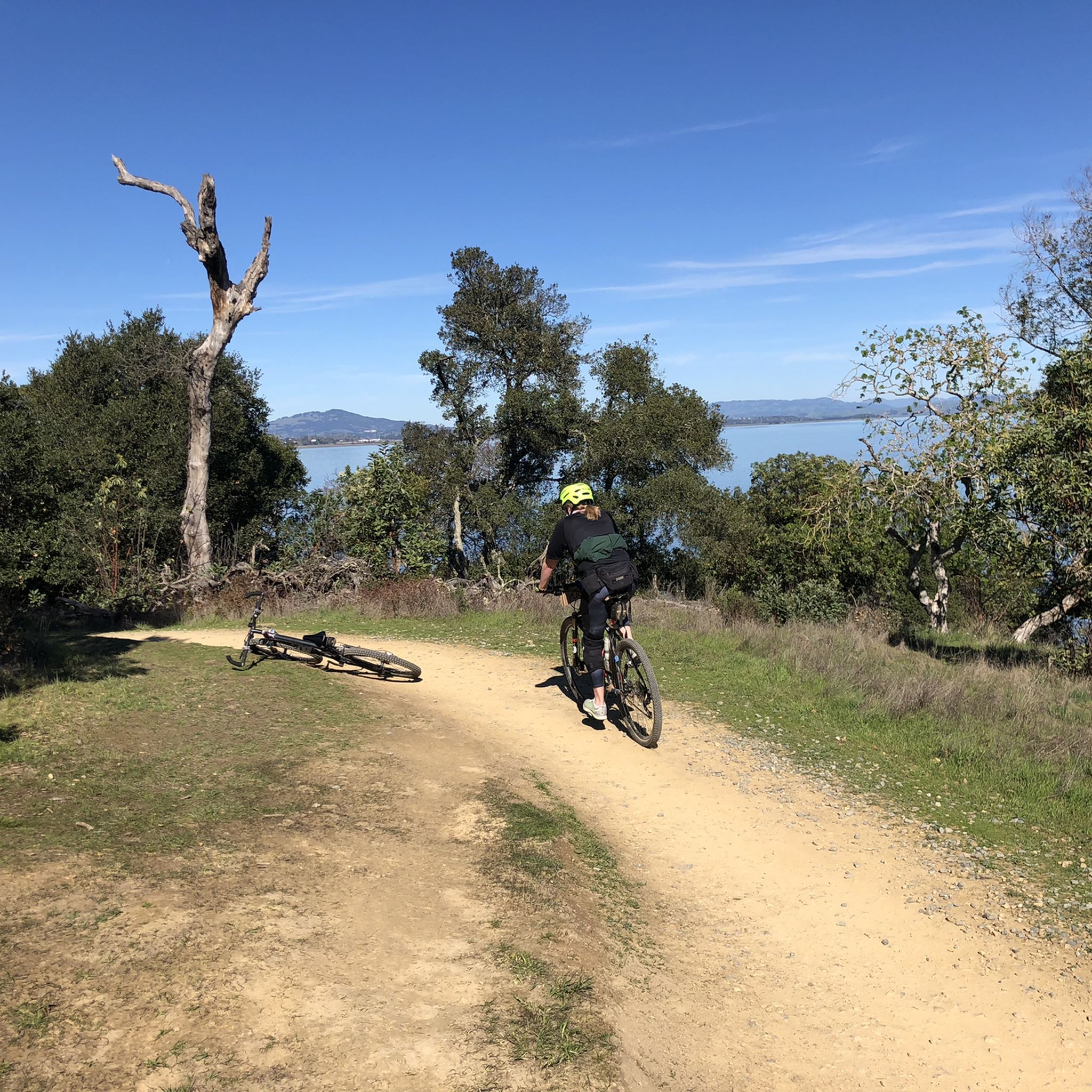
China Camp State Park was set up around a historic Chinese-American fishing village located next to a salt marsh. It's a very scenic spot! Such a joy to ride here.
0
0
This Park marks the official start of the San Francisco Bay Area Water Trail and sits in a sheltered cove boasting fantastic San Pablo Bay views. Parking is free; however, if you plan to fish off the pier, you need a fishing license. It is a great place to spend an afternoon, with plenty of picnic tables, a swimming pool, and well-maintained tennis/pickleball courts.
0
0
The campground offers fantastic walk-in, tent-only campsites to spend the night in the Park and enjoy a peaceful retreat from the city. The sites are on a first-come, first-serve basis and include a picnic table, potable water, a fire ring and a wooden footlocker.
0
0
Frequently Asked Questions
How many running routes are available in San Rafael?
San Rafael offers a wide variety of running experiences with over 18 routes documented on komoot. These range from easy, flat paths to challenging, hilly trails, ensuring options for all fitness levels. The area's extensive open spaces, including woodlands, savannas, and wetlands, provide diverse and scenic backdrops for your runs.
What kind of terrain can I expect on jogging trails in San Rafael?
Jogging routes in San Rafael feature diverse terrain, from flat, accessible shoreline paths along the San Francisco Bay to challenging, hilly trails through forested areas. You can experience oak-bay woodlands, savannas, grasslands, and tidal wetlands, offering a dynamic and varied running environment.
Are there any easy or beginner-friendly running routes in San Rafael?
Yes, San Rafael has options suitable for beginners and those seeking an easier run. For example, sections of the San Francisco Bay Trail, such as the San Francisco Bay Trail: Hamilton Wetlands, offer flat terrain with beautiful views and opportunities to observe wildlife, making them ideal for a relaxed jog. The Pond 3 – Pond 1 loop from Gallinas is another moderate option that is relatively flat.
Can I find circular running routes in San Rafael?
Absolutely. Many of San Rafael's trails are designed as loops, allowing for varied scenery without retracing your steps. The Shoreline and Bay View Trail Loop in China Camp State Park is a popular choice, offering picturesque bay views and wooded sections. Another option is the San Francisco Bay Trail – Hamilton Wetlands viewpoint loop from Gallinas.
Are there any scenic viewpoints or landmarks along the running routes?
Many routes in San Rafael offer stunning scenic viewpoints. The Bay Area Ridge Trailhead – Big Rock Ridge loop from Marin Civic Center provides breathtaking panoramic views of Marin County and the San Francisco skyline. Additionally, trails within China Camp State Park offer continuous vistas of the San Francisco Bay. For specific natural landmarks, you can explore nearby highlights like Mount Tamalpais Summits or the Laurel Dell Falls.
Are the jogging trails in San Rafael suitable for families?
Yes, San Rafael offers several family-friendly jogging options, particularly those with flatter, well-maintained paths. Trails like the San Francisco Bay Trail sections are generally accessible and provide a pleasant environment for families to run or walk together, often with opportunities for wildlife observation.
Are dogs allowed on the running trails in San Rafael?
Many parks and trails in San Rafael are dog-friendly, though specific regulations can vary by location. It's always best to check the local park rules or trail signage for the most current information regarding leash requirements and restricted areas to ensure a pleasant experience for you and your dog.
What do other runners enjoy most about jogging in San Rafael?
The running routes in San Rafael are highly rated by the komoot community, with an average score of 3.9 stars from over 11 reviews. Runners frequently praise the diverse landscapes, from serene bay views to challenging forest climbs, and the extensive network of trails that cater to various fitness levels. The natural beauty and variety of ecosystems are often highlighted as key attractions.
Are there any waterfalls or significant natural features to see near the running routes?
While San Rafael's immediate trails focus on bay views and woodlands, the region is close to areas with impressive natural features. For those interested in waterfalls, you can explore nearby highlights such as Laurel Dell Falls or Carson Falls. These are often found along scenic trails like the Cataract Trail 🌲.
Is parking available at the trailheads in San Rafael?
Yes, many of the popular trailheads and parks in San Rafael offer designated parking areas. For instance, China Camp State Park and areas near the Hamilton Wetlands typically have parking facilities. It's advisable to check specific park websites or komoot route details for precise parking information and any potential fees before your visit.
What is the best time of year to go jogging in San Rafael?
San Rafael offers excellent jogging conditions year-round due to its mild climate. Spring and fall generally provide the most comfortable temperatures for running. Summer mornings are also pleasant, though afternoons can be warmer. Winter runs are often cool and crisp, with occasional rain, but trails remain accessible. The diverse ecosystems mean there's always something beautiful to see, regardless of the season.
Most popular routes around San Rafael
Most popular attractions around San Rafael

Get inspired with the komoot mobile app


Explore more
Browse the best Running Trails & Routes in other regions.
