The best walks and hikes around Sand City
4.6
(97)
1,333
hikers
105
hikes
Hiking around Sand City, California, is characterized by its coastal setting on Monterey Bay. The terrain features expansive sand dunes and wide beaches, providing a distinct backdrop for outdoor activities. Most hiking trails offer open views of the Pacific Ocean and generally have minimal elevation gain. This landscape provides a network of routes suitable for various activity levels.
Best hiking trails around Sand City
- The most popular hiking route is Cannery Row – Cannery Row, Monterey loop from Monterey, an easy 3.3 miles (5.4 km) trail that takes 1 hour 24 minutes to complete. This walk follows the coastline with views of the bay.
- Another top favourite among local hikers is Lovers Point Beach – Fishermans Wharf loop from Pacific Grove, a moderate 6.6 miles (10.6 km) path. This route provides an extended experience along the shoreline.
- Local hikers also love the Fishermans Wharf – Shoreline Park Path loop from Monterey, a 3.8 miles (6.1 km) trail leading through the waterfront area, often completed in about 1 hour 33 minutes.
- Hiking around Sand City is defined by coastal paths, sand dunes, and paved recreational trails. The network offers mostly easy and moderate options suitable for various fitness levels.
- The routes in Sand City are highly rated by the komoot community with an average score of 4.8 stars from over 90 reviews. More than 1,400 hikers have used komoot to explore Sand City's varied terrain.
Last updated: July 8, 2026
2
hikers
12.2km
03:07
50m
40m
If you're looking for an accessible coastal walk with continuous ocean views, the Monterey Bay Coastal Recreation Trail delivers. This 7.6-mile (12.2 km) moderate hike follows a paved path along the former Southern Pacific Railroad, offering stunning vistas of sandy beaches and dramatic dunes. You'll pass iconic spots like Fisherman's Wharf and Cannery Row, with plenty of chances to spot sea otters and seals, especially in the celebrated section between Pacific Grove and Fisherman's Wharf.
This trail is incredibly convenient, connecting many of Monterey's top attractions directly. Parking is available at various points along the route, but popular areas can fill up quickly, so an early start is often a good idea. The trail is open year-round, but for the most pleasant experience and to avoid the biggest crowds, consider visiting during the spring or fall.
What makes this trail truly special is its unique blend of natural beauty and historical significance, tracing the path of an old railway line. It provides a fantastic way to explore Monterey's vibrant culture and natural environment, offering easy access to shops, restaurants, and even the Monterey Bay Aquarium. It's an ideal choice for families or anyone seeking an easy hike in Monterey Bay with high scenic payoff.
4.5
(6)
198
hikers
5.39km
01:24
30m
30m
Easy hike. Great for any fitness level. Easily-accessible paths. Suitable for all skill levels.

Sign up for free
4.6
(5)
163
hikers
This easy 3.3-mile (5.3 km) hike, taking about 1 hour and 21 minutes with only 97 feet (30 metres) of elevation gain, offers continuous stunning views of Monterey Bay, making it one of the best trails along the Monterey Bay Coastal Trail. You'll wander past historic cannery buildings, glimpse playful sea lions and sea otters, and enjoy the refreshing coastal air on a mostly paved surface. It’s an ideal route for a relaxed outing, blending natural beauty with urban charm.
Planning your visit is straightforward, as the trail connects directly to popular spots like Cannery Row and Monterey State Historic Park, helping you bypass traffic and parking challenges. The path is generally flat and accessible, with separate pedestrian and cycling lanes in the Pacific Grove section, ensuring a pleasant experience for everyone. Consider starting early to enjoy the calmest conditions and avoid peak crowds.
Built on a former railway right-of-way, this trail offers a unique historical perspective alongside its natural appeal. It's part of the larger 18-mile Monterey Bay Coastal Recreation Trail, providing ample opportunities for wildlife sightings on Cannery Row Monterey trails and easy access to attractions like the Monterey Bay Aquarium and Fisherman's Wharf. It’s a fantastic way to experience the heart of Monterey.
5.0
(4)
63
hikers
10.6km
02:46
80m
80m
Moderate hike. Good fitness required. Easily-accessible paths. Suitable for all skill levels.
31
hikers
4.13km
01:04
20m
20m
Easy hike. Great for any fitness level. Easily-accessible paths. Suitable for all skill levels.
Get access to more routes and recommendations from other explorers.
Sign up for free
Already have an account?
Our route recommendations are based on thousands of hikes, rides, and runs completed by other people on komoot.
Start today with a free account
Your next adventure awaits.
Login or Signup

Tips from the Community

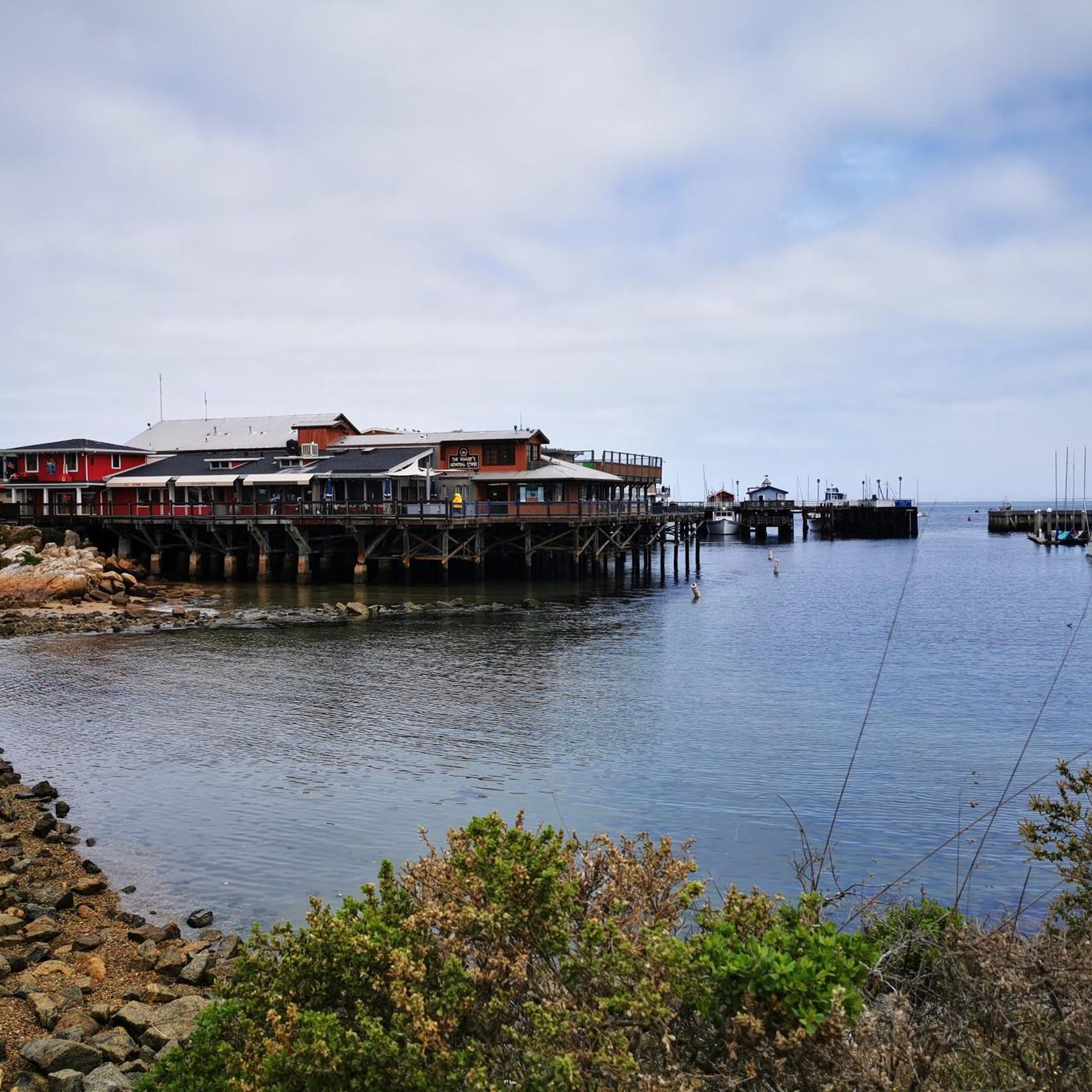
A lovely wharf you should see
0
0

Nice flat run on footpath to aquarium.
0
0


Great paved trail that runs along the Pacific Ocean. You get wonderful views of the water and will pass through several popular cultural attractions in the area.
0
0

Kalisa Moore, known as the “Queen of Cannery Row,” was born in Latvia and came to America after World War II. She bridged the eras, opening her fine dining restaurant when most canneries had already closed. Over the years, “Kalisa’s” evolved into a bohemian coffeehouse where artists, writers and poets “hung out.” Her weekend cabaret was filled with musicians, dancers and the occasional celebrity from the Monterey Jazz Festival. As time went on and Cannery Row was reborn, Kalisa became a major factor in preserving memories of Steinbeck’s era and promoted tourism and commerce as president of the Cannery Row Foundation. For fifty years, she was a friend to the famous and a mother to the needy with a local following that knew and loved her. Kalisa's La Ida Cafe was a very special time and place, and Kalisa will always be remembered as the "Queen of Cannery Row."
3
0
Cannery Row, the waterfront district that boomed in the 1850s - For thousands of years it was home to the Ohlone, Esselen and Salinas tribes, and in the 19th century immigrants from Europe and Asia settled here to fish the waters, especially for sardines. Thanks to the canneries that resulted, Monterey became known as the "Sardine Capital of the World." John Steinbeck, born and raised in nearby Salinas, immortalized this era in his 1945 novel Cannery Row, and the name stuck.
3
0
Bruce Ariss Way is a narrow alley, the pedestrian-only continuation of Irving Avenue between Wave Street and Cannery Row. What was once an unofficial walkway between the residential area of the row, across the railroad tracks, and the waterfront canneries has been converted into a small park. In the early 1990s, the City of Monterey relocated three worker's shacks from 866 Wave Street to this site and opened them to the public. They are interpreted as being occupied by a Japanese, a Filipino, and a Spanish family, respectively, alluding to the cultural mix that characterized cosmopolitan Cannery Row and representing the living conditions of workers between the 1920s and 1950s. There were many shacks like this in the neighborhood in the early 20th century, but these are the only remaining remnants of this housing type on Cannery Row.
3
0
Frequently Asked Questions
Are there many hiking trails in the Sand City area?
Yes, there are over 80 hiking routes to explore around Sand City. The vast majority are rated as easy, with a smaller selection of moderate trails, making the area very accessible for most fitness levels.
What is the general difficulty of hikes around Sand City?
Most hikes in the Sand City area are easy and relatively flat, especially those following the Monterey Bay Coastal Recreation Trail. You'll find gentle paths along the coast and through sand dunes with minimal elevation gain, perfect for relaxed walks and family outings.
Are there any good circular hikes?
Absolutely. Many trails in the area are designed as loops, allowing you to enjoy a varied scenic journey without retracing your steps. A great example is the Cannery Row, Monterey – Monterey State Historic Park loop from New Monterey, which offers a pleasant walk along the historic waterfront.
Can I bring my dog on the trails?
Dogs are welcome on many trails, but policies vary. Leashed dogs are generally permitted on the paved Monterey Bay Coastal Recreation Trail and in certain areas of Fort Ord Dunes State Park. Always check signage at trailheads for specific park rules before you start your hike.
What are some good options for a short, easy walk?
The area is perfect for short and easy hikes. For a straightforward coastal walk with great views, consider the Shoreline Park Path – Old Fisherman's Wharf loop from Monterey. It's a manageable distance and showcases the beautiful shoreline.
Where can I find the best coastal views?
For stunning ocean vistas, head to Fort Ord Dunes State Park. The park features a bluff-top platform with panoramic views of Monterey Bay. The Eolian Dunes Preserve is another local favorite, offering an elevated perspective of the coastline from the dunes.
What kind of wildlife might I see while hiking?
The coastal environment is rich with wildlife. While hiking along the Monterey Bay shoreline, keep an eye out for marine life like sea lions and sea otters. The dunes and parklands are also home to many bird species, including California brown pelicans and western snowy plovers.
Are the trails suitable for families with children?
Yes, Sand City is very family-friendly. The paved and flat Monterey Bay Coastal Recreation Trail is ideal for strollers and little legs. The Sand Dune Boardwalk in Fort Ord Dunes State Park is another excellent choice, offering a safe and engaging 1.5-mile walk through a unique landscape.
What are the main parks or areas for hiking near Sand City?
The two primary destinations for hiking are Fort Ord Dunes State Park and the Eolian Dunes Preserve. Fort Ord offers miles of trails through coastal dunes and grasslands with historical context, while the Eolian Dunes Preserve provides beautiful views from its sandy trails right next to the city.
What do other hikers think of the trails around Sand City?
The trails are highly regarded by the komoot community, with an average rating of 4.8 out of 5 stars. Hikers frequently praise the stunning coastal scenery, the well-maintained paths, and the easy accessibility of the routes.
Where can I find information on trail conditions at Fort Ord Dunes State Park?
For the most current information on trail status, accessibility, and any park alerts for Fort Ord Dunes State Park, it's best to consult the official California Department of Parks and Recreation website. You can often find a park brochure with a map and rules, like this one for Fort Ord.
Is parking available for the main hiking trails?
Yes, parking is available at key access points. Fort Ord Dunes State Park has a dedicated parking lot near the main trailhead on Beach Range Road. For the Monterey Bay Coastal Recreation Trail, you can find parking in various lots and street spots in Monterey, Seaside, and Sand City, though they can be busy on weekends.
Most popular attractions around Sand City

Get inspired with the komoot mobile app


Explore more
Browse the best Hikes in other regions.
