The best MTB trails around Brea
4.6
(148)
596
riders
46
rides
Mountain biking around Brea offers a diverse landscape characterized by rolling hills, canyons, and extensive parklands, providing varied terrain for riders. The region's proximity to the Santa Ana Mountains and large natural areas like Chino Hills State Park and Carbon Canyon Regional Park creates numerous opportunities for exploration. Trails feature elevation changes, ranging from strenuous climbs to exhilarating descents, amidst natural features and scenic views.
Best mountain bike trails around Brea
- The most popular mountain bike trail is Fullerton Loop, an 11.0 miles (17.8 km) trail that takes 1 hour 17 minutes to complete, offering diverse terrain and urban greenways.
- Another top favourite among local mountain bikers is Telegraph Canyon Trail, a moderate 14.0 miles (22.5 km) path known for its scenic views and challenging sections.
- Local mountain bikers also love the Telegraph Canyon and South Ridge Loop, a 16.4 miles (26.4 km) trail leading through canyons and hills, often completed in about 2 hours 42 minutes.
- Mountain biking around Brea is defined by rolling hills, scenic canyons, and extensive parklands like Chino Hills State Park. The network offers options for different ability levels, from easy paths to more challenging routes with significant elevation.
- The routes in Brea are highly rated by the komoot community with an average score of 4.7 stars from over 170 reviews. More than 800 mountain bikers have used komoot to explore Brea's varied terrain.
Last updated: August 31, 2026
4.7
(31)
159
riders
17.8km
01:17
220m
220m
The Fullerton Loop offers a unique mountain biking experience, blending urban convenience with a surprising sense of natural escape. This easy 11.0-mile (17.8 km) route, with 716 feet (218 metres) of elevation gain, takes about 1 hour and 16 minutes to complete. You'll ride through diverse terrain, from dirt singletrack to paved sections, enjoying views of Laguna Lake and coastal sage scrub, making it a popular choice for all skill levels.
Planning your visit to the Fullerton Loop is straightforward, as it's highly accessible for residents. However, be aware that navigation can be challenging due to numerous unmarked junctions and about 20 road crossings; using a GPS app is strongly advised. The trail is popular for night riding, offering a different dimension to the experience, and it's a great option for after-work outings or training rides.
What makes the Fullerton Loop truly notable is its existence as an extensive trail system within the heart of Orange County suburbia, providing a
4.8
(5)
45
riders
22.5km
02:07
360m
360m
Embark on the Telegraph Canyon Trail for a moderate mountain biking experience through Chino Hills State Park. You will ride 14.0 miles (22.5 km) and gain 1166 feet (355 metres) in elevation, with an estimated duration of 2 hours and 6 minutes. As you pedal, you will encounter classic California terrain, featuring rolling hills, scattered oak trees, and vibrant riparian areas, offering picturesque views throughout your journey. Keep an eye out for local wildlife and seasonal wildflowers as you pass through diverse habitats.
Planning your visit is straightforward, as the trail is a multi-use path welcoming mountain bikers, hikers, trail runners, and equestrians. Parking is generally available at various access points to Chino Hills State Park. This route serves as a key east-west connector within the park, linking up with other popular trails like the North Ridge and South Ridge, giving you options to extend your ride.
The Telegraph Canyon Trail is a notable route within Chino Hills State Park, known for its diverse ecosystems and as a prime spot for observing local flora and fauna. A convenient rest stop awaits you at the Four Corners junction, complete with a shade ramada, picnic tables, and restrooms, making it an ideal spot to pause and refuel. This trail offers a rewarding exploration of Southern California's natural beauty.

Sign up for free
4.7
(6)
32
riders
26.4km
02:42
610m
610m
Get ready for a moderate mountain biking adventure on the Telegraph Canyon and South Ridge Loop. This 16.4-mile (26.4 km) route takes you through Chino Hills State Park, offering wide fire roads and scenic vistas. You will climb 2010 feet (613 metres) over approximately 2 hours and 42 minutes. Telegraph Canyon itself is known for its picturesque sections, especially when wildflowers are in bloom, winding past oak trees and alongside a creek. As you reach the South Ridge, prepare for expansive views, including a notable outlook over Yorba Linda. While mostly non-technical, the route includes challenging climbs that provide a good workout.
This popular multi-use trail means you will likely share the path with both fellow mountain bikers and hikers. Before heading out, it is always wise to check park conditions, as some sections can become loose and sandy. Planning your tire choice accordingly will help ensure a smoother ride. The park is generally accessible, but being prepared for varying trail surfaces is key to enjoying your outing.
The Telegraph Canyon and South Ridge Loop is a highlight within Chino Hills State Park, a significant natural area known for its diverse landscapes. The park itself serves as an important wildlife corridor and offers a chance to experience nature close to urban areas. This route showcases the park's blend of challenging terrain and rewarding scenery, making it a favorite for those seeking an active escape. It provides a great opportunity to explore the unique environment of the Chino Hills.
4.4
(5)
43
riders
Moderate mountain bike ride. Good fitness required. Suitable for all skill levels.
9
riders
49.7km
04:23
860m
860m
Moderate mountain bike ride. Good fitness required. Suitable for all skill levels.
Get access to more routes and recommendations from other explorers.
Sign up for free
Already have an account?
Our route recommendations are based on thousands of hikes, rides, and runs completed by other people on komoot.
Start today with a free account
Your next adventure awaits.
Login or Signup
Tips from the Community

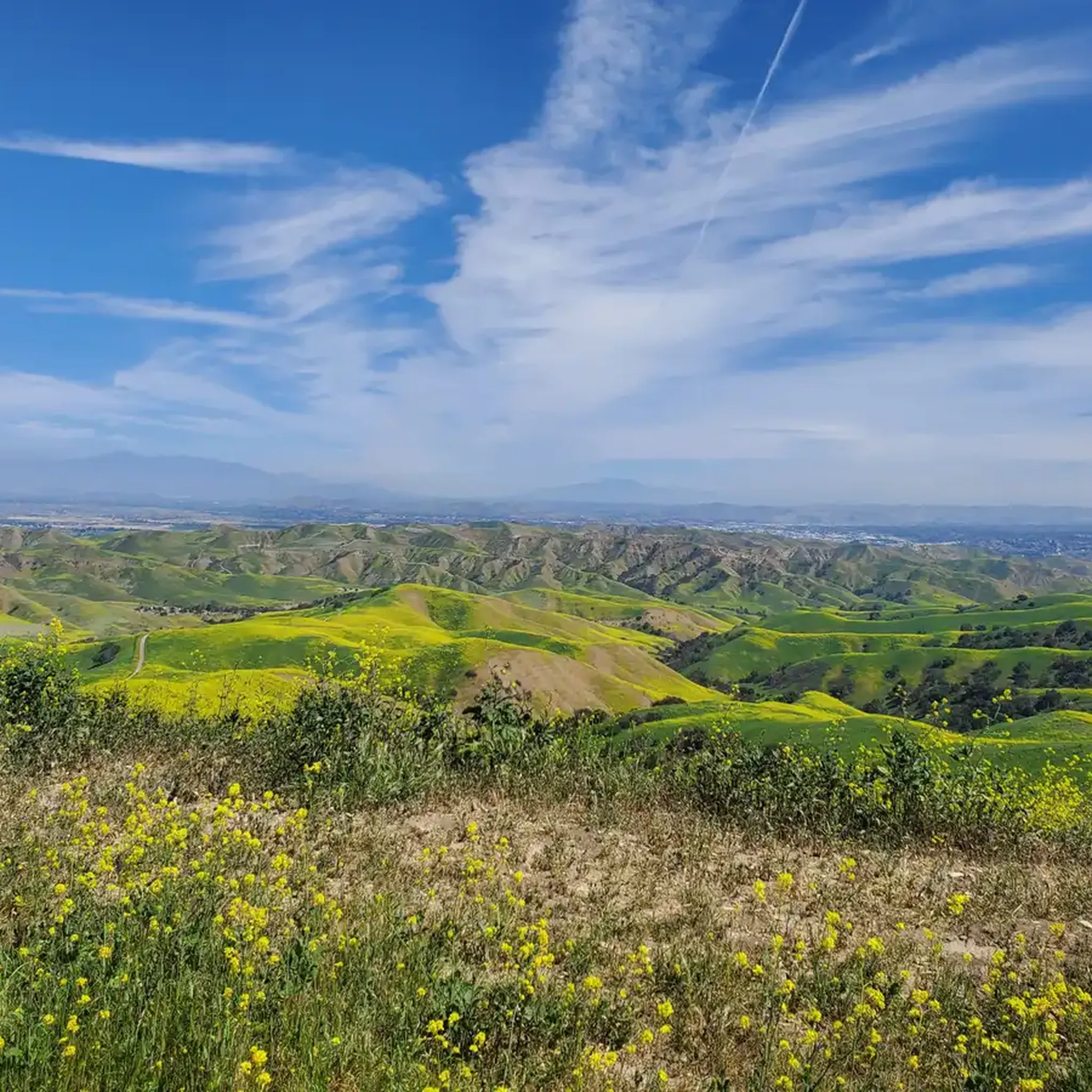
This is the intersection of five trails: Raptor Ridge Trail, North Ridge Trail, Bovinian Delight Trail or Telegraph Canyon Road. There are also some boards with information about the trails and a restroom.
0
0

The Faultline Trail is a mix of dirt singletrack and fire road sections. There are some short, steep climbs and fast descents with loose gravel in places. It is a blue trail with a few sections that may challenge newer riders due to ruts, roots, and tight turns. This trail can get busy with runners and hikers on weekends as well.
1
0


The Hiltscher Park Trail is a really popular path in the area. It's open to a bunch of different trail users and connects to a number of other paths and parks. This is a pretty common commuter trail, too.
0
0

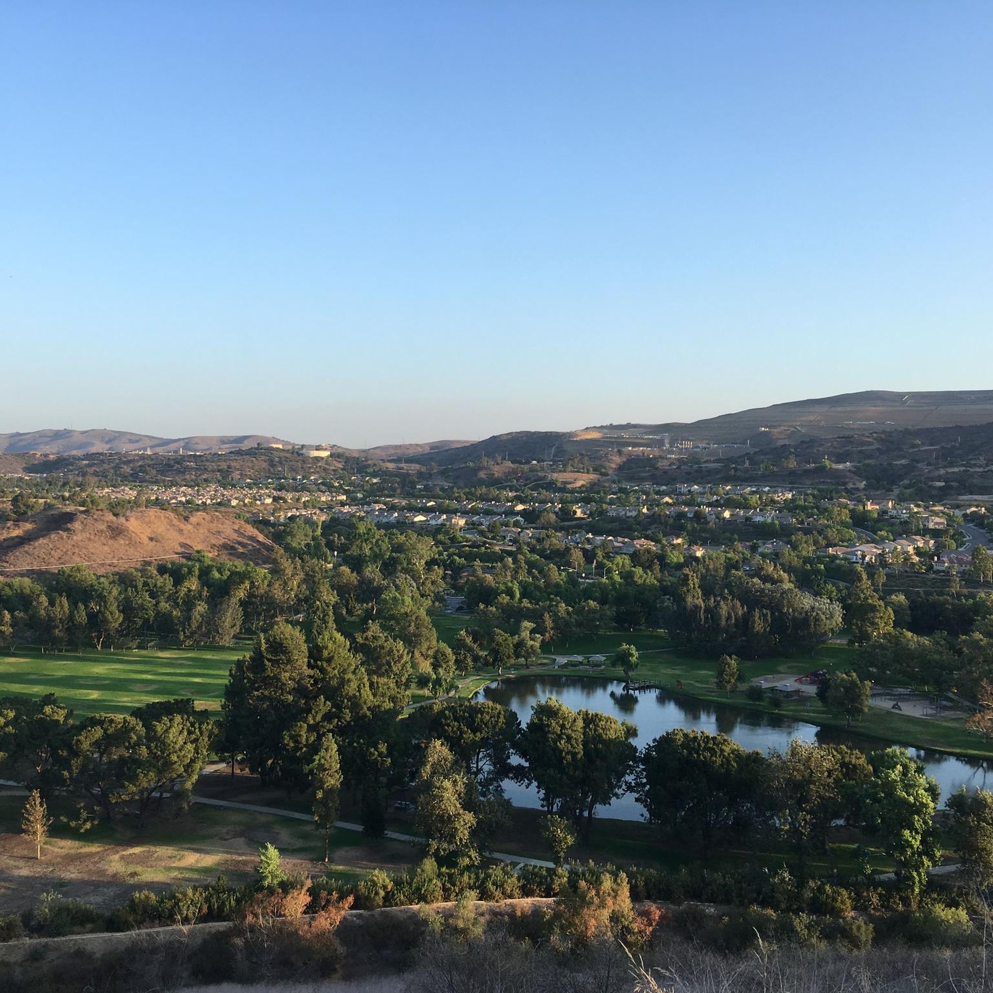
This is a beautiful lake, definitely a pleasant spot for a small break.
0
0
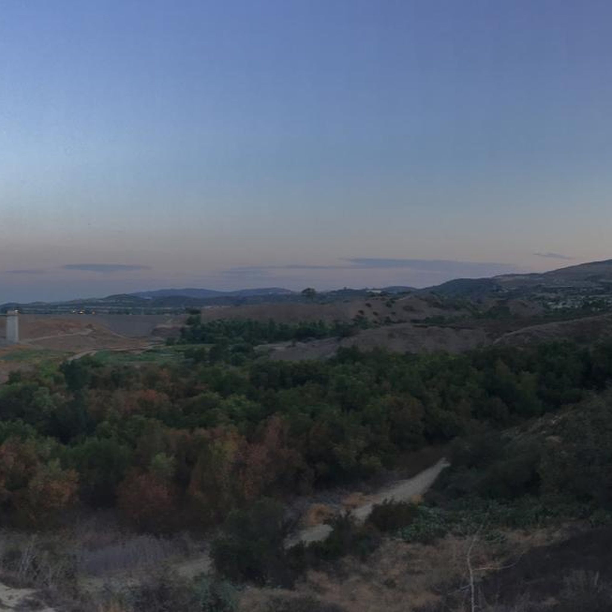
This area is designated as a wildlife sanctuary for rare and endangered wildlife. It has about 4,500 acres of wild space and open land.
0
0
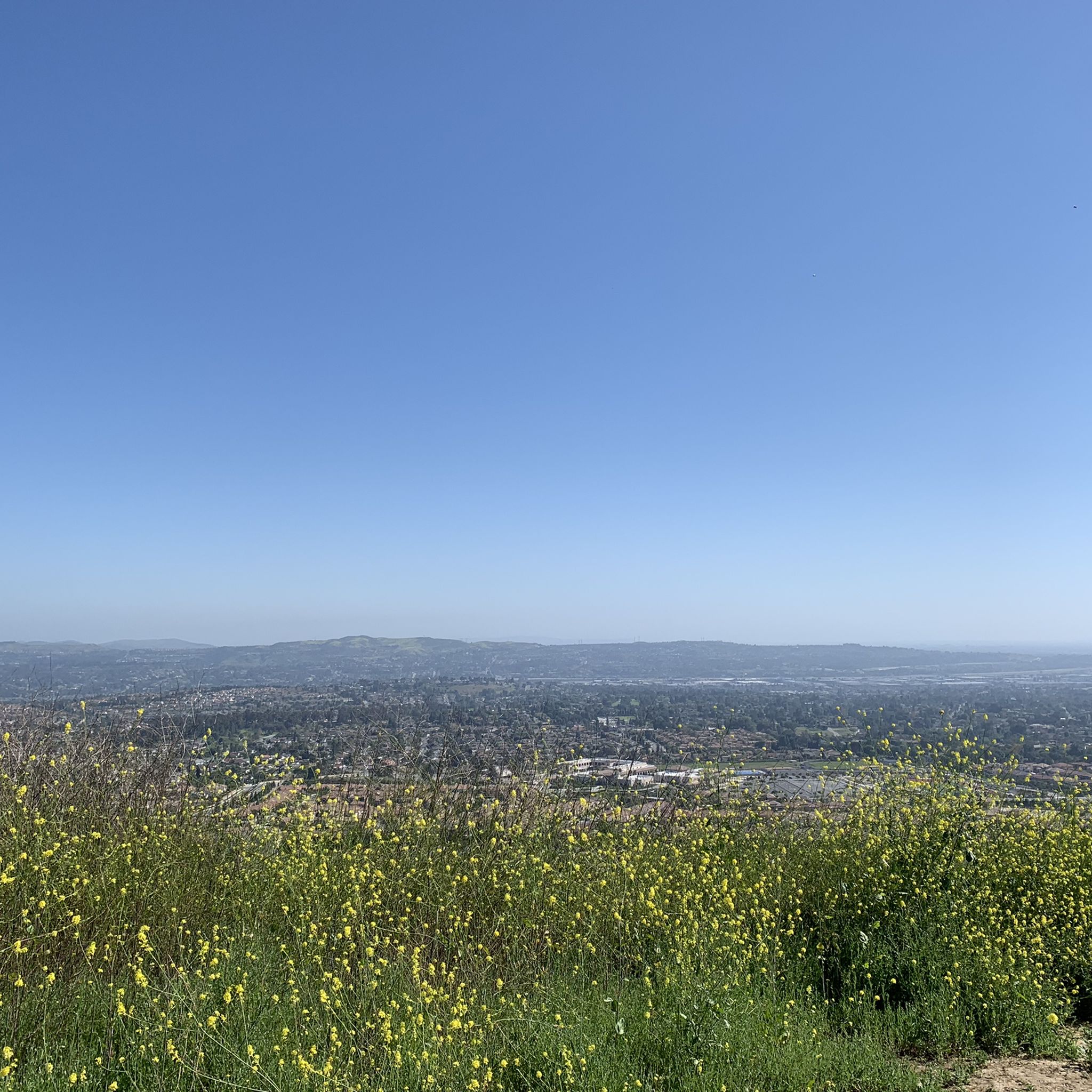
This is a cool, panoramic overlook with a placard off the side of the South Ridge Trail. The overlook is situated over the city and neighborhoods of Yorba Linda.
0
0
Frequently Asked Questions
How many mountain bike trails are available around Brea?
Brea and its surrounding areas offer a wide variety of mountain biking options. You'll find over 45 mountain bike routes, with a good mix of easy, moderate, and challenging trails to explore.
What kind of terrain can I expect on mountain bike trails in Brea?
The terrain around Brea is quite diverse, characterized by rolling hills, scenic canyons, and extensive parklands. You can expect elevation changes, from strenuous climbs to exhilarating descents. Trails may feature fire roads, narrow singletrack, and technical sections with loose gravel, ruts, and roots, especially in areas like Chino Hills State Park.
Are there mountain bike trails suitable for beginners in Brea?
Yes, Brea offers several beginner-friendly mountain bike trails. For instance, the Carbon Canyon Creek Nature Trail and Redwood Trail within Carbon Canyon Regional Park are considered good options for those new to mountain biking. Overall, nearly half of the routes in the area are rated as easy.
Are there challenging mountain bike trails in Brea for experienced riders?
Absolutely. Experienced riders looking for a challenge will find routes with significant elevation changes and technical features. Trails within Chino Hills State Park, such as Sidewinder and Bane Canyon, are known for their 'lung-busting' climbs and fun downhills. The Telegraph Canyon and South Ridge Loop, for example, features over 600 meters of elevation gain.
What do other mountain bikers say about the trails in Brea?
The mountain bike trails around Brea are highly rated by the komoot community, with an average score of 4.7 stars from over 170 reviews. Riders often praise the diverse terrain, scenic views, and the variety of options available for different skill levels.
Can I find loop mountain bike trails in Brea?
Yes, there are several excellent loop mountain bike trails in Brea. A popular choice is the Fullerton Loop, an 11-mile route offering diverse terrain. Another great option is the Telegraph Canyon Trail – Four Corners loop from Carbon Canyon Regional Park, which provides a longer, moderate challenge.
Are there any natural features or landmarks to see along the mountain bike trails?
Yes, Brea's trails offer access to several interesting natural features and landmarks. You can encounter a rare grove of coastal redwoods at Redwood Grove within Carbon Canyon Regional Park, or explore the historic Olinda Oil Museum & Trail which offers panoramic views and insights into Brea's oil legacy. The Twisted Tree in Carbon Canyon Regional Park is also a notable sight.
What is the best time of year to go mountain biking in Brea?
Brea offers good mountain biking conditions for much of the year. Spring and fall generally provide the most pleasant temperatures. While winter riding is possible, be mindful of potential wet and muddy conditions after rainfall, especially on trails with loose gravel and ruts. Summers can be hot, so early morning or late afternoon rides are often preferred.
Is parking available at the trailheads in Brea?
Yes, parking is generally available at the major parks and trailheads in Brea and the surrounding areas. Parks like Carbon Canyon Regional Park and access points to Chino Hills State Park typically have designated parking facilities. It's always a good idea to check specific park websites for any parking fees or regulations before your visit.
Are the mountain bike trails in Brea dog-friendly?
Many parks and trails in the Brea area, including parts of Carbon Canyon Regional Park and Chino Hills State Park, allow dogs on leashes. However, specific regulations can vary by trail and park. It's recommended to check the rules for the particular trail you plan to ride to ensure it's dog-friendly.
Are there family-friendly mountain bike trails in Brea?
Yes, Brea has options for family-friendly mountain biking. Many of the easier trails, particularly those within Carbon Canyon Regional Park, are suitable for families. These trails often feature less challenging terrain and provide a pleasant outdoor experience for riders of varying ages and skill levels.
Are permits required for mountain biking in Brea?
Generally, permits are not required for mountain biking on most public trails in Brea and its adjacent parks like Carbon Canyon Regional Park. However, some areas, particularly within Chino Hills State Park, may have specific entry fees or regulations. It's always advisable to check the official websites of the parks you plan to visit for the most current information on permits or fees.
Most popular attractions around Brea

Get inspired with the komoot mobile app


Explore more
Browse the best MTB trails in other regions.
