The best cycling routes around Moraga
4.7
(206)
2,823
riders
111
rides
Touring cycling routes around Moraga traverse a landscape characterized by hilly and wooded terrain, offering a mix of challenging climbs and gentle descents. The region features rural roads and paved rail-trails, providing diverse cycling environments. Riders can experience scenic tree-lined stretches and potential views of Mount Diablo. This area offers a compelling setting for outdoor enthusiasts seeking varied cycling experiences.
Best touring cycling routes around Moraga
- The most popular touring cycling route is Lamorinda Trail Loop, a 17.4 miles…
Last updated: August 24, 2026
4.7
(11)
45
riders
28.0km
01:45
270m
270m
Moderate bike ride. Good fitness required. Mostly paved surfaces. Suitable for all skill levels.
5.0
(1)
89
riders
81.4km
05:36
1,270m
1,270m
Hard bike ride. Very good fitness required. Mostly paved surfaces. Suitable for all skill levels.

Sign up for free
5.0
(8)
65
riders
22.3km
01:24
240m
240m
Moderate bike ride. Good fitness required. Mostly paved surfaces. Suitable for all skill levels.
42
riders
62.6km
04:01
760m
760m
Hard bike ride. Very good fitness required. Mostly paved surfaces. Suitable for all skill levels.
5.0
(2)
14
riders
34.1km
02:24
650m
650m
Hard bike ride. Very good fitness required. Mostly paved surfaces. Suitable for all skill levels.
Get access to more routes and recommendations from other explorers.
Sign up for free
Already have an account?
Our route recommendations are based on thousands of hikes, rides, and runs completed by other people on komoot.
Start today with a free account
Your next adventure awaits.
Login or Signup
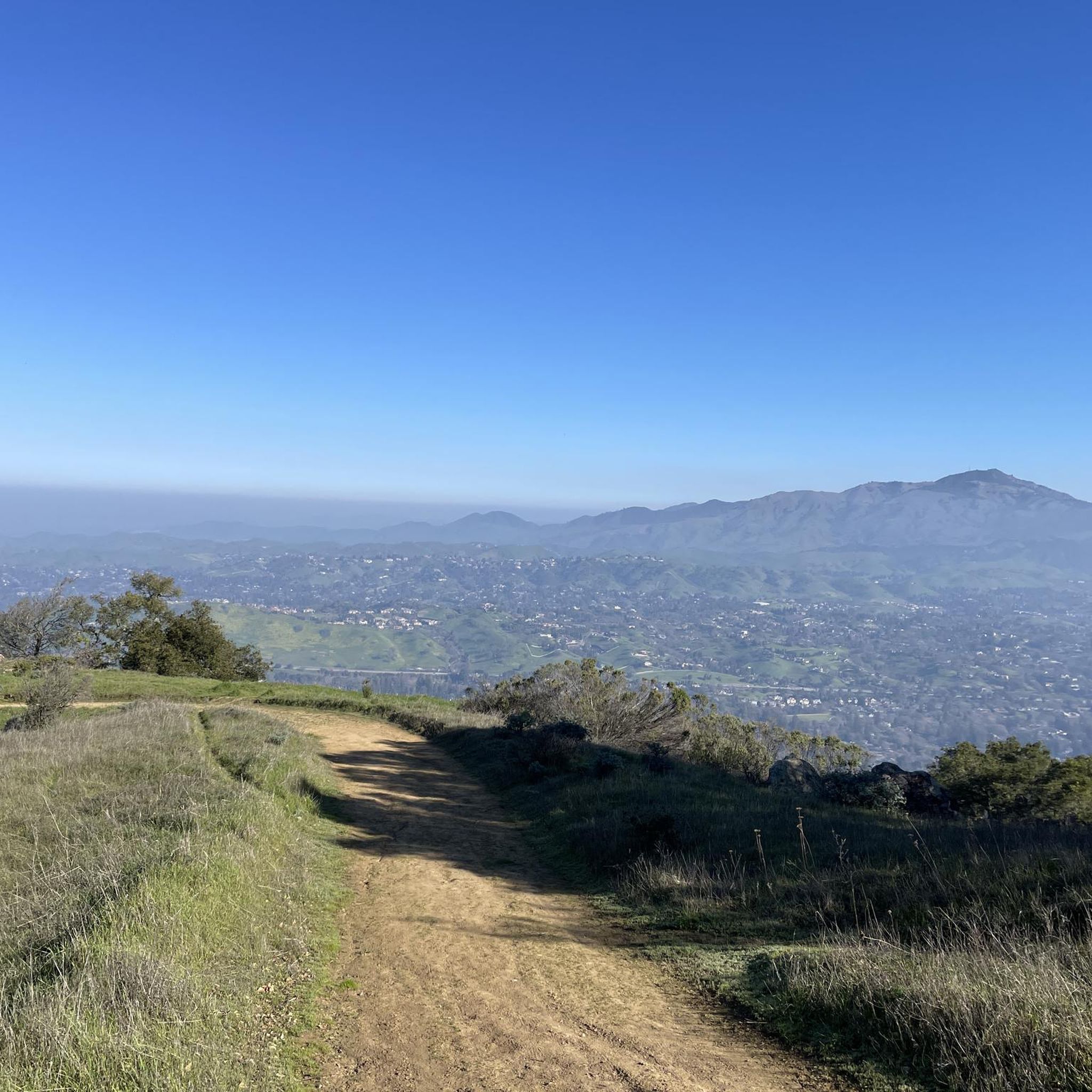
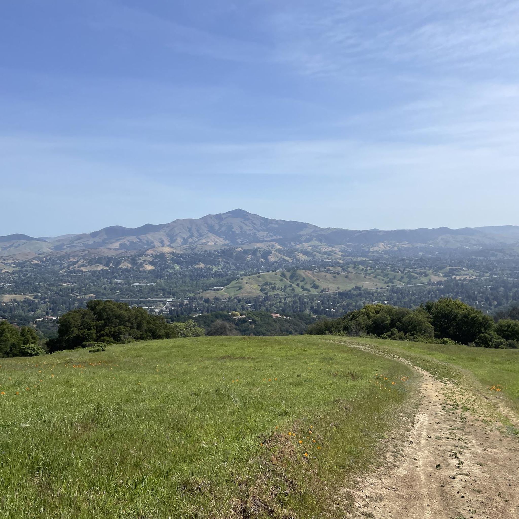
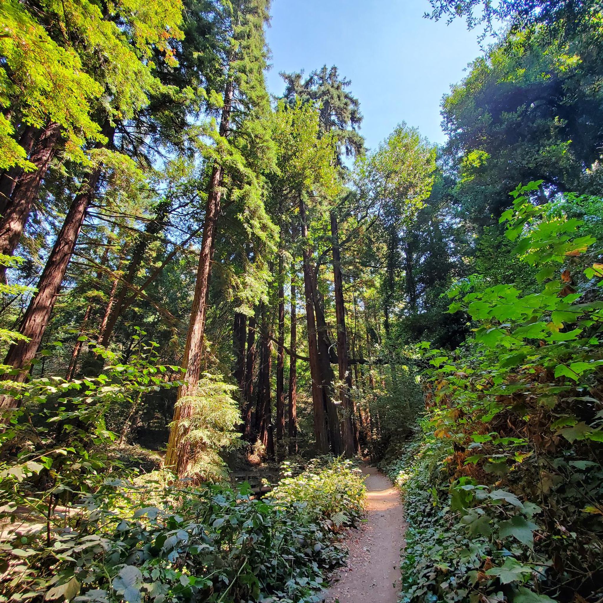
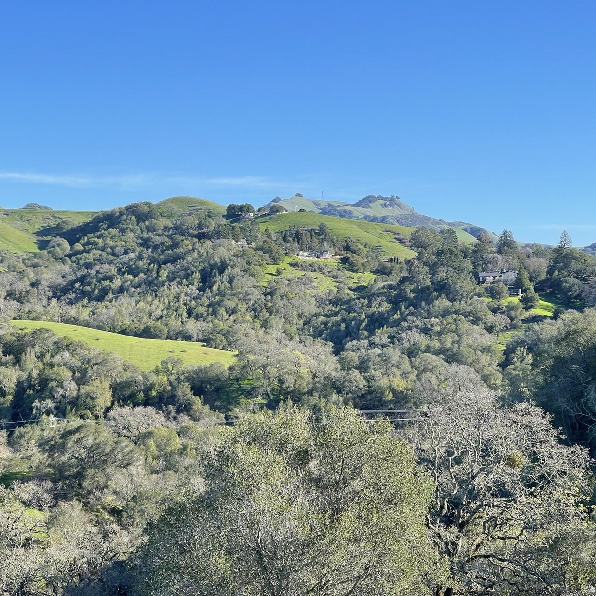

Tips from the Community

Mount Diablo, is the Bay Area second-highest peak at 1173m (3849ft). The challenging climb features constantly fluctuating gradients averaging 8%, with tough sections up to 18% and a brutal 23% finish in the last 200m. The equally demanding descent requires good bike handling due to tight corners, potholes, and strong winds. The road to the top is open daily from 8 AM till sunset.
0
0

The Museum of the San Ramon Valley was established in 1985 and sits in a restored 1891 Southern Pacific Railroad Depot with the Victorian-era “Combination Station No. 22” listed on the National Register of Historic Places. The Official Visitor Information Center offers maps, guides, and knowledgeable staff, along with free parking and restrooms located in the caboose.
1
0
The Lafayette-Moraga Regional Trail is a 7.65-mile paved path for hiking, biking, and horseback riding, open from 5 a.m. to 10 p.m. daily. Paralleling St. Mary's Road, the trail connects Lafayette and Moraga, passing through the scenic Moraga Valley. It is a historical route for mule and steam trains transporting redwood lumber. The trail starts at Olympic Boulevard in Lafayette and ends at the Valle Vista staging area near the San Leandro Reservoir. Along the way, it links to schools, parks, and commercial areas and is maintained by the East Bay Regional Park District.
0
0

Leigh Creekside Park is a small park that is just over an acre in size. The park is a nice resting spot just off the Lafayette-Moraga Trail and features picnic tables, a drinking fountain, and plenty of shade
0
0

One of the nastiest downhills I ever rode, the road is in terrible condition and car drivers where cutting corners at pretty decent speeds. Very beautiful though, would defnitely recommend as an uphill (north to south)
1
0

The Lamorinda Trail Loop has an interesting beginning. Initially the three communities of Lafayette, Orinda and Moraga convened a committee to look at connecting themselves via trails. However, upon looking closely at existing trails they discovered a trail route already existed through the three cities and they simply need to raise funds for signage along the route. After placing the signs designating the route the trail was officially opened on August 10th, 2006.
0
0

By this spot on the Lafayette-Moraga Regional Trail, also known as the Lafayette-Moraga Regional Trail, the Las Trampas and Grizzly Creeks merge. Near this spot you can also access Burton Valley, a small neighborhood in Lafayette.
0
0

Frequently Asked Questions
How many touring cycling routes are available in Moraga?
Moraga boasts nearly 100 touring cycling routes, catering to a wide range of abilities from easy, paved paths to challenging climbs. This extensive network ensures diverse cycling experiences for everyone.
What kind of terrain can I expect on touring cycling routes in Moraga?
The touring cycling routes around Moraga are characterized by hilly and wooded terrain, offering a mix of challenging climbs and gentle descents. You'll find rural roads, scenic tree-lined stretches, and paved rail-trails, providing varied environments for your ride.
Are there any easy touring cycling routes suitable for beginners or families in Moraga?
Yes, Moraga offers several easy touring cycling routes perfect for beginners or families. A great option is the Lamorinda Trail – Lafayette-Moraga Trail loop from Lafayette, an 11.1-mile path that follows a mostly paved rail-trail, ensuring an accessible and smooth ride.
Where can I find challenging touring cycling routes in Moraga?
For those seeking a challenge, Moraga has routes with significant elevation gains. Consider the Skyline Blvd of Oakland Hills – Tilden Park Steam Train loop from Moraga, which covers 38.9 km with over 800 meters of ascent, offering a demanding experience for advanced riders.
Are there any circular touring cycling routes in Moraga?
Many of Moraga's touring cycling routes are designed as loops, allowing you to start and end in the same location. A popular circular route is the Lamorinda Trail Loop, a 17.4-mile ride that takes about 1 hour 45 minutes to complete.
What are some notable landmarks or viewpoints I might see along the routes?
Moraga's routes offer scenic views and access to interesting landmarks. You might encounter potential views of Mount Diablo on certain routes. For specific viewpoints, consider exploring areas near Grizzly Peak Vista Point or Las Trampas Ridge. The East Shore Trail — Lake Chabot Regional Park is another notable attraction in the vicinity.
Is there parking available for touring cyclists in Moraga?
Yes, for routes like the Lafayette-Moraga Regional Trail, the Olympic Blvd. Staging Area serves as a convenient starting point with parking, restrooms, and water access directly connected to the trail.
What makes Moraga a good destination for touring cyclists?
Moraga is an excellent destination for touring cyclists due to its diverse terrain, ranging from gentle rail-trails to challenging hilly roads. The region offers picturesque landscapes, potential views of Mount Diablo, and a network of routes that cater to various skill levels, all highly rated by the komoot community.
What is the best time of year to go touring cycling in Moraga?
While specific seasonal recommendations are not provided, Moraga, like much of California, generally offers pleasant cycling conditions for most of the year. Spring and fall often provide mild temperatures, ideal for exploring the varied terrain.
Are there any specific roads known for touring cycling in Moraga?
Yes, Pinehurst Road is a popular choice among cyclists, known for its rural, wooded character and relatively low auto traffic. Redwood Road also offers a pleasant and often quiet route with a mix of descents, climbs, and moderate-speed sections, making it attractive for touring.
What do other cyclists say about the routes in Moraga?
The touring cycling routes in Moraga are highly regarded by the komoot community, holding an impressive average rating of 4.7 stars from over 140 reviews. Cyclists often praise the varied terrain, scenic beauty, and the options available for different fitness levels.
Are there any routes that offer views of Mount Diablo?
Yes, certain routes in Moraga, particularly those passing through areas like Canyon Road and Pinehurst Road, can offer captivating views of Mount Diablo, enhancing the visual appeal of your ride.
Are there any routes that are particularly quiet or have low traffic?
Redwood Road is known for being a pleasant and often quiet route with very little traffic, making it a good choice for those seeking a more serene cycling experience. Pinehurst Road also offers a rural feel with relatively low auto traffic.
Most popular attractions around Moraga

Get inspired with the komoot mobile app


Explore more
Browse the best Cycling routes in other regions.
