The best walks and hikes around Alveser Lake
4.5
(602)
2,337
hikers
268
hikes
Hiking around Alveser Lake offers a network of trails primarily characterized by flat terrain and minimal elevation changes, making it suitable for accessible outdoor activities. The region is situated in Nienburg/Weser, featuring the lake itself as a central natural landmark. The surrounding landscape typically includes open areas and possibly some wooded sections, providing a gentle environment for walks.
Best hiking trails around Alveser Lake
- The most popular hiking route is Picnic area at Lake Alves – Alveser Lake loop from…
Last updated: July 15, 2026
5.0
(1)
9
hikers
Easy hike. Great for any fitness level. Easily-accessible paths. Suitable for all skill levels.
5.0
(2)
11
hikers
5.45km
01:22
10m
10m
Easy hike. Great for any fitness level. Easily-accessible paths. Suitable for all skill levels.

Sign up for free
4.0
(1)
8
hikers
Easy hike. Great for any fitness level. Easily-accessible paths. Suitable for all skill levels.
5.0
(1)
10
hikers
5.44km
01:22
10m
10m
Easy hike. Great for any fitness level. Easily-accessible paths. Suitable for all skill levels.
4
hikers
Easy hike. Great for any fitness level. Easily-accessible paths. Suitable for all skill levels.
Get access to more routes and recommendations from other explorers.
Sign up for free
Already have an account?
Our route recommendations are based on thousands of hikes, rides, and runs completed by other people on komoot.
Start today with a free account
Your next adventure awaits.
Login or Signup

Tips from the Community

The five bays in the main nave of the church have a cross-ribbed vault supported by octagonal pillars, while the narrow side aisles are only indicated. The rectory next door is also a listed building and serves as a parish hall and parish office.
1
1

Break with a view of Alverse Lake
0
0

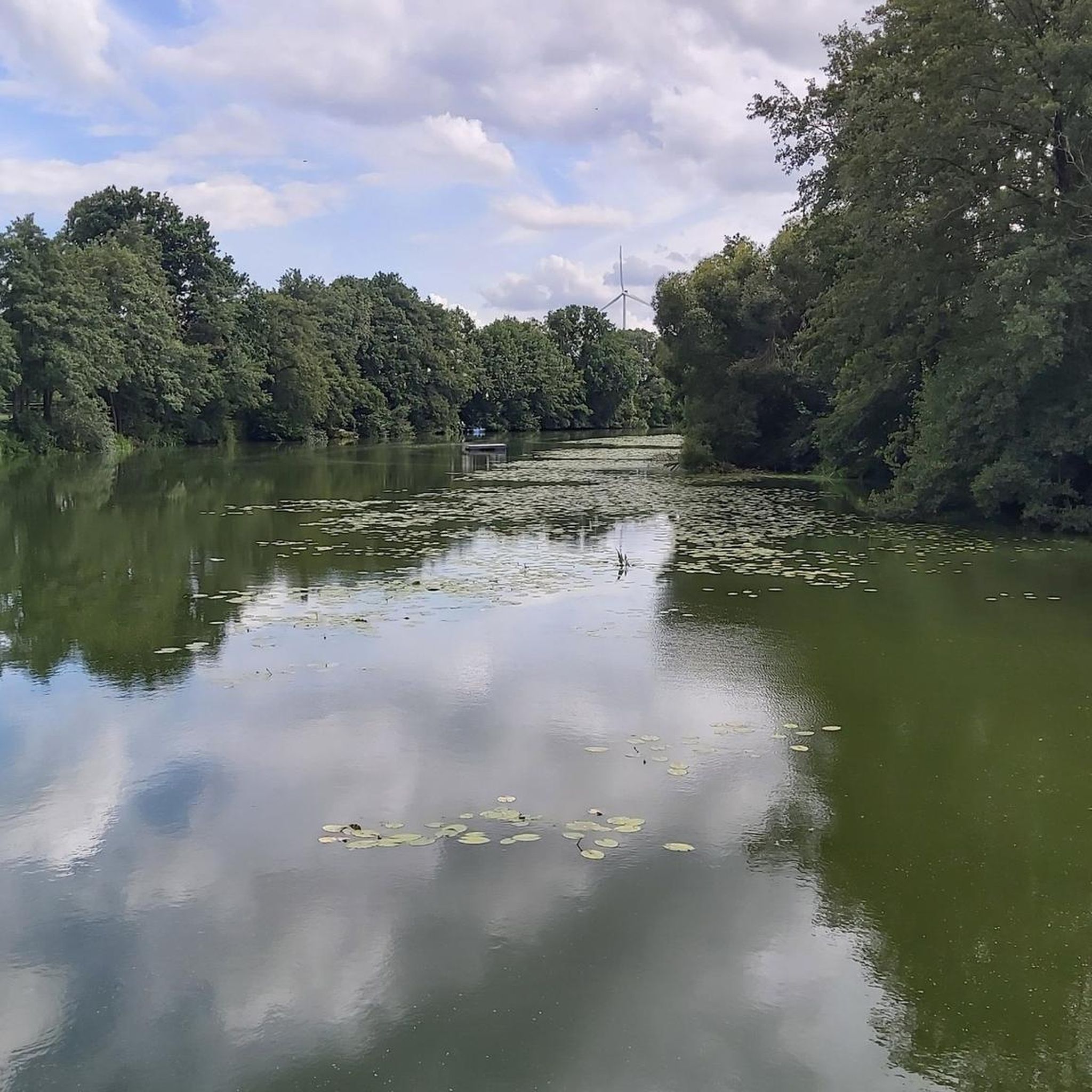
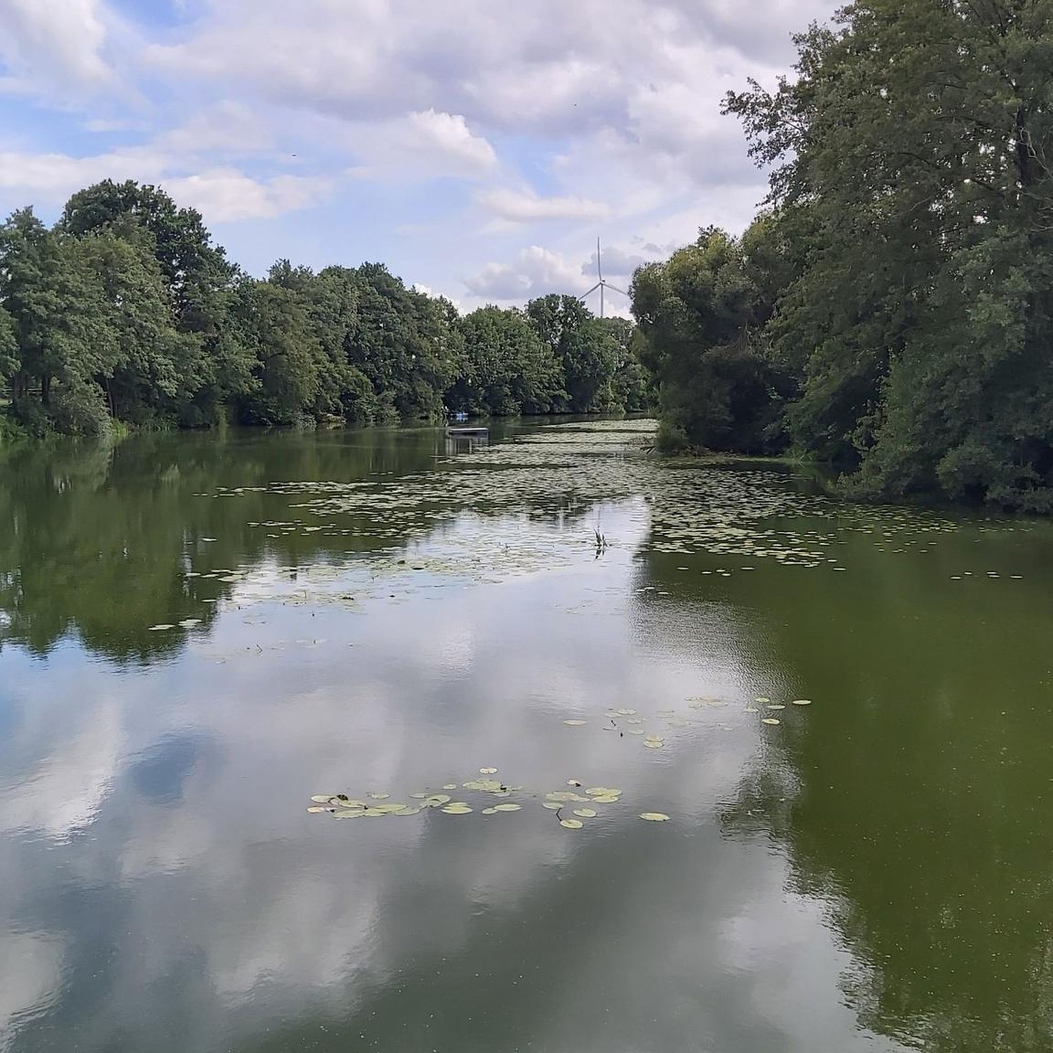
The Alveser See is an oxbow lake of the Weser and lies between the districts of Eitzendorf and Alvesen in the municipality of Hilgermissen. It is around three kilometers long and a maximum of 180 meters wide. Here you can take a break on the idyllic bank.
4
0

The Alveser See with an area of approx. 14 ha is approx. 3 km long, a maximum of 180 m wide and extends largely in a north-south direction and offers appropriate opportunities for fishing. The Blender Emte flows out at the northern end of the lake.
5
0
The Alveser See, an arm of the Weser, lies between the districts of Eitzendorf and Alvesen in the municipality of Hilgermissen in the combined municipality of Grafschaft Hoya and can be reached via the L 201. Here you will find the two campsites "Seerose" and "Am See" with the individual facilities on the inland water. The Alveser See with an area of approx. 14 ha is approx. 3 km long, a maximum of 180 m wide and extends largely in a north-south direction and offers appropriate opportunities for fishing. The Blender Emte flows out at the northern end of the lake.
3
0

Here you can briefly cross the lake. Nevertheless, you should be careful here, because this bridge looks very unstable and slippery.
8
0
I find this bus stop very interesting because it was almost taken over by Pflancen.
6
0
Frequently Asked Questions
What kind of terrain can I expect on hikes around Alveser Lake?
The hiking trails around Alveser Lake are primarily characterized by flat terrain and minimal elevation changes. This makes them suitable for accessible outdoor activities, offering a gentle environment for walks through open areas and some wooded sections.
How many hiking trails are available in the Alveser Lake area?
There are over 260 hiking routes available around Alveser Lake, catering to various preferences. The majority, about 197, are considered easy, with 64 moderate and 7 more challenging options.
Are there any family-friendly hiking options around Alveser Lake?
Yes, the flat terrain and minimal elevation changes make many of the trails around Alveser Lake ideal for families. Routes like the Picnic area at Lake Alves – Alveser Lake loop from Magelsen are easy and offer pleasant lakeside views, perfect for a family outing.
Can I bring my dog on the hiking trails at Alveser Lake?
Given the gentle nature of the trails and the open landscape around Alveser Lake, many routes are suitable for walking with dogs. Always ensure your dog is on a leash and follow local regulations regarding pets in natural areas.
What are some notable natural features or landmarks to see while hiking?
While hiking around Alveser Lake, you can enjoy the lake itself, which is a central natural landmark. Other points of interest include the Wooden Bridge Over the Stream and a designated Swimming spot at Alveser See, offering pleasant stops along your walk.
Are there many circular hiking routes around Alveser Lake?
Yes, many of the trails around Alveser Lake are designed as circular routes, offering convenient starting and ending points. Examples include the Picnic area at Lake Alves – Alveser Lake loop from Eitzendorf and the St. George's Church, Eitzendorf – Alveser Lake loop from Eitzendorf.
What do other hikers say about the trails around Alveser Lake?
The trails around Alveser Lake are highly regarded by the komoot community, holding an average rating of 4.6 stars from over 500 reviews. Hikers often praise the accessible, flat paths and the serene lakeside views, making it a popular choice for relaxed walks.
What is the best time of year to go hiking at Alveser Lake?
Given the flat and gentle nature of the trails, hiking around Alveser Lake is enjoyable for much of the year. Spring and autumn offer pleasant temperatures and scenic views, while summer is ideal for combining a walk with a visit to the Swimming spot at Alveser See. Winter walks can also be peaceful, depending on weather conditions.
Are there any longer hiking routes for those seeking a bit more distance?
While many routes are shorter and easy, you can find longer options. For instance, the St. George's Church, Eitzendorf – Wooden Bridge Over the Stream loop from Eitzendorf covers approximately 4.6 miles (7.4 km), offering a slightly extended walk through the local area.
Is Alveser Lake suitable for beginners or those new to hiking?
Absolutely. The region's trails are predominantly easy with minimal elevation, making Alveser Lake an excellent destination for beginners, casual walkers, or anyone looking for a relaxed outdoor experience without strenuous climbs.
Where is Alveser Lake located?
Alveser Lake is situated in the Nienburg/Weser region, offering a central natural landmark for outdoor activities in the area.
Most popular routes around Alveser Lake
Most popular attractions around Alveser Lake

Get inspired with the komoot mobile app


Explore more
Browse the best Hikes in other regions.
