The best walks and hikes around Broadmoor
4.8
(75)
2,449
hikers
146
hikes
Hikes around Broadmoor Colorado Springs are set in a landscape at the foot of the Rocky Mountains. The area is defined by its proximity to dramatic red rock formations, forested canyons, and prominent peaks like Pikes Peak. Trails navigate through pine and aspen forests, follow mountain streams, and ascend to viewpoints overlooking Colorado Springs and the Great Plains.
Best hiking trails around Broadmoor
- The most popular hiking route is Lake Merced loop — San Francisco, a 5.0 mile (8.0 km) trail that takes around 2 hours 5 minutes to complete. It offers a relatively flat path suitable for a wide range of abilities.
- Another top favourite among local hiking enthusiasts is San Bruno Mountain loop from Daly City, an easy 3.8 mile (6.2 km) path. This route involves some elevation gain, leading to open views of the surrounding area.
- Local hiking enthusiasts also love the San Bruno Mountain loop from Crocker-Amazon, a 9.8 mile (15.8 km) trail leading through varied terrain, often completed in about 4 hours 30 minutes.
- Hiking around Broadmoor is defined by canyon trails, red rock ridges, and forested mountain slopes. The trail network provides options for different ability levels, from easy walking trails to more challenging ascents.
- The routes in Broadmoor are highly rated by the komoot community with an average score of 4.8 stars from more than 60 reviews. More than 1,700 hikers have used komoot to explore Broadmoor's varied terrain.
Last updated: September 29, 2026
10
hikers
3.46km
00:59
80m
70m
The Mussel Rock Trail offers a refreshing coastal hiking experience, delivering stunning panoramic views of the Pacific Ocean with relatively little effort. As you walk the 2.1 miles (3.5 km) of unpaved, uneven paths, you'll encounter dramatic cliffs, crashing waves, and vibrant wildflowers. Keep an eye on the sky for paragliders launching from the bluffs and scan the ocean for seals or even whales, making this easy 58-minute route with 253 feet (77 metres) of elevation gain a rewarding journey for nature lovers.
Planning your visit is simple; the trail is easily accessible, and it's particularly magical around sunset, which is renowned as one of the best in the Bay Area. If you time your trip for low tide, you can explore the fascinating tide pools along the shoreline. Remember to wear sturdy shoes, as some sections can be gravelly or steep, and always stay on marked paths due to the erosion-prone cliffs.
Beyond its natural beauty, Mussel Rock holds significant geological importance as the closest point to the epicenter of the 1906 San Francisco earthquake, where the San Andreas Fault meets the ocean. You can also find the remnants of "Tobin's Folly," an old highway tunnel, accessible at extreme low tide. This unique blend of history, geology, and wildlife makes the Mussel Rock Trail a standout among coastal hiking routes.
2
hikers
2.50km
00:40
30m
30m
The Fort Funston Coastal Trail offers a unique blend of dramatic ocean bluffs and historical intrigue, making it a standout among San Francisco's outdoor offerings. You'll walk along 200-foot cliffs, with expansive views of the Pacific Ocean, and encounter remnants of a decommissioned naval defense base, including Battery Davis. The terrain varies from paved sections to sandy paths, providing a diverse experience underfoot.
This easy 1.6-mile (2.5 km) hike, with a gentle 90 feet (27 metres) of elevation gain, typically takes around 39 minutes to complete. It's an ideal spot for a quick, refreshing outing, especially if you're looking for Fort Funston family friendly dog friendly options. Be sure to dress in layers, as the coastal location means strong winds are common, and some paths can be unstable after winter storms.
What truly sets this trail apart is its popularity among hang gliders, who launch from the cliffs, creating a spectacular aerial display. It's also a renowned

2
hikers
1.37km
00:24
40m
40m
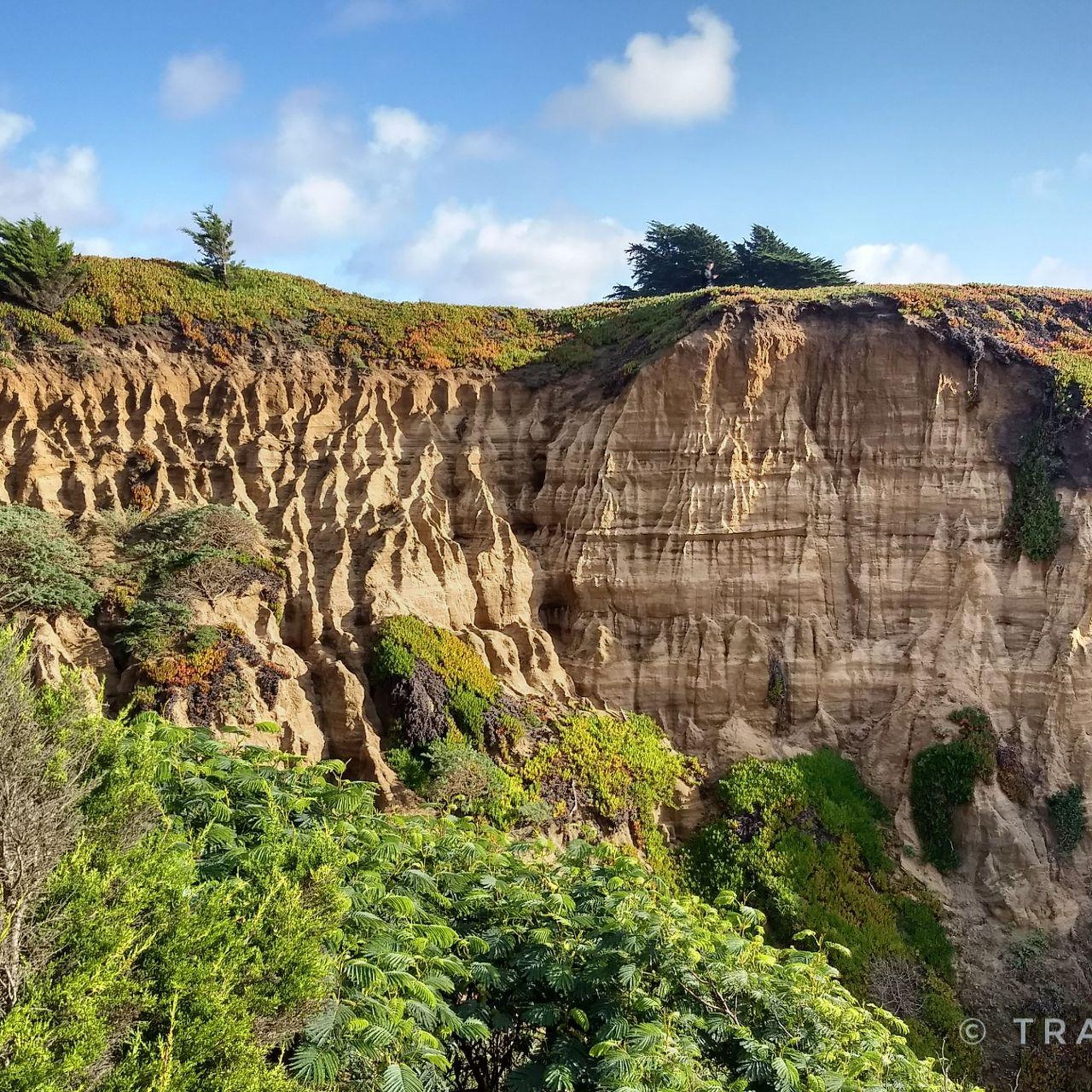
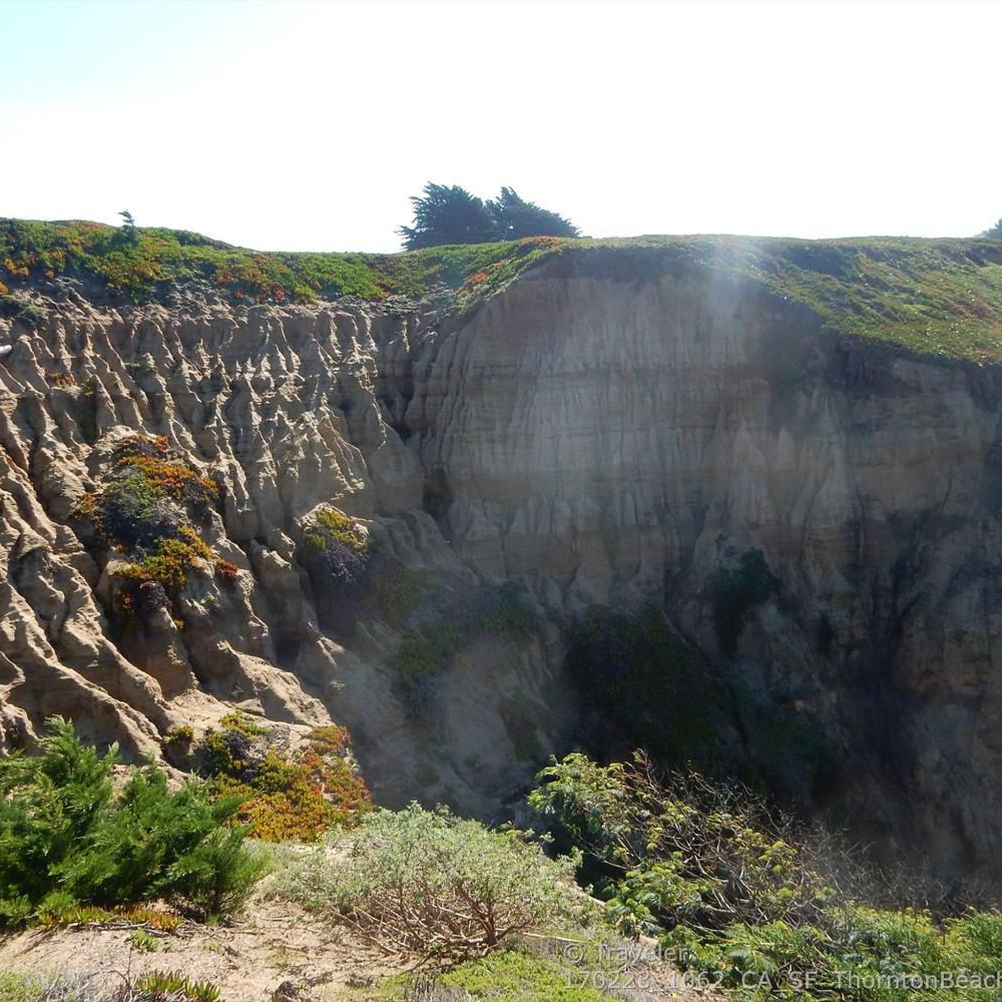
The Thornton Beach Trail offers a unique glimpse into California's dynamic coastline, where dramatic coastal bluffs meet the Pacific Ocean. This easy 0.9-mile (1.4 km) hike, with a gentle 121 feet (37 metres) of elevation gain, takes about 24 minutes to complete, providing spectacular panoramic views from the bluffs. You'll find yourself immersed in a landscape shaped by continuous erosion, with the soothing sounds of crashing waves and the occasional sight of crows soaring overhead.
Planning your visit to this trail, located in Daly City just south of San Francisco, requires a bit of foresight. Parking can be limited, and there are no public restrooms or amenities available, so come prepared. The area is known for being windy and cold, with frequent fog, especially in summer, so layering up is always a good idea. While official beach access is restricted due to landslides, the viewing platforms still offer incredible vistas.
What makes Thornton Beach truly stand out is its location directly atop the active San Andreas Fault, making it a fascinating site for understanding coastal geological processes. Beyond the views, the coastal bluffs and nearshore waters support diverse wildlife, making it a great spot for birdwatching, with species like red-tailed hawks and great horned owls often spotted. It's a tranquil escape that feels far removed from city life, despite its proximity to San Francisco.
7.18km
01:55
100m
40m
This easy 4.5-mile (7.2 km) hike along the Bay Area Ridge Trail from Lake Merced to Stern Grove offers a delightful urban escape, perfect for a leisurely afternoon. You'll wander past the tranquil waters of Lake Merced, where marsh grasses and cypresses create a serene atmosphere, before transitioning through charming city parks. The route culminates in the iconic Stern Grove, famous for its majestic redwood trees, providing a refreshing change of scenery with only 342 feet (104 metres) of elevation gain over about 1 hour and 55 minutes.
Accessing the trail is convenient, with parking available at both ends and public transport options connecting to the starting points. The path is mostly level, featuring a mix of paved and natural surfaces, making it suitable for a wide range of users, including families and those with strollers. You'll find public restrooms and picnic areas along the way, so it's easy to make a day of it.
This segment is a fantastic way to experience San Francisco's natural side, connecting urban landscapes with peaceful park areas. Lake Merced is a notable stop along a major bird migration route, offering excellent birdwatching opportunities, while Stern Grove is renowned for its outdoor performances. It's a great choice if you're looking for an accessible, family-friendly hike that showcases the city's diverse environments.
8.41km
02:21
150m
190m
Hike the Bay Area Ridge Trail from Mussel Rock to Lake Merced, a moderate 5.2-mile route offering coastal views and lakeside serenity.
Get access to more routes and recommendations from other explorers.
Already have an account?
Our route recommendations are based on thousands of hikes, rides, and runs completed by other people on komoot.
Start today with a free account
Your next adventure awaits.

Tips from the Community

You could almost overlook it, but at the tip of the lake is also the official starting line for the tour.
1
0


West entrance into the large combined park. Sigmund Stern Grove is nestled into the southwest corner of San Francisco’s Sunset District. Its 63 acres are comprised of meadows, lush forests, and Pine Lake, one of only three natural lakes in San Francisco. The Greene family, a family of early homesteaders, staked out the land in 1847 and began farming, but not without challenges. Shifting sands and property disputes with armed and aggressive neighbors were commonplace for settlers in the largely untamed region. Following the Gold Rush and a long legal battle to keep their land, the Greenes opened The Trocadero Inn on the property and played host to ruffians and celebrities of the day. North Pole explorer Dr. Frederick Cook was a resident of the inn, which closed during prohibition but still stands today. In 1931, the land was purchased by the wife of the late Sigmund Stern and gifted to the city as a park shortly thereafter. Free summer performances of music and dance have taken place at the grove’s natural eucalyptus amphitheater and outdoor stage since 1938. World-class artists grace the Stern Grove Festival stage every Sunday in the summer. The events are free of charge, and donations can be made at the gates. Trails interlaced through the park are popular with runners and walkers. The park features tennis courts, picnic tables, and a children’s playground. A large off-leash dog area rests between the concert meadow and Pine Lake. Coyotes and other wildlife call Stern Grove home, so please observe leash regulations and stay on the trails. Street parking is easy on the surrounding residential streets near the park's multiple entrances. Much of the park is handicap accessible from this entrance.
0
1

Along with Pine Lake, and Mountain Lake, Lake Merced is one of three freshwater lakes in San Francisco. The lake is fed through a natural underground spring and provides opportunities for all sorts of outdoor activities.
0
0
Large fresh water lake divided into 3 parts, next to Fort Funston and Ocean Beach, surrounded by a circular trail and crossed by two bridges and a causeway, all with beautiful views. It has a public paddle boat launch and a golf course, and several picnic areas.
0
0

The top of the steep hill is a good spot for a break and take in the sweeping coastal community view to the south.
2
0
Frequently Asked Questions
Are there any dog-friendly hiking trails near The Broadmoor?
Yes, many trails in the area are dog-friendly, but policies can vary. Red Rock Canyon Open Space is a popular choice for hiking with dogs, offering numerous trails with beautiful red-rock scenery. North Cheyenne Cañon Park also allows dogs on its extensive trail system. Always remember to keep your dog on a leash and clean up after them to help preserve the natural beauty of these areas.
What are some easy, family-friendly hikes in the Broadmoor area?
For a gentle and accessible walk, the Perkins Central Garden Trail in Garden of the Gods is a great option. It's a 1.5-mile paved loop that is suitable for strollers and wheelchairs, winding through the park's iconic red rock formations. For a slightly more traditional but still easy hike, the Mount Cutler trail in North Cheyenne Cañon Park offers rewarding views for a relatively small effort.
Where can I find hikes with waterfalls near Broadmoor?
The most famous waterfall destination is Seven Falls, which features a series of seven cascading waterfalls in a box canyon. For a different experience within a beautiful forest setting, visit North Cheyenne Cañon Park, which is home to both Helen Hunt Falls and Silver Cascade Falls.
What are the hiking trails at Seven Falls like?
After climbing the 224-step staircase alongside the falls, you can access two distinct trails. The Trail to Inspiration Point is a one-mile round trip offering fantastic views over Colorado Springs and the Great Plains. The other option is the shorter Midnight Falls Trail, a 30-minute hike leading to a more secluded waterfall.
How does hiking in Red Rock Canyon compare to Garden of the Gods?
Both parks feature stunning red rock geology. Garden of the Gods is a National Natural Landmark known for its dramatic, iconic formations and paved central trails, which can make it more crowded. Red Rock Canyon Open Space often provides a quieter experience with more rugged dirt trails that are very popular with local hikers and dog walkers. It offers a similar landscape but with a wilder feel.
Are there any challenging, high-altitude hikes available near The Broadmoor?
Yes, for a serious challenge, you can tackle Pikes Peak. The Barr Trail and the Crags Trail are the two primary routes to the 14,115-foot summit. These are strenuous, full-day hikes that require proper preparation for high altitude and changing weather conditions. The San Bruno Mountain loop from Crocker-Amazon is a long route that can help you prepare for such endurance challenges.
What kind of hiking is available in North Cheyenne Cañon Park?
North Cheyenne Cañon Park offers a diverse trail system of over 15 miles within a beautiful forested canyon. You can find everything from the family-friendly Mount Cutler trail to the more strenuous Mount Muscoco trail, which rewards hikers with panoramic views from its summit. The popular Seven Bridges Trail follows a creek, crossing it multiple times.
Is it difficult to find parking at the trailheads?
Parking can be challenging, especially at popular trailheads on weekends. For trails like Mount Muscoco, the lot at the trailhead is small, and you may need to park further down the road and walk. It's always a good idea to arrive early in the morning to secure a spot. Some destinations, like Seven Falls, have designated parking lots with shuttle services.
What do other hikers think of the trails around Broadmoor?
The trails in this region are highly regarded by the komoot community, earning an average rating of 4.8 out of 5 stars. Hikers frequently praise the stunning scenery, from the unique red rock formations to the forested canyons and expansive views of the Great Plains. The variety of trails, catering to all skill levels, is also a commonly highlighted feature.
How many hiking trails are there around Broadmoor?
There are over 100 designated hiking routes in and around the Broadmoor area. These range from short, easy walks like the San Francisco Zoo loop from Wawona Street & 46th Avenue to difficult mountain ascents, offering a wide variety of options for every type of hiker.
Are there any circular or loop hikes available?
Yes, there are many excellent loop trails. The Lake Merced loop — San Francisco is a popular moderate loop that offers a great way to experience the local landscape. Many trails in Red Rock Canyon and North Cheyenne Cañon Park can also be combined to form satisfying loops.
What should I know before hiking in this area?
The weather in the Rocky Mountains can change quickly, so it's wise to dress in layers and bring rain gear, even on a sunny day. The altitude can affect hikers differently; be sure to drink plenty of water before and during your hike. Finally, some trails are rocky and uneven, so sturdy hiking shoes with good grip are highly recommended.
Most popular attractions around Broadmoor

Get inspired with the komoot mobile app


Explore more
Browse the best Hikes in other regions.
