The best cycling routes around Carnelian Bay
4.5
(23)
668
riders
46
rides
If you've ever tried to plan touring cycling around Carnelian Bay, you know how overwhelming the options can be. With so many roads and trails winding through this stunning region, it's tough to tell which routes are genuinely worth your time and effort, and which are just filler. That's where komoot comes in. Our community has ridden, reviewed, and mapped the best touring cycling routes, so you don't have to guess. We've curated a shortlist of the ones that truly deliver, saving you the guesswork.
Touring cycling around Carnelian Bay is defined by the incredible Lake Tahoe scenery. You'll find everything from gentle lakeside paths to challenging climbs through dense pine forests and up towards mountain lookouts. The terrain offers a mix of well-paved roads and unpaved fire roads, providing a diverse experience for all abilities. This is the north shore of Lake Tahoe, backed by the Sierra Nevada mountains, so expect varied elevation and panoramic views.
For a rewarding ride that balances effort with scenery, we'd start with the Burton Creek and Dollar Reservoir Loop, a moderate 13.3 miles (21.4 km) route that winds through beautiful forested areas. If you're looking for a bigger challenge and an incredible payoff, the Martis Peak Lookout via Martis Peak Road is a difficult 9.8 miles (15.8 km) climb that delivers truly panoramic views from the top. More than 600 touring cyclists have already explored Carnelian Bay with komoot, and we think you'll love what you find.
Last updated: May 10, 2026
14
riders
21.4km
01:29
260m
260m
Embark on the Burton Creek and Dollar Reservoir Loop for a scenic ride through diverse Sierra Nevada landscapes. This moderate 13.3-mile (21.4 km) touring cycling route, with 838 feet (256 metres) of elevation gain and an estimated duration of 1 hour and 28 minutes, winds through wildflower meadows, deep pine forests, and past the tranquil Dollar Creek Reservoir. You'll find yourself immersed in nature, with occasional rewarding views of Lake Tahoe.
Planning your visit to Burton Creek State Park is straightforward, though you'll want a robust bike like a gravel or mountain bike for the unpaved and sometimes rugged terrain. The park is dog-friendly on its roads, and clear trail maps are available at junctions to help you navigate. Consider visiting in spring for wildflowers or autumn for the vibrant cottonwood colors.
This undeveloped 2,000-acre park offers more than just a ride; it's a gateway to a larger network, connecting to routes like the Tahoe Rim Trail. The park also protects State Natural Preserves, safeguarding a Sierra mountain meadow and a riparian forest, contributing to the rich natural beauty and providing opportunities for wildlife and bird watching.
4
riders
15.8km
01:25
590m
590m
For a truly epic touring cycling experience with unparalleled rewards, Martis Peak Lookout via Martis Peak Road offers a difficult 9.8-mile (15.8 km) ascent that will test your legs. The route climbs a substantial 1948 feet (594 metres) to the historic Martis Peak Fire Lookout, where you're greeted with incredible 360-degree panoramic views of the Lake Tahoe Basin and beyond. While the lower sections wind through forest, the higher you go, the more expansive the Martis Peak views become, making every pedal stroke worth it.
When planning your trip on these Martis Peak cycling trails, remember that the road is typically closed due to snow from late fall to mid-spring. The best window for cycling is usually June, July, and September. The estimated duration for this challenging ride is around 1 hour and 24 minutes, so plan your start time accordingly, especially if you want to enjoy the summit views without rushing. Be aware that the road is multi-use and shared with other traffic.
The Martis Peak Fire Lookout itself is a notable attraction, a historic structure built in 1914 that provides shelter and a fascinating glimpse into the region's past. From this vantage point at 8,656 feet, you can spot distant landmarks like Lassen Peak and Castle Peak on clear days, alongside the vast expanse of Lake Tahoe. The Martis Peak cycling seasonal conditions mean this route transforms into a popular spot for snowshoeing and cross-country skiing in winter, highlighting its versatility.

Sign up for free
2
riders
15.5km
01:24
220m
220m
The Antone Meadows Loop offers a delightful touring cycling experience through the dense pine forests of Burton Creek State Park. As you navigate the well-packed dirt and gravel roads, you'll encircle the tranquil Antone Meadows Nature Preserve, where you might spot active beaver dams and lodges. Keep an eye out for abundant wildflowers, especially in the early season, and enjoy occasional glimpses of Lake Tahoe from various lookout points along the way.
This moderate 9.6-mile (15.5 km) route, with 726 feet (221 metres) of elevation gain, typically takes about 1 hour and 24 minutes to complete. While mostly level, some sections can be challenging, making it suitable for cyclists with good fitness looking for a rewarding ride. The trail is easily accessible near Tahoe City, which provides amenities like cafes and bike rentals, and is best enjoyed during the warmer months.
The Antone Meadows Loop is part of a larger multi-use trail network, connecting to other routes like the Dollar Creek Shared Use Path and the Tahoe XC Special Green Trail. The area holds historical significance, named after Antone Rossi who ran dairy cows here in the 1880s, with a small dam still supplying water to the Tahoe City Golf Course. It's a fantastic way to immerse yourself in the natural environment and history of the region.
2
riders
18.8km
01:51
410m
410m
The Tahoe Rim Trail via Whoop-dee-doo loop offers a dynamic touring cycling adventure, blending the renowned Tahoe Rim Trail's diverse landscapes with the Whoop-dee-doo's specific character. You'll traverse a mix of singletrack and dirt roads, winding through conifer forests and open areas that provide spectacular views of Lake Tahoe. The terrain includes everything from packed earth to loose sand and rocky sections, ensuring a varied and engaging ride that keeps you on your toes.
Planning your ride on this difficult 11.7-mile (18.8 km) route, which involves 1352 feet (412 metres) of elevation gain and takes around 1 hour and 51 minutes, requires some preparation. Parking is typically available near the Tahoe XC area, which serves as a common access point for this network of trails. Given the challenging nature of the route, it's wise to start early, especially during peak season, to secure a spot and avoid the midday heat. Always ensure your bike is suitable for varied and potentially technical terrain, as some sections can be quite demanding.
This route is a fantastic way to experience a segment of the iconic Tahoe Rim Trail, a 165-mile loop celebrated for its world-class scenery and challenging sections. While the Whoop-dee-doo loop itself is often associated with more aggressive mountain biking, its inclusion here provides a unique blend for touring cyclists seeking a workout with rewarding vistas. The trail passes through diverse ecosystems, offering glimpses of alpine meadows and the vast expanse of Lake Tahoe, making it a memorable ride for those ready for a challenge.
23.1km
02:31
780m
780m
The Fire Road 16N54 via North Lake Boulevard loop offers a truly immersive touring cycling experience through the stunning North Lake Tahoe landscape. You'll navigate a mix of unpaved dirt, gravel, and rocky fire roads, interspersed with smoother sections along North Lake Boulevard. The highlight is a spectacular viewpoint from the Tahoe Rim Trail, where a clearing provides expansive views of Lake Tahoe, making the challenging terrain worthwhile.
This difficult 14.3-mile (23.1 km) route involves a significant 2563 feet (781 metres) of elevation gain, typically taking around 2 hours and 30 minutes to complete. It's best suited for advanced cyclists with a gravel or mountain bike, as the sustained climbs and descents on loose surfaces require experience. Always carry plenty of water, food, and tools, and be prepared for changing weather conditions in this remote area.
This loop stands out as one of the more demanding cycling routes in the North Lake Tahoe area, offering a vigorous workout combined with picturesque natural features. Its combination of challenging off-road segments and scenic vistas makes it a top choice for experienced riders looking for an adventurous day out, far from the more crowded paved paths.
Get access to more routes and recommendations from other explorers.
Sign up for free
Already have an account?
Our route recommendations are based on thousands of hikes, rides, and runs completed by other people on komoot.
Start today with a free account
Your next adventure awaits.
Login or Signup
Tips from the Community

Lake Tahoe Commons Beach is just a one-minute walk from the main street of Tahoe City. A nice beachfront area and a fantastic swimming spot.
0
0

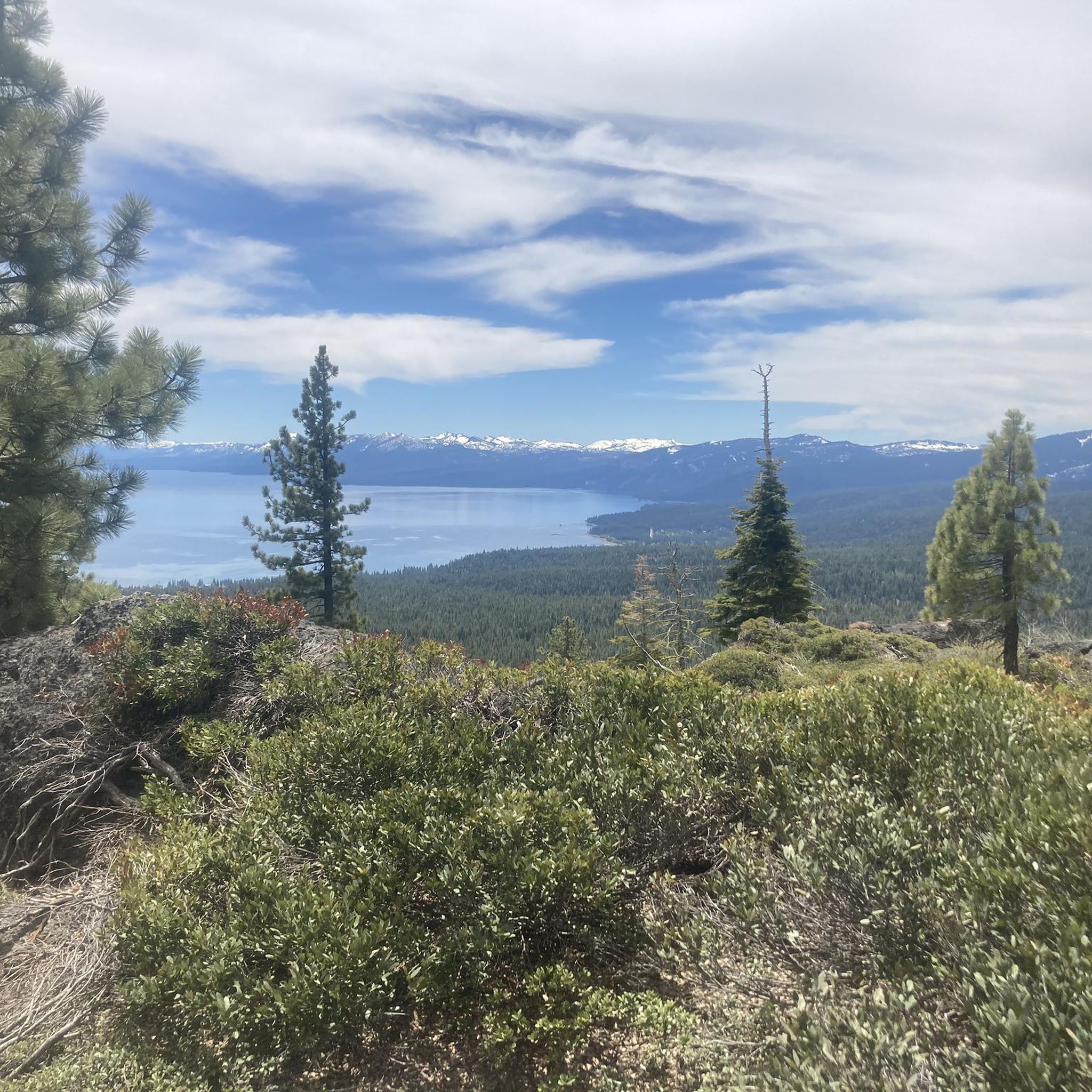
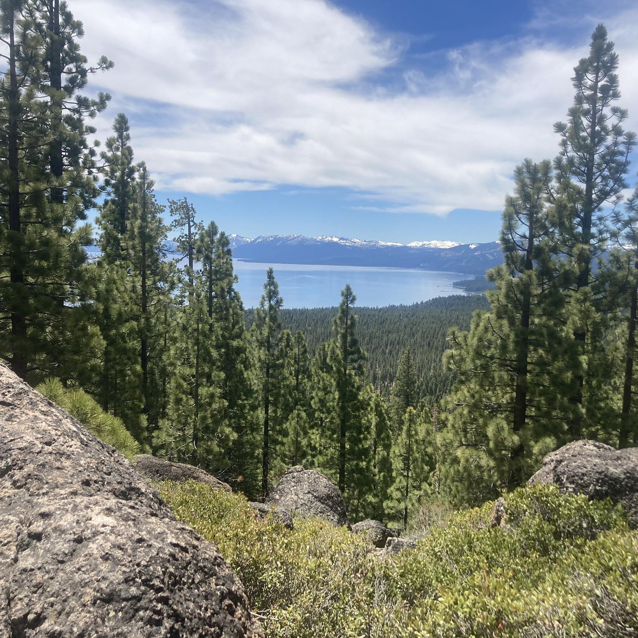
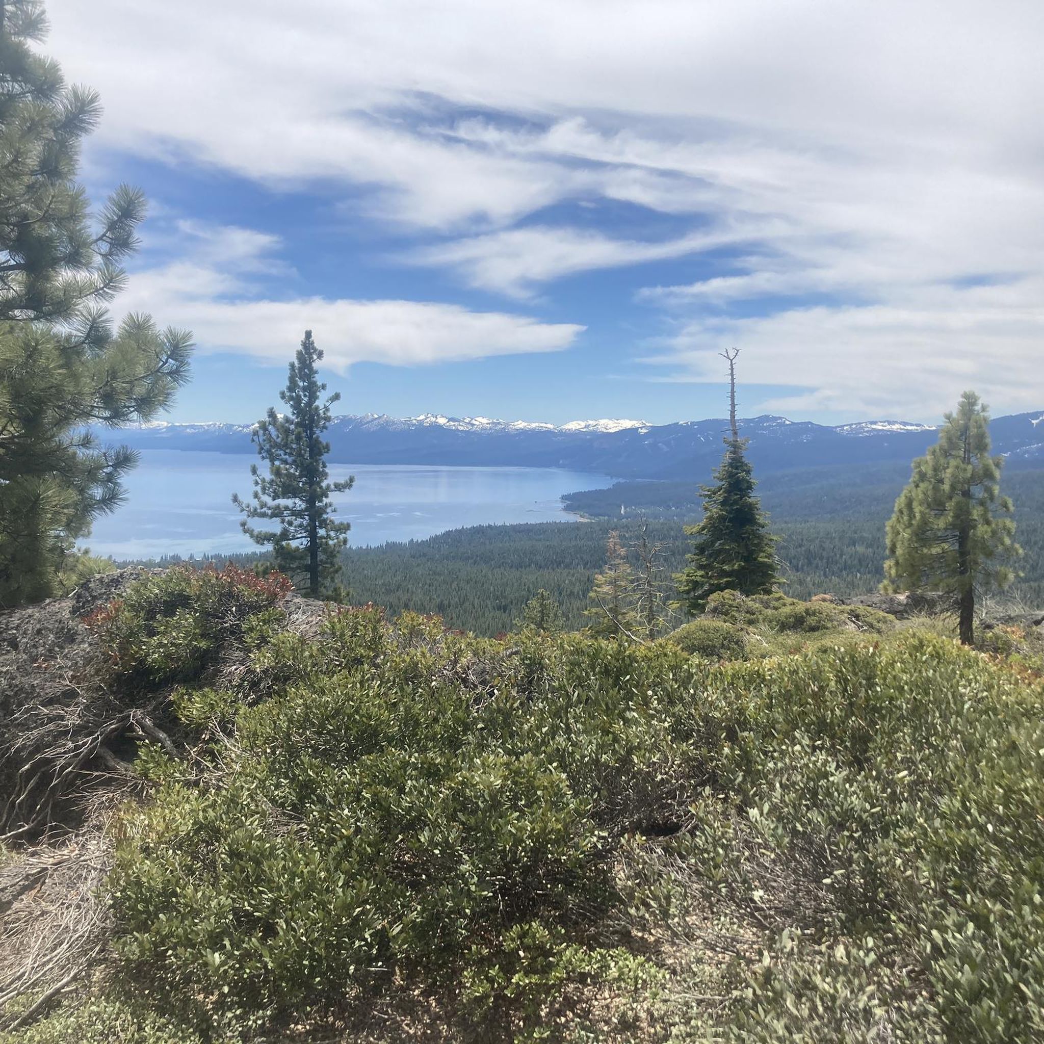
Tahoe Rim Trail is a stunning trail that runs through some trees along a mountain side. Along the trail, there are overlooks of the preserve land as it runs down into the vast Lake Tahoe. If you suffer from decision-making like myself, this area is a real challenge because of how many amazing trails you can tie into your ride!
0
0
This is a small dirt road leading to a spectacular view from the Tahoe Rim Trailhead. There is a clearing in the trees that allows you to see all the way down to Lake Tahoe. There is quite a lot of climbing to get here, but it makes it all worth it!
0
0
Lake Tahoe Commons Beach is just a one minute walk from the main street of Tahoe City. A nice beachfront area and a fantastic swimming spot.
0
0

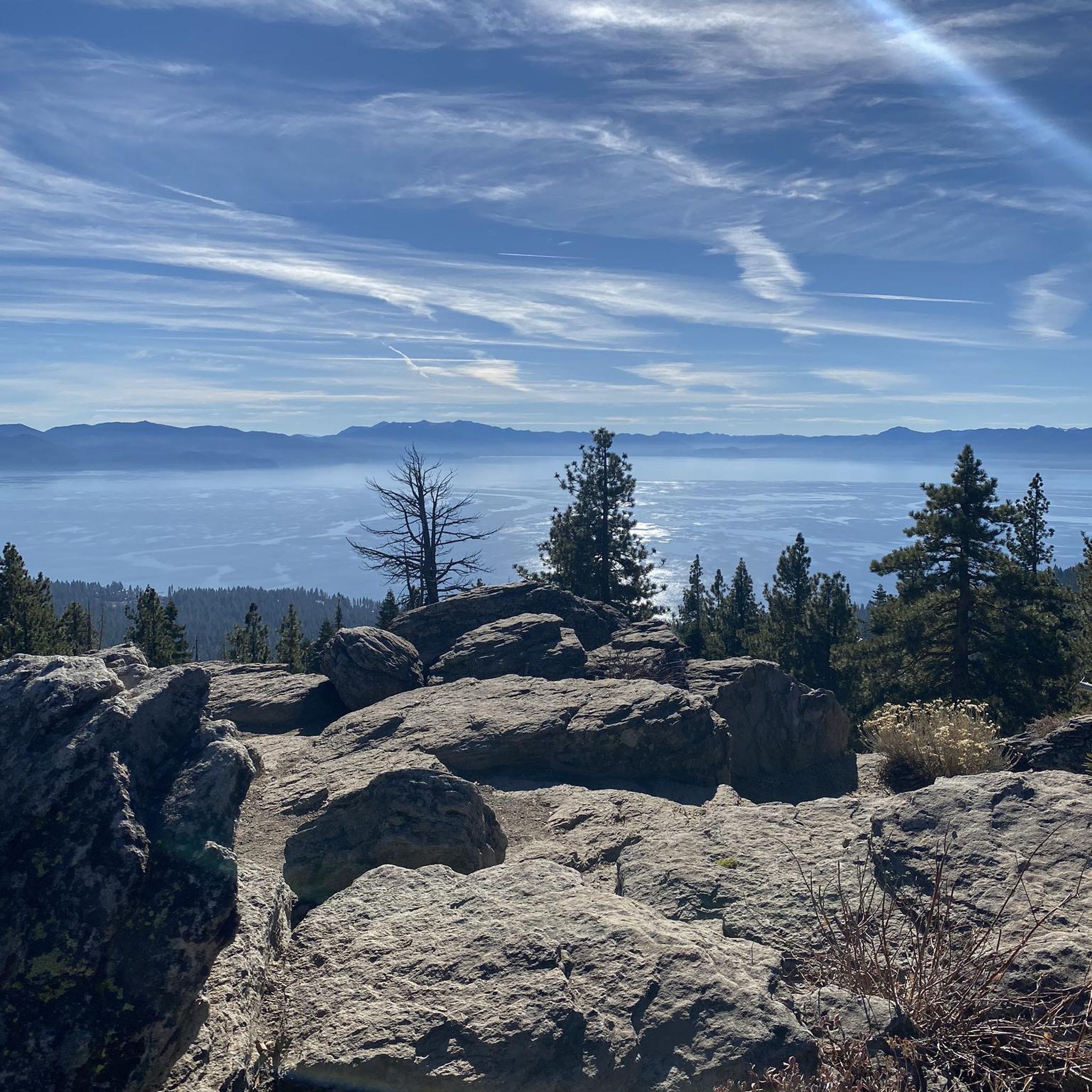
Mantis Peak Lookout is the spot of a fire lookout built in 1914. There are several routes up to the top and are definitely worth the effort for the great views from the lookout.
1
0
Mantis Peak Road is a narrow, paved road leading to Mantis Peak Lookout, home to a fire lookout built in 1914. Sometimes the pavement has cracks and potholes, so be aware. It is used by cars, bikers, and hikers, so be careful when coming around turns. Mantis Peak Road is closed in the winter.
0
0
Mantis Peak is at an elevation of 8,700 feet, so the ride up can get riders quite winded at this elevation. Staying hydrated is important. The Mantis Peak Lookout is here with the best view, but continue on the Mantis Peak Summit Path, just about 150 feet east, where the technical summit sits.
0
0
North Tahoe Beach is a beach that gets busy in the summer, so it is best to arrive early. It is 2.7 acres in size, and this beach park has 540 feet of public shoreline and a grassy area if visitors don't want to lay in the sand. There is no parking fee, and the park offers permanent restrooms, one horseshoe pit, barbecue picnic tables, and volleyball courts.
0
0
Frequently Asked Questions
How many touring cycling routes are available in Carnelian Bay?
There are over 40 touring cycling routes around Carnelian Bay, offering a diverse range of experiences for cyclists of all skill levels.
Are there any easy touring cycling routes suitable for beginners or families?
Yes, Carnelian Bay offers several easy touring cycling routes. For a pleasant ride, consider the Burton Creek and Dollar Reservoir Loop, which is a moderate route but features sections suitable for those seeking a less strenuous experience through forested areas.
What are some challenging touring cycling routes in the area?
For experienced touring cyclists seeking a challenge, the Martis Peak Lookout via Martis Peak Road offers significant elevation gain and panoramic views. Another demanding option is the Fire Road 16N54 via North Lake Boulevard loop, known for its varied terrain and substantial climbs.
Are there any circular touring cycling routes around Carnelian Bay?
Many routes in Carnelian Bay are designed as loops. For instance, the Dollar Property – Antone Meadows Nature Preserve loop from Carnelian Bay provides a scenic circular ride through natural landscapes. The Brockway Summit – Watson Lake Campground loop from Tahoe Vista is another excellent circular option with varied terrain.
What kind of scenic viewpoints or attractions can I expect along the routes?
Carnelian Bay's touring cycling routes often feature stunning natural attractions. You can find breathtaking vistas at Mantis Peak Lookout and Picnic Rock. Many routes also pass by beautiful natural features like Watson Lake Campground and sections of the Truckee River Trail.
What is the best time of year for touring cycling in Carnelian Bay?
The best time for touring cycling in Carnelian Bay is typically from late spring through early autumn (May to October), when the weather is mild, and trails are clear of snow. Summer offers warm temperatures, while spring and fall provide cooler rides and vibrant scenery.
What do other touring cyclists enjoy most about cycling in Carnelian Bay?
The area is highly rated by the komoot community, with an average score of 4.4 stars from over 10 reviews. Reviewers often praise the diverse terrain, ranging from serene lakeside paths to challenging mountain climbs, and the stunning views of Lake Tahoe and surrounding forests.
Are there any specific considerations for winter touring cycling?
Winter touring cycling in Carnelian Bay can be challenging due to snow and ice, especially at higher elevations. Many trails may be impassable or require specialized equipment like fat bikes. It's advisable to check local weather and trail conditions before planning a winter ride.
Where can I find parking near the touring cycling routes?
Parking availability varies by trailhead. Many popular starting points, especially near state parks or designated recreational areas, offer parking facilities. It's recommended to check specific route details on komoot for information on parking at the trailhead you plan to use.
Are there cafes or places to refuel along the touring cycling routes?
While some routes might pass through or near small towns with cafes and shops, many of the touring cycling routes in Carnelian Bay venture into more remote natural areas. It's always a good idea to carry sufficient water and snacks, especially on longer rides, and plan your stops in advance.
What types of terrain can I expect on touring cycling routes in Carnelian Bay?
The terrain around Carnelian Bay is quite varied. You'll encounter paved roads, unpaved fire roads, and some singletrack sections. Expect a mix of gentle lakeside paths, rolling hills, and challenging climbs with significant elevation changes, particularly on routes leading to mountain lookouts.
Most popular attractions around Carnelian Bay

Get inspired with the komoot mobile app


Explore more
Browse the best Cycling routes in other regions.
