The best cycling routes around Del Aire
4.5
(104)
1,728
riders
62
rides
Touring cycling around Del Aire, California, offers access to a network of paved routes within Los Angeles County. The area is characterized by urban green spaces, local parks like Del Aire Park, and its proximity to the Pacific coastline. Cyclists can explore extensive coastal paths and community-generated routes, providing a blend of urban and scenic riding experiences. The terrain is generally flat, with minor elevation changes typical of coastal and urban environments.
Best touring cycling routes around Del Aire
- The most popular touring cycling route is Venice Beach Bike Path – Marina del Rey loop from El Segundo, a 22.3 miles (35.8 km) trail that takes 2 hours 6 minutes to complete. This moderate route follows the scenic coastline, connecting popular beach areas.
- Another top favourite among local touring cyclists is El Segundo Beach – Redondo Beach Esplanade loop from El Segundo, a moderate 21.6 miles (34.7 km) path. This route offers continuous ocean views along the South Bay's beaches and esplanades.
- Local touring cyclists also love the Ballona Creek Bike Path – Venice Beach Bike Path loop from Westchester/Veterans, a 28.5 miles (45.9 km) trail leading through urban waterways and coastal areas, often completed in about 2 hours 39 minutes.
- Touring cycling around Del Aire is defined by urban green spaces, paved coastal paths, and the Ballona Creek corridor. The network offers options for various ability levels, from easy rides to more challenging routes with greater distances.
- The routes in Del Aire are highly rated by the komoot community with an average score of 4.5 stars from over 100 reviews. More than 1800 touring cyclists have used komoot to explore Del Aire's varied terrain.
Last updated: September 1, 2026
4.7
(38)
511
riders
43.2km
02:37
190m
190m
Moderate bike ride. Good fitness required. Mostly paved surfaces. Suitable for all skill levels.
4.8
(46)
416
riders
42.8km
02:31
170m
170m
Moderate bike ride. Good fitness required. Mostly paved surfaces. Suitable for all skill levels.

Sign up for free
4.3
(4)
81
riders
53.2km
03:28
690m
690m
Hard bike ride. Very good fitness required. Mostly paved surfaces. Suitable for all skill levels.
19
riders
93.3km
06:33
1,180m
1,180m
Hard bike ride. Very good fitness required. Mostly paved surfaces. Suitable for all skill levels.
15
riders
90.6km
05:55
1,020m
1,020m
Hard bike ride. Very good fitness required. Mostly paved surfaces. Suitable for all skill levels.
Get access to more routes and recommendations from other explorers.
Sign up for free
Already have an account?
Our route recommendations are based on thousands of hikes, rides, and runs completed by other people on komoot.
Start today with a free account
Your next adventure awaits.
Login or Signup


Tips from the Community

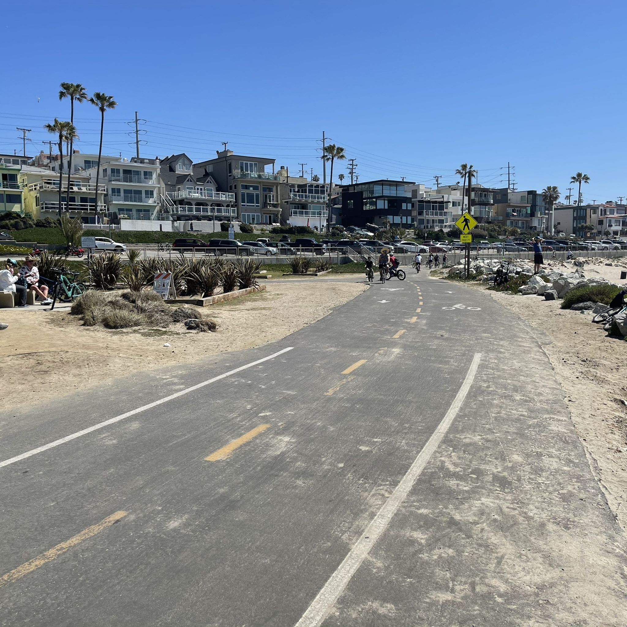
This path is very curvy, I think on purpose to slow people down.
0
0

This beach extends for almost two miles along the shore, with a nice bike path, walkway, playground equipment, and volleyball courts. Do check the current restrictions, because as of now (June 2025), the beach is closed due to its proximity to the staging site for recovery from the Palisades fire.
0
0

Popular large, free public skating facility at the beach, with a variety of options for all skill sets. Smooth concrete as of 2025.
1
0

at the end of the bike path, there's a juice bar that's fantastic!
0
0

Captain Kidd's Fish Market & Restaurant in Redondo Beach offers a unique dining experience where patrons can select fresh seafood from the market and have it prepared to their liking, all while enjoying scenic harbor views from one of three outdoor patios. Established in 1976, this longstanding establishment has become a local favorite, known for its casual atmosphere, diverse seafood menu, and commitment to serving the freshest catches from both local and international waters.
0
0
Torrance Beach lies between Redondo Beach and Malaga Cove. The region shared by Torrance and Redondo Beaches is often called “RAT Beach” (short for “Right After Torrance” Beach or “Redondo and Torrance Beach”). This beautiful, soft sand beach has 40 acres of beach and is at the foot of cliffs which extend to the Palos Verdes Peninsula. There restrooms, a concession stand, showers, bike path, beach wheelchairs, and volleyball nets. Torrance Beach is great for swimming, fishing, scuba and skin diving, and surfing.
1
0

As you ride along Palos Verdes Drive West, look down into Bluff Cove, a scenic rocky cove popular with local surfers, scuba divers, and snorkelers braveing the shoreline. A hiking trail descends to Bluff Cove Beach, with a steeper trail leading to Flat Rock Point, where you can explore tide pools at low tide. Walking south beyond the cove takes you into Palos Verdes Estate Shoreline Preserve, continuing to Palos Verdes Point and the rusted remains of a shipwreck along the Shipwreck Hiking Trail.
1
0
Noble Park is a small park right on The Strand. The Millennium Walkway winds through this small park that is a little more than an acre in size. This is a popular place for kids to learn how to ride a bike before graduating to the strand. There are tall palm trees here and a few grassy hills, but not much else. It's small and a nice stop along a beach ride.
0
0
Frequently Asked Questions
How many touring cycling routes are available around Del Aire?
There are over 50 touring cycling routes available around Del Aire, catering to various skill levels. You'll find a good mix of easy, moderate, and difficult options to explore.
What is the general terrain like for touring cycling in Del Aire?
The terrain for touring cycling around Del Aire is generally flat, especially along the extensive paved coastal paths and urban green spaces. You'll experience minor elevation changes typical of coastal and urban environments in Los Angeles County, making it suitable for a relaxed touring experience.
What is the best time of year for touring cycling in Del Aire?
Del Aire benefits from a temperate climate, making it suitable for touring cycling year-round. The weather is generally mild, but spring and fall offer particularly pleasant conditions with comfortable temperatures and less chance of extreme heat or rain.
What interesting places can I see or visit along the touring cycling routes near Del Aire?
Many routes offer access to scenic spots and attractions. You can cycle past the El Segundo Beach, explore the vibrant Marina del Rey, or enjoy the views at Manhattan Beach and Pier. The South Bay Bike Path at Dockweiler State Beach is also a popular highlight.
What do other touring cyclists enjoy most about cycling in Del Aire?
The touring cycling routes around Del Aire are highly rated by the komoot community, with an average score of 4.5 stars from over 100 reviews. Cyclists often praise the scenic coastal paths, the accessibility of urban green spaces, and the variety of routes that connect popular beach areas and landmarks.
Are there any easy touring cycling routes suitable for beginners in Del Aire?
Yes, Del Aire offers a significant number of easy touring cycling routes, with over 30 options available. These routes are generally flat and well-paved, perfect for beginners or those looking for a relaxed ride. Many local parks and coastal sections provide gentle terrain.
Can I find family-friendly touring cycling routes in Del Aire?
Absolutely. The generally flat terrain and well-maintained paved paths, especially along the coast and within local parks like Del Aire Park, make many routes suitable for families. These paths often provide a safe and enjoyable environment away from heavy traffic.
Are there touring cycling routes that form a loop around Del Aire?
Yes, several popular touring cycling routes in the area are loops. For example, the Ballona Creek Bike Path – Venice Beach Bike Path loop from Westchester/Veterans offers a diverse ride through urban waterways and coastal areas. Another option is the Venice Beach Bike Path – El Segundo Beach loop from Westchester/Veterans, providing extensive coastal views.
Where can I find parking for touring cycling routes near Del Aire?
Parking is generally available at various access points along the major bike paths and near popular beaches. For instance, you can often find parking near the start points of routes along the Marvin Braude Bike Trail or in areas close to El Segundo Beach and Marina del Rey. It's advisable to check specific parking regulations and availability for your chosen starting point.
How accessible are the touring cycling routes in Del Aire by public transport?
Del Aire's location within Los Angeles County means many routes are accessible via public transport, particularly those connecting to major urban centers or coastal areas. Buses and some Metro lines can get you close to popular bike path access points, though you may need to plan your route carefully to minimize travel with your bike on public transit.
Are there cafes or places to stop for refreshments along the touring cycling routes?
Yes, especially along the popular coastal routes like the Marvin Braude Bike Trail and around areas like Marina del Rey, Venice Beach, and Manhattan Beach. You'll find numerous cafes, restaurants, and snack stands where you can stop for refreshments, grab a meal, or simply enjoy a break with a view of the ocean.
What are some longer distance touring cycling routes available?
For those seeking longer rides, routes like the Venice Beach Bike Path – Marina del Rey loop from Westchester/Veterans cover nearly 100 km. These routes combine various sections of coastal and urban paths, offering a more challenging and extended touring experience.
Most popular routes around Del Aire
Most popular attractions around Del Aire

Get inspired with the komoot mobile app


Explore more
Browse the best Cycling routes in other regions.
