Attractions and Places To See around Dixon Lane-Meadowcreek - Top 14
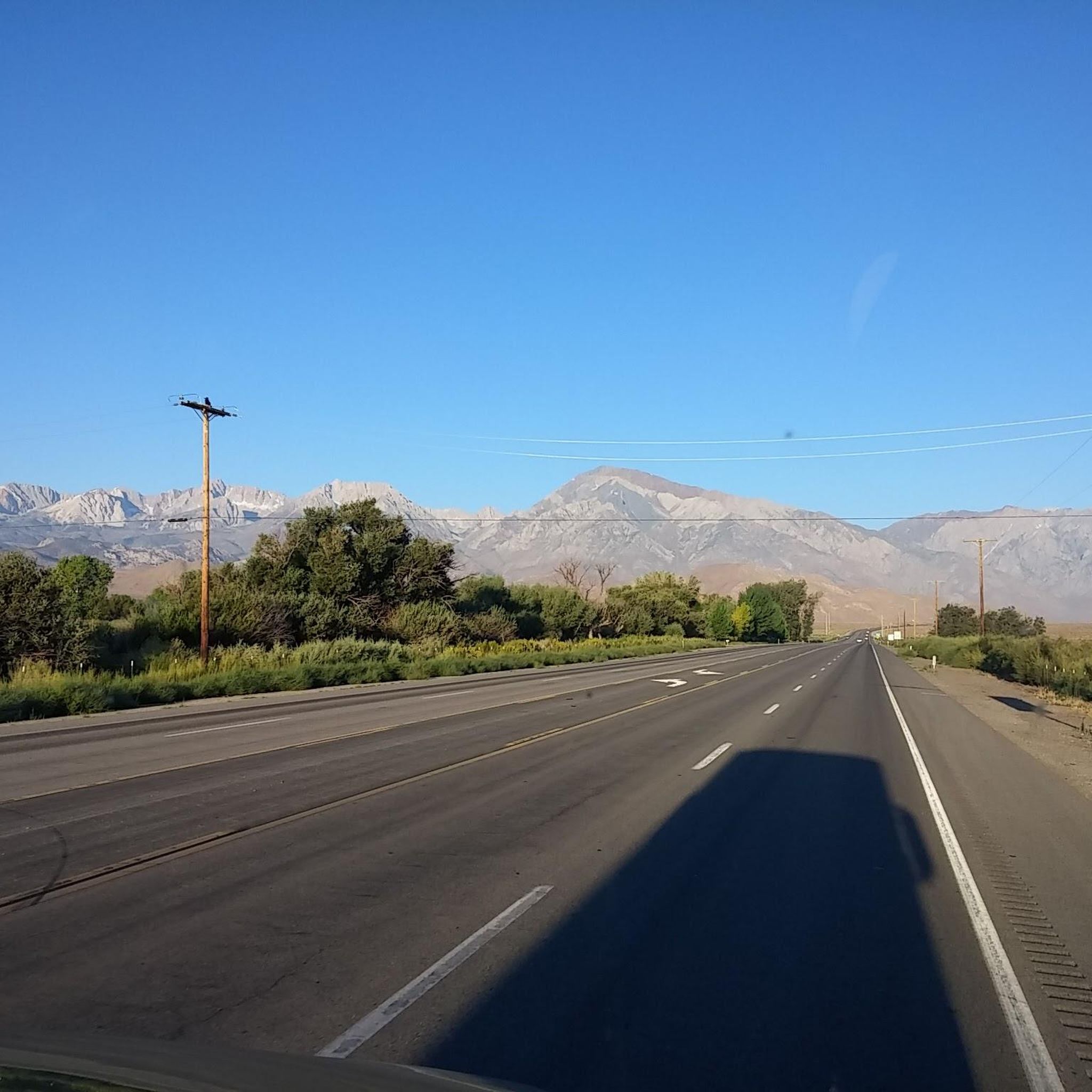
Best attractions and places to see around Dixon Lane-Meadowcreek, a census-designated place in Inyo County, California, are primarily centered around its natural beauty and outdoor recreational opportunities. The area serves as a gateway to the broader Eastern Sierra region, offering views of the Sierra Nevada, Bishop Valley, and White Mountains. Visitors can explore unique geological formations and access the Owens River, which flows through the landscape. This location provides a variety of outdoor experiences for those interested in the natural…
Last updated: October 5, 2026
Bishop
Highlight • Settlement
Tip by

Waganobe Trail (32E01)
Highlight (Segment) • Trail
Tip by

Sign up now to discover places like this
Get recommendations on the best single tracks, peaks, & plenty of other exciting outdoor places.
Druid Stones
Highlight • Natural Monument
Tip by

Chalk Bluff
Highlight • Natural Monument
Tip by
Lake Sabrina Climb
Highlight (Segment) • Climb
Tip by

Sign up for free to discover even more attractions around Dixon Lane-Meadowcreek.
Already have an account?
Start today with a free account
Your next adventure awaits.
Popular around Dixon Lane-Meadowcreek

Tips from the Community

Starting in the Owens Valley, this climb gradually leads you toward the majestic Sierra Nevada mountains, with an easy initial stretch before the terrain steepens. After a few miles, the grade intensifies, particularly between miles 4.9 and 5.9, where a challenging 11% slope greets you, leading you past picturesque views and the small town of Aspendell. The last few miles offer breathtaking scenery as you near Lake Sabrina, ending with a thrilling descent that ranks among the fastest in the United States.
0
0

Formerly known as the Druid Stones Trail, the Waganobe Trail has been renamed by the local Paiute Tribe. This challenging downhill trail can be reached a few different ways, but for folks looking for a very full day you can climb the Coyote Valley Road (7S10) with a 4,500-foot elevation gain. Alternatively, you can shuttle cars and complete a shorter 2,600-foot climb up Habegger Road to about 11,000 feet that offers stunning views and fun descents on dirt roads leading to the singletrack portion. The start of the Waganobe Trail is about half a mile south of where Coyote Valley Road (7S10) crosses the West Fork of Coyote Creek. After taking the Coyote Flat Connector to the Waganobe Trail, and after a brief climb, you descend along a doubletrack, and complete another climb. The road then transitions into a steep, overgrown singletrack that opens into a meadow. Cross the meadow and find the trail in a stand of aspen trees until you reach a road, turning right to an open meadow. From here, a faint trail heads east through sagebrush. Watch your pedals in this section. Eventually, a left-hand turn across a creek appears. If missed (which is easy to do), the trail dead-ends shortly after anyway, s you can just backtrack to find the faint path up the hill on your right. This segment is technical if overgrown. As the brush clears, the trail becomes loose, but still super fun. The descent includes a few short, steep climbs, leading to a saddle where another trail splits left. Continuing straight, the landscape changes to open desert with large boulders and you'll eventually encounter plenty of hikers (so be respectful) as the trail becomes increasingly steep and technical over rocks. You continue the steep descent until you reach the trailhead.
0
0
Chalk Bluff, for which the road is named for, is remarkably a straight, ~5-mile-long, escarpment that forms the south edge of the Volcanic Tableland. Named Chalk Bluff for its light tan-to-white colored, chalk-like rocks, they stand in contrast to the darker, volcanic Bishop tuff boulders that stand atop the escarpment and are popular with rock climbers. The Owens River flows below the Chalk Bluff with the gravel road running between, all making for a truly unique riding experience.
0
0

These are some interesting rock formations, with the trailhead located just 5 miles from downtown Bishop. The trail to the stones has a considerable elevation gain in a few miles, delivering panoramic views of the Sierra Nevada, Bishop Valley, and the White Mountains. The Druid Stones are a popular destination for climbers due to the boulders, but it can also be an interesting hike, offering a different landscape than the alpine trails in the Sierra. Trekking poles are going to be very useful for balance.
1
0

Bishop is the largest town along 395 in California's Eastern Sierra region. It's a great place to stop for a resupply or overnight stay. Due to its central location you can reach a number of National Parks & Monuments as well as mountain resorts and desert hot springs.
0
0

Bishop sits at 4,140 feet near the northern end of the Owens Valley. The town, situated near the Eastern Sierra Mountains, offers an abundance of outdoor activities such as bouldering, fishing, hiking, and camping.
0
0

Bishop is a lovely town in the Eastern Sierras with everything a hiker could need: restaurants, some affordable motels, laundromat, grocery stores, some outfitters for ultralight gear and even a small old-fashioned cinema with great atmosphere. If you are hiking the Pacific Crest Trail, it is a nice place to spend a zero day. Hiking northbound, there are two options to get to Bishop. At Bishop Pass Trail, hike 12 miles to South Lake and hitchhike 19 miles to Bishop. Or take the Piute Pass Trail 24 miles farther, hike for 18 miles to North Lake and hitchhike 18 miles to Bishop.
4
0
Frequently Asked Questions
What unique natural features can I explore around Dixon Lane-Meadowcreek?
The area boasts several distinctive natural features. You can visit Druid Stones, known for its interesting rock formations and panoramic views of the Sierra Nevada, Bishop Valley, and White Mountains. Another notable site is Chalk Bluff, a five-mile-long escarpment with light tan-to-white colored rocks contrasting with darker volcanic boulders, with the Owens River flowing below.
Are there hiking trails suitable for different skill levels?
Yes, the region offers a variety of trails. For a challenging experience, the Waganobe Trail (32E01), formerly known as Druid Stones Trail, features significant elevation gains and technical sections. For easier walks, the Canal Walk Dixon Lane provides an accessible 2.1-mile section along the canal, offering scenic views and wildlife spotting opportunities.
Where can I find amenities and services near Dixon Lane-Meadowcreek?
The nearby town of Bishop serves as a crucial hub for visitors. It offers a wide range of amenities including restaurants, motels, grocery stores, outfitters for outdoor gear, and even a small cinema, making it a convenient base for exploring the region.
What kind of cycling opportunities are available in the area?
Dixon Lane-Meadowcreek and its surroundings are excellent for cycling. You can find various road cycling routes, including challenging climbs like the Lake Sabrina Climb, and gravel biking options such as the scenic Chalk Bluff Road. For more detailed routes, explore the Road Cycling Routes around Dixon Lane-Meadowcreek and Gravel biking around Dixon Lane-Meadowcreek guides.
Are there any cultural or historical points of interest?
While primarily known for its natural beauty, the region has cultural significance. The Waganobe Trail, formerly Druid Stones Trail, was renamed by the local Paiute Tribe, reflecting indigenous cultural connections. Additionally, the Laws Railroad Museum & Historical Site, located nearby, offers insights into the region's historical development.
What are the best times of year to visit Dixon Lane-Meadowcreek for outdoor activities?
The region is well-suited for outdoor enthusiasts, with activities like hiking, cycling, and climbing. The best time to visit largely depends on the specific activity. Spring and fall generally offer pleasant temperatures for hiking and cycling. Summer is ideal for higher elevation activities, while winter can bring opportunities for snow-related sports in the broader Eastern Sierra region.
Can I spot wildlife while exploring the area?
Yes, the natural landscapes around Dixon Lane-Meadowcreek provide opportunities for wildlife observation. The Canal Walk Dixon Lane, for instance, is a great place to spot local wildlife such as deer and various bird species, especially in the wetlands below Chalk Bluff.
Are there family-friendly activities or attractions?
The area offers several family-friendly options, particularly those focused on nature. The town of Bishop provides essential services and a community park. Easy walks like the Canal Walk are suitable for families, offering gentle terrain and opportunities to enjoy the outdoors together.
What kind of views can I expect from the attractions?
From various vantage points, you can expect breathtaking, unobstructed views of the majestic Sierra Nevada, the expansive Bishop Valley, and the White Mountains. Locations like Druid Stones and the Waganobe Trail are particularly noted for their panoramic vistas.
Is the area suitable for rock climbing or bouldering?
Yes, the region is a popular destination for climbers. The unique rock formations at Druid Stones and the volcanic Bishop tuff boulders atop Chalk Bluff are well-known spots for bouldering and rock climbing enthusiasts.
Are there any accessible trails or attractions for visitors with mobility considerations?
The town of Bishop itself is noted for being wheelchair accessible, offering amenities and services. While specific accessible trails directly within Dixon Lane-Meadowcreek are not detailed, the Canal Walk Dixon Lane offers a relatively flat and easily accessible path for walking, running, or biking.
What are some of the popular routes for gravel biking near Dixon Lane-Meadowcreek?
Gravel biking is a popular activity here. Routes like Chalk Bluff Road offer an easy ride, while more challenging options include the Silver Canyon and Poleta Canyon Loop or the Fish Slough Road loop. You can find more details and routes in the Gravel biking around Dixon Lane-Meadowcreek guide.
Most popular routes around Dixon Lane-Meadowcreek

Get inspired with the komoot mobile app


Explore more
Still not found the Highlight you’re looking for? See guides of the top attractions in other regions:
