The best walks and hikes around La Riviera
5.0
(2)
144
hikers
43
hikes
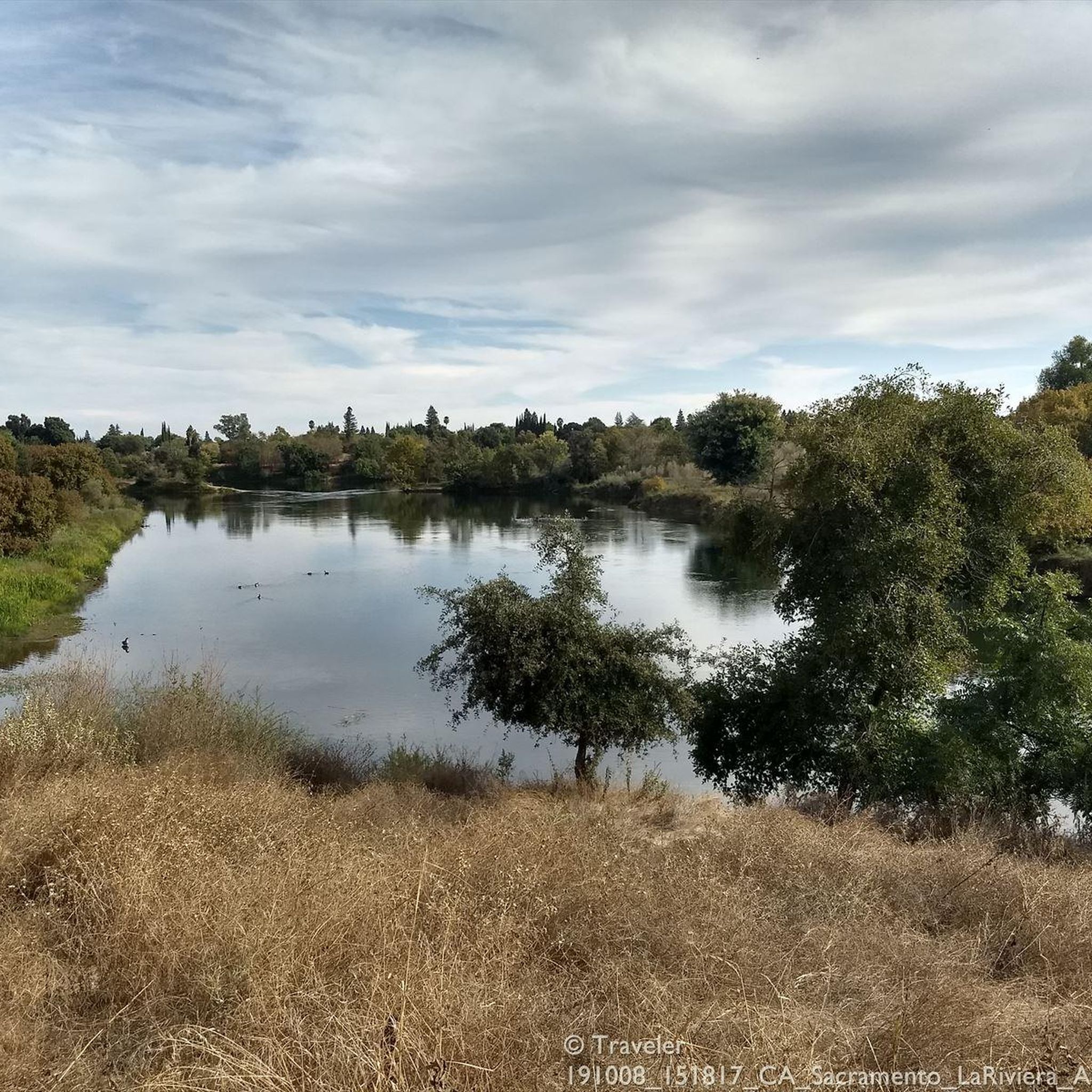
Hiking around La Riviera features trails primarily along riverine landscapes and community parks in the Sacramento area of California. The region is characterized by flat terrain, often following the American River, with minimal elevation changes. Hikers can expect paths through parklands and levee trails, offering views of the river and surrounding green spaces. The routes are generally accessible, suitable for walks through urban and suburban natural areas.
Best hiking trails around La Riviera
- The most popular hiking route is River Bend Park Riverside Loop, a 5.1 miles (8.2 km) trail that takes 2 hours 5 minutes to complete. This route offers a moderate loop through parkland and along the river.
- Another top favourite among local hikers is Levee Path and American River Bike Trail Loop, a moderate 6.7 miles (10.8 km) path. This trail combines levee paths with sections of the American River Bike Trail, offering varied river views.
- Local hikers also love the Levee Path and American River Bike Trail, a 3.3 miles (5.3 km) trail leading through parkland and along the river, often completed in about 1 hour 21 minutes.
- Hiking around La Riviera is defined by river paths, community parks, and levee trails. The network offers options for different ability levels, from easy strolls to longer, moderate loops.
- The routes in La Riviera are highly rated by the komoot community with an average score of 5.0 stars from over 2 reviews. More than 90 hikers have used komoot to explore La Riviera's varied terrain.
Last updated: August 18, 2026
7
hikers
10.8km
02:43
20m
20m
Embark on a moderate hiking loop along the American River, offering consistent water views and shaded sections. This 6.7-mile (10.8 km) route features plenty of greenery and opportunities to spot local wildlife, such as herons, as you pass by the tranquil William B. Pond. With a gentle elevation gain of 65 feet (20 metres), you can expect to complete this hike in about 2 hours and 43 minutes, enjoying a pleasant and varied outdoor experience.
Planning your visit is straightforward, as the American River Bike Trail system, which includes this loop, provides numerous access points from various parks along the American River Parkway. You will find amenities like restrooms, picnic areas, and drinking water at designated locations. Parking is generally available at these access points, making it easy to start your adventure.
This trail is part of a popular multi-use pathway, so be prepared to share the route with cyclists, joggers, and inline skaters. The easy access to the river shore and the consistent natural scenery make it a notable option for a refreshing outing. It offers a great way to experience the natural beauty of the American River within a well-maintained park setting.
2
hikers
8.26km
02:05
10m
20m
The River Bend Park Riverside Loop offers a delightful, easygoing journey along the American River, perfect for a relaxed outing. You'll traverse a mix of singletrack and multi-use paths, enjoying continuous river views and the chance to spot wildlife like wild turkeys and deer. The highlight is undoubtedly the Harold Richey Bicycle Bridge, providing spectacular panoramic vistas of the water and surrounding parkland.
This moderate 5.1-mile (8.3 km) hiking trail involves a minimal 42 feet (13 metres) of elevation gain, making it accessible for nearly everyone and taking about 2 hours and 5 minutes to complete. Parking is available at River Bend Park, which also features picnic areas. Dogs are permitted on leash, but be prepared for dry, dusty conditions and potentially long grass in some sections.
Part of the broader Jedediah Smith Memorial Trail, this loop is a popular spot for both hiking and horse riding. It's also a common take-out point for rafters on the American River, adding to the lively atmosphere. The trail is an excellent choice for families or anyone seeking a gentle, scenic escape without a strenuous climb.

Sign up for free
5.32km
01:21
10m
10m
Explore the Levee Path and American River Bike Trail, an easy 3.3-mile (5.3 km) hike with a minimal 29 feet (9 metres) of elevation gain, taking about 1 hour and 20 minutes to complete. This route winds alongside the scenic American River, offering picturesque water vistas and lush greenery. You will find mostly paved surfaces, though some sections feature gravel or natural paths, leading you through varied sights from the confluence at Discovery Park to secluded wooded areas and open wildflower fields. Keep an eye out for local wildlife like deer and wild turkeys as you enjoy the gentle grade.
Planning your visit is straightforward, as this is a multi-use pathway shared by hikers, runners, and cyclists. For your safety, signage advises walkers and runners to stay on the left shoulder, facing oncoming bike traffic. The trail is well-equipped with amenities, including mile markers, trailside maps, water fountains, and restrooms, especially in park areas like William B. Pond Recreation Area. Its gentle incline, typically 5% or less, makes much of the trail suitable for all skill levels, including those with strollers or wheelchairs.
This trail is also known as the Jedediah Smith Memorial Trail or American River Parkway Trail, forming part of a significant recreational asset that stretches 32 miles between Discovery Park and Beal's Point at Folsom Lake. Recognized as one of the longest paved purpose-built bike trails in the United States, it was designated a National Recreational Trail in 1974. Along your journey, you will pass through several parks and recreational areas, and cross pedestrian bridges, including the historic Old Fair Oaks Bridge, adding to the route's unique character.
561m
00:08
0m
0m
Easy 0.3-mile hiking loop in Ancil Hoffman Park, offering abundant wildlife, educational signs, and views of the American River.
17.8km
04:28
20m
10m
Embark on the American River Bike Trail to Campus Commons, a moderate hiking route spanning 11.0 miles (17.8 km) with a gentle elevation gain of just 53 feet (16 metres). You can expect to complete this journey in about 4 hours and 28 minutes. The trail offers a relaxed experience on a predominantly paved path, winding through areas with abundant trees and greenery, providing welcome shade. As you hike, you will enjoy picturesque river views and cross the impressive Guy West Bridge, a notable landmark along the way.
When planning your visit, be aware that some sections of the trail may experience flooding during cooler, wetter months, potentially making parts impassable. Always check local conditions for any reroutes or closures, especially near the Campus Commons golf course. The route offers multiple park access points with convenient parking, and you will find restroom facilities, picnic areas, and drinking water available along the way.
This trail is a highlight within the American River Parkway, known for its accessible and scenic outdoor opportunities. While primarily paved, you have the option to step onto designated 'soft shoulders' if you prefer hiking off the main cycling route. The gentle grades and continuous river scenery make this a popular choice for a leisurely outing, allowing you to immerse yourself in nature without strenuous climbs.
Get access to more routes and recommendations from other explorers.
Sign up for free
Already have an account?
Our route recommendations are based on thousands of hikes, rides, and runs completed by other people on komoot.
Start today with a free account
Your next adventure awaits.
Login or Signup


Tips from the Community

An easy spot to hop off your bike and lounge by the riverside for a little while.
0
0

At nearly 80 acres, Hagan Community Park is the largest park within Cordova Recreational Park District CRPD. It is also located adjacent to the American River Parkway, providing quick access to natural walking and biking trails and eco-friendly commuter routes to downtown Sacramento. This spectacular park boasts dozens of family-friendly amenities. Hagan Community Park will remain open even while parking security gates and restrooms will be closed on Thanksgiving Day, Christmas Day and New Year’s Day.
3
0

William B. Pond is the name giving pond in the recreation area of the same name. It is located along the American River in Carmichael, California and is mainly used for fishing. Along the pond, you will find multiple nice picnic areas to relax.
0
0
William B. Pond is the name giving pond in the recreation area of the same name. It is located along the American River in Carmichael, California, and is mainly used for fishing. Along the pond, you will find multiple nice picnic areas to relax.
0
0

The Guy West Bridge is a suspension bridge for pedestrians and bicyclists over the American River in Sacramento, California's Sacramento County. It connects the campus of California State University at Sacramento with the neighboring Commons campus.
0
0
This beautiful park on the American River is a nice place to hike and relax. There are also plenty of recreation areas. You have to pay an entrance fee, for more information click here: https://regionalparks.saccounty.gov/Parks/Pages/RiverBendPark.aspx.
0
0
The Guy West Bridge is a pedestrian and bicycle suspension bridge across the American River, linking the campus of California State University Sacramento with the neighboring Campus Commons development. It was designed to resemble the Golden Gate Bridge, both in form and signature international orange color.
2
1
Frequently Asked Questions
What kind of hiking experience can I expect in La Riviera?
Hiking around La Riviera primarily features trails along riverine landscapes and community parks. The terrain is generally flat, often following the American River, with minimal elevation changes. You'll find paths through parklands and levee trails, offering views of the river and surrounding green spaces, suitable for walks through urban and suburban natural areas.
How many hiking trails are available in La Riviera?
There are 18 hiking routes available in La Riviera. These include a mix of easy strolls, moderate loops, and a few more challenging options.
Are there easy trails suitable for families or casual walkers?
Yes, La Riviera offers many easy trails. Out of the 18 routes, 11 are classified as easy. An example is the Bannister Park to American River via Bannister Bike Trail, which is a straightforward 2.0 miles (3.2 km) path.
What are some moderate hiking options in La Riviera?
For a moderate experience, you can explore routes like the American River Loop in Rosemont, which is 5.1 miles (8.2 km) long and takes about 2 hours 4 minutes. Another moderate option is the Sutter's Landing Regional Park to Paradise Beach via Levee Path — Sacramento.
Are there any longer or more challenging hikes in the area?
Yes, for those seeking a longer challenge, the River Bend Park via American River Trail — Shutter's Landing Regional Park is a difficult route spanning over 20 miles (33 km), typically taking over 8 hours to complete.
What kind of landmarks or points of interest can I see along the trails?
Many trails in La Riviera follow the American River, offering views of several bridges. Notable points of interest include the Harold Richey Memorial Bicycle Bridge, the Guy West Bridge, and the Fair Oaks Bridge. You might also encounter sections of the Sacramento Northern Bike Trail.
What do other hikers enjoy most about hiking in La Riviera?
The area is highly rated by the komoot community, with an average score of 5.0 stars. Hikers often praise the accessible river paths, well-maintained community parks, and the generally flat terrain that makes for enjoyable walks.
Are there any circular hiking routes in La Riviera?
Yes, there are several circular routes. A popular one is the River Bend & Hagan Community Park loop — Rancho Cordova, which is 4.1 miles (6.6 km) long and takes about 1 hour 39 minutes to complete.
Is parking available at the trailheads in La Riviera?
Given that many trails are located within regional and community parks, parking facilities are generally available at or near the trailheads. It's advisable to check specific park information for details on parking availability and any potential fees.
What is the best time of year to go hiking in La Riviera?
With its riverine and parkland trails, La Riviera is generally pleasant for hiking during spring and fall when temperatures are mild. Summer can be warm, so early morning or late afternoon hikes are recommended, while winter offers cooler, often clear days.
Are dogs allowed on the hiking trails in La Riviera?
Many regional and community parks in the area typically allow dogs on trails, often requiring them to be on a leash. It's always best to check the specific regulations for each park or trail you plan to visit to ensure a dog-friendly experience.
Most popular attractions around La Riviera

Get inspired with the komoot mobile app


Explore more
Browse the best Hikes in other regions.
