The best walks and hikes around Newcastle
5.0
(26)
755
hikers
66
hikes
Hikes around Newcastle offer access to a varied landscape, from urban green spaces and riverside paths to the more rugged terrain of nearby national parks and coastlines. The region is characterized by wooded valleys, rolling hills, and historic trails. This proximity to both city parks and wilder, open spaces provides a diverse network of routes for hiking.
Best hiking trails around Newcastle
- The most popular hiking route is Robie Point Firebreak & Western States Trail loop — Auburn State Recreation Area, a 5.9 mile (9.5 km) trail that takes about 2 hours 45 minutes to complete. The route features a mix of firebreak and singletrack paths with moderate elevation changes.
- Another top favourite among local hiking enthusiasts is Shirland Canal & Pioneer Express Trail loop, a moderate 4.5 mile (7.3 km) path. This trail follows sections of a historic canal before climbing through the surrounding woodland.
- Local hiking enthusiasts also love the Pioneer Express Trail loop from Skyridge Elementary School, a 3.7 mile (5.9 km) trail leading through a mix of open and wooded areas, often completed in about 2 hours.
- Hiking around Newcastle is defined by riverside paths, coastal trails, and rolling moorland. The network of trails provides options suitable for various fitness and experience levels.
- The routes in Newcastle are highly rated by the komoot community with an average score of 4.8 stars from more than 20 reviews. More than 500 hikers have used komoot to explore Newcastle's varied terrain.
Last updated: July 8, 2026
13
hikers
6.72km
02:08
280m
280m
Embark on the Robie Point Loop via Western States Trail, a moderate hiking route that guides you through a diverse landscape of paved sections, packed dirt, and rocky paths winding through lush forests. This 4.2 miles (6.7 km) loop offers impressive panoramic views of the American River Canyon and the North Fork American River, with the American River Canyon Overlook Park providing a prime vantage point. You will also catch glimpses of the Auburn Dam construction site and the towering Foresthill Bridge as you navigate the 913 feet (278 metres) of elevation gain, typically completed in about 2 hours and 8 minutes.
When planning your visit, be aware that some sections of the trail can be steep, particularly towards the southern end. During summer months, the limited shade means temperatures can be very hot, so consider starting your hike in the late afternoon or early evening for a more comfortable experience. Always be vigilant for potential hazards such as rattlesnakes, ticks, and poison oak, which are common in this area.
This route follows a significant section of the historic Western States Trail, a path renowned for its challenging endurance races and rich heritage. The trail's connection to this famous route adds a layer of historical context to your hike, allowing you to experience a segment of a legendary course. It offers a unique blend of natural beauty and historical significance within the Auburn State Recreation Area.
5.0
(1)
8
hikers
8.72km
02:42
350m
320m
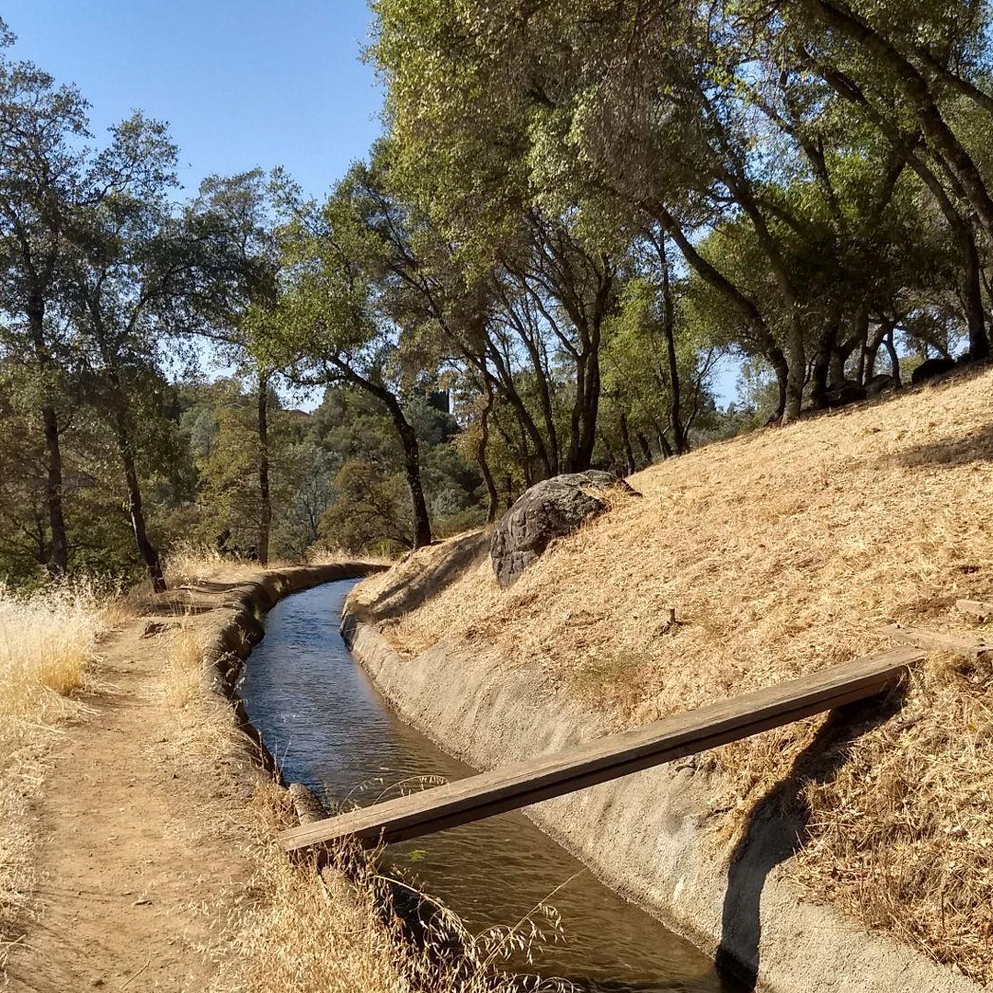
Embark on the Shirland Canal and Cardiac Bypass Loop, a moderate hike that offers a diverse and engaging experience. You will cover 5.4 miles (8.7 km) and ascend 1141 feet (348 metres), typically taking around 2 hours and 41 minutes to complete. The route blends the tranquility of shady canal-side paths with the challenge of steep climbs and switchbacks in the Cardiac sections. As you hike, you will pass through old growth manzanita chaparral, oak woodlands, and riparian zones along creeks. The canal section provides a cool, shaded respite, perfect for enjoying the natural surroundings. This trail truly delivers a varied workout and scenic journey.
When planning your visit, be aware that this is a multi-use trail, so you will likely encounter mountain bikers. It is always a good idea to stay alert and share the path respectfully with others. Parking is generally available at various trailheads within the Auburn State Recreation Area, making access straightforward. A key consideration for your comfort and safety is the abundance of poison oak along the trail sides; wearing long pants and sleeves is highly recommended. Prepare for a rewarding outing by checking local conditions before you go.
This trail stands out for its unique combination of natural features and historical elements. The Shirland Canal itself is a notable feature, providing a consistent water source and a distinct riparian environment. You might spot various wildflowers like blue dicks and rainbow iris, especially during spring, adding vibrant color to your hike. The contrast between the gentle canal and the vigorous Cardiac sections makes this route a dynamic exploration of the local landscape, offering both serene moments and physical exertion.

Sign up for free
3
hikers
15.4km
04:26
370m
390m
Embark on a moderate hike along the Pioneer Express Trail, stretching 9.6 miles (15.4 km) from Newcastle to Rattlesnake Bar. This route offers continuous views of Folsom Lake as you traverse through oak woodlands and chaparral. You will gain 1227 feet (374 metres) of elevation over an estimated 4 hours and 26 minutes, making it a rewarding journey for those seeking a scenic outing. The path often stays just above the high water line, providing a unique perspective of the lake.
When planning your visit, be aware that this segment of the trail is popular with hikers and horse riders, but bikes are not permitted. The path features some rocky areas and steep drop-offs, so wearing good hiking shoes is essential for your comfort and safety. Families with children should exercise caution due to these steep sections and the presence of poison oak along the route.
As you hike, keep an eye out for remnants of the historic North Fork Ditch, an 1856 water canal system once used for mining in the area. The trail also provides opportunities for birdwatching, with diverse wildlife often spotted among the trees. Even during summer, you will find shaded sections, offering a pleasant escape from the sun.
2
hikers
18.6km
05:28
500m
580m
Hike the difficult 11.6-mile Western States, Robie Point, Cardiac Hill and Shirland Canal Loop with 1649 feet of elevation gain.
5.77km
01:41
80m
290m
Hike the easy 3.6-mile Shirland Canal and Cardiac Bypass Loop, combining shaded canal paths and river views in Auburn State Recreation Area.
Get access to more routes and recommendations from other explorers.
Sign up for free
Already have an account?
Our route recommendations are based on thousands of hikes, rides, and runs completed by other people on komoot.
Start today with a free account
Your next adventure awaits.
Login or Signup


Tips from the Community

Trailhead with drinking water fountain, picnic area, and a central location along Shirland Canal Trail that crosses Maidu Drive here.
0
0
A little east parallel and between road and the the Shirland Canal Trail, Pioneer Express has excellent views into American River Canyon.
1
0
Loop road and start/end of a network of trails, including the Overlook Trail and the Western States Trail. Scenic views of the American River Canyon to the east and south
1
0
Pioneer Express Trail runs parallel a little below Shirland Canal. Whenever the trees open up in easterly direction the views down into the American River canyon can be awesome.
0
0
Good overlook and starting point for hikes along the crest or down into the trail system on the west bank of the American River canyon.
0
0

The American River sits at the bottom of this dry, riparian canyon. The hills above the river offer sweeping vistas of the American as it snakes through the yellow and green grasses.
0
0

Rattlesnake Bar is right on the border of Placer County and El Dorado County on the North Fork American River. This area features the Rattlesnake Boat Launch and Avery's Pond Trailhead for hikers. When the water gets low, the bottom of the muddy river is exposed, and it can be an interesting sight to see.
0
0
The American River Canyon Overlook Park is best known for its views right there from the park, but it is also a trailhead for hikers. There is quite a bit of parking, and there is an awesome skatepark as well.
0
0
Frequently Asked Questions
Are there many hiking trails to choose from around Newcastle?
Yes, there are over 40 curated hiking routes around Newcastle. These range from easy strolls to more demanding treks, with the majority falling into the easy and moderate difficulty categories, ensuring there's a path for every fitness level.
Are there any family-friendly hikes near Newcastle?
Absolutely. For an easy and accessible walk, the Pioneer Express Trail loop from Skyridge Elementary School is a great option. It's a relatively short loop that's perfect for a family outing. Additionally, Jesmond Dene within the city offers a network of gentle paths through a peaceful wooded valley, ideal for walkers of all ages.
Can I bring my dog on the trails?
Many trails in and around Newcastle are dog-friendly, but it's always best to check specific regulations, especially in nature reserves or areas with livestock. In places like Northumberland National Park, dogs are welcome but must be kept on a lead to protect wildlife and farm animals. Always be prepared to clean up after your pet.
Where can I find good coastal walks near Newcastle?
The Northumberland Coast offers some of the UK's most dramatic coastal hiking. A popular section of the Northumberland Coast Path runs from the village of Craster to the iconic ruins of Dunstanburgh Castle. This route provides stunning sea views, sandy beaches, and a dose of history.
Are there any hikes that feature waterfalls?
Yes, the North Pennines AONB, south of Hadrian's Wall, is renowned for its waterfalls. A hike to High Force, one of England's most spectacular waterfalls, is a must-do. The area also features the nearby Low Force and Cauldron Snout, which can be incorporated into a longer trek through the dramatic landscape.
What are the most challenging hikes in the area?
For those seeking a challenge, the Cheviot Hills in Northumberland National Park offer strenuous climbs and a true sense of wilderness. The ascent of The Cheviot, the highest point in the park, is a demanding hike that rewards with panoramic views on a clear day. The Tamaroo Bar loop from Auburn is another challenging option with significant elevation gain.
How can I experience hiking along Hadrian's Wall?
The Hadrian's Wall Path is a UNESCO World Heritage site easily accessible from Newcastle. You can tackle a section of the 73-mile trail for a day hike. The stretch between Chollerford and Birdoswald is particularly scenic and historic, passing by Housesteads Roman Fort and the famous Sycamore Gap.
Are there circular walks with parking available?
Many routes are designed as loops and start from locations with parking. The Hiking loop from Auburn is a moderate circular trail that begins in a convenient spot. Forest parks like Tollymore Forest Park and country parks such as Big Waters also typically offer dedicated car parks for visitors.
What do other hikers think of the trails around Newcastle?
The trails are highly regarded by the komoot community, with an average rating of 4.8 stars. Hikers often praise the variety of scenery, from the tranquil riverside paths of the Shirland Canal & Pioneer Express Trail loop to the rugged beauty of the national parks. The well-maintained paths and historical interest are also frequently mentioned.
How can I reach the hiking areas using public transport?
Newcastle has good transport links to surrounding hiking destinations. The Hadrian's Wall Path can be reached via the AD122 bus service, which runs seasonally. Local bus and train services also connect the city to towns and villages along the Northumberland Coast and on the edge of the North Pennines.
What are some popular places for hiking near Newcastle?
Several spots are local favorites for a day's hike.
Tollymore Forest Park is a top-rated destination with a variety of trails through ancient woodland and along the Shimna River. Jesmond Dene Falls offers a beautiful and accessible walk within the city itself. For a quieter experience, Hedley Hall Woods provides peaceful woodland paths and interesting sculptures.
Are the hiking trails free to access?
Most public footpaths, including the Hadrian's Wall Path and trails in Northumberland National Park, are free to access. However, some managed sites like Tollymore Forest Park or specific car parks may charge an entry or parking fee. It's always a good idea to have some change with you for parking meters.
Most popular attractions around Newcastle

Get inspired with the komoot mobile app


Explore more
Browse the best Hikes in other regions.
