The best running trails around Silverton
159
runners
17
runs
If you've ever tried to plan jogging around Silverton, you know how quickly the options can feel overwhelming. With so many trails winding through the San Juan Mountains, it's tough to tell which routes are genuinely worth your time and effort, and which are just filler. That's where we come in. Our komoot community has mapped, ridden, and reviewed countless routes here, and we've distilled all that local knowledge into a curated shortlist to save you the guesswork.
Jogging in…
Last updated: May 10, 2026
26
runners
15.0km
02:23
870m
870m
The Kendall Mountain Road offers a truly epic high-altitude jogging experience, climbing through rugged terrain to deliver unparalleled views of Silverton and the vast San Juan Mountains. As you ascend…
4
runners
6.30km
00:43
140m
140m
If you're looking for a moderate jogging route that offers a quick escape into the mountains, the Rainbow Trail is a solid choice. This 3.9-mile (6.3 km) segment, with its…

Sign up for free
1
runners
7.65km
00:59
160m
160m
The Colorado Trail: Little Molas Lake offers a fantastic high-alpine jogging experience, winding through expansive meadows and past the picturesque Little Molas Lake itself. You'll be treated to panoramic views…
2
runners
24.2km
04:02
1,530m
1,530m
The Boulder Gulch Trail to Velocity Basin offers a truly wild alpine jogging experience near Silverton, Colorado. You'll start on a dirt road, then climb steadily through Boulder Gulch on…
10.9km
01:46
650m
650m
The Tower Mountain via South Fork Trail offers a demanding yet incredibly rewarding jogging experience in the heart of Colorado's San Juan Mountains. You'll ascend through diverse terrain, from shaded…
Get access to more routes and recommendations from other explorers.
Sign up for free
Already have an account?
Our route recommendations are based on thousands of hikes, rides, and runs completed by other people on komoot.
Start today with a free account
Your next adventure awaits.
Login or Signup



Tips from the Community

Little Molas Lake is a high-altitude body of water at about 11,000 feet. It is located nearby parking lots and provides easy access to the Colorado Trail. It is the ideal place to enjoy a packed lunch before or after your ride.
0
0

Little Molas Lake is a small body of water found off the Colorado trail. At 11,000 feet, the lake is surrounded by beautiful mountains. There is a picnic area along the banks of the lake, so it is a great place for a break to enjoy the peaceful surroundings.
0
0
The Molas Lake Trailhead has parking, but no restrooms. The trail leads to the popular Molas Lake and has a connector trail to the Colorado Trail.
0
0

Here the road ends and splits into a trail. To the north is Kendall Mountain, and you can follow the western trail up along its ridge. To the east, the trail leads up towards Kendall Peak.
0
0
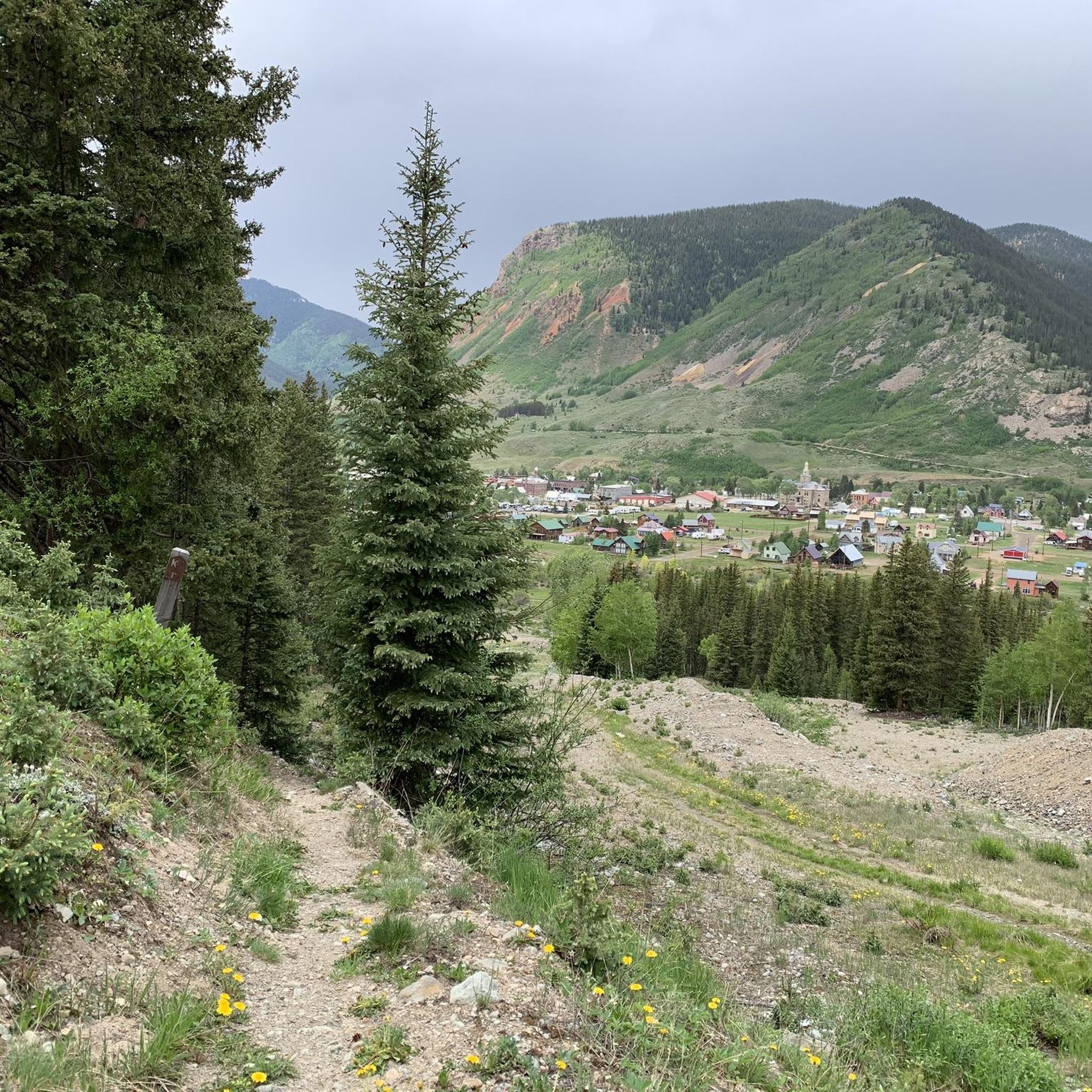
The road up Kendall Peak is a rough PHV track. This is a great spot to run and hike, as the grade is not too steep nor the trail too technical and it leads straight into the mountains from town.
0
0
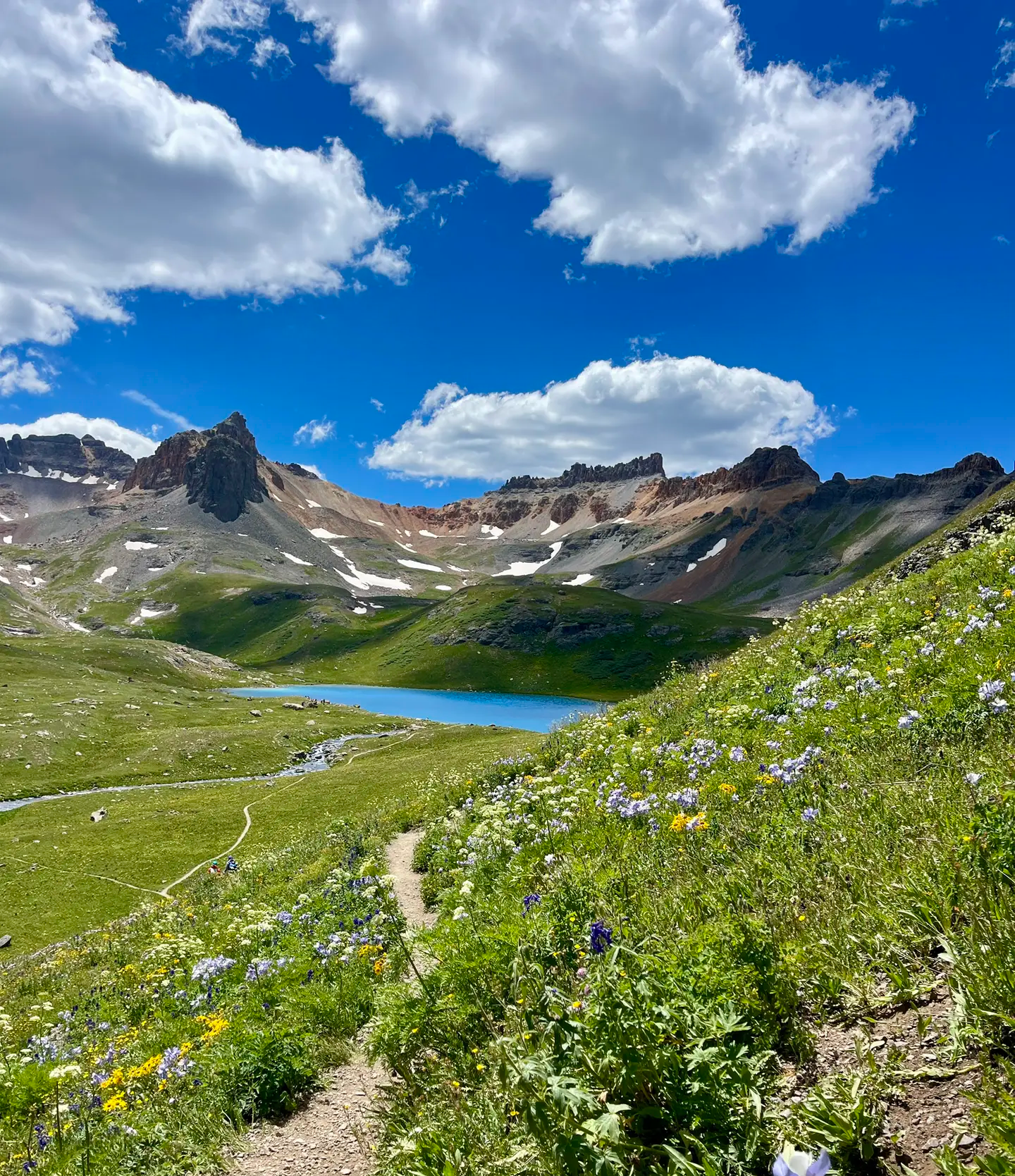
There is an alpine lake that rests blow towering Storm Peak. The trail that climbs up out of the basin is steep and takes you east along the South Fork Trail or south along the Boulder Gulch Trail near Tower Mountain.
0
0
The Rainbow Trail runs along the foothills of Anvil Mountain to where it crosses the Million Dollar Highway and climbs Bear Creek. Presumably, the trail gets its name from the multicolored mineral deposits that paint the mountainside as it runs down toward Mineral Creek. Victoria Mine sits at the east end of the trail, and the South Anvil Mine is along the middle of the trail.
0
0
This 12-ton statue of Christ sits at the base of Anvil Mountain overlooking Silverton. Silverton's mining industry collapsed in the 1950s, and the statue was commissioned in 1959 as a testament to the mining workers of the region who gave their sweat and blood to the mountain town.
0
0
Frequently Asked Questions
How many running routes are available around Silverton?
Komoot features over 15 running routes around Silverton, offering a wide range of experiences from moderate paths to challenging mountain trails. These routes are set amidst the majestic San Juan Mountains, providing diverse terrain and stunning views.
Are there easy running trails for beginners in Silverton?
While Silverton is known for its rugged mountain terrain, there are some moderate options suitable for beginners looking for a less strenuous run. For example, the Colorado Trail: Little Molas Lake offers a moderate 4.8-mile path with panoramic views, making it a good choice for those starting out or seeking a more relaxed pace.
What kind of terrain can I expect on Silverton's jogging routes?
Jogging routes in Silverton offer a diverse range of terrain, from paved sections to steep, mountainous trails. You'll encounter everything from high-altitude paths with significant elevation gains to routes winding through alpine lakes and vibrant wildflower fields. The region is characterized by the rugged San Juan Mountains, ensuring a varied and scenic running experience.
Can I find routes with significant elevation gain for a challenging run?
Absolutely. Silverton is an ideal location for challenging runs due to its high altitude and mountainous landscape. Routes like Kendall Mountain Road, a 9.3-mile trail, and the Boulder Gulch Trail to Velocity Basin, a 15-mile route, offer substantial elevation gains and panoramic views, perfect for advanced trail runners.
Are there any scenic viewpoints or natural attractions along the running paths?
Many running paths in Silverton offer breathtaking scenic viewpoints and natural attractions. You can expect panoramic views of the San Juan Mountains, pristine alpine lakes like Little Molas Lake, and vibrant wildflower fields in season. Some trails also pass by historical mining sites, adding a unique cultural element to your run.
Are the running trails in Silverton suitable for families?
While many trails in Silverton are challenging, some moderate routes can be enjoyed by families, especially those with older children accustomed to outdoor activities. The Colorado Trail: Little Molas Lake is a good example of a moderate path that offers beautiful scenery without extreme difficulty, making it more accessible for family outings.
Are dogs allowed on the jogging routes in Silverton?
Many trails in the San Juan Mountains and surrounding national forests are dog-friendly, but it's always best to check specific trail regulations before heading out. Generally, dogs are welcome on leash, allowing your furry companion to join you on your Silverton running adventures.
Are there any circular running routes in the Silverton area?
Yes, Silverton offers several circular running routes that allow you to start and end in the same location, providing a convenient experience. While specific loop routes vary in difficulty and length, many trails can be combined or are inherently circular, offering diverse landscapes without retracing your steps.
What is the best time of year to go jogging in Silverton?
The summer months, particularly from late June through September, are generally the best time for jogging in Silverton. During this period, trails are typically clear of snow, and you can enjoy vibrant wildflower displays. However, due to the high altitude, weather can change rapidly, so always be prepared for varying conditions.
Is parking available near the trailheads for Silverton's running routes?
Yes, parking is generally available near the trailheads for many of Silverton's popular running routes. For example, areas around Molas Pass and Little Molas Lake, which access sections of the Colorado Trail, typically have designated parking. It's advisable to arrive early during peak season to secure a spot.
What do other runners appreciate most about the trails in Silverton?
Runners frequently praise Silverton's trails for their stunning natural beauty, the challenge of high-altitude running, and the sense of adventure. The panoramic views of the San Juan Mountains, the pristine alpine lakes, and the opportunity to run past historical mining sites are often highlighted as unique and rewarding aspects of jogging in the area.
Are there any routes that pass by historical mining sites?
Yes, Silverton's rich mining history means that many trails wind past historical landmarks, including old mines and ghost towns like Animas Forks. These sites add a fascinating historical dimension to your run, allowing you to explore the region's past while enjoying its natural beauty.
Can I find routes that are part of the Colorado Trail near Silverton?
Absolutely. Sections of the iconic Colorado Trail are accessible near Silverton, particularly around Molas Pass and Little Molas Lake. The Colorado Trail: Little Molas Lake route is a popular moderate option that offers incredible views of the San Juan Mountains.
Are there any waterfalls visible from the jogging routes?
Yes, the Silverton area is home to beautiful natural features, including waterfalls. You might encounter Clear Creek Waterfall along some routes or nearby, adding to the scenic beauty of your run. The rugged terrain and abundant water sources in the San Juan Mountains create several picturesque cascades.
Most popular routes around Silverton
Most popular attractions around Silverton

Get inspired with the komoot mobile app


Explore more
Browse the best Running Trails & Routes in other regions.
