The best walks and hikes in Dibër
4.7
(363)
2,549
hikers
27
hikes
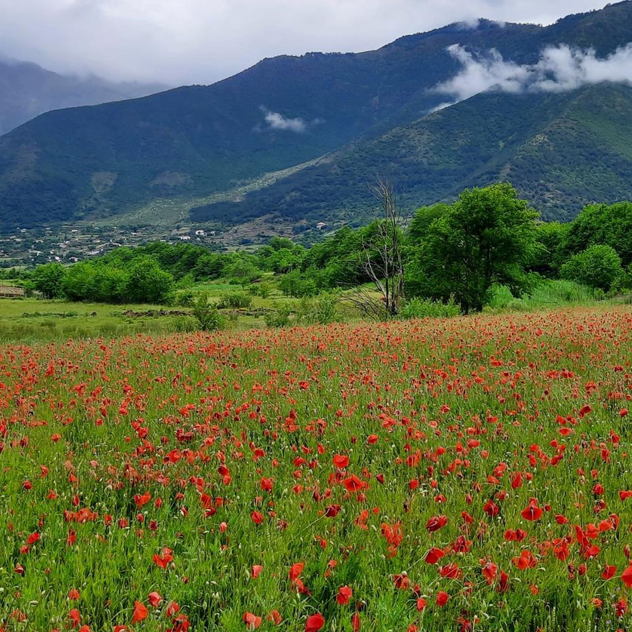
Hiking in Dibër offers diverse terrain in northeastern Albania, characterized by its predominantly mountainous landscape. The region features towering peaks, deep valleys, and dense forests, with elevations ranging from approximately 380 meters to 2,700 meters above sea level. Key natural features include Mount Korab, the Lura Mountains, and the Black Drin River, providing varied opportunities for outdoor activities. This area is known for its wild character, encompassing crags, alpine pastures, and mixed forests.
Best hiking trails in Dibër
- The most…
Last updated: October 4, 2026
4.7
(40)
272
hikers
13.9km
07:18
1,200m
1,200m
Hard hike. Very good fitness required. Mostly accessible paths. Sure-footedness required.
4.7
(26)
157
hikers
20.2km
09:01
1,440m
1,440m
Hard hike. Very good fitness required. Mostly accessible paths. Sure-footedness required.

4.8
(25)
209
hikers
17.1km
08:21
1,310m
1,310m
Hard hike. Very good fitness required. Mostly accessible paths. Sure-footedness required.
5.0
(5)
44
hikers
2.05km
00:49
140m
150m
Easy hike. Great for any fitness level. Easily-accessible paths. Suitable for all skill levels.
4.5
(10)
20
hikers
5.81km
02:29
390m
390m
Moderate hike. Good fitness required. Mostly accessible paths. Sure-footedness required.
7
hikers
15.1km
04:52
670m
670m
Moderate hike. Good fitness required. Easily-accessible paths. Suitable for all skill levels.
3
hikers
18.6km
08:24
1,160m
1,160m
Hard hike. Very good fitness required. Mostly accessible paths. Sure-footedness required.
4.5
(2)
5
hikers
4.11km
01:34
290m
290m
Easy hike. Great for any fitness level. Easily-accessible paths. Suitable for all skill levels.
Get access to more routes and recommendations from other explorers.
Already have an account?
Our route recommendations are based on thousands of hikes, rides, and runs completed by other people on komoot.
Start today with a free account
Your next adventure awaits.


Tips from the Community

Getting to the top is optional, getting down is mandatory. you read on the trig frame.
4
0
Coming from the Korabtop you take left (winter trail) for Albania or right (summer trail) for North Macedonia. The left path is unmarked and not always clear at the beginning. We keep to the right along the shiny silver rock fields.
7
0
"Getting to the top is optional, getting down is mandatory." you read on the trig frame.
5
0
Mount Korab (2,764 m) has two classic ascents: from Albania, a gradual, logically built route runs from Radomirë, through a long valley and over open karst plateaus to the broad border ridge; from North Macedonia, the rougher, steeper variant starts at Strezimir in Mavrovo Park, with less marking and scree slopes, after which both routes converge on the same ridge towards the metal trig frame on the summit.
6
0
Since Mavrovo National Park is located in North Macedonia, I assume he means an entrance ticket for when you climb Korab from North Macedonia.
7
0
The highest peak of both Albania and North Macedonia lies exactly on the border ridge. Modern geodesy gives Korab a height of 2,764 m. Older maps and guides still mention 2,754 m, but that is an outdated Yugoslav measurement.
6
0
The saddle on the border ridge between Albania and North Macedonia. No more markings are visible here, apart from a single red arrow, but there are cairns. From the saddle, a path runs to the left – now marked with red-white-red markings – over the pass. Lower-lying snow betrays the altitude we are at.
5
0
Important rock face, especially because you can get fresh, cool water there. Sometimes you have to queue, because again this is a marker from the local guides.
7
0
Frequently Asked Questions
What is the general difficulty level of hiking trails in Dibër?
Dibër offers a diverse range of hiking experiences, from easy strolls to challenging mountain ascents. Out of approximately 27 available trails, 7 are considered easy, 14 are moderate, and 6 are difficult. The region's terrain varies significantly, from deep valleys to towering peaks like Mount Korab, which demands good fitness and sure-footedness.
Are there easy hiking options suitable for beginners or families in Dibër?
Yes, Dibër has several easy hiking options perfect for beginners or families. For example, the Duf Waterfall – Duf Canyon loop from Monastery of Bigor is an easy 2 km trail. Another gentle option is the Rabdisht Village loop from Rabdisht, which is about 4 km long and offers a pleasant walk.
Are there any waterfalls to see on hikes in Dibër?
Yes, you can discover waterfalls while hiking in Dibër. The Duf Waterfall – Duf Canyon loop from Monastery of Bigor specifically features the Duf Waterfall. Additionally, the Pocest Waterfall is a notable natural attraction in the region, offering a scenic walk.
What natural attractions can I expect to see while hiking in Dibër?
Dibër is rich in natural beauty. You can expect to encounter towering peaks like Mount Korab Summit, deep valleys, canyons, and dense forests. The region also features glacial lakes in the Lura Mountains, dramatic gorges carved by the Black Drin River, and alpine pastures. The varied landscape ranges from 380 meters to 2,700 meters above sea level, offering diverse flora and fauna.
Are there many circular hiking routes available in Dibër?
Yes, many of the trails in Dibër are designed as circular routes, allowing you to start and end at the same point. Examples include the challenging Old Stone House Foundations – Mount Korab Summit loop from Kala e Dodës and the moderate Sulfur Cold Spring loop from Staravec. These loops provide varied scenery without retracing your steps.
What is the best time of year to go hiking in Dibër?
The best time for hiking in Dibër is generally from late spring to early autumn (May to October). During these months, the weather is more stable, and the higher mountain trails are typically free of snow. Summer offers lush meadows and warmer temperatures, while spring and autumn provide vibrant colors and fewer crowds. Winter hiking is possible but requires specialized gear and experience due to snow and colder conditions.
Is public transport available to reach trailheads in Dibër?
While some larger towns in Dibër may have limited public transport connections, many trailheads, especially those leading to more remote mountain areas like Mount Korab or the Lura Mountains, are not directly accessible by public transport. It's often advisable to arrange private transportation or use a car to reach starting points for hikes.
Where can I find parking for hiking trails in Dibër?
Parking availability varies by trailhead. For popular routes, such as those around Mount Korab, you might find designated parking areas near villages like Radomirë, which serves as a common starting point for the Korab ascent. For more remote trails, parking might be less formal, often along roadsides or in small village centers. Always ensure you park responsibly and do not obstruct local access.
Are dogs allowed on the hiking trails in Dibër?
Generally, dogs are allowed on hiking trails in Dibër, especially in the more natural and less regulated areas. However, it's always recommended to keep your dog on a leash, especially in national parks like Korab-Koritnik Nature Park or Lurë-Dejë Mountain National Park, to protect wildlife and ensure the safety of other hikers. Be mindful of livestock, particularly in alpine pastures.
What do other hikers say about the trails in Dibër?
The hiking trails in Dibër are highly rated by the komoot community, with an average score of 4.8 stars from over 280 reviews. Hikers frequently praise the region's 'off-menu' feel, characterized by big-mountain drama and quiet valleys, offering a less curated and more adventurous experience. The panoramic views from peaks like Mount Korab Summit are often highlighted as a major draw.
Are there options for multi-day hikes or overnight stays in Dibër?
Yes, Dibër's extensive mountainous terrain and national parks like Korab-Koritnik and Shebenik-Jabllanica offer excellent opportunities for multi-day hikes. The region's 'wild' character means you can find secluded trails and bivouac spots, such as the Rrajcë Meadows, which are known for traditional shepherding life and simple stone huts. For longer treks, planning and self-sufficiency are key.
Are there any notable viewpoints in Dibër?
Dibër is home to numerous breathtaking viewpoints due to its mountainous landscape. The summit of Mount Korab Summit offers unparalleled panoramic views across Albania and North Macedonia. Another highly recommended spot is the View of the Drin Valley and Korab Mountains, providing stunning vistas of the dramatic river valley and surrounding peaks.
Most popular routes in Dibër
Most popular attractions in Dibër

Get inspired with the komoot mobile app


Didn’t find what you were looking for?
Check out more Hikes throughout Dibër below and find the perfect route in your destination.
Explore more
Browse the best Hikes in other regions.
