The best cycling routes around Glendollach Lough
4.7
(13)
111
riders
11
rides
Touring cycling around Glendollach Lough offers routes through a landscape characterized by freshwater loughs, rolling hills, and views of the Twelve Bens mountain range. The region features a mix of quiet country roads and dedicated greenways, providing varied terrain for cyclists. Expect to encounter coastal stretches, forested areas, and open moorland. This area is known for its natural beauty and offers a range of cycling experiences.
Best touring cycling routes around Glendollach Lough
- The most popular touring cycling route is…
Last updated: July 7, 2026
2
riders
Moderate bike ride. Good fitness required. Mostly paved surfaces. Suitable for all skill levels.
5.0
(1)
3
riders
84.0km
05:00
580m
580m
Hard bike ride. Very good fitness required. Mostly paved surfaces. Suitable for all skill levels.

Sign up for free
5.0
(1)
7
riders
12.1km
00:42
70m
70m
Easy bike ride. Great for any fitness level. Mostly paved surfaces. Suitable for all skill levels.
7
riders
Easy bike ride. Great for any fitness level. Mostly paved surfaces. Suitable for all skill levels.
5.0
(1)
1
riders
90.0km
05:16
500m
500m
Hard bike ride. Very good fitness required. Mostly paved surfaces. Suitable for all skill levels.
Get access to more routes and recommendations from other explorers.
Sign up for free
Already have an account?
Our route recommendations are based on thousands of hikes, rides, and runs completed by other people on komoot.
Start today with a free account
Your next adventure awaits.
Login or Signup
Popular around Glendollach Lough
Tips from the Community

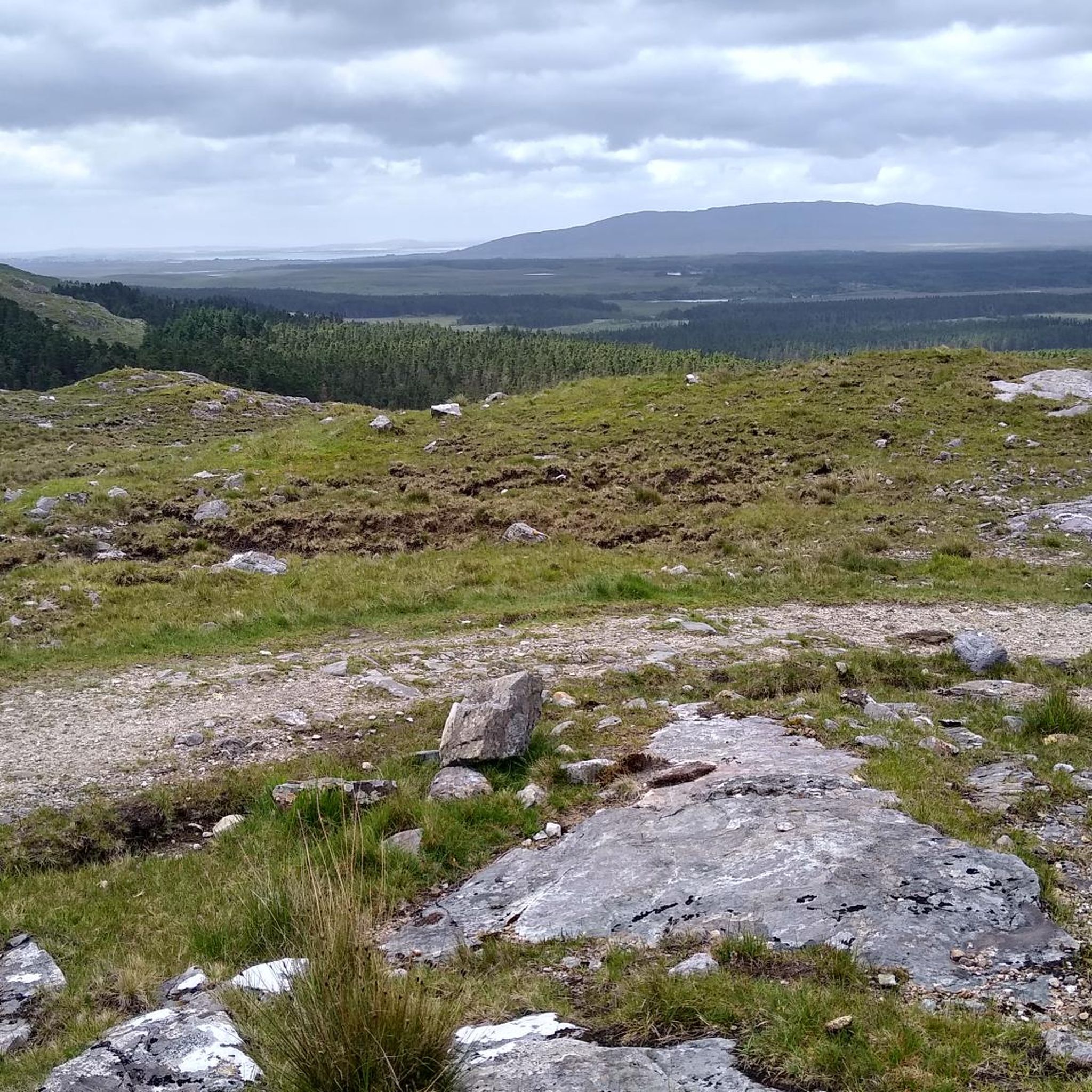
Long, narrow mountain lake in the northwest of Connemara, formed in a glacial valley between the Mweelrea massif and the lower ridges towards Letterfrack. The water lies in a quiet, remote valley where peat, heather and rock alternate. The shores are largely uninhabited, giving the lake a distinctly wild and natural character.
1
0
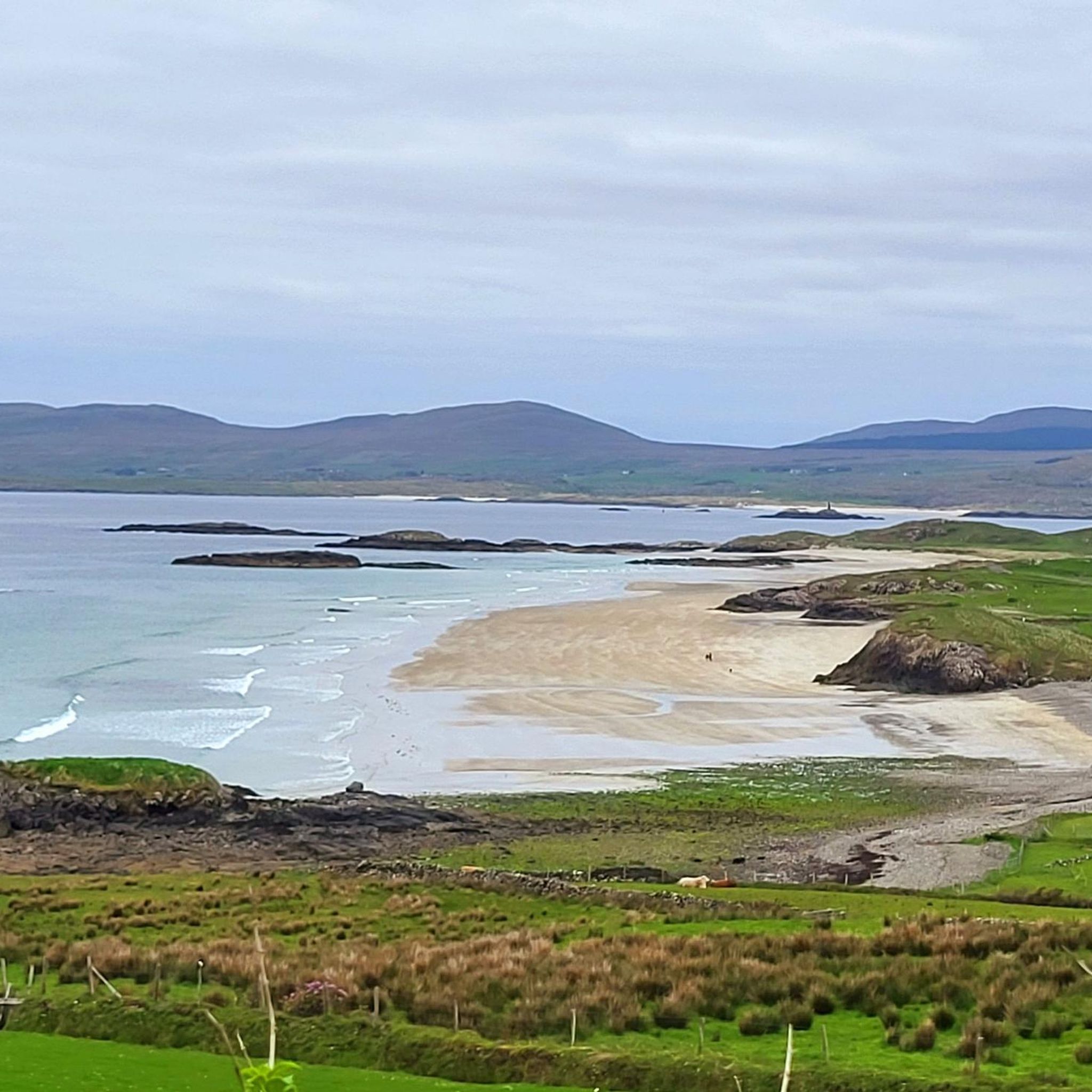
A breathtaking panorama where the green hills of Connemara literally slide into the Atlantic Ocean. Lettergesh Beach is known for its wide sandy expanse, intersected by rugged black rocks, creating a spectacular contrast with the turquoise water. From the higher coastal road, you have a bird's-eye view of the surf and the islands in the distance.
6
0
One of the most characteristic stops on the Renvyle peninsula. At the height of the historic Mullaghgloss House, you will be treated to a wide panorama of the Atlantic Ocean, where the islands of Inishbofin and Inishturk lie as sharp silhouettes on the horizon. The scenery is completed by the unperturbed sheep grazing in the salty meadows (and often right on the road).
4
0
Thatched seaside cottages – rare Connemara cottages with traditional thatch, heather or seagrass, built low and firmly anchored against the Atlantic wind.
6
0
This narrow inlet, which runs for 14 km between rocky cliffs, reaches a depth of 30 m at its mouth. The northern shore, on the Mayo side, is bordered by imposing hills, the highest of which, Mount Mweelrea, is 817 m high.
6
0
This completed section of the Connemara Greenway follows the old railway line and is a relief for cyclists. The route is completely traffic-free, flat, and asphalted. You cycle through a beautifully varied landscape of dense forests and tranquil lakes such as Athry Lough. Ideal for enjoying the rugged nature of Connemara in complete peace.
1
0

The fjord has cut deep into the interior of the country.
3
0

It is very touristy here at the Benedictine nuns. Entry costs 16 euros per person, students 13.50 euros. Were not there. There are also gardens and a restaurant.
0
0
Frequently Asked Questions
Are there cycling routes suitable for beginners around Glendollach Lough?
Yes, Glendollach Lough offers several easy touring cycling routes. A great option for beginners is the Connemara Greenway from Ballynahinch Castle, which is 7.5 miles (12.1 km) long and follows a dedicated greenway, providing a smooth and accessible surface. Another easy route is Thatched Cottages by the Sea – Ballynahinch Castle Gardens loop from Owenwee River, covering 14.8 miles (23.8 km).
What are the options for challenging long-distance touring cycling in the area?
For those seeking a more challenging experience, Glendollach Lough has several difficult routes. The View of Kylemore Abbey – View of Kylemore Abbey loop from Red Island is a substantial 52.2 miles (84.0 km) ride with significant elevation changes. Another demanding option is the Carna & Ballynahinch Castle Estate loop from Maam Cross, which stretches over 55.9 miles (90.0 km).
Are there any circular cycling routes around Glendollach Lough?
Yes, many of the touring cycling routes in Glendollach Lough are designed as loops, allowing you to start and finish in the same location. Examples include the popular Pine Island, Derryclare Lough – View of the Twelve Bens loop from Pine Island and the longer View of Kylemore Abbey – View of Kylemore Abbey loop from Red Island.
What kind of scenery can I expect while cycling around Glendollach Lough?
The region offers diverse and picturesque scenery. Cyclists can expect routes that feature freshwater loughs, rolling hills, and stunning views of the Twelve Bens mountain range. You'll encounter a mix of quiet country roads, dedicated greenways, coastal stretches, forested areas, and open moorland, providing a rich visual experience.
What is the best time of year to go touring cycling in Glendollach Lough?
The best time for touring cycling around Glendollach Lough is typically from late spring to early autumn (May to September). During these months, the weather is generally milder, with longer daylight hours and less rainfall, making for more enjoyable riding conditions. However, be prepared for changeable weather at any time of year.
What should I wear for touring cycling in this region?
Given the often changeable weather in the Glendollach Lough region, it's advisable to dress in layers. Waterproof and windproof outer layers are essential, even on sunny days. Comfortable cycling shorts, a moisture-wicking base layer, and appropriate footwear are also recommended. Don't forget a helmet and gloves for safety and comfort.
Are there places to stop for food and drink along the cycling routes?
While specific cafes and pubs are not detailed for every route, the Glendollach Lough area, being a popular tourist destination, has various villages and towns where you can find refreshments. It's always a good idea to check local amenities along your chosen route beforehand, especially in more remote sections.
How many touring cycling routes are available in Glendollach Lough?
There are 11 touring cycling routes available around Glendollach Lough on komoot, catering to various skill levels from easy to difficult. This includes 2 easy routes, 4 moderate routes, and 5 difficult routes.
What do other touring cyclists say about the routes in Glendollach Lough?
The touring cycling routes in Glendollach Lough are highly regarded by the komoot community, holding an impressive average rating of 4.7 stars from over 13 reviews. Cyclists frequently praise the stunning natural beauty, the variety of terrain, and the peacefulness of the lough-side paths and greenways.
Is public transport an option for accessing cycling routes in Glendollach Lough?
Public transport options in the Glendollach Lough region can be limited, especially for reaching the starting points of some more remote cycling routes. While there might be bus services connecting larger towns, it's recommended to check local timetables and consider the feasibility of transporting your bike. Many cyclists opt for personal vehicles to access trailheads.
Where can I park my car when starting a cycling tour?
Parking availability varies depending on the specific starting point of your chosen route. Generally, you can find parking in nearby villages or designated car parks close to popular trailheads. For routes like the Connemara Greenway from Ballynahinch Castle, parking facilities are often available at or near the castle itself. Always check for local parking regulations and fees.
Most popular routes around Glendollach Lough

Get inspired with the komoot mobile app


Explore more
Browse the best Cycling routes in other regions.
