The best cycling routes around Lough Fee
4.8
(44)
225
riders
13
rides
Touring cycling around Lough Fee offers diverse terrain within the Connemara region of County Galway, Ireland. The area features a freshwater lake surrounded by mountains and cliffs, with a rugged Atlantic coastline to the west. Inland, cyclists encounter valleys, bogs, and heaths, all set against the backdrop of the Twelve Bens mountain range. This landscape, shaped by the last Ice Age, provides varied routes for touring cyclists.
Best touring cycling routes around Lough Fee
- The most popular touring cycling route…
Last updated: June 27, 2026
4.7
(3)
20
riders
39.2km
02:27
360m
360m
Moderate bike ride. Good fitness required. Mostly paved surfaces. Suitable for all skill levels.
10
riders
26.4km
01:50
240m
240m
Moderate bike ride. Good fitness required. Mostly paved surfaces. Suitable for all skill levels.

Sign up for free
4.8
(6)
26
riders
Hard bike ride. Very good fitness required. Mostly paved surfaces. Suitable for all skill levels.
5.0
(5)
18
riders
83.1km
04:59
610m
610m
Hard bike ride. Very good fitness required. Mostly paved surfaces. Suitable for all skill levels.
5.0
(1)
11
riders
30.1km
02:02
250m
250m
Moderate bike ride. Good fitness required. Mostly paved surfaces. Suitable for all skill levels.
Get access to more routes and recommendations from other explorers.
Sign up for free
Already have an account?
Our route recommendations are based on thousands of hikes, rides, and runs completed by other people on komoot.
Start today with a free account
Your next adventure awaits.
Login or Signup
Popular around Lough Fee
Tips from the Community

Killary Fjord (of Killary Harbour) is often called the only true fjord in Ireland, although technically it is one of the three glacial fjords on the island. This deep sea arm cuts 16 kilometres inland, forming the natural border between the counties of Galway and Mayo.
6
0
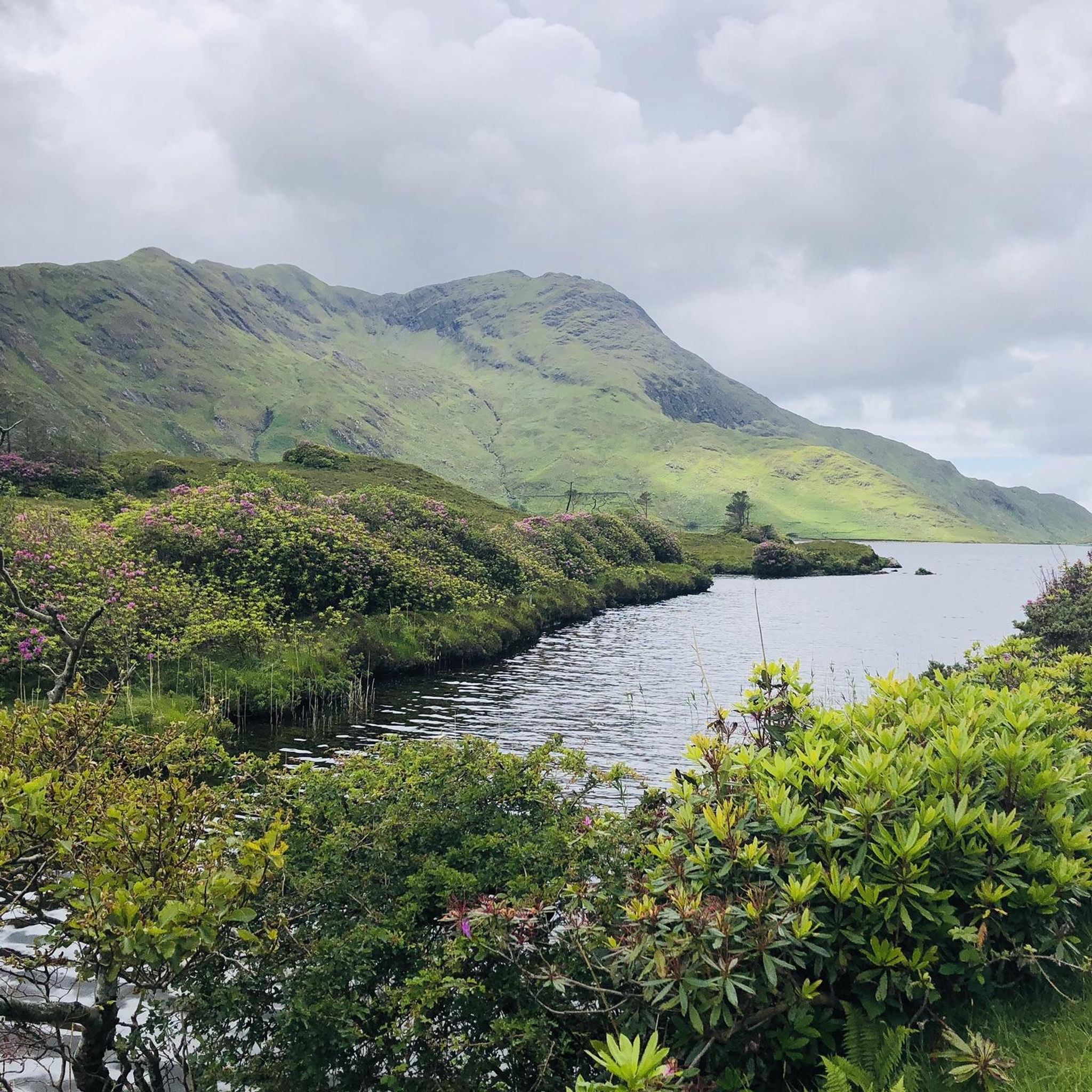
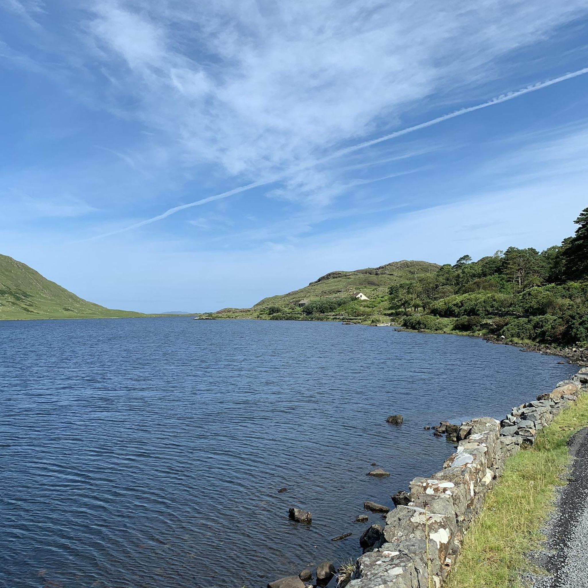
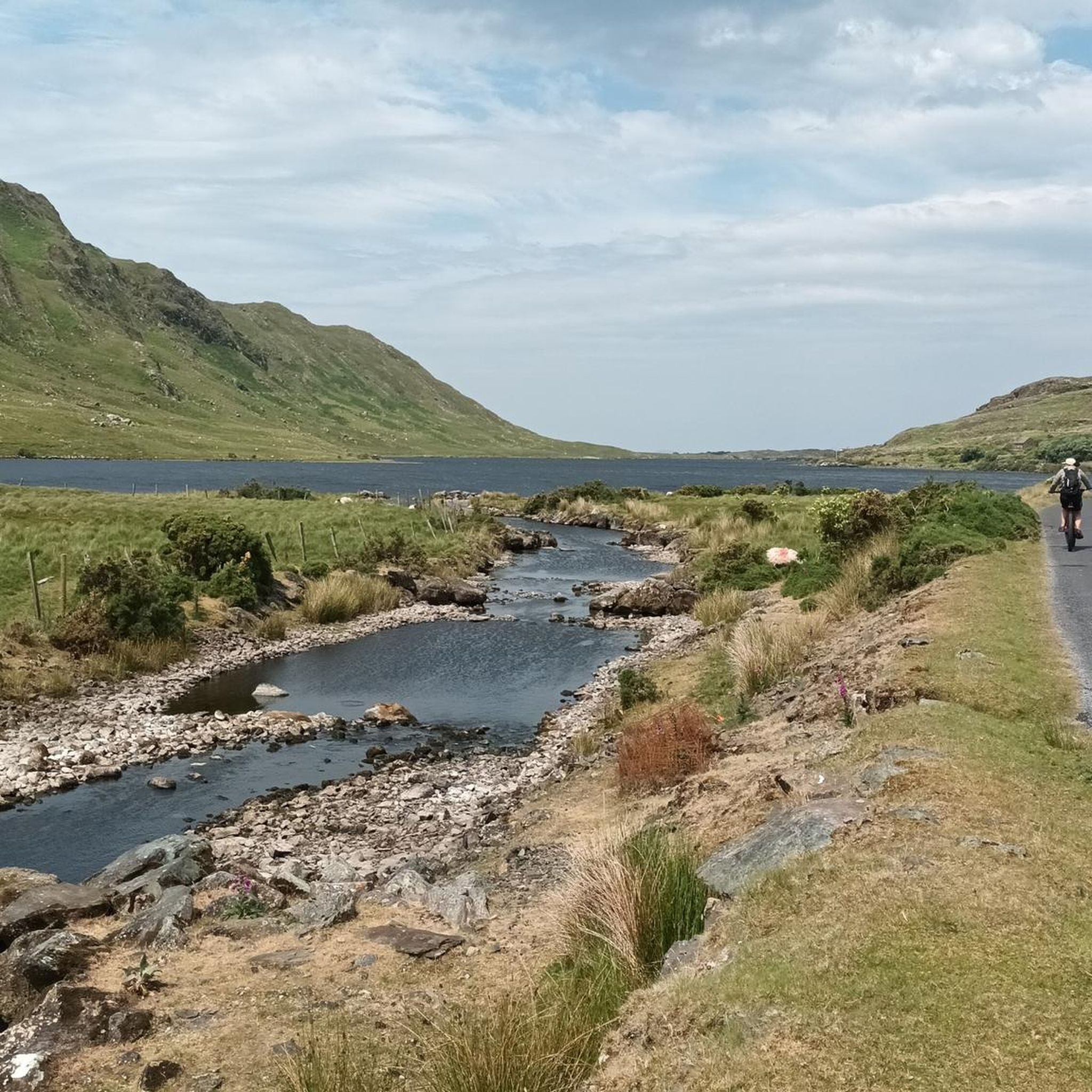
One of the most characteristic Connemara roads: narrow asphalt, slightly undulating, and constantly accompanied by water and low green ridges. Lough Fee lies elongated and open in the landscape. The road runs close to the banks, giving you almost continuous views of water, bog, and the surrounding hills. It feels remote and serene, with broad west coast air and an almost timeless tranquility.
7
0
Long, narrow mountain lake in the northwest of Connemara, formed in a glacial valley between the Mweelrea massif and the lower ridges towards Letterfrack. The water lies in a quiet, remote valley where peat, heather and rock alternate. The shores are largely uninhabited, giving the lake a distinctly wild and natural character.
1
0
A breathtaking panorama where the green hills of Connemara literally slide into the Atlantic Ocean. Lettergesh Beach is known for its wide sandy expanse, intersected by rugged black rocks, creating a spectacular contrast with the turquoise water. From the higher coastal road, you have a bird's-eye view of the surf and the islands in the distance.
6
0
One of the most characteristic stops on the Renvyle peninsula. At the height of the historic Mullaghgloss House, you will be treated to a wide panorama of the Atlantic Ocean, where the islands of Inishbofin and Inishturk lie as sharp silhouettes on the horizon. The scenery is completed by the unperturbed sheep grazing in the salty meadows (and often right on the road).
4
0
Wild Atlantic Way Discovery Point @Islands View A breathtaking discovery point on the northern loop of Renvyle. From this elevated spot, you have a direct view over the Connemara archipelago: the inhabited islands of Inishbofin and Inishturk, and the rugged, deserted Inishark. In clear weather, you can even see the contours of the holy mountain Croagh Patrick in County Mayo to the north. For cyclists, this is the ultimate 'Wild Atlantic Way' feeling: the wind in your hair, the smell of salt water, and a horizon that seems endless.
6
0
A characteristic stone arch bridge over the fast-flowing Dawros River. From this point, you can see how the fresh water from the mountains of Kylemore mixes with the salt water of Ballinakill Bay. For cyclists, this is a beautiful resting spot: look upstream for a glimpse of the wooded hills or gaze downstream to see the local fishermen and mussel farmers at work. The bridge marks the entrance to atmospheric Letterfrack and offers a moment of peace just before you enter the village.
5
0
One of the most beautiful beaches in the world: secluded, serene, beautiful and all yours, for the afternoon. Occasionally a curragh drifts in with the tide, laden with the best delicacies the sea has to offer, and then it is quiet again. A tangible reminder of the power of the sea. This enormous rusty anchor belonged to the Norwegian ship the 'Varity', which ran aground here in 1890 during a severe storm. The ship was en route from Canada to Belfast with a cargo of timber when it was wrecked near Aughris Beach. For cyclists on the Lower Sky Road, this is an impressive stop just 4 metres above sea level. As you gaze out over the white sands of Aughris Beach here, you realise how untameable the coast of Connemara can be.
5
0
Frequently Asked Questions
What kind of terrain can I expect on touring cycling routes around Lough Fee?
The terrain around Lough Fee is diverse, shaped by the last Ice Age. You'll encounter a mix of rugged Atlantic coastline, inland valleys, bogs, and heaths, all set against the backdrop of the impressive Twelve Bens mountain range. Most routes utilize paved surfaces, offering a constantly changing and breathtaking backdrop for cyclists.
Are there any circular touring cycling routes around Lough Fee?
Yes, many of the touring cycling routes around Lough Fee are circular. For example, the Lough Fee – Lough Fee loop from Killary Harbour offers a direct loop around the lake. Another option is the Lough Fee – Lough Fee loop from Glassilaun Beach, which also provides a circular experience.
Are there family-friendly touring cycling routes suitable for beginners around Lough Fee?
While the guide features 13 routes in total, with 2 categorized as easy, the region generally offers routes for various fitness levels. The area is known for its tranquil roads with little traffic, which can be suitable for families. Always check the specific route details for distance and elevation to ensure it matches your family's ability.
What are some of the more challenging touring cycling routes in the Lough Fee area?
For those seeking a challenge, Lough Fee offers several difficult routes with significant elevation gains. A notable option is the View of Kylemore Abbey – Lough Fee loop from Glassilaun Beach, which is 75.4 km long and includes views of Kylemore Abbey. Another demanding route is the Lough Fee – Thatched Cottages by the Sea loop from Glassilaun Beach, extending over 80 km.
What natural features or landmarks can I see while cycling around Lough Fee?
Cyclists around Lough Fee can enjoy a wealth of natural and cultural attractions. You'll experience the serene Lough Fee itself, surrounded by mountains and cliffs. Routes often pass by Killary Harbour, Ireland's only fjord, and offer stunning views towards Lettergesh Beach with the Mweelrea Mountains. You might also spot Kylemore Abbey, a significant Benedictine Monastery, and observe the vibrant rhododendrons in spring. The area is also known for its bird watching opportunities.
Is there parking available for cyclists near the Lough Fee routes?
While specific parking locations are not detailed for every route, many touring cycling routes around Lough Fee start and end near villages or beaches like Killary Harbour or Glassilaun Beach, where parking is typically available. It's advisable to check local information for specific starting points before your trip.
How can I reach the Lough Fee cycling routes using public transport?
The Connemara region, including Lough Fee, is primarily accessed by car. Public transport options to directly reach the starting points of these specific cycling routes may be limited. It's recommended to research local bus services to nearby towns and plan accordingly, as some routes might require a short cycle to the official start.
When is the best time of year to go touring cycling around Lough Fee?
The Connemara region is known for its 'wonderful colors with sunshine, mystical and mysterious with fog.' Spring brings vibrant rhododendrons, adding a splash of color. While cycling is enjoyable in various seasons, the best time generally depends on weather preferences. Summer offers longer daylight hours, but spring and autumn can provide beautiful scenery and fewer crowds, though weather can be unpredictable.
Can I bring my dog on the touring cycling routes around Lough Fee?
While the routes are on quiet roads, the Connemara area is a working landscape with sheep and Connemara ponies often present. If you bring your dog, it's crucial to keep them under strict control, preferably on a leash, to ensure the safety of livestock and wildlife, and to respect local farming practices.
What do other touring cyclists enjoy most about cycling in Lough Fee?
The touring cycling routes around Lough Fee are highly rated by the komoot community, with an average score of 4.8 stars from over 40 reviews. Cyclists often praise the stunning and diverse Connemara scenery, the tranquil roads with little traffic, and the opportunity to immerse themselves in the region's natural beauty and traditional Irish culture.
Are there any viewpoints along the Lough Fee cycling paths?
Yes, the routes around Lough Fee are rich with scenic viewpoints. You can expect spectacular vistas of Lough Fee itself, surrounded by mountains. The View of Lettergesh Beach – Lough Fee loop from Killary Harbour, for instance, offers direct views of Lettergesh Beach and is close to the impressive Killary Harbour fjord.
What is the overall difficulty level of touring cycling routes in Lough Fee?
The routes around Lough Fee cater to a range of abilities. Out of 13 available routes, 2 are considered easy, 6 are moderate, and 5 are difficult. This variety ensures that both casual riders and experienced cyclists can find suitable options, from shorter loops to longer, more challenging rides with significant elevation gains.

Get inspired with the komoot mobile app


Explore more
Browse the best Cycling routes in other regions.
