The best cycling routes around Lough Barra
5.0
(3)
24
riders
4
rides
Touring cycling routes around Lough Barra traverse a landscape characterized by a freshwater lake, lowland blanket bog, and the scenic Gweebarra River Valley. The region is part of a protected nature reserve, offering diverse terrain from hedgerow-lined agricultural lowlands to exposed upland bogs. It is situated near Glenveagh National Park, providing access to routes with mountain vistas and coastal views.
Best touring cycling routes around Lough Barra
- The most popular touring cycling route is Glenveagh National Park & Dunlewey Lough…
Last updated: October 2, 2026
2
riders
48.2km
03:21
600m
600m
Hard bike ride. Very good fitness required. Mostly paved surfaces. Suitable for all skill levels.
2
riders
45.8km
03:09
600m
600m
Hard bike ride. Very good fitness required. Mostly paved surfaces. Suitable for all skill levels.

4
riders
26.4km
01:41
280m
280m
Moderate bike ride. Good fitness required. Mostly paved surfaces. Suitable for all skill levels.
5.0
(3)
10
riders
77.6km
05:08
830m
830m
Hard bike ride. Very good fitness required. Some segments of this route may be unpaved and difficult to ride.
6
riders
Hard bike ride. Very good fitness required. Mostly paved surfaces. Suitable for all skill levels.
Our route recommendations are based on thousands of hikes, rides, and runs completed by other people on komoot.
Tips from the Community

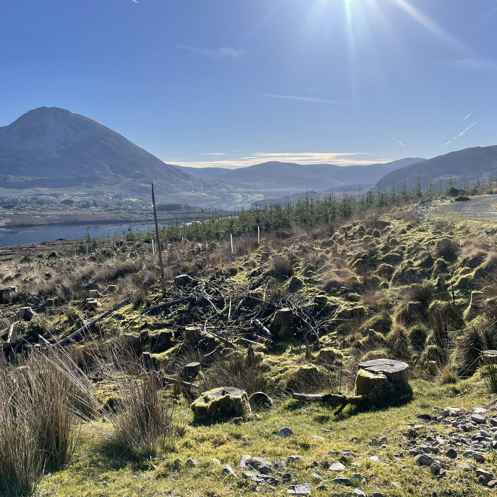
Mount Errigal dominates the landscape of West Donegal with its 751-meter-high quartzite pyramid. From the road around Dunlewy and Gweedore, you'll see the mountain constantly change shape: first broad and massive, then sharp and almost symmetrical as you get closer. The light grey scree slopes and the open moorland valleys around it give Errigal an almost alpine appearance, unique to this region. For cyclists, Errigal is primarily a visual anchor point: a constant presence above the Derryveagh Mountains, visible for miles ahead and behind you. In clear weather, the summit reflects in Dunlewy Lough, making this one of Donegal's most impressive panoramas. The surroundings are open, rugged, and vast — precisely the kind of landscape that makes a ride here so special.
9
0
Mount Errigal (751 m) is the highest mountain in Donegal and one of Ireland's most iconic peaks. The mountain is immediately striking with its sharp, pyramid-shaped silhouette and its quartz summit that shines almost white in sunlight. Errigal stands apart from the surrounding hills, giving it a dominant presence from all directions — especially when driving inland from Dungloe, Doochary, or Dunlewey.
5
0
Here the cycle path still runs completely separate from the N56: a wide, quiet strip in its own bed that takes you completely away from traffic for a while. The route here winds gently through the hilly landscape, with an open view of the valley and the river below.
7
0

"Where the mountains rise to the oft-changing skies, And the castle stands stately and gray; Where the still lake still lies, beneath that wild, rugged hill, In the vale of lovely Glenveagh..." By Herbert W.K. Sterritt
1
0

The route out of the valley is not recommended with heavy equipment, but it is possible, but it is extremely strenuous and only possible if you push the bike. With lighter luggage and the right bike, it is more likely to be possible.
0
0

Towering above all else in the Derryveagh Mountains, Errigal is one of Ireland's most photogenic mountains. From this direction, it looks every bit the classic peak, its scree slopes tumbling from an arrowed quartzite summit. The ascent options from this direction are as exciting as its appearance would suggest. The North Ridge is a superb grade one scramble, while the neighbouring Tower Ridge is a steeper, more committing grade three scramble.
1
0

A beautiful view of the Irish Fujijama. Near the hotel on the road there are a few archaic round stone posts which, together with the water, provide a beautiful foreground.
1
0

Frequently Asked Questions
How many touring cycling routes are available around Lough Barra?
There are 5 touring cycling routes available around Lough Barra. These routes offer diverse experiences, from exploring national parks to coastal views.
What kind of terrain and difficulty can I expect on touring cycling routes in Lough Barra?
The touring cycling routes around Lough Barra primarily feature challenging terrain, with all 5 routes rated as 'difficult' or 'moderate'. You'll encounter a mix of hedgerow-lined agricultural lowlands, exposed upland bogs, and mountain vistas. Some routes may include unpaved segments, so a hybrid or e-bike might be suitable for mixed terrain.
Are there any particularly challenging touring cycling routes in the Lough Barra area?
Yes, several routes offer a significant challenge. For instance, the View of Magheroarty Beach – Lovely quiet road loop from Church Hill is a difficult 71.2-mile (114.6 km) path with over 1300 meters of elevation gain, offering panoramic vistas including Magheroarty Beach.
What natural features or scenic viewpoints can I expect to see while cycling around Lough Barra?
The region is rich in natural beauty. You can expect to see Lough Barra itself, a freshwater lake within the Gweebarra River Valley, and the protected Lough Barra Bog Nature Reserve. Routes often feature stunning views of Mount Errigal, the highest peak in County Donegal, and the captivating Magheroarty Beach. Many paths also traverse parts of Glenveagh National Park, offering landscapes of lakes, mountains, and open heather uplands.
Are there any family-friendly or easier touring cycling options near Lough Barra?
While many routes in the immediate Lough Barra area are rated as 'difficult', there is one 'moderate' option: the Cycleway loop from Doocharry. This 26.4 km route with 280 meters of elevation gain might be a more accessible choice for families or those seeking a less strenuous ride.
What is the best time of year for cycling in the Lough Barra region?
The best time to cycle in County Donegal, including the Lough Barra area, is generally during the warmer and drier months, typically from late spring to early autumn (May to September). During this period, you'll experience more favorable weather patterns, longer daylight hours, and the full beauty of the landscape.
Can I cycle through Glenveagh National Park from Lough Barra?
Yes, Lough Barra is located just outside the southwest corner of Glenveagh National Park. Routes like the Glenveagh National Park & Dunlewey Lough loop from Dungloe allow you to explore the park's stunning landscapes, including its lakes, mountains, and heather uplands, with opportunities to visit Glenveagh Castle and its gardens.
Are there any circular touring cycling routes around Lough Barra?
Yes, all the touring cycling routes listed for the Lough Barra area are designed as loops, allowing you to start and finish at the same point. An example is the View of Mount Errigal – Gravel Path Along the Stream loop from Gortahork, which is a 29.7-mile (47.8 km) circular route.
What do other touring cyclists enjoy most about cycling in Lough Barra?
The touring cycling routes around Lough Barra are highly rated by the komoot community, with an average score of 5.0 stars. Cyclists often praise the serene lake and bogland environments, the dramatic mountain vistas, and the captivating coastal views that define the region's diverse terrain.
Is it possible to reach the Lough Barra cycling routes using public transport?
While specific public transport connections directly to every trailhead around Lough Barra can be limited due to its rural nature, regional bus services operate within County Donegal. It's advisable to research local bus routes and schedules to nearby towns like Dungloe or Gortahork, and then plan for a short cycle or taxi connection to your desired starting point. Parking is generally available at the start of many routes.
Are there any specific wildlife or ecological features to be aware of while cycling in the area?
Yes, the Lough Barra area is ecologically significant. It's part of the Lough Barra Bog Nature Reserve and the Cloghernagore Bog and Glenveagh National Park Special Area of Conservation. This lowland blanket bog is home to distinct plant species and provides habitat for specially protected birds like the Greenland White-fronted Goose, Merlin, and Golden Plover. The lake itself supports brown trout, salmon, and the critically endangered European eel. Cyclists should stay on marked paths to help protect these sensitive environments.
Most popular routes around Lough Barra

Get inspired with the komoot mobile app


Explore more
Browse the best Cycling routes in other regions.
