The best cycling routes around Robie Creek
5.0
(1)
67
riders
5
rides
Touring cycling routes around Robie Creek are situated within the Boise National Forest, characterized by forested gulches, rolling hills, and basalt cliffs. The landscape features significant elevation changes, with routes often leading through varied terrain including paved surfaces, unpaved segments, and gravel roads. Lucky Peak Lake and Mores Creek are prominent natural features, offering scenic views and contributing to the diverse environment. The area's topography provides a range of experiences from challenging climbs to winding paths at the edge of…
Last updated: October 12, 2026
25
riders
33.3km
02:30
830m
830m
Hard bike ride. Very good fitness required. Mostly paved surfaces. Suitable for all skill levels.
12
riders
Hard bike ride. Very good fitness required. Mostly paved surfaces. Suitable for all skill levels.

14
riders
44.3km
04:21
1,090m
1,090m
Hard bike ride. Very good fitness required. Mostly paved surfaces. Suitable for all skill levels.
12
riders
9.37km
01:01
270m
270m
Moderate bike ride. Good fitness required. Mostly paved surfaces. Suitable for all skill levels.
5.0
(1)
4
riders
60.0km
04:33
1,020m
1,020m
Hard bike ride. Very good fitness required. Mostly paved surfaces. Suitable for all skill levels.
Our route recommendations are based on thousands of hikes, rides, and runs completed by other people on komoot.
Tips from the Community

Thomas Davis helper create this park as a memorial to his wife by donating 43 acres of land in 1907. This makes Julia Davis the oldest park in the city and it is home to the Boise Rose Garden and the zoo.
0
0

Winding through Boise for 25 miles, the Boise River Greenbelt is a favorite hiking destination. With its tree-lined paths along the river, it offers scenic views and wildlife sightings. However, it's also a popular biking spot, so hikers should stay alert for cyclists zooming by.
0
0
Covering 25 scenic miles in Boise, the Boise River Greenbelt is a beloved biking destination. With tree-lined paths tracing the river's edge, cyclists can enjoy stunning views, wildlife sightings, and easy access to riverside parks, making it perfect for biking adventures.
0
0

The Ponderosa Pine Scenic Route is a 131-mile route that connects Highway 21 with the cities of Boise and Idaho City. This route travels through a mixture of terrain, including mountain roads, woodlands, and some lush forested landscapes. Here, near Lucky Peak Reservoir, the route gives way to arid foothills and scenic river views, along with dramatic vistas of the Lucky Peak Reservoir itself. This is a stunning byway to do on a bicycle.
1
0
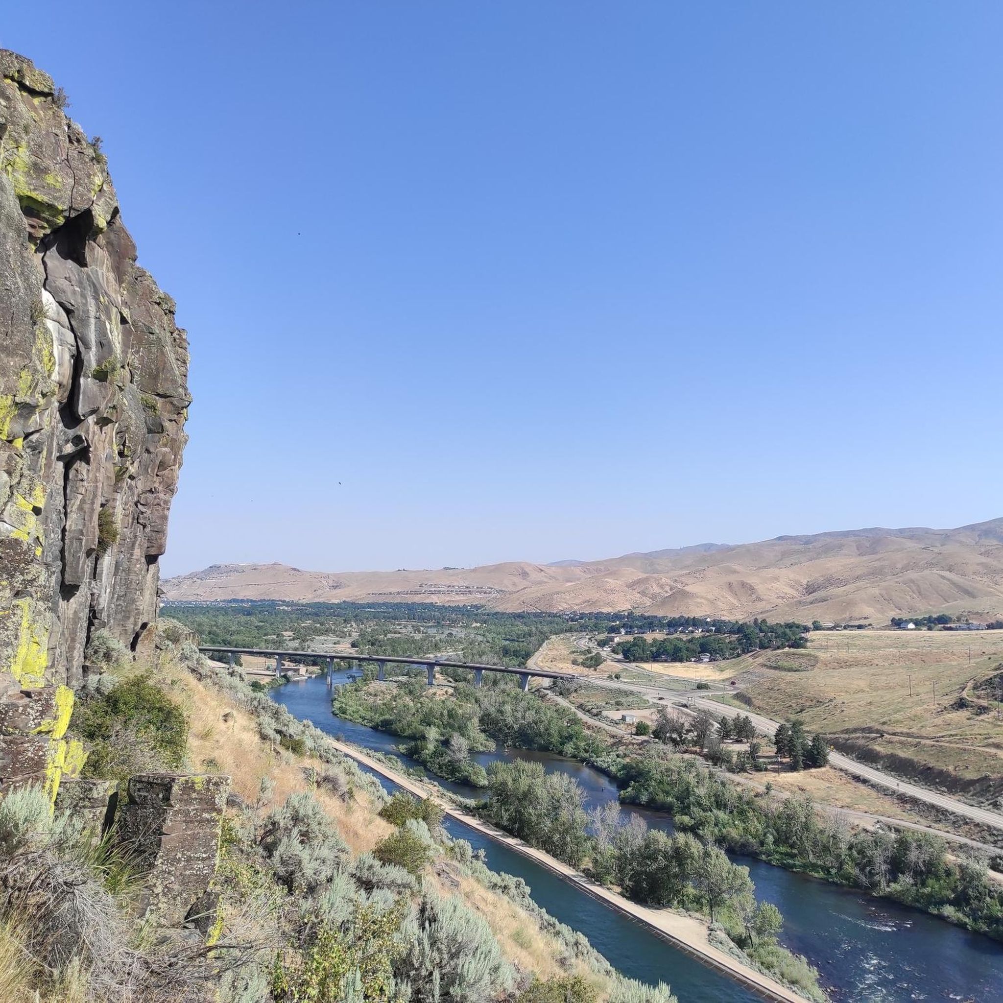
This is a perfect overlook to look out over Lucky Peak Reservoir. There is plenty of room for parking, and there are picnic benches dotted around the place for a more relaxing time of things. The reservoir sure is in a tranquil setting, and the surrounding high hills make this a dramatic overlook.
1
0
This is Mores Creek Lucky Peak Bridge, where the Ponderosa Pine Scenic Route crosses Mores Creek just before the creek enters the Boise River at Lady Peak Reservoir. There is no hard shoulder, just one lane in each direction, so there is no stopping. The views here are quite dramatic over the side rails over the bridge, as Mores Creek has carved out quite a deep canyon by now, and the surrounding hills just emphasize this dramatic landscape.
0
0

Bogus Basin is overseen by the non-profit organization Bogus Basin Recreation Association. In the summer, visitors can go mountain biking and go gravel riding, and in the winter, there is skiing and snowboarding.
0
0

This 292-acre reserve packs a lot into a small space. There are trails with views of the city of Boise as well as trails with views of the scenic Hulls Gulch.
0
0
Frequently Asked Questions
What kind of terrain can I expect on touring cycling routes around Robie Creek?
Touring cycling routes in Robie Creek offer a diverse range of terrain. You'll find a mix of paved surfaces, unpaved segments, and gravel roads. The area is characterized by forested gulches, rolling hills, and basalt cliffs, with significant elevation changes. For example, the Lucky Peak Reservoir – Boise River loop from Boise covers nearly 60 km with over 1000 meters of elevation gain, traversing varied landscapes.
Are there any particularly challenging touring cycling routes in Robie Creek?
Yes, Robie Creek is known for its challenging routes with substantial elevation gains. Many routes are classified as 'difficult'. For instance, the Hulls Gulch Reserve – East Shaw Mountain Road loop from Boise is a difficult 50.4 km route with over 1200 meters of ascent. Another demanding option is the Hulls Gulch Reserve – East Shaw Mountain Road loop from West Castle Drive & North Eugene Street SWC, which is 53.1 km long with over 1100 meters of climbing.
Are there any moderate or beginner-friendly touring cycling routes?
While many routes in Robie Creek feature significant climbs, there are options for moderate skill levels. The Bogus Basin Ski Lift – Bogus Basin loop from Deer Point is a moderate 9.4 km trail with about 270 meters of elevation gain, leading through foothills and pine forests. For more relaxed cycling, the Boise River Greenbelt, though slightly further, offers 25 scenic miles of tree-lined paths along the river.
What scenic viewpoints or landmarks can I see while cycling in Robie Creek?
The Robie Creek area offers numerous scenic viewpoints and natural landmarks. Many routes provide panoramic views, especially after challenging climbs. Notable spots include Table Rock Viewpoint and Camel's Back, which offer breathtaking panoramas over Boise. You'll also encounter the beautiful Lucky Peak Lake and Mores Creek, and the forested gulches and basalt cliffs within the Boise National Forest.
Are there any circular touring cycling routes in the Robie Creek area?
Yes, many of the touring cycling routes in the Robie Creek area are designed as loops, allowing you to start and end at the same point. Examples include the East Shaw Mountain Road – Hulls Gulch Reserve loop from Boise and the Lucky Peak Reservoir – Boise River loop from Boise. These loops offer diverse scenery and varied terrain throughout your ride.
What is the best season for touring cycling in Robie Creek?
The best season for touring cycling in Robie Creek is generally spring through fall. Spring offers lush greenery and pleasant temperatures, while fall provides cooler weather and beautiful foliage. Summers can be warm, especially in lower elevations, so early morning rides are recommended. Winter cycling can be challenging due to snow and ice, particularly on higher elevation routes like the Bogus Basin climb.
Where can I find parking for touring cycling routes near Robie Creek?
Parking availability varies depending on the specific trailhead or starting point for your chosen route. Many routes begin near Boise, where public parking options are available. For routes deeper into the Boise National Forest or near Lucky Peak Lake, designated parking areas or roadside pull-offs are often present. It's advisable to check specific route details on komoot for recommended parking locations.
Are there cafes or amenities available along the touring cycling routes?
While the routes themselves often traverse natural, undeveloped areas within the Boise National Forest, amenities like cafes and shops are typically found in nearby towns such as Boise or Idaho City. Robie Creek itself is a more remote area. It's recommended to carry sufficient water and snacks, especially on longer routes, and plan your stops in advance if you require services.
What kind of wildlife might I encounter while cycling in Robie Creek?
Cycling through the Boise National Forest around Robie Creek offers opportunities to observe diverse wildlife. Common sightings include deer and elk. More elusive animals like bears, wolves, and mountain lions also inhabit the area. Always be aware of your surroundings, maintain a respectful distance, and store food properly to avoid attracting wildlife.
Does the Robie Creek area have any historical significance for touring cyclists?
Yes, the Robie Creek area holds historical significance, particularly from Idaho's gold rush era. It was once a gateway with a stagecoach road connecting Fort Boise to Idaho City. This historical context adds a unique dimension to your touring experience, as you cycle through landscapes that were once bustling with prospectors and pioneers.
Are there opportunities for multi-day touring cycling adventures?
Yes, the Robie Creek area, situated within the expansive Boise National Forest, lends itself to multi-day touring adventures. Events like the 'Knobby Tire Bike Tour' from Boise to Idaho City, which includes Robie Creek as a stop, highlight the potential for self-supported, multi-day journeys on public dirt roads. These tours can involve significant distances and elevation changes, appealing to experienced touring cyclists looking to immerse themselves in the region's natural beauty.
Is public transport available to reach touring cycling routes in Robie Creek?
Direct public transport to the more remote touring cycling trailheads in Robie Creek is generally limited. Most cyclists access the routes by car, often starting from Boise. For routes closer to urban areas, local bus services might get you part of the way, but you'll likely need to cycle the remaining distance to reach the specific trailheads.
Most popular routes around Robie Creek
Most popular attractions around Robie Creek

Get inspired with the komoot mobile app


