The best road cycling routes around Moline
4.4
(5)
380
riders
47
rides
Road cycling around Moline, Illinois, features a landscape shaped by the Mississippi River and its tributaries, offering largely flat terrain suitable for various cycling abilities. The region is characterized by extensive riverfront trails, including sections of the Great River Trail, providing open views of the Mississippi. Cyclists can also find routes along the Rock River and around Sylvan Island, an area repurposed for outdoor recreation. This topography makes Moline a destination for road cycling.
Best road cycling routes around Moline
…Last updated: October 18, 2026
3
riders
69.1km
02:56
340m
340m
Moderate road ride. Good fitness required. Mostly well-paved surfaces and easy to ride.
25
riders
35.5km
02:07
90m
90m
Moderate road ride. Good fitness required. Mostly well-paved surfaces and easy to ride.

20
riders
Moderate road ride. Good fitness required. Mostly well-paved surfaces and easy to ride.
7
riders
Moderate road ride. Good fitness required. Mostly well-paved surfaces and easy to ride.
5
riders
33.4km
02:07
80m
80m
Moderate road ride. Good fitness required. Mostly well-paved surfaces and easy to ride.
Get access to more routes and recommendations from other explorers.
Already have an account?
Our route recommendations are based on thousands of hikes, rides, and runs completed by other people on komoot.


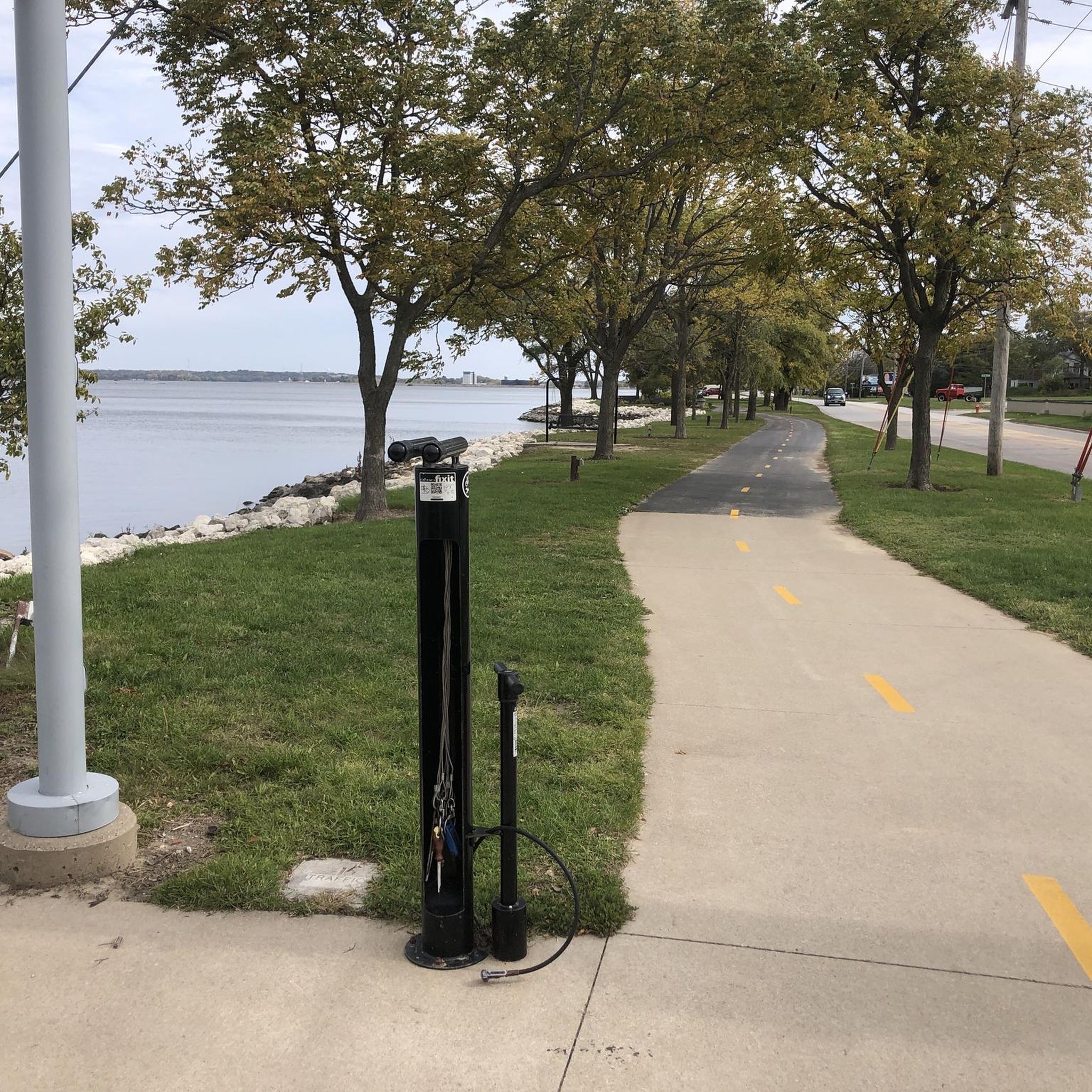
Tips from the Community

This bridge parallels the course of I-74 across the Mississippi River, keeping cyclists and other pedestrians safely away from the fast-moving vehicles. The bridge connects to cycleways on either side of the river, and also has a viewing area with an oculus.
1
0

The Government Bridge, also known as the Arsenal Bridge, spans the Mississippi River between Rock Island, Illinois, and Davenport, Iowa. Built in 1896, the bridge has two levels: the upper deck serves the Iowa Interstate Railroad, while the lower deck carries vehicle traffic and has lanes on each side for pedestrians and cyclists. It features a swing section to allow river navigation. The current bridge is the fourth at this location; the first, built in 1856, was the first railroad bridge across the Mississippi. Subsequent bridges were built after damage from collisions, ice storms, and tornadoes.
1
0

Schwiebert Riverfront Park offers a variety of features, including art sculptures, a digital playground, a fountain, a great lawn, an observation shelter, a parking lot, a promenade, restrooms, a stage, a triangle lawn, an urban concrete beach, and a walk/jog path/trail. The park was named after former Mayor Mark Schwiebert, who lived from 1989 to 2009, for his dedication to enhancing public access to the riverfront. The park hosts live music events and is a picturesque setting for leisure and for recreation.
0
0
The Butterworth Center and Deere-Wiman House are open from 9 a.m. to 5 p.m. Monday through Saturday and from 12 p.m. to 5 p.m. on Sundays. The property was originally owned by descendants of John Deere but is now managed by the William Butterworth Foundation. These historic homes host educational and cultural events year-round and provide meeting spaces for nonprofit organizations. Tours are offered to visitors, but they can also be admired from the outside as you ride by on your bike.
0
0
This 50-acre lake is part of wooded Sunset Park, right on the edge of the Mississippi River. The park also offers restrooms, picnic and playground equipment, and a ball diamond.
0
0

Sylvan Slough is a river in Illinois that passes Rock Island. If you follow the river further east, you'll get wonderful views to Rock Island Arsenal and Sylvan Island.
1
0
From this spot along the Great River Trail you get great views of Sylvan Island. You can cross a bridge to the island, but there are really only hiking and single track mountain bike trails that are unsuitable for road cycling.
2
0

Fort Armstrong, established in 1816, served as a vital military installation on Rock Island Arsenal, Illinois. Initially constructed to maintain peace among Native American tribes and European settlers, it later played a significant role in safeguarding American interests during the War of 1812. Throughout its history, Fort Armstrong served as a key strategic outpost, witnessing various conflicts and transformations until its eventual decommissioning in 1836.
0
0
Frequently Asked Questions
How many road cycling routes are available around Moline?
There are over 50 road cycling routes around Moline, catering to various skill levels. You'll find a good mix, with 21 easy routes, 28 moderate routes, and 1 more challenging option.
What kind of terrain can I expect on Moline's road cycling routes?
Moline's road cycling routes are largely characterized by a flat topography, especially along the extensive riverfront trails. While the area is generally flat, once past the initial climb out of the Mississippi River valley, you can expect fast riding conditions. Routes often feature smooth asphalt and concrete surfaces, with some sections potentially including crushed stone.
Are there any family-friendly road cycling routes in Moline?
Yes, Moline offers several easy road cycling routes suitable for families. The largely flat terrain and dedicated paved trails, such as sections of the Government Bridge – Sylvan Slough loop from Moline, make it an ideal destination for cyclists of all abilities, including beginners and families.
What natural features and scenic views can I enjoy while cycling in Moline?
Moline's cycling routes are defined by its scenic riverfronts. You'll experience open views of the Mississippi River along trails like the Birks Recreational Trail (Ben Butterworth Memorial Parkway) and the larger Great River Trail. Routes also follow the Rock River, and you can explore the unique repurposed industrial site of Sylvan Island, which offers a different cycling experience.
What landmarks or points of interest can I see along the road cycling routes?
Many routes offer views of significant landmarks. For instance, the Safe Harbor – View of Sylvan Island loop from Augustana College provides views of Sylvan Island. Other notable points of interest in the area include the Government Bridge and the Sylvan Slough.
Are there any loop trails for road cycling in Moline?
Yes, Moline features several loop trails. A popular option is the Princeton loop, which is a substantial 42.9-mile route. Another favorite is the Sylvan Island Ruins – View of Sylvan Island loop from Augustana College, a 16.0-mile trail leading through the Sylvan Island area.
What is the best time of year for road cycling in Moline?
The Quad Cities area, including Moline, offers diverse terrain suitable for cycling across different seasons. While specific weather considerations vary, the region's trails are generally enjoyable from spring through fall. For current weather conditions and trail status, it's always best to check local forecasts.
What do other road cyclists enjoy most about cycling in Moline?
The road cycling routes around Moline are highly rated by the komoot community, with an average score of 4.0 stars from over 2 reviews. Cyclists often praise the extensive riverfront paths, the scenic views of the Mississippi and Rock Rivers, and the variety of routes available for different ability levels.
Is parking available near Moline's bike trails?
Moline is part of the bike-friendly Quad Cities trail system, which generally includes accessible trailheads. While specific parking information for each route varies, the city's commitment to cycling infrastructure suggests that parking is typically available near popular trail access points. For detailed parking options, it's advisable to check specific route descriptions or local city resources.
Can I access Moline's bike paths using public transport?
The Quad Cities area has a public transportation system that may offer access to certain areas near bike paths. For specific routes and schedules that connect to trailheads, it's recommended to consult the local public transport authority's website for detailed information.
Are there any resources for more information about cycling in the Quad Cities area?
For additional information about the broader Quad Cities trail system and cycling amenities, you can visit the official tourism website: visitquadcities.com. This resource provides insights into the region's bike-friendly infrastructure and diverse trail options.
Most popular attractions around Moline

Get inspired with the komoot mobile app


Explore more
Browse the best Road cycling routes in other regions.
