The best running trails around Bückeberg
4.6
(21)
204
runners
25
runs
Jogging around Bückeberg offers diverse landscapes within a picturesque hill range in central Germany. The region is characterized by lush, mixed forests and rolling hills, providing varied terrain for runners. An extensive network of trails caters to different fitness levels, from gentle loops to more demanding routes with significant elevation changes. These running routes often feature scenic views over valleys and integrate natural and historical attractions.
Best jogging routes around Bückeberg
- The most popular jogging route is Highest point of…
Last updated: July 11, 2026
5.0
(2)
21
runners
9.68km
01:01
80m
90m
Moderate run. Good fitness required. Mostly paved surfaces. Suitable for all skill levels.
3.0
(2)
30
runners
5.27km
00:35
120m
120m
Moderate run. Good fitness required. Mostly paved surfaces. Suitable for all skill levels.

Sign up for free
4.5
(2)
14
runners
4.71km
00:30
70m
70m
Easy run. Great for any fitness level. Mostly paved surfaces. Suitable for all skill levels.
4.5
(2)
13
runners
4.31km
00:28
70m
70m
Easy run. Great for any fitness level. Mostly paved surfaces. Suitable for all skill levels.
10
runners
16.4km
01:47
240m
230m
Hard run. Very good fitness required. Mostly accessible paths. Some sure footedness required.
Get access to more routes and recommendations from other explorers.
Sign up for free
Already have an account?
Our route recommendations are based on thousands of hikes, rides, and runs completed by other people on komoot.
Start today with a free account
Your next adventure awaits.
Login or Signup

Other adventures around Bückeberg

Tips from the Community

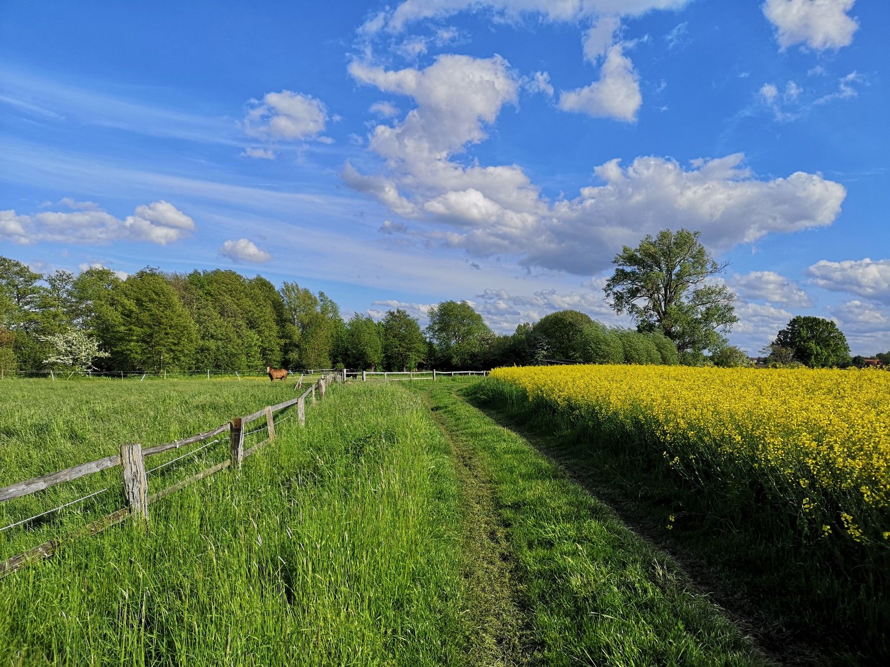
The view rewards the climb to the old Hawk station.
0
0

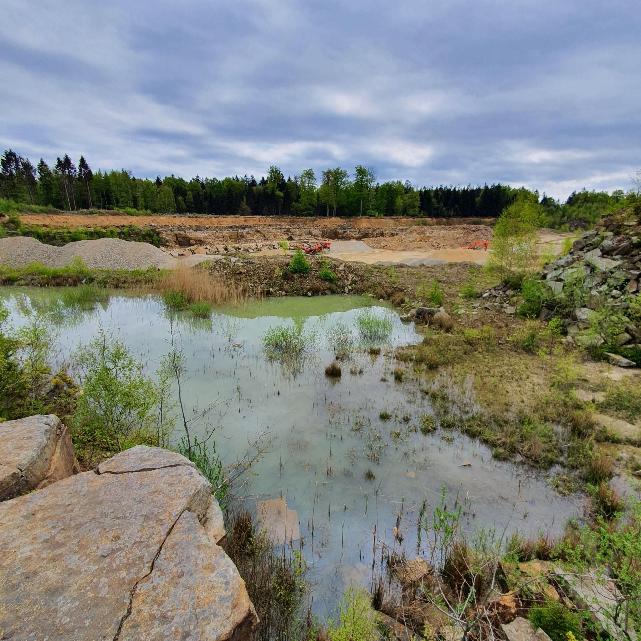
The fire pond on the Mühlenbach stream lies idyllically in the Bückeberg hills and is a tranquil, natural spot amidst the wooded hills. Fed by the Mühlenbach, the pond blends harmoniously into its surroundings and is now an integral part of the landscape of this region. Surrounded by trees and gentle hills, it invites hikers and walkers to take a short break and offers a peaceful place to enjoy nature. The pond owes its name to its original function as a water reservoir for firefighting. In times before centralized water supplies, such fire ponds were of great importance, especially in heavily forested areas. They provided readily available water for firefighting in emergencies, thus contributing to the protection of the surrounding villages and forests. Today, the fire pond is primarily of ecological and scenic significance. It provides habitat for amphibians, insects, and waterfowl and contributes to the diversity of flora and fauna in the Bückeberg hills. At the same time, it is a quiet meeting point in the region's network of hiking trails and uniquely combines nature, history and recreation in one of the most beautiful forest landscapes of the Schaumburg region.
1
0
The Brandshof shelter is idyllically situated near Wendthagen-Ehlen in the Bückeberg hills and is a popular rest stop and meeting place for hikers, walkers, and nature lovers. Nestled in the wooded, hilly landscape of the Bückeberg, it offers a tranquil spot to linger and relax amidst nature. The shelter is located on several well-maintained hiking trails and is often used as a starting or ending point for tours through the surrounding mixed forests. From here, numerous scenic features of the region can be discovered, including springs, old quarries, and viewpoints overlooking the Schaumburg region. Besides providing shelter from the elements, the Brandshof shelter is also a meeting place: the local tourism association and hiking groups regularly use it for joint events and social gatherings. Thus, the Brandshof shelter uniquely combines experiencing nature, relaxation, and community, and is an integral part of the leisure and hiking opportunities in the Bückeberg.
1
0
The event is based on a running event held by the German Gymnastics Association (DT) until 1934, the run around the Bückeberg, which covered a distance of 15 kilometers. In 1934 and 1935, waste from the Obernkirchen sandstone quarries was used to create a gymnastics area on the Bückeberg with the help of gymnasts from the district's clubs. This was located near the Jahn Tower, but has now been leveled and is no longer visible. The annual mountain gymnastics festivals held on the Bückeberg from 1935 onwards were initially called Jahn memorial gymnastics. The first took place on August 11, 1935. The head gymnastics officer and organizer was Ernst Stahlhut, who set up a mountain gymnastics festival committee. In contrast to most other mountain sports festivals, the events even took place throughout the Second World War with what was described as "extraordinarily good" participation, for example on August 24, 1944. Many of the gymnasts came to Bückeberg directly from the front during their home leave, including the organizer Stahlhut. Source: https://de.wikipedia.org/wiki/Jahn-Bergturnfest
3
0
40 years of the Brandshof refuge: 1996 was almost the end. In its 40 years, the Brandshof refuge in Wendthagen has experienced numerous storms and celebrations - and was almost demolished in 1996. At that time, the nearby quarry was to be expanded - but the people of Wendthagen were able to save their hut. Source: https://www.sn-online.de/lokales/schaumburg/stadthagen/40-jahre-schutzhuette-brandshof-1996-waere-fast-schluss-gewesen-4H57KPAEAYEGTQRYGDNSVDRFPI.html
3
0

You can also check your own range here.
2
0
The oak tree forms the center of a rest area.
3
0
Nice break bench on the boulder.
1
0
Frequently Asked Questions
What kind of running trails can I expect in Bückeberg?
Bückeberg offers a diverse network of running trails, characterized by lush, mixed forests and rolling hills. You'll find a variety of terrain, from gentle loops to more demanding routes with significant elevation changes. The area provides options for easy, moderate, and difficult runs, catering to various fitness levels.
Are there running routes suitable for beginners in Bückeberg?
Yes, Bückeberg has several easy running routes perfect for beginners or those looking for a less strenuous run. There are 7 easy routes available, often featuring minimal elevation gain and shorter distances. An example is the Flothbach loop from Hörkamp, which is an easy 2.9 miles (4.7 km) trail.
Where can I find more challenging running trails in Bückeberg?
For runners seeking a challenge, Bückeberg offers 4 difficult routes with more significant elevation changes and longer distances. These trails require good fitness and sure-footedness. A notable challenging route is the View of the Weser Uplands – Mühlenbach Firefighting Pond loop from Bückeberg, which spans over 10 miles (16.4 km) with substantial climbs.
How many running routes are available in the Bückeberg area?
There are 28 dedicated running routes available in the Bückeberg area, offering a wide range of options for all abilities. These include 7 easy, 17 moderate, and 4 difficult trails.
What natural features will I encounter on the running routes in Bückeberg?
While running in Bückeberg, you'll experience a rich tapestry of mixed woods, including beech, spruce, birch, maple, and hornbeam. The routes often traverse rolling hills and offer scenic views over valleys. You might also encounter natural springs and historical quarries, adding to the explorative appeal of the landscape.
Are there any historical sites or landmarks to see while running in Bückeberg?
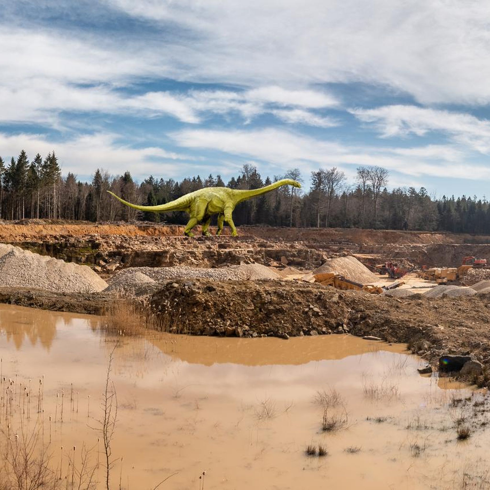
Yes, Bückeberg's running routes integrate several historical sites. You can explore the Bückeberg Brake Shaft – Obernkirchen Sandstone Quarry loop from Bückeberg, which takes you through historical quarries. The Dinosaur Tracks in the Obernkirchen Sandstone Quarries offer a unique glimpse into prehistoric life, and the Bremsschacht 7 Mining Heritage Site details the region's coal mining history.
Can I find routes with scenic viewpoints in Bückeberg?
Absolutely. Many running paths in Bückeberg offer expansive views over the valleys. Prominent hills like Diebische Ecke (375 meters) and Großer Karl (301.7 meters) provide challenging inclines and rewarding vistas. The Ida Tower, located on the Harrl foothills, also presents panoramic views of the Weser Mountains and the Steinhuder Sea, making for a memorable scenic reward.
Are there circular running routes in Bückeberg?
Yes, many of the running routes in Bückeberg are designed as circular loops, allowing you to start and finish at the same point. Popular examples include the Highest point of Böckeberg loop from Hörkamp and the Flothbach loop from Hörkamp.
What do other runners say about the trails in Bückeberg?
The running routes in Bückeberg are highly rated by the komoot community, with an average score of 4.6 stars from over 20 reviews. Runners often praise the diverse landscapes, the well-maintained trails, and the blend of natural beauty with historical points of interest.
Is parking available near the running routes in Bückeberg?
Yes, parking is generally available near the trailheads and popular starting points for running routes in Bückeberg. For instance, the An der Eulenburg Hiking Car Park is a known facility in the area.
Are dogs allowed on the running trails in Bückeberg?
Bückeberg is generally dog-friendly, and many trails are suitable for running with your canine companion. However, it's always recommended to keep dogs on a leash, especially in nature reserve areas like the Heeßer Berge, and to be mindful of other trail users and wildlife.
Are there places to rest or get refreshments along the running routes?
Yes, for those seeking a rest or refreshments, the Brandshof Shelter is a popular spot for nature lovers amidst the wooded hills. While specific cafes directly on every route might be limited, there are often options in nearby towns or villages surrounding Bückeberg.
Most popular routes around Bückeberg
Most popular attractions around Bückeberg

Get inspired with the komoot mobile app


Explore more
Browse the best Running Trails & Routes in other regions.
