The best running trails around Sierra de Ricote
4.8
(10)
1,197
runners
75
runs
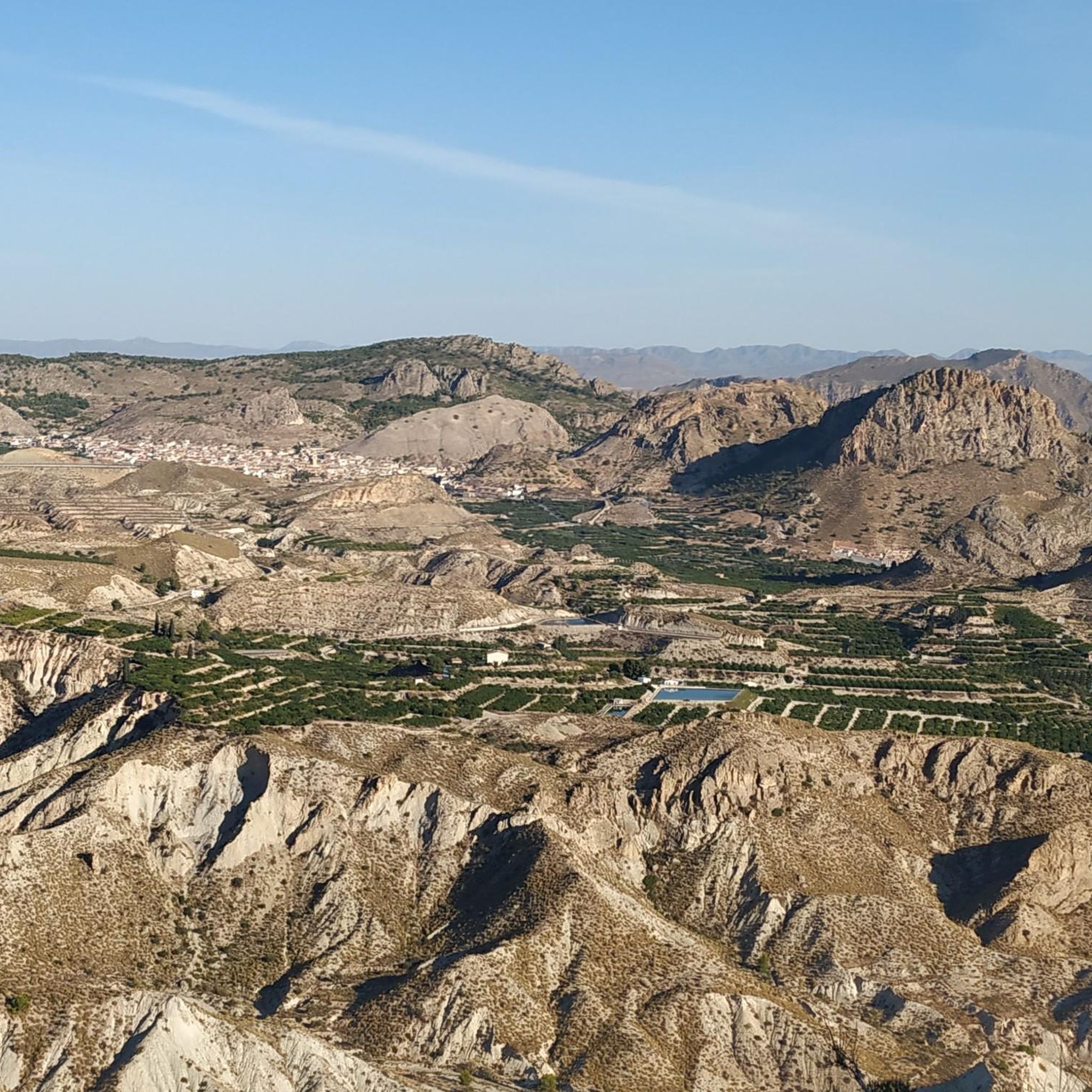
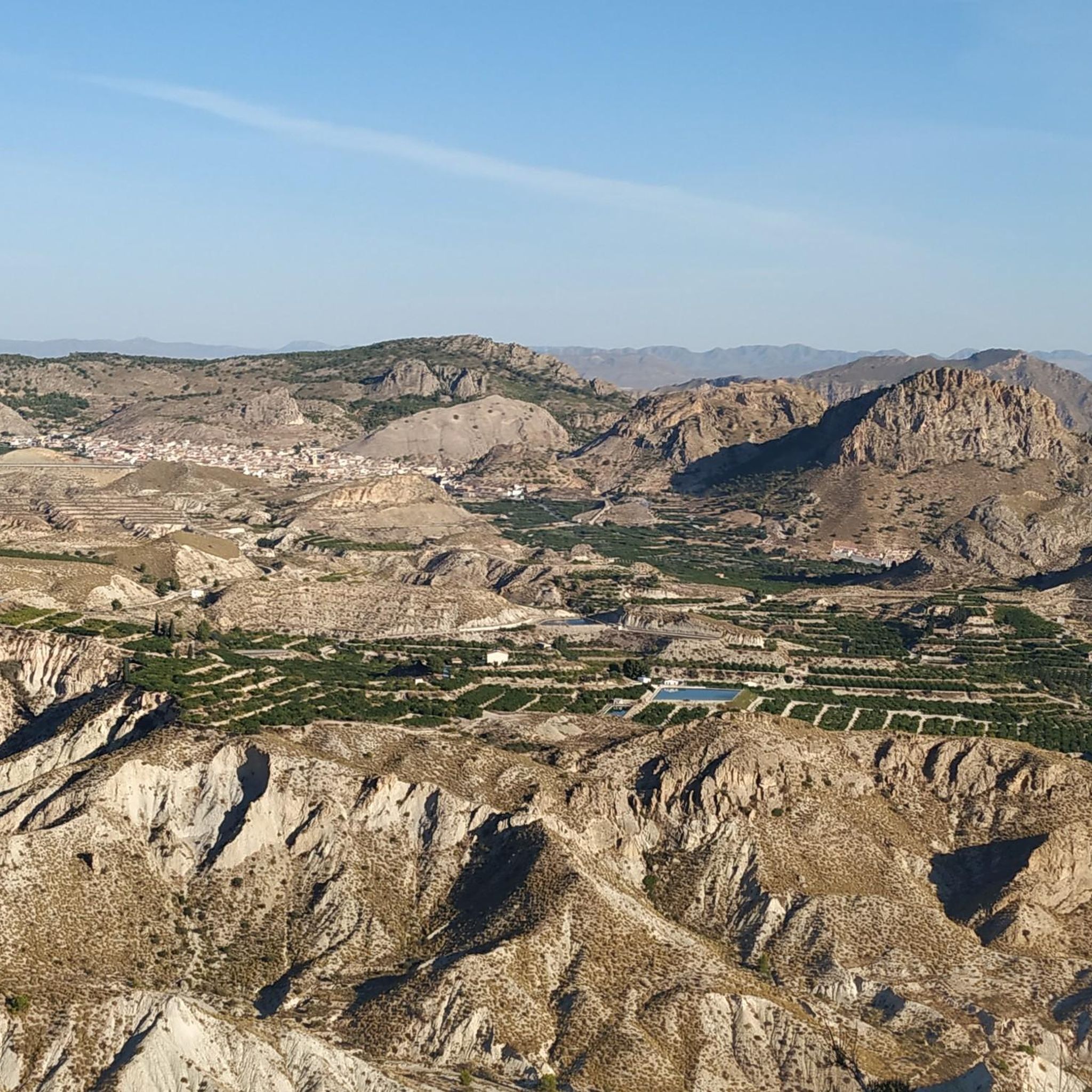
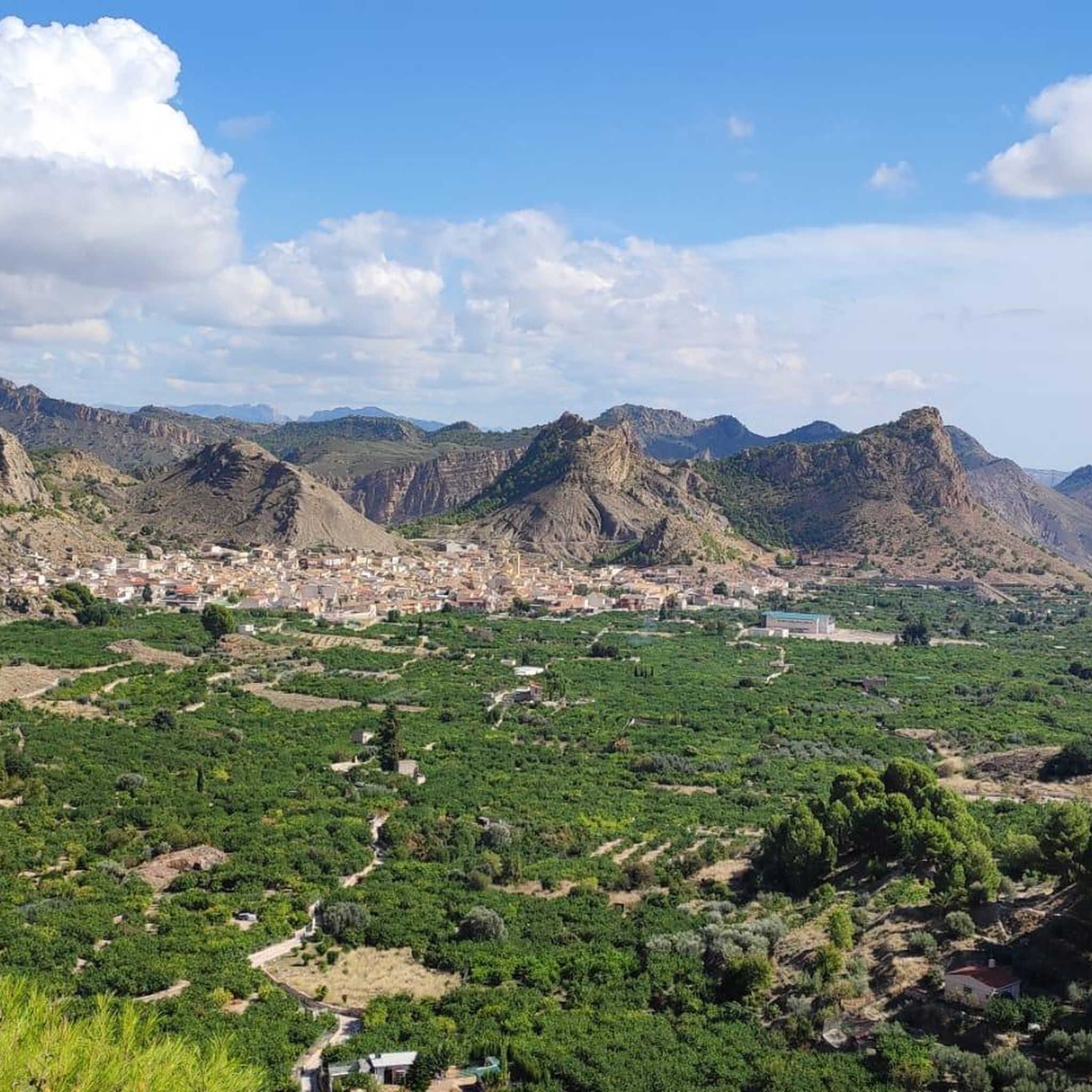
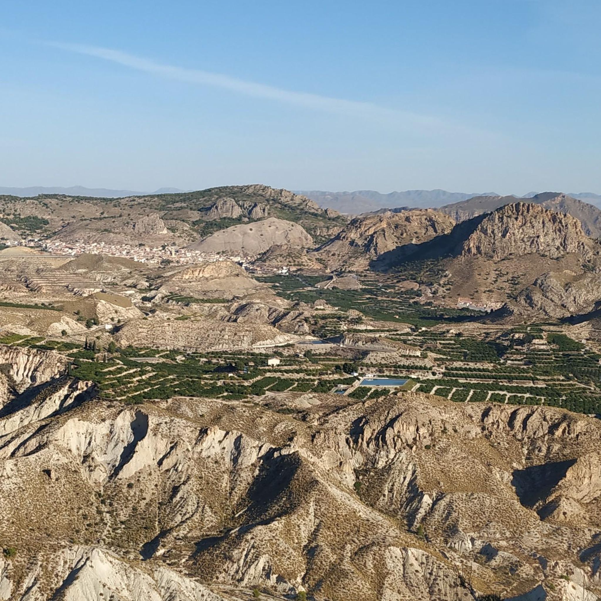
Jogging routes around Sierra de Ricote traverse a diverse landscape characterized by arid ravines, towering cliffs, and abundant vegetation. The winding Segura River nourishes fertile plains, offering level running surfaces alongside more challenging inclines in the mountainous areas. Half of Ricote's territory is forest, providing a network of trails for outdoor pursuits, with limestone walls adding to the dramatic scenery.
Best jogging routes around Sierra de Ricote
- The most popular jogging route is Running circular to the top of Almeces…
Last updated: July 13, 2026
12
runners
17.4km
02:08
730m
730m
Hard run. Very good fitness required. Mostly paved surfaces. Suitable for all skill levels.
7
runners
20.0km
02:57
930m
930m
Hard run. Very good fitness required. Sure-footedness, sturdy shoes and alpine experience required.

Sign up for free
5.0
(1)
68
runners
22.2km
03:12
1,070m
1,070m
Hard run. Very good fitness required. Sure-footedness, sturdy shoes and alpine experience required.
13
runners
8.54km
01:14
350m
350m
Hard run. Very good fitness required. Mostly paved surfaces. Suitable for all skill levels.
3.0
(1)
8
runners
13.5km
01:35
290m
290m
Moderate run. Good fitness required. Mostly paved surfaces. Suitable for all skill levels.
Get access to more routes and recommendations from other explorers.
Sign up for free
Already have an account?
Our route recommendations are based on thousands of hikes, rides, and runs completed by other people on komoot.
Start today with a free account
Your next adventure awaits.
Login or Signup

Tips from the Community

Pico de los Almeces, at 1,123 meters, is the highest point in the Sierra de Ricote mountain range. Reaching it is a challenge for hiking enthusiasts, but the reward is well worth it: breathtaking panoramic views, unspoiled nature, and a unique sense of accomplishment. The circular route is approximately 17 km long, with an elevation gain of 770 meters. It begins on the outskirts of the town of Ricote and winds through stunning natural landscapes, passing through pine forests, rosemary bushes, and trails that meander through the mountains.
0
0

If you decide to explore this route, you will be surrounded by nature and breathtaking views. Enjoy your hike! 🏞️🚶♂️🥾🚵🌞
4
0

Make sure you have enough water and leave the tough climb on time
1
1

Located in the Sierra de Ricote and surrounded by extensions of pine forests and vertical limestone walls that make this a wonderful place, we find ourselves in the Poza de Fuente Caputa, whose name comes from Roman times and its meaning is "head of the water". » Without a doubt, one of the best pools in the Region of Murcia. In some section we will have to be attentive in case we have to get off the bike and push it for a few meters.
0
0

The most beautiful of the most beautiful!!
1
0

Nice views of Piedra Lisa, which is a popular spot for climbers at certain times of the year.
1
0

Getting to the top of the Almeces peak at 1124 meters above sea level will be demanding but you will have spectacular views when you get there. Despite having many antennas in the surroundings, you can search to get some beautiful panoramic views.
0
0
At an altitude of 1,124 meters above sea level, the views from the top of Almeces are spectacular. Despite having many antennas in the surroundings, you can search to get some beautiful panoramic views.
2
0
Frequently Asked Questions
How many running routes are available in Sierra de Ricote?
Sierra de Ricote offers a wide variety of running routes, with over 65 trails documented on komoot. These range from easy paths to more challenging mountain runs, ensuring options for all fitness levels.
Are there easy running routes suitable for beginners or families in Sierra de Ricote?
Yes, Sierra de Ricote has several easy running routes. While many trails offer a moderate to difficult challenge, there are 3 routes specifically categorized as easy, and 47 as moderate, providing accessible options for beginners or families looking for a less strenuous jog. The region's diverse terrain includes flat paths along the Segura River, which are generally more suitable for an easier pace.
Can I find challenging mountain runs in Sierra de Ricote?
Absolutely. Sierra de Ricote is known for its challenging mountain runs, with 15 routes categorized as difficult. Trails like Running circular to the top of Almeces (PR-MU 10), which ascends to the 1,124-meter summit of Almeces, offer significant elevation gain and panoramic views, perfect for experienced runners seeking a strenuous workout.
Are there any running trails with waterfalls in Sierra de Ricote?
Yes, you can enjoy a run that includes a beautiful waterfall. The Fuente Caputa Waterfall – Poza de Fuente Caputa loop from Río Mula is a moderate route that takes you past the picturesque Fuente Caputa Waterfall, a unique spot with natural pools that provides a refreshing sight.
What kind of landscapes can I expect to see while jogging in Sierra de Ricote?
Jogging in Sierra de Ricote offers incredibly diverse landscapes. You'll encounter arid ravines, towering limestone cliffs, and abundant forests, as half of Ricote's territory is wooded. The winding Segura River creates lush, fertile plains with orchards, providing a green contrast to the more rugged mountainous areas. This varied topography ensures a dynamic and scenic running experience.
Are there running routes that offer panoramic views in Sierra de Ricote?
Many running routes in Sierra de Ricote lead to stunning panoramic viewpoints. The summit of Almeces, for instance, offers spectacular vistas of the entire region. Other notable viewpoints include Mirador de La Calera and Mirador del Gurugú, with routes like the "Ruta de los Miradores" specifically designed to showcase these breathtaking sights.
What do other runners say about the trails in Sierra de Ricote?
The running trails in Sierra de Ricote are highly rated by the komoot community, boasting an average score of 4.6 stars from more than 10 reviews. Over 1000 runners have explored the region's varied terrain using komoot, often praising the diverse landscapes, challenging ascents, and the beauty of the Segura River paths.
Are there circular running routes in Sierra de Ricote?
Yes, many of the running routes in Sierra de Ricote are circular, allowing you to start and finish at the same point without retracing your steps. An example is the Running circular to the top of Almeces (PR-MU 10), which offers a complete loop through the mountainous terrain.
What is the best time of year to go running in Sierra de Ricote?
Sierra de Ricote is suitable for running year-round, but the best seasons are typically spring and autumn when temperatures are milder. Summers can be very hot, especially in the arid areas, while winters are generally mild, though mountain tops like Almeces can occasionally see snow, adding a unique seasonal beauty to your run.
Are there any historical or cultural sights along the running paths in Sierra de Ricote?
Yes, as you jog through Sierra de Ricote, you can encounter rich historical and cultural elements. The region has a strong Moorish heritage, visible in ancient irrigation systems and traditional water wheels along the Segura River. Roman sites related to water use can also be found near Fuente Caputa Waterfall, adding an intriguing historical dimension to your run.
Is Sierra de Ricote suitable for running with dogs?
While the guide doesn't specify dog-friendly rules for every trail, many natural areas in Spain allow dogs on trails, often requiring them to be on a leash. It's always best to check local regulations or specific trail signs before heading out with your canine companion to ensure a pleasant experience for everyone.
How can I access the running trails in Sierra de Ricote using public transport?
Accessing some running trails in Sierra de Ricote via public transport can be challenging, as many trailheads are located in more remote natural areas. While major towns in the Ricote Valley may have bus services, direct public transport to specific trail starting points is limited. Planning your route in advance and checking local bus schedules for towns like Ricote or Ojós is recommended.
Where can I find parking near the running trailheads in Sierra de Ricote?
Parking availability varies by trailhead in Sierra de Ricote. Many popular starting points, especially near villages like Ricote or Ojós, will have designated parking areas. For more remote trails, you might find informal parking spots. It's advisable to check the specific route details on komoot or local maps for parking information before your run.
Most popular routes around Sierra de Ricote
Most popular attractions around Sierra de Ricote

Get inspired with the komoot mobile app


Explore more
Browse the best Running Trails & Routes in other regions.
