The best road cycling routes around Maize
10
riders
2
rides
Road cycling routes around Maize primarily feature flat to gently rolling terrain, characteristic of the Kansas landscape. The region is defined by open country roads and pathways alongside the Arkansas River, offering consistent surfaces for road cyclists. Elevation changes are minimal, making it suitable for sustained riding.
Best road cycling routes around Maize
- The most popular road cycling route is Cheney State Park loop, a 63.8 miles (102.6 km) trail that takes 4 hours 12 minutes to complete. This…
Last updated: September 28, 2026
1
riders
103km
04:13
230m
230m
This moderate 63.7-mile road cycling route in Cheney State Park offers flat terrain, scenic views of Cheney Reservoir, and wildlife spotting
3
riders
58.3km
02:30
150m
150m
Moderate road ride. Good fitness required. Mostly well-paved surfaces and easy to ride.

4
riders
45.3km
01:48
140m
140m
Easy road ride. Great for any fitness level. Mostly well-paved surfaces and easy to ride.
2
riders
48.4km
01:54
100m
100m
Easy road ride. Great for any fitness level. Mostly well-paved surfaces and easy to ride.
Our route recommendations are based on thousands of hikes, rides, and runs completed by other people on komoot.


Tips from the Community

Cheney State Park is a large park that has many different activities to offer. There are 29 miles of asphalt roads, camping areas, and picnic benches.
0
0
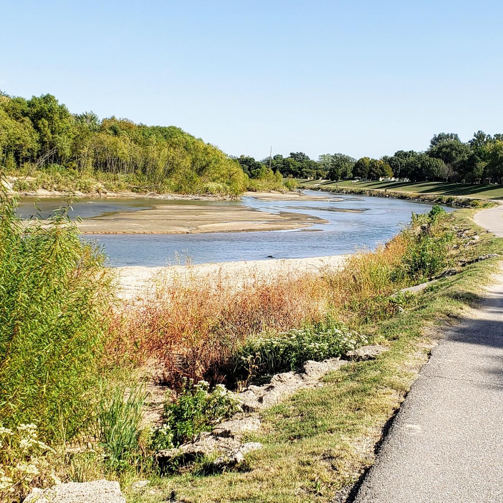
The Arkansas River Bicycle Path is a 15.6 mile loop on both sides of the Arkansas River. It is fully paved and mostly flat. The path does not join up with any roads, so you can take your time to enjoy the wonderful views of the river.
2
0
Frequently Asked Questions
How many road cycling routes are available around Maize?
There are 5 road cycling routes detailed in this guide, offering various options for exploring the Maize area.
Are there easy road cycling routes suitable for beginners in Maize?
Yes, beginners can enjoy the Arkansas River Bike Path – Arkansas River Bike Path loop from Bishop Carroll Catholic High School. This easy 24.0-mile (38.7 km) path follows the river, providing a smooth and accessible ride.
What are some of the longer road cycling routes near Maize?
For longer rides, consider the Cheney State Park loop, which spans 63.8 miles (102.6 km). Other moderate options include the Roadbike loop from Believer's Southern Baptist Church at 36.2 miles (58.3 km) and the Arkansas River Bike Path – Arkansas River Bike Path loop from Sedgwick County Zoo at 35.2 miles (56.7 km).
What kind of terrain can I expect on road cycling routes in Maize?
Road cycling routes around Maize are characterized by flat to gently rolling terrain, typical of the Kansas landscape. You'll primarily find open country roads and pathways alongside the Arkansas River, offering consistent surfaces with minimal elevation changes.
Are there any loop road cycling routes around Maize?
Yes, all the routes featured in this guide are loops. This includes popular options like the Cheney State Park loop and the various Arkansas River Bike Path loops, allowing you to start and finish at the same point.
When is the best time of year for road cycling in Maize?
Spring and fall generally offer the most pleasant conditions for road cycling in Maize, with milder temperatures. Summers can be hot, and winters can be cold, so checking the weather forecast is always recommended.
What do other road cyclists enjoy the most about road cycling in Maize?
The road cycling routes in Maize are highly rated by the komoot community, with an average score of 5.0 stars. Cyclists often praise the smooth surfaces of the river paths and the expansive views of the open country roads.
Are there scenic road bike routes with viewpoints in Maize?
While Maize's terrain is generally flat, routes along the Arkansas River, such as the Arkansas River Bike Path – Keeper of the Plains Statue loop from New Market Square, offer scenic riverfront views and opportunities to see local landmarks like the Keeper of the Plains statue.
Can I find less crowded road bike trails around Maize?
Many of the open country roads around Maize offer a less crowded cycling experience compared to urban areas. Routes like the Cheney State Park loop provide extensive riding through parkland, often with fewer people.
Are there any road cycling routes that pass by notable landmarks or points of interest?
Yes, the Arkansas River Bike Path – Keeper of the Plains Statue loop from New Market Square leads through riverfront areas and passes by the iconic Keeper of the Plains statue, offering a cultural point of interest during your ride.
What is the average duration for road cycling routes in Maize?
The duration of road cycling routes in Maize varies. For example, the easy Arkansas River Bike Path loop from Bishop Carroll Catholic High School takes about 1 hour 54 minutes, while the longer Cheney State Park loop typically requires around 4 hours 12 minutes to complete.
Most popular routes around Maize

Get inspired with the komoot mobile app


Explore more
Browse the best Road cycling routes in other regions.
