The best road cycling routes around Indian Hills
4.6
(8)
1,059
riders
92
rides
Road cycling around Indian Hills, Colorado, offers varied terrain within the Rocky Mountain foothills, situated at elevations between 6,800 and 7,800 feet. The area features challenging climbs and picturesque rides through ponderosa pine forests and open meadows. Road cyclists can expect routes with significant elevation gains, providing a demanding experience amidst natural landscapes.
Best road cycling routes around Indian Hills
- The most popular road cycling route is Ohio River – Waterfront Park loop from Bellewood, a 29.5 miles (47.5…
Last updated: July 8, 2026
4.0
(1)
76
riders
59.6km
02:34
210m
210m
Moderate road ride. Good fitness required. Mostly well-paved surfaces and easy to ride.
66
riders
49.4km
02:01
150m
150m
Moderate road ride. Good fitness required. Mostly well-paved surfaces and easy to ride.

Sign up for free
34
riders
31.8km
01:34
150m
150m
Easy road ride. Great for any fitness level. Mostly well-paved surfaces and easy to ride.
31
riders
44.2km
01:59
220m
220m
Easy road ride. Great for any fitness level. Mostly well-paved surfaces and easy to ride.
5.0
(3)
56
riders
39.6km
01:47
160m
160m
Easy road ride. Great for any fitness level. Mostly well-paved surfaces and easy to ride.
Get access to more routes and recommendations from other explorers.
Sign up for free
Already have an account?
Our route recommendations are based on thousands of hikes, rides, and runs completed by other people on komoot.
Start today with a free account
Your next adventure awaits.
Login or Signup
Popular around Indian Hills


Tips from the Community

Cherokee Park is a 400‑acre municipal park in East Louisville. It was created in 1891 by landscape architect Frederick Law Olmsted. It has several trails, including a paved loop trail, as well as restrooms and picnic areas.
1
0

Originally constructed in 1895 as a railroad bridge the Big Four Bridge was converted as pedestrian and bike connector between Louisville, Kentucky, and Jeffersonville, Indiana. This has proven to be an extremely popular conversion as the bridge sees over 1.5 million crossings per year.
0
0
This is a nice, riverside park with ample parking and restrooms, which makes it a great place to start and finish your ride. The, as yet, incomplete Louisville Loop Trail runs through the park, giving riders access to other parts of the city.
0
0
Patrick Star and Mr. Krabs brighten up the side of an otherwise unremarkable building.
0
0
The Lewis and Clark Bridge was built to connect two disjointed stretches of Interstate 265, to form part of the Louisville ring road. Ample space was built in for pedestrian and bicycle access.
0
0

The Scenic Loop is a paved path through Cherokee Park that is open to both bikes and foot-traffic. It is next to the road a lot of the time, so you will have cars close by for a lot of the run. This is a great addition to the actual trail loop that you can also run in the park.
0
0

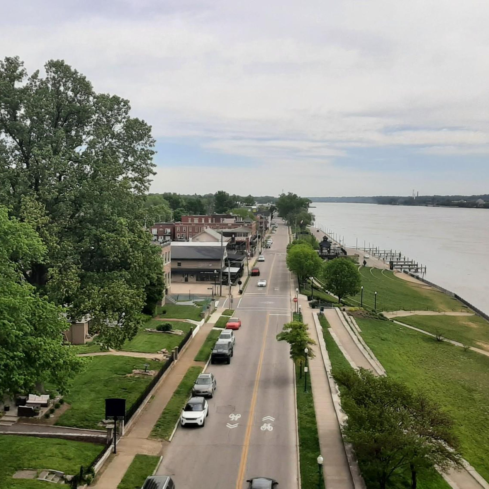
Waterfront Park is an attractive riverside park with benches, picnic areas, open areas, and paved walking/biking paths. You get great views over the river and of the Big Four Bridge, a pedestrian/ cycling bridge which spans the Ohio River, connecting Louisville, Kentucky, and Jeffersonville, Indiana.
0
0
The Scenic Loop is a paved path through Cherokee Park that is open to both bikes and foot-traffic. It is next to the road a lot of the time, so you will have cars close by for a lot of the walk. This is a great addition to the actual trail loop that you can also walk in the park.
0
0
Frequently Asked Questions
How many road cycling routes are available around Indian Hills?
There are nearly 80 road cycling routes around Indian Hills, Colorado, offering a wide range of options for different skill levels. You'll find routes traversing the Rocky Mountain foothills, ponderosa pine forests, and open meadows.
What kind of terrain can I expect when road cycling in Indian Hills?
Road cycling in Indian Hills features varied terrain, from challenging climbs with significant elevation gains to picturesque rides through scenic landscapes. The area is nestled in the Rocky Mountain foothills, with elevations typically between 6,800 and 7,800 feet, providing a demanding yet rewarding experience.
Are there routes suitable for beginners or those looking for an easier ride?
Yes, while Indian Hills is known for its challenging terrain, there are options for various fitness levels. Out of the nearly 80 routes, 27 are classified as easy, offering a more gentle introduction to road cycling in the area. You can also find paved multi-use pathways nearby, like the Alameda Bike Path and Bear Creek Trail, which connect to Denver and the foothills.
What are the options for experienced road cyclists seeking a challenge?
For experienced road cyclists, Indian Hills offers numerous challenging routes with significant elevation gains. Many routes feature over 1500 feet of climbing, providing a robust workout amidst the dramatic backdrop of the Front Range. There are 49 moderate and 2 difficult routes available for those seeking a more intense ride.
What do other road cyclists think about the routes in Indian Hills?
The road cycling routes around Indian Hills are highly regarded by the komoot community, with an average rating of 4.8 out of 5 stars from over 8 reviews. Cyclists often praise the stunning natural beauty, the challenging climbs, and the serene riding experience through ponderosa pine forests and flowery meadows.
Are there any scenic viewpoints or landmarks along the road cycling routes?
While specific named routes are not detailed, the region itself offers stunning views. The area provides expansive views of the surrounding peaks and the Front Range. Nearby Mount Falcon Park offers trails that can be incorporated into cycling excursions, providing panoramic views and historic ruins. The iconic Red Rocks Amphitheatre is also a short distance away, offering a memorable cycling destination or scenic backdrop.
What is the best time of year for road cycling in Indian Hills?
The best time for road cycling in Indian Hills is generally during the warmer months, from late spring through early fall, when the weather is most favorable and roads are clear of snow. The area's elevation means conditions can vary, so checking local weather forecasts is always recommended.
Are there any loop routes available for road cycling?
Yes, many of the road cycling routes around Indian Hills are designed as loops, allowing you to start and finish at the same point. This is ideal for exploring the diverse landscapes without having to retrace your path.
Can I find cafes or places to stop for refreshments along the routes?
While the immediate Indian Hills area is more residential and natural, you can find cafes and amenities in nearby towns and communities. Planning your route to pass through these areas or carrying sufficient supplies is advisable, especially on longer rides through more remote sections of the foothills.
What are the typical durations for road cycling routes in Indian Hills?
Route durations vary significantly based on distance and elevation gain. You can find shorter rides lasting an hour or two, as well as longer, more challenging routes that can take several hours to complete. For example, some moderate routes might take around 2-3 hours, while more difficult ones could extend to 4-5 hours or more.
Is parking available at trailheads for road cyclists?
Parking is generally available at various access points and trailheads throughout the Indian Hills area and nearby open spaces. For instance, areas around Mount Falcon Park and other Jefferson County Open Space parks often provide designated parking facilities for visitors accessing trails.
Are there any multi-use paths or trails that connect to broader networks?
Yes, Indian Hills provides access to broader cycling networks. Nearby, the Alameda Bike Path and the Bear Creek Trail offer paved multi-use pathways that connect to Denver and the foothills, providing additional options for road cyclists looking for longer, interconnected rides.
Most popular routes around Indian Hills
Most popular attractions around Indian Hills

Get inspired with the komoot mobile app


Explore more
Browse the best Road cycling routes in other regions.
