The best MTB trails around South Berwick
5.0
(5)
13
riders
5
rides
Mountain biking around South Berwick, Maine, offers diverse terrain for outdoor enthusiasts. The region is characterized by its forested areas, including Vaughan Woods State Park, and the scenic Salmon Falls River which forms its western edge. Elevation changes are present, with some trails featuring moderate climbs and others, like those near Mount Agamenticus, offering more significant ascents. The landscape provides a mix of natural surfaces suitable for various mountain biking experiences.
Best mountain bike trails around South Berwick
- The most popular mountain bike trail is Mount Agamenticus Trail Loop, a 12.7 miles (20.4 km) trail that takes 1 hour 59 minutes to complete. This moderate route features significant elevation gain and varied terrain.
- Another top favourite among local mountain bikers is Porcupine Trail, Notch Trail, and Cedar Trail Loop, an easy 6.3 miles (10.1 km) path. This route winds through forested areas with moderate climbs.
- Local mountain bikers also love the Middle Pond Loop, a 7.6 miles (12.3 km) trail leading through varied woodlands, often completed in about 1 hour 7 minutes.
- Mountain biking around South Berwick is defined by forested trails, river views along the Salmon Falls River, and the hills of Mount Agamenticus. The network offers options for different ability levels, from easy paths to more challenging climbs.
- The guide includes highly-rated routes that showcase the best of the region's landscape.
Last updated: June 25, 2026
5.0
(5)
5
riders
20.4km
01:59
370m
370m
The Mount Agamenticus Trail Loop offers a diverse mountain biking experience through a unique coastal forest ecosystem in Southern Maine. You'll encounter everything from smooth singletrack to technical rocky sections, including exposed granite and rooty climbs, all while winding through dense hemlock, pine, and oak old-growth forests. The 12.7-mile (20.4 km) route, with its 1216 feet (371 metres) of elevation gain, is rated moderate and takes about 1 hour and 59 minutes, providing a rewarding challenge for intermediate riders.
While the trails are generally accessible, be aware that they can become very slippery and challenging when wet, especially after rain. The Mount Agamenticus Conservation Region is located in York, Maine, and is easily reached, though arriving early is advisable during peak times. Checking trail conditions before heading out is always a good idea to ensure a safe and enjoyable ride.
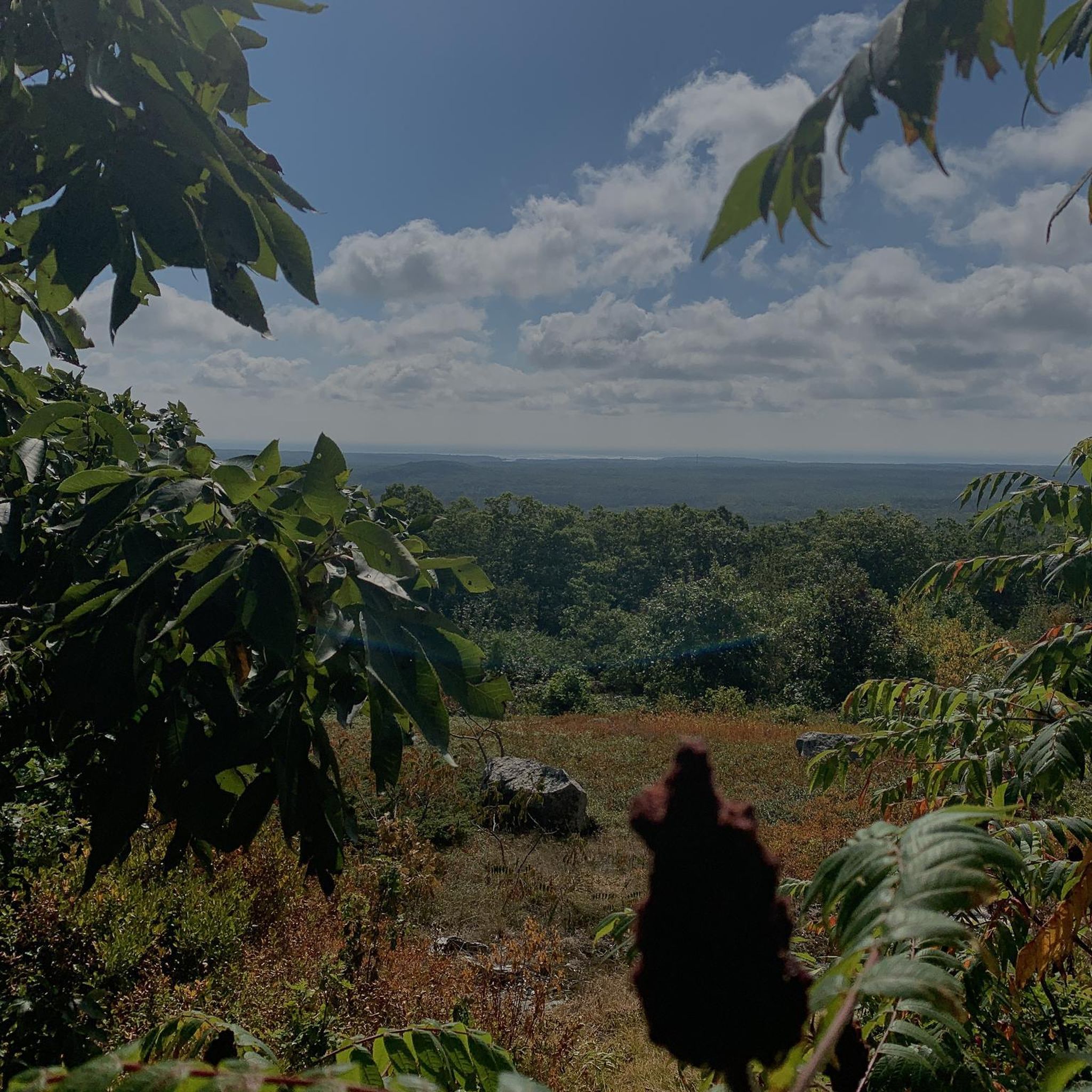
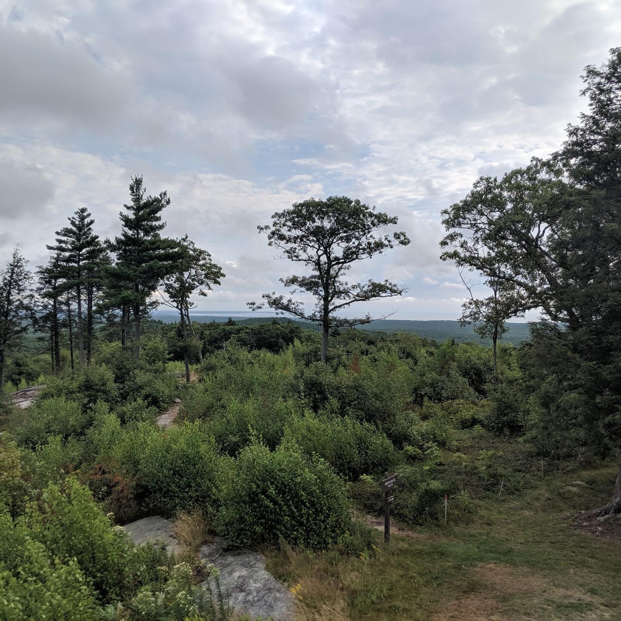
Mount Agamenticus stands out for its panoramic views from the summit, which, despite the mountain's modest 692-foot elevation, stretch across the Atlantic Ocean to the White Mountains. The area is also an ecologically significant habitat, supporting a high diversity of rare plants and animals. Its well-maintained, sustainably designed trail network offers over 30 miles of multi-use trails, making it a notable destination for mountain bikers in the region.
2
riders
10.1km
01:04
260m
250m
The Porcupine Trail, Notch Trail, and Cedar Trail Loop offers a refreshing mountain biking escape around Mount Agamenticus, providing a scenic and approachable ride for all skill levels. You'll navigate through pleasant forest paths, enjoying the natural surroundings without encountering overly technical sections. It's a great way to experience the local landscape on two wheels, with the changing terrain keeping things interesting.
This easy 6.3-mile (10.1 km) mountain biking route involves 856 feet (261 metres) of elevation gain, typically taking just over an hour to complete. It's an excellent option for a casual ride or for those looking to build their mountain biking confidence. Plan your visit during dry conditions to ensure the best trail experience, and check for specific trailhead parking details near Mount Agamenticus before you go.
What makes this loop particularly appealing is its accessibility and the opportunity to explore the area around Mount Agamenticus, a prominent landmark in York County, Maine. Unlike some of the more challenging trails found elsewhere with similar names, this route focuses on enjoyable, flowy sections, making it a local favorite for a quick and satisfying outdoor adventure.

Sign up for free
2
riders
7.48km
00:37
30m
30m
This easy 4.6-mile mountain biking route in Dover offers varied terrain, river views, and passes by the Voyage Mark II Solar System Exhibit.
12.3km
01:06
140m
140m
The Middle Pond Loop offers a dynamic mountain biking experience, circling the isolated Middle Pond and providing scenic glimpses of Folly Pond. You'll navigate a challenging mix of steep ascents and descents over rocky and rough terrain, with some sections demanding extra effort or even a short hike-a-bike. This moderate 7.6-mile (12.3 km) route, with 464 feet (141 metres) of elevation gain, takes about 1 hour and 6 minutes to complete, making it ideal for intermediate riders seeking a varied and engaging ride.
Accessing the Middle Pond Loop typically involves standard trailhead parking within the Mount Agamenticus area. While specific parking details aren't always prominent, arriving early on busy days is a good strategy. For the best views and riding conditions, plan your visit for clear weather, as the trail's scenic appeal is enhanced on bright days. Always check local trail conditions before you head out.
This trail stands out for its location within the Mount Agamenticus system, offering a secluded feel despite its accessibility. The challenging, rocky terrain and significant elevation changes make it a notable option for those looking to push their skills. Its position between McIntire Highlands and Highland Farms Preserves adds to its natural charm, providing a true escape into Maine's wilderness.
4
riders
11.6km
01:11
290m
290m
Hard mountain bike ride. Great for any fitness level. Advanced riding skills necessary. Some portions of the route may require you to push your bike.
Our route recommendations are based on thousands of hikes, rides, and runs completed by other people on komoot.
Start today with a free account
Your next adventure awaits.
Login or Signup
Tips from the Community

Strong legs and low gears needed to climb. Good views of the ocean, mountains of NH and the Maine forests from the top.
0
0

Mount Agamenticus is a 692-foot peak. There are no other peaks around this one, so you get great views over the surrounding area. The ride up to the peak is challenging, but it is worth the effort for the wonderful vistas at the top.
1
0

Some portions of Notch Trail can be a little rugged depending on recent rainfall. A mountain bike, gravel bike, or anything really other than a road tire would be best.
0
0

The Notch Trail is a long trail that runs north-south through the Mount Agamenticus Conservation Region. All the major summits in this area (Mount Agamenticus, Second, and Third Hill) are all accessible from the Notch Trail via spur trails; you can make seemingly-endless combinations of routes from the Notch Trail, making a great jumping off point to explore what this area has to offer.
0
0

Second Hill is a small peak within Mount Agamenticus Conservation Region that tops out at 555 feet in elevation.
0
0
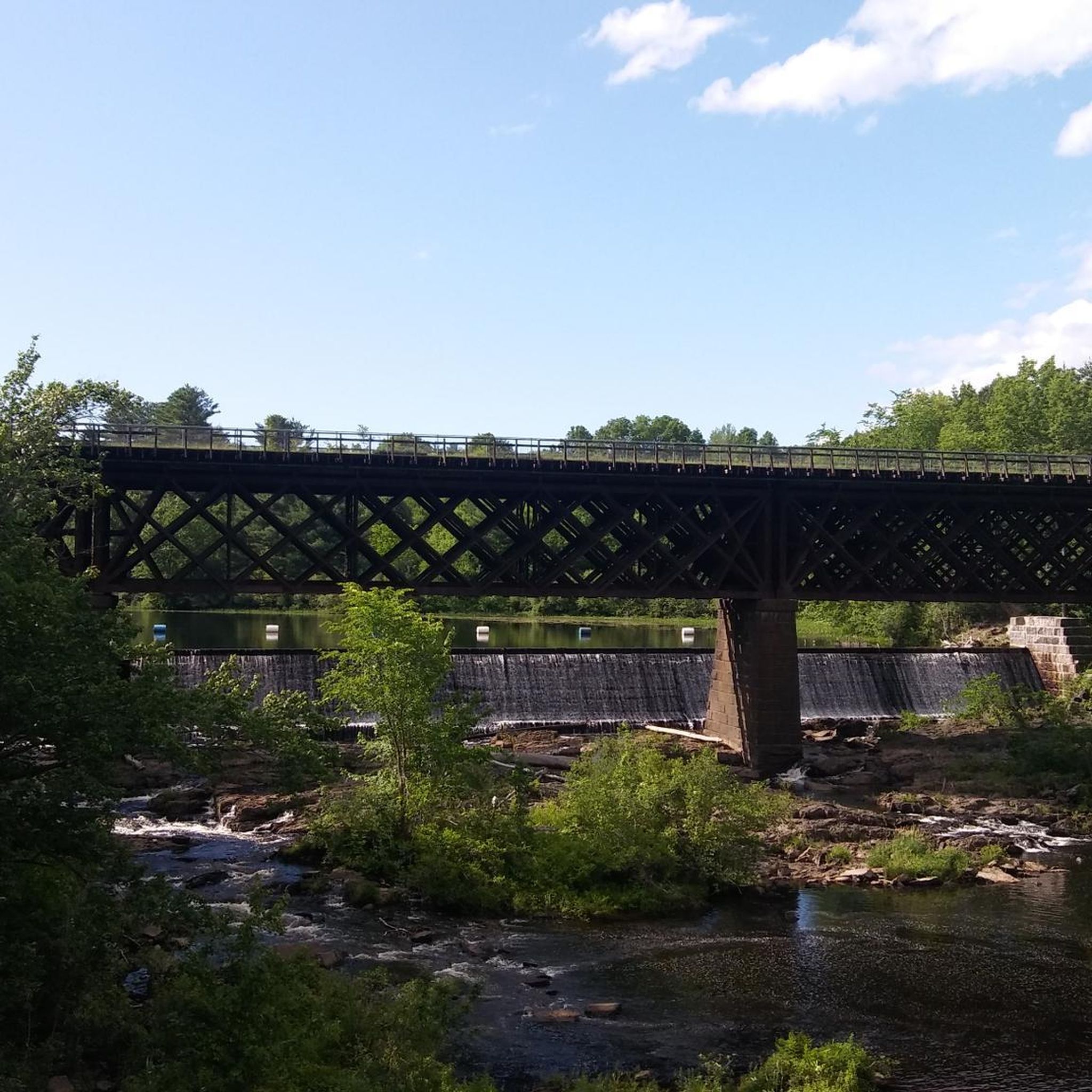
The Dover Community Trail is a wonderful multiuse trail that runs through Dover. The surface varies from crushed gravel to pavement. The trail passes through woodland and urban areas, and it crosses several bridges.
0
0

Located at the southern tip of Folly Pond, Middle Pond is a remote lake sandwiched between McIntire Highlands and Highland Farms Preserves. A multi-use hiking and biking trail encircles the lake, with steep ascends and descends over quite rocky and rough terrain. Most of the trails are rated as black diamonds, so bring your best mountain bike skills with you!
0
0
Situated only a stones throw away from Mount Agamenticus, Folly Pond is a long, narrow lake that stretches from north to south along the edge of the McIntire Highlands Preserve. The hiking and biking trail runs along the perimeter of the lake.
0
0
Frequently Asked Questions
How many mountain bike trails are available around South Berwick?
South Berwick and its surroundings offer a good selection of mountain biking opportunities, with around 11 designated trails in the area. These trails cater to various skill levels, from easy paths to more challenging climbs.
Are there any family-friendly mountain bike trails in South Berwick?
Yes, there are family-friendly options available. The Porcupine Trail, Notch Trail, and Cedar Trail Loop is an easy 6.3-mile path that winds through forested areas with moderate climbs, suitable for a family outing. Another easy option is the Dover Community Trail, which is 4.6 miles long and features minimal elevation gain.
What are the most scenic mountain bike trails with good views in the area?
For panoramic views, consider trails around Mount Agamenticus. While challenging, routes like the Mount Agamenticus Trail Loop offer significant elevation gain and rewarding vistas. Additionally, trails along the Salmon Falls River provide scenic waterside views.
Are there any mountain bike trails suitable for beginners or those looking for an easy ride?
Absolutely. The Porcupine Trail, Notch Trail, and Cedar Trail Loop is classified as easy, covering 6.3 miles through forested areas. Another excellent choice for beginners is the Dover Community Trail, which is also easy and relatively flat.
Where can I find more challenging mountain biking routes around South Berwick?
For more advanced riders, the trails around Mount Agamenticus offer technical terrain and significant elevation changes. The Mount Agamenticus – Second Hill loop from York Water District Lands is a difficult 7.2-mile route with substantial climbing, providing a good test for experienced mountain bikers.
What kind of landmarks or attractions can I explore near the mountain bike trails?
Beyond the trails, you can explore several points of interest. Vaughan Woods State Park offers old-growth forests and trails along the Salmon Falls River, and it's home to the historic Hamilton House. You might also encounter Orris Falls or the scenic Salmon Falls River Bridge.
Are there any loop mountain bike trails in South Berwick?
Yes, many of the trails are designed as loops for convenience. For example, the Middle Pond Loop is a 7.6-mile moderate trail that takes you through varied woodlands. The Porcupine Trail, Notch Trail, and Cedar Trail Loop is another popular loop option.
What do other mountain bikers enjoy most about mountain biking in South Berwick?
The area is highly rated by the komoot community, with an average score of 5.0 stars. Reviewers often praise the diverse terrain, from forested paths to challenging climbs, and the scenic beauty, particularly along the Salmon Falls River and around Mount Agamenticus.
What are the typical elevation gains on mountain bike trails in South Berwick?
Elevation gains vary significantly. Easier trails like the Dover Community Trail have minimal elevation, around 33 feet. Moderate routes such as the Middle Pond Loop can have around 141 feet of ascent. For a substantial challenge, the Mount Agamenticus Trail Loop features over 1,200 feet (370 meters) of elevation gain.
Are there any cafes or pubs near the mountain bike trails in South Berwick?
South Berwick has local establishments where you can refuel after your ride. While specific cafes directly adjacent to trailheads are not listed, the town center offers options for food and drink within a short distance of many trail access points.
What is the best time of year for mountain biking in South Berwick?
The best time for mountain biking in South Berwick is generally from spring through fall. The region experiences diverse weather, with pleasant conditions for riding during these seasons. Winter riding can be possible but may involve snow and ice, requiring appropriate gear and caution.
Is parking available for mountain bikers accessing trails in South Berwick?
Parking is typically available at various trailheads and access points for the mountain biking trails in and around South Berwick. Specific parking details can often be found on individual trail pages or local park websites.
Most popular attractions around South Berwick

Get inspired with the komoot mobile app


Explore more
Browse the best MTB trails in other regions.
