The best cycling routes around Plymouth
4.6
(90)
426
riders
31
rides
Touring cycling around Plymouth offers diverse landscapes, from coastal routes along the English Channel to woodland trails and river valleys. The region features extensive parkland and riverside paths, providing access to the edge of Dartmoor National Park. Elevations vary, offering routes from sea level to over 880 feet (269 meters). The city is situated on National Cycle Network routes 2 and 27, providing a well-developed network for cyclists.
Best touring cycling routes around Plymouth
- The most popular touring cycling route…
Last updated: October 1, 2026
4.7
(15)
74
riders
47.7km
02:45
190m
190m
Moderate bike ride. Good fitness required. Mostly paved surfaces. Suitable for all skill levels.
3.0
(1)
27
riders
30.5km
01:52
110m
110m
Easy bike ride. Great for any fitness level. Mostly paved surfaces. Suitable for all skill levels.

4.8
(6)
22
riders
Moderate bike ride. Good fitness required. Mostly paved surfaces. Suitable for all skill levels.
5.0
(1)
23
riders
26.8km
01:34
130m
130m
Easy bike ride. Great for any fitness level. Mostly paved surfaces. Suitable for all skill levels.
4.3
(4)
24
riders
69.9km
04:21
270m
270m
Moderate bike ride. Good fitness required. Mostly paved surfaces. Suitable for all skill levels.
Get access to more routes and recommendations from other explorers.
Already have an account?
Our route recommendations are based on thousands of hikes, rides, and runs completed by other people on komoot.
Start today with a free account
Your next adventure awaits.

Tips from the Community

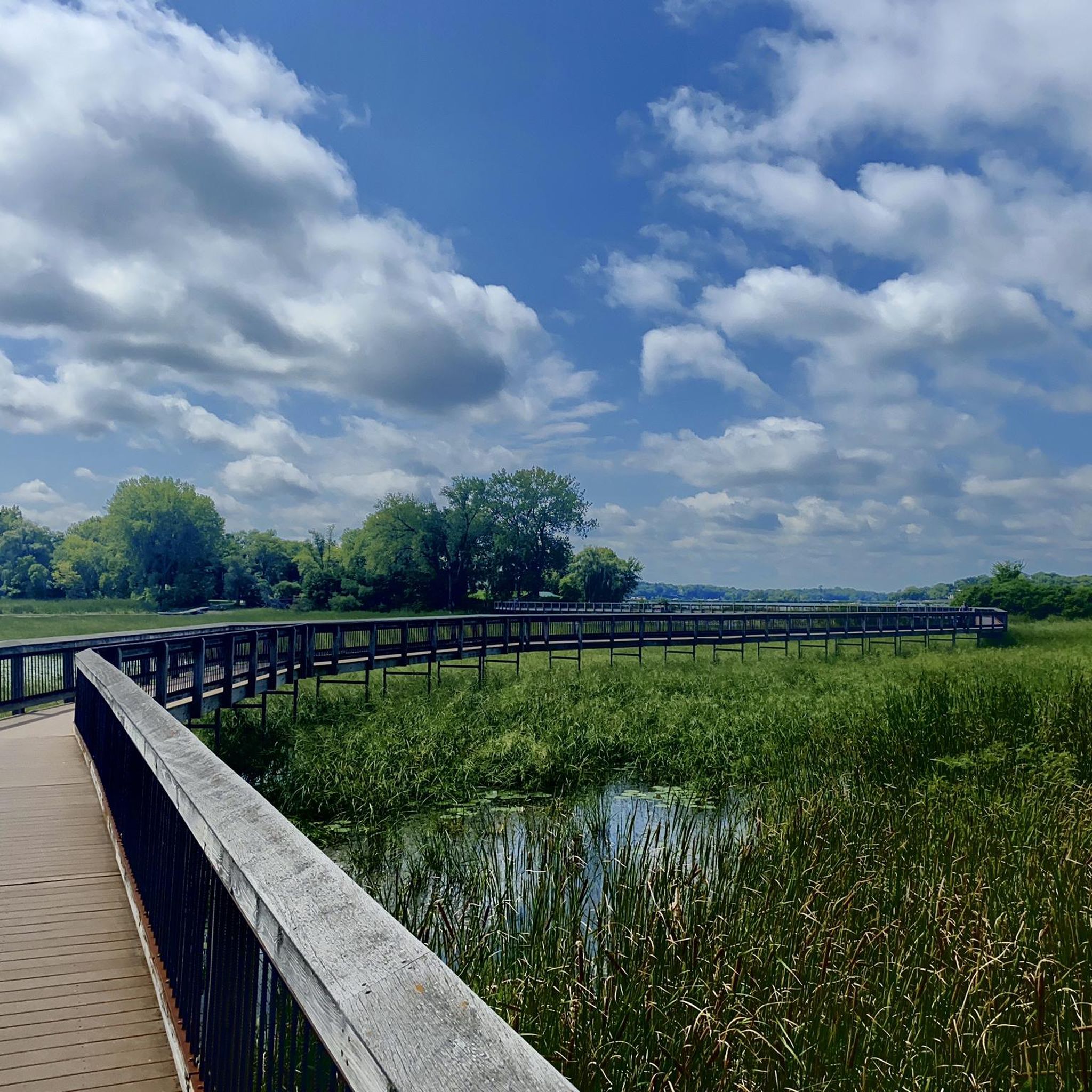
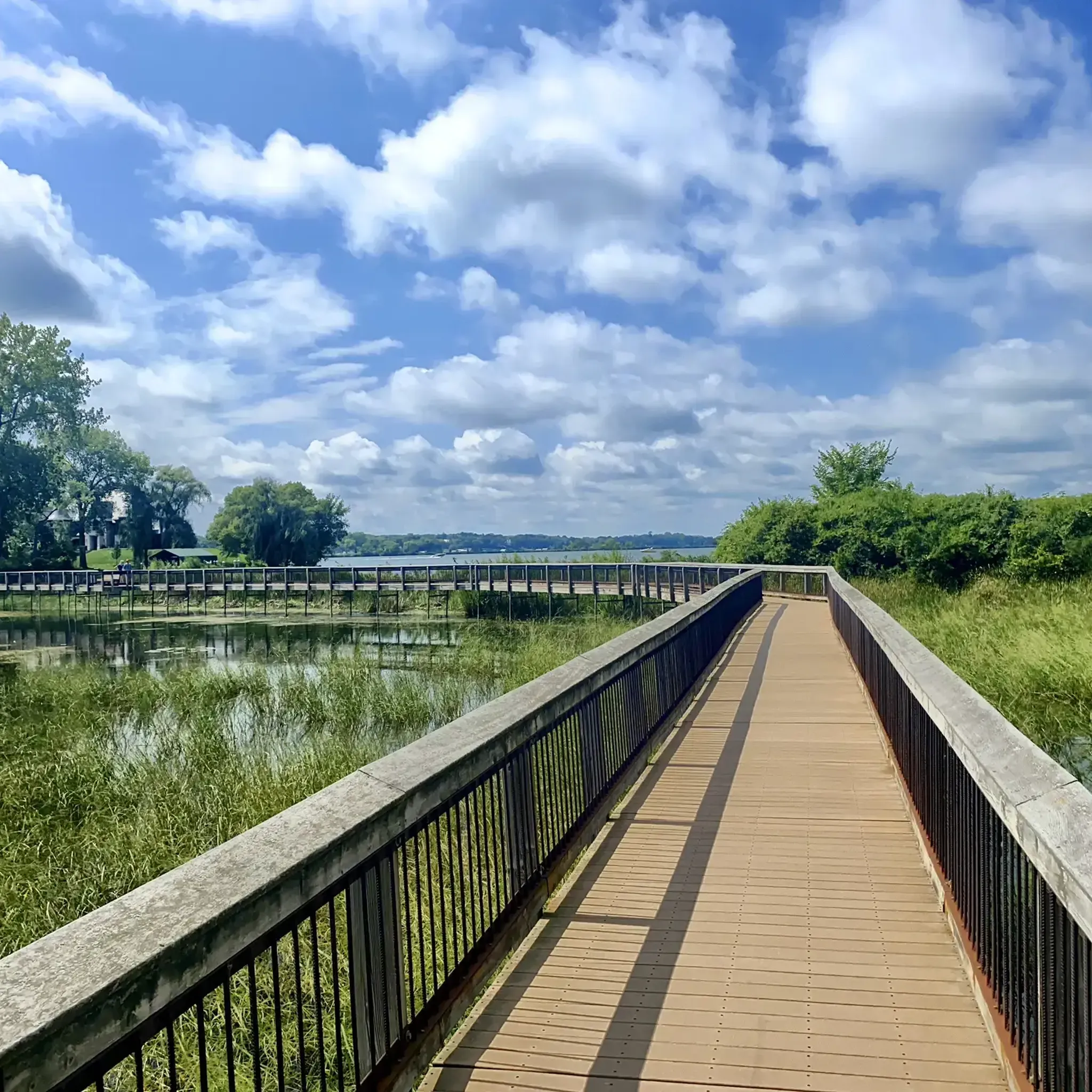
This lengthy boardwalk on the Medicine Regional Trail, which crosses a marsh along Elm Creek, has been under reconstruction for several months. According to a local in the neighborhood with whom we visited, the project's completion is delayed because a necessary component for the reconstruction is unavailable. Today, we backtracked 1,500 feet north to a paved trail that connected to neighborhood roads, bringing us back to the Medicine Lake Regional Trail.
0
0

Getting near Elm Creek park as you get to this bridge.
0
0
This is the only sign of it's type I have ever seen, when they built this bridge to get over 610/81 it gets near the power lines, and apparently you can feel weird as you go under them. They say it's safe, it's just magnetic force.
0
0
A nice regional trail that tucks in and out of the woods
0
0
The Wayzata Railroad Depot has a rich and contentious history. The first train arrived in Wayzata in 1867, when the town was considered the "end of the road." The original depot was located about a block east of the current depot. As the railroad expanded westward, more tracks were laid between Lake Minnetonka and Main Street in Wayzata. This decision led to protests from citizens due to issues such as noise, cinders, sparks, and the feeling of being cut off from the lake. Residents demanded that the railroad owner, James J. Hill, relocate the tracks further north, away from the lakeshore. Hill refused, resulting in the town filing a lawsuit. In 1881, the Minnesota Supreme Court ruled that Hill was trespassing on village property. Known for his stubborn and powerful nature, Hill was infuriated. Instead of moving the tracks north, he tore down the existing Wayzata depot and built a new, smaller depot a mile east of town. This action effectively made Wayzata "off the map" for rail service, forcing residents to walk a mile through marshy terrain to catch a train. Hill famously declared that Wayzata residents could "walk a mile for the next twenty years." Eventually, the city of Wayzata reconciled with Hill. As part of this agreement, Hill commissioned the construction of the current magnificent Wayzata Depot in 1906. This new depot was built in a more convenient location, closer to the downtown business district and on the shores of Lake Minnetonka, officially putting Wayzata "back on the map." The tracks were never moved, and trains still operate between the lakeshore and the town of Wayzata.
0
0

Clifton E. French Regional Park provides a wide range of activities, including playgrounds, a visitor center, swimming beach, fishing pier, and illuminated trails. The north shore of Medicine Lake is the most popular area, attracting people who enjoy swimming in the water and relaxing on the beach.
0
0

THis 12-acre park along the shore of Medicine Lake is a good spot to have a water or snack break during your ride. There's a playground for the kids too, if you are out on a family ride.
0
0
Frequently Asked Questions
How many touring cycling routes are available around Plymouth?
There are over 25 touring cycling routes available around Plymouth, catering to various skill levels. You'll find a good mix of easy and moderate trails to explore the diverse landscapes.
What kind of terrain can I expect on touring cycling routes near Plymouth?
Plymouth offers a diverse range of terrain for touring cyclists. You can expect stunning coastal routes along the English Channel, peaceful woodland trails, and scenic river valleys. The area also provides access to the edge of Dartmoor National Park for more challenging rides. Elevations vary from sea level to over 269 meters, ensuring options for all preferences.
Are there routes suitable for beginners or families cycling in Plymouth?
Yes, Plymouth has several easy routes perfect for beginners and families. The West Medicine Lake Park Beach – Boardwalk loop from Cornerstone Commons offers a pleasant ride through parkland with water views. The Plym Valley Trail is another gentler option, and Plymouth's Waterfront Route is easy and suitable for all ages, taking you past iconic sights like Plymouth Hoe and Smeaton's Tower.
What do other cyclists say about the touring routes in Plymouth?
The touring cycling routes around Plymouth are highly rated by the komoot community, with an average score of 4.5 stars from over 50 reviews. More than 300 touring cyclists have used komoot to explore the varied terrain, often praising the scenic coastal paths, river valleys, and woodlands.
What are some notable landmarks or scenic spots I can see while cycling in Plymouth?
While cycling in Plymouth, you can enjoy panoramic views of Plymouth Sound National Marine Park from Plymouth Hoe, see landmarks like Smeaton's Tower, and explore the historic Barbican and Royal William Yard. Inland, Plymbridge Woods offers picturesque woodland cycling, and you can find highlights like West Medicine Lake Park Beach and Luce Line Trail Wooden Bridge along various routes.
Are there any long-distance touring cycling routes accessible from Plymouth?
Yes, Plymouth is situated on National Cycle Network routes 2 and 27. Route 2, the Southern Coastal route, connects Cornwall to Dover, while Route 27, the Devon Coast to Coast Cycle Route, spans 99 miles from Ilfracombe to Plymouth. Drake's Trail, a spectacular 21.3-mile route, also links Plymouth with Tavistock, offering a longer ride through diverse scenery.
Can I find circular touring cycling routes in the Plymouth area?
Absolutely. Many routes in Plymouth are designed as loops, allowing you to start and finish at the same point. Examples include the Hardin Park – Bederwood Park loop from Hennepin County, which navigates through local parks, and the Hardin Park – Ox Yoke Inn loop from Long Lake, leading through varied parkland and suburban landscapes.
What are the highlights of the Plym Valley Trail for touring cyclists?
The Plym Valley Trail offers a gentler cycling experience, winding through extensive parkland, woodlands, and riverside paths along the River Plym. Cyclists can enjoy views of viaducts and quarry faces, making it a picturesque and accessible option for many.
Is Plymouth well-connected for cyclists using public transport?
Plymouth's extensive cycle network and position on major National Cycle Network routes make it accessible. While specific public transport options for bikes vary, the city's infrastructure is designed to be cycle-friendly, and many routes are easily reachable from urban centers. For detailed information on public transport with bikes, it's best to check local transport provider websites.
Are there any dog-friendly cycling routes in Plymouth?
Many of Plymouth's trails, particularly those through woodlands and along river paths like parts of the Plym Valley, are suitable for cycling with dogs, provided they are well-behaved and kept under control. Always check specific trail regulations regarding dogs before you go, especially in nature reserves or protected areas.
What is the best time of year to go touring cycling in Plymouth?
The best time to go touring cycling in Plymouth is generally from spring through early autumn (April to October). During these months, the weather is milder and more predictable, making coastal rides and woodland trails more enjoyable. Summer offers longer daylight hours, but spring and autumn provide pleasant temperatures and beautiful scenery without the peak crowds.
Where can I find cafes or pubs along the cycling routes in Plymouth?
Plymouth's urban and semi-urban routes, such as those around the Barbican, Royal William Yard, and near the city center, offer numerous cafes, pubs, and restaurants. Even on trails like Drake's Trail, you'll find villages and towns along the way with refreshment stops. For specific recommendations, exploring the local area around your chosen route is best, or checking resources like Visit Plymouth's cycling guides can provide more details.
Are there any routes that offer a mix of urban and natural scenery?
Yes, many routes in Plymouth beautifully blend urban and natural scenery. The Waterfront Route, for example, takes you through the city's historic waterfront and past iconic landmarks before transitioning to more open coastal views. Similarly, routes that start in the city quickly lead into areas like Plymbridge Woods or towards the Tamar Valley, offering a diverse cycling experience.
Most popular routes around Plymouth
Most popular attractions around Plymouth

Get inspired with the komoot mobile app


Explore more
Browse the best Cycling routes in other regions.
