The best walks and hikes around Ellisville
4.8
(38)
626
hikers
59
hikes
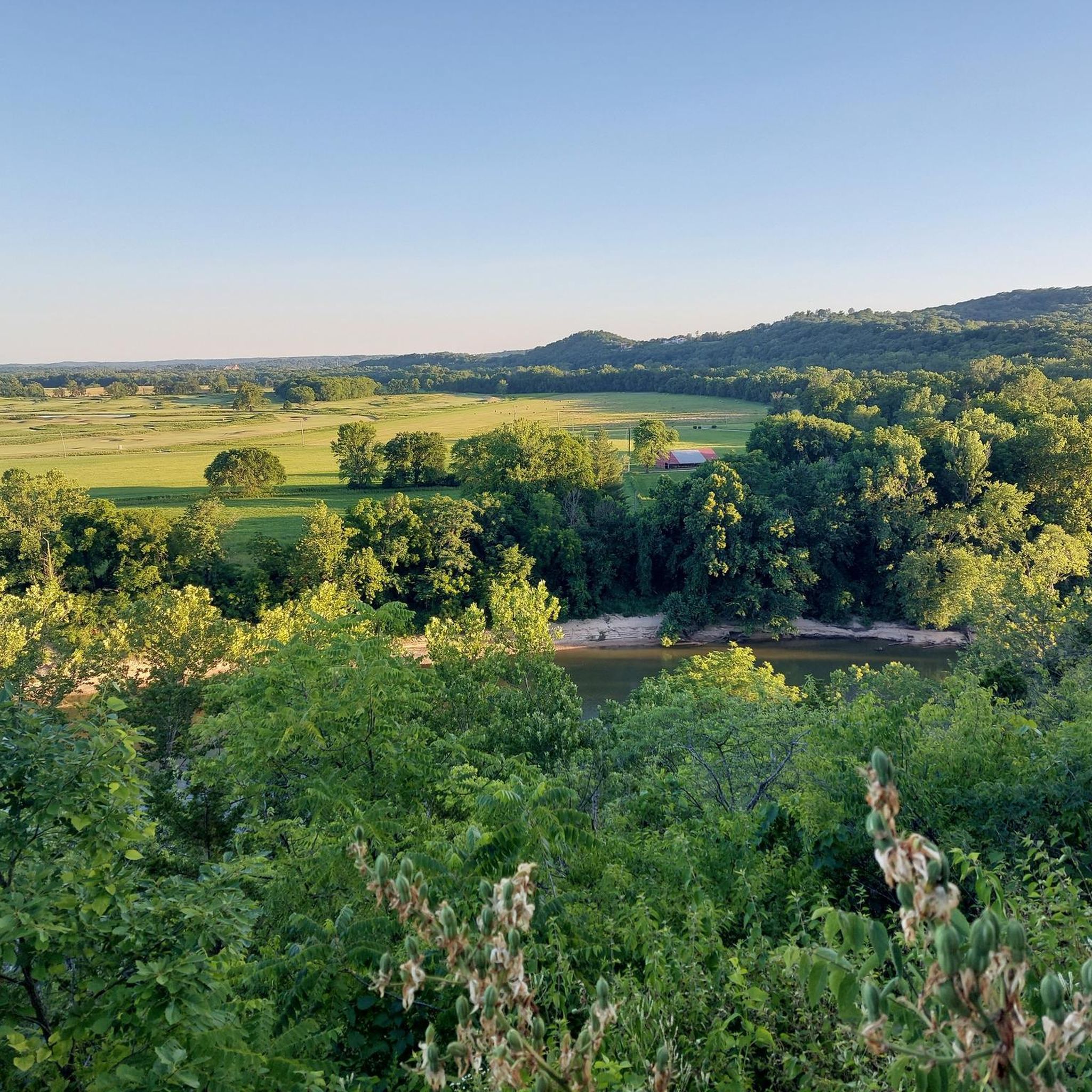
Hiking around Ellisville, Missouri, features a landscape characterized by river bluffs, wooded areas, and established greenways. The terrain includes varied elevation changes, from gentle paths along waterways to moderate climbs offering scenic overlooks. These natural features provide diverse environments for outdoor activities within state parks like Castlewood State Park and Sherman Beach Park. The region's forests, valleys, and river systems create a rich setting for outdoor exploration.
Best hiking trails around Ellisville
- The most popular hiking route is Bluff View…
Last updated: October 10, 2026
4.3
(4)
16
hikers
5.29km
01:30
110m
130m
Hike the easy 3.3-mile Bluff View Trail in Bluff View Park, featuring a panoramic overlook of the Meramec River and varied forest terrain.
10
hikers
7.16km
01:56
90m
90m
Step into the intriguing world of the Zombie Trail via Upper Rock Hollow Greenway, an easy 4.4-mile (7.2 km) hike that winds through dense, natural-surface singletrack. You'll navigate through lush…

1
hikers
3.13km
00:51
40m
40m
The Wildwood Community Park Trail in Wildwood, Missouri, is a delightful, easy loop that offers a surprising amount of variety for its length. This 1.9-mile (3.1 km) hike, which takes…
1.98km
00:32
30m
30m
The Bluebird Park Trail in Ellisville, Missouri, offers a delightful, easy hike through lush greenery and diverse natural landscapes. As you walk, you'll encounter a mix of paved and asphalt…
4.3
(3)
28
hikers
7.34km
01:59
100m
100m
Hike the easy 4.6-mile Bluff View Trail Loop in Sherman Beach Park, gaining 335 feet with panoramic views of the Meramec River.
Get access to more routes and recommendations from other explorers.
Already have an account?
Our route recommendations are based on thousands of hikes, rides, and runs completed by other people on komoot.
Start today with a free account
Your next adventure awaits.


Tips from the Community

Nice stopping point along the trail. There are a few benches on the side and a stream that passes in from.
0
0

This is a beautiful lookout and great place to catch your breath on the Bluff View Trail. The trail is known for its scenic viewpoints, and this is probably the best of the bunch.
1
0

Scenic spot to stop on your climb to take in the views of the Meramec River and the Crescent Valley before continuing to the top and enjoying the fun downhill run back to the bottom.
0
0

The Bluff View Trail gets its name from having a few different clifftop overlooks. This one is just off the side of the trail and is not too close to the cliff's edge. There is another overlook down a longer spur trail that basically dead ends at a shear cliff edge.
0
0

Found two anchors in a crag above small cave-like overhang, you can follow the same trail around and up to get to the top.
0
0
Frequently Asked Questions
What kind of terrain can I expect on hikes around Ellisville?
Hiking around Ellisville features a diverse landscape characterized by river bluffs, dense wooded areas, and established greenways. You'll encounter varied elevation changes, ranging from gentle paths along waterways to moderate climbs that offer scenic overlooks, particularly within areas like Castlewood State Park and Sherman Beach Park.
Are there family-friendly hiking options in Ellisville?
Yes, Ellisville offers several family-friendly hiking options. Many trails are rated as easy, providing accessible experiences for all ages. For example, the Grotpeter Trail loop in Castlewood State Park is an easy 4.4-mile (7.1 km) path suitable for families.
Can I bring my dog on trails in Ellisville?
Many trails in Ellisville's parks, including Castlewood State Park and Sherman Beach Park, are dog-friendly. However, it's always recommended to keep your dog on a leash and check specific park regulations before your visit to ensure a pleasant experience for everyone.
Are there any circular hiking trails in Ellisville?
Yes, Ellisville has several excellent circular hiking trails. A popular choice is the Bluff View Trail loop via Rock Hollow Greenway in Sherman Beach Park, which is 4.6 miles (7.3 km) long and offers scenic bluff views. Another option is the Zombie Trail loop, also in Sherman Beach Park, which is a longer 9.4-mile (15.1 km) route.
What natural features or landmarks can I see while hiking near Ellisville?
While hiking near Ellisville, you can explore various natural features and landmarks. Notable spots include the scenic Lone Wolf Trail viewpoint, and expansive forested areas like Greensfelder Park, Forest 44 Conservation Area, and Rockwoods Reservation Conservation Area. These areas provide opportunities to experience the region's natural beauty.
When is the best time of year to go hiking in Ellisville?
The best time to hike in Ellisville is typically during the spring and fall months. Spring brings lush greenery and blooming wildflowers, while fall offers vibrant foliage. Summer can be warm and humid, so early mornings or late afternoons are preferable. Winter hiking is also possible, though some trails may be icy or muddy.
Where can I find parking for hiking trails in Ellisville?
Most major hiking areas in Ellisville, such as Castlewood State Park and Sherman Beach Park, provide designated parking lots at their trailheads. It's advisable to check the specific park's website or signage upon arrival for parking availability and any potential fees.
What is the typical length and duration of hikes in Ellisville?
Hikes in Ellisville vary in length and duration. Many easy trails are around 4-5 miles (6-8 km) and can be completed in 1.5 to 2.5 hours. Longer, moderate trails, like the Zombie Trail loop, can extend up to 9.4 miles (15.1 km) and take around 4 hours to complete.
What do other hikers say about the trails in Ellisville?
The hiking trails in Ellisville are highly rated by the komoot community, with an average score of 4.7 stars from over 20 reviews. Hikers often praise the well-maintained paths, scenic river bluff views, and the diverse natural environments found within parks like Castlewood State Park and Sherman Beach Park.
How many hiking trails are available around Ellisville?
There are over 45 hiking trails available around Ellisville, offering a wide range of options for different skill levels and preferences. This includes 30 easy routes and 16 moderate routes, ensuring there's a trail for almost everyone.
Are there any accessible trails for wheelchairs or strollers in Ellisville?
While many trails in Ellisville feature natural surfaces and varied terrain, some greenways and paved sections within parks may offer better accessibility for wheelchairs or strollers. It's best to check specific park information for details on paved or universally accessible paths.
Which parks offer hiking trails in Ellisville?
The primary parks offering extensive hiking trails in Ellisville are Castlewood State Park and Sherman Beach Park. These parks are known for their river bluffs, wooded areas, and a network of trails suitable for various hiking experiences.
Most popular attractions around Ellisville

Get inspired with the komoot mobile app


Explore more
Browse the best Hikes in other regions.
