The best walks and hikes around Edt bei Lambach
4.5
(1328)
10,051
hikers
16
hikes
Hiking around Edt bei Lambach offers a diverse landscape characterized by the confluence of the Traun and Alm rivers, providing numerous riverside paths. The terrain generally features gentle elevations, making many routes accessible for various fitness levels. Woodlands and open fields are common, with some trails leading to scenic viewpoints over the surrounding countryside. The region's geography supports a network of trails suitable for both leisurely walks and longer excursions.
Best hiking trails around Edt bei Lambach
- The most popular…
Last updated: October 8, 2026
4.3
(6)
25
hikers
12.1km
03:08
60m
60m
Moderate hike. Good fitness required. Easily-accessible paths. Suitable for all skill levels.
4.0
(1)
5
hikers
20.1km
05:15
150m
150m
Hard hike. Very good fitness required. Easily-accessible paths. Suitable for all skill levels.

3.0
(1)
8
hikers
Easy hike. Great for any fitness level. Easily-accessible paths. Suitable for all skill levels.
4.0
(2)
10
hikers
Easy hike. Great for any fitness level. Easily-accessible paths. Suitable for all skill levels.
5.0
(1)
5
hikers
9.19km
02:31
140m
140m
Moderate hike. Good fitness required. Easily-accessible paths. Suitable for all skill levels.
Get access to more routes and recommendations from other explorers.
Already have an account?
Our route recommendations are based on thousands of hikes, rides, and runs completed by other people on komoot.
Start today with a free account
Your next adventure awaits.
Tips from the Community

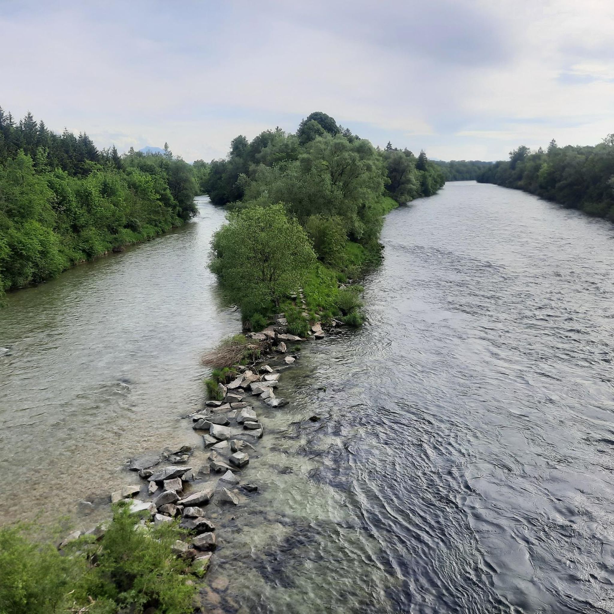
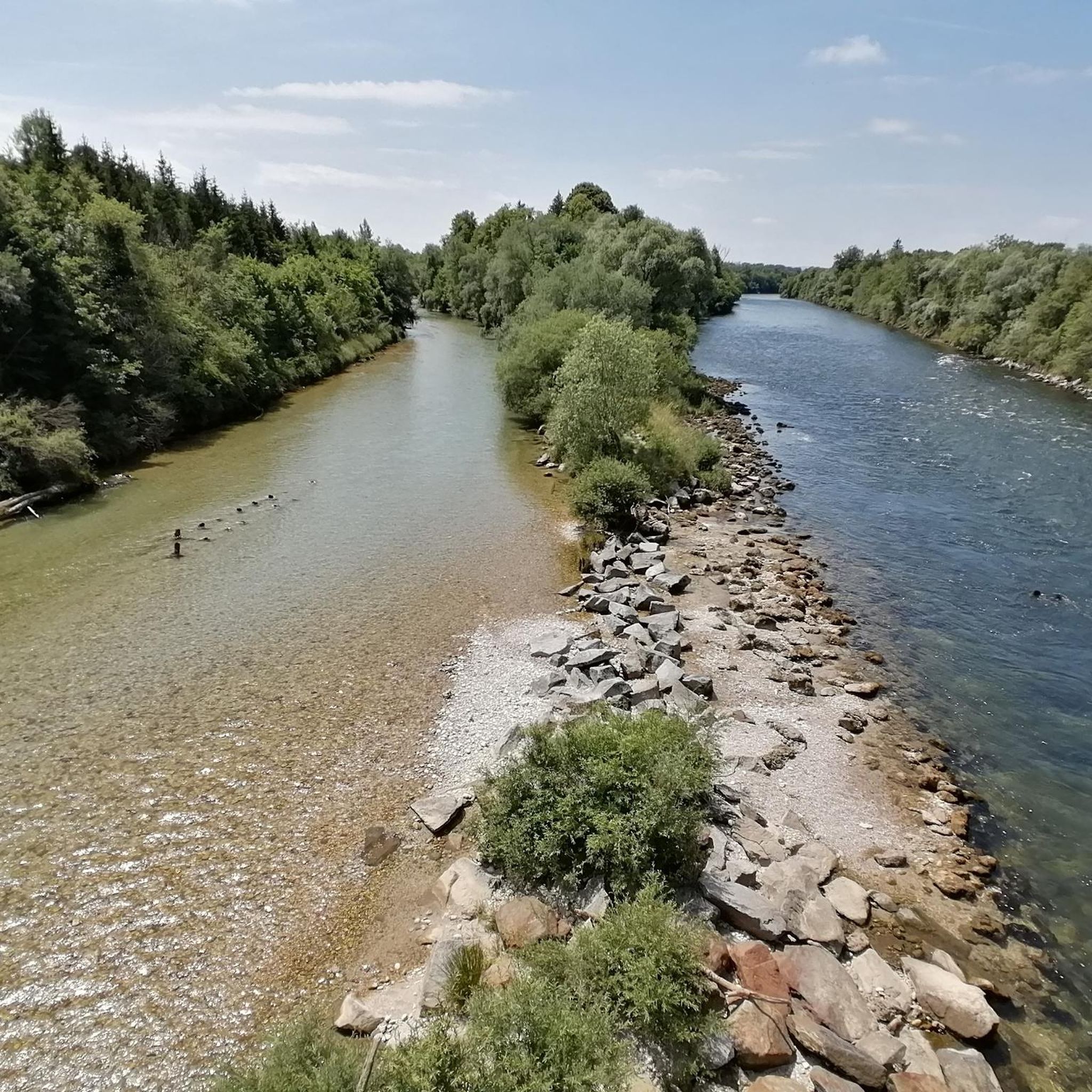
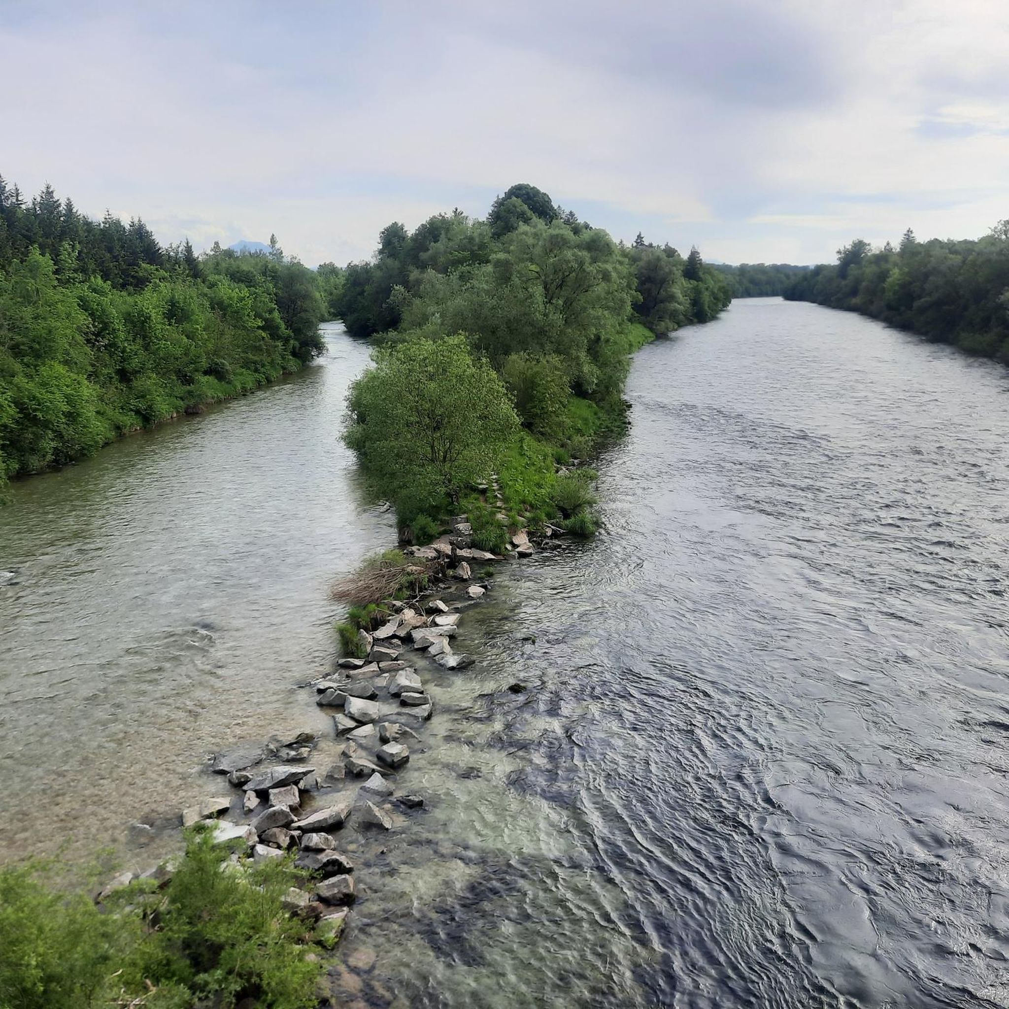
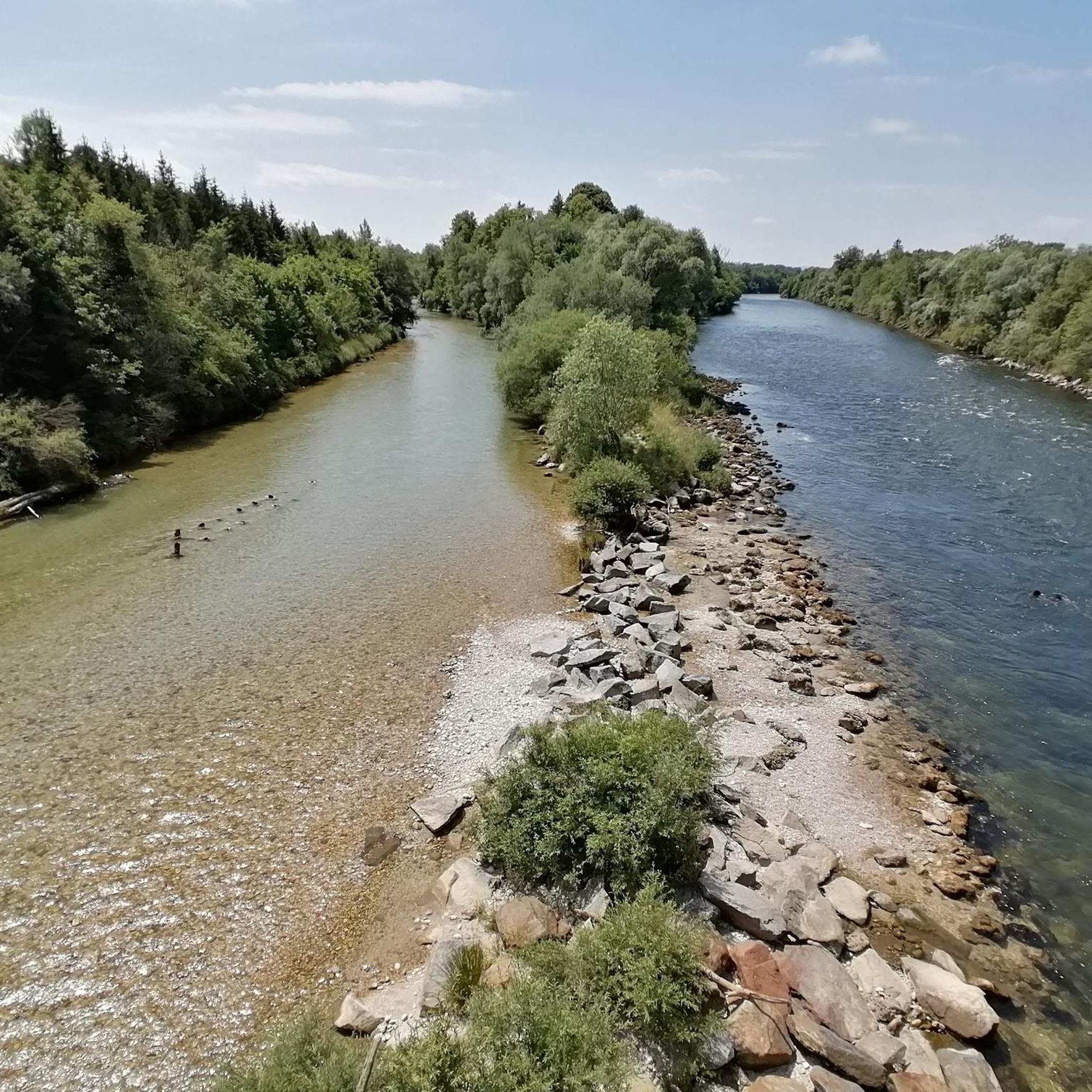
Regardless of the water level, the different coloring of the two rivers is clearly visible here - the Alm, as a significantly shorter mountain river, is usually significantly clearer and thus brighter than the Traun, which has already flowed through 2 large lakes
0
0

Halfway point of the Krailbergrunde, good rest stop
1
0

The highest point in the Wels-Land district is on the Steindlberg at 513m. That's 9m higher than the famous Krailberg.
1
0
Coming from the south (vineyard), enter the forest, then turn left (do not go around the forest to the southwest, it will be difficult there), from the north (staffel) there are 2 steeper paths leading up, we used the left one around the outside, at the top it is then comfortably flat in the forest to the summit cross
1
0


Very nice view from the bridge, worth a short stop to capture the great impressions. The Alm is the outflow of the Almsee north of the Totes Gebirge and flows through the Almtal towards the north. It flows through Grünau in the Almtal, passes Scharnstein, Pettenbach, later Vorchdorf, Steinerkirchen an der Traun and Bad Wimsbach-Neydharting and flows into the Traun in the municipality of Fischlham.
4
1

The Bad Wimsbach Neydharting parish church is a Roman Catholic church dedicated to Saint Stephen. It belongs to the Gmunden deanery in the diocese of Linz. The Patronage is celebrated every year on the 3rd Sunday in August. The church was built in the 15th century and renovated in Baroque style in the 18th century. It has a Gothic choir, a Baroque high altar, a pulpit from 1720 and an organ from 1891
6
0
Wirt in Klaus is a restaurant in Edt bei Lambach, Upper Austria, Austria. It offers traditional cuisine, a beautiful garden, a playground, homemade desserts, cozy atmosphere, homemade cider, homemade food and eggs from free-range chickens. It is just 2 km from Lambach Monastery. If you are looking for a place where you can enjoy a delicious meal and a relaxing time, Wirt in Klaus could be a good option for you. 😊
1
0
Frequently Asked Questions
How many hiking trails are available around Edt bei Lambach?
There are 17 hiking trails around Edt bei Lambach, offering a variety of experiences. This includes 12 easy routes, 4 moderate routes, and 1 difficult route, catering to different fitness levels.
Are there easy hiking trails suitable for beginners in Edt bei Lambach?
Yes, Edt bei Lambach offers several easy hiking trails perfect for beginners or those looking for a relaxed walk. A good option is the Picnic Area by the Traun loop from Edt bei Lambach, which is 4.4 miles (7.2 km) long and takes about 1 hour 49 minutes, featuring pleasant riverside areas.
What kind of terrain can I expect on the hiking trails in Edt bei Lambach?
The terrain around Edt bei Lambach is characterized by gentle elevations and features numerous riverside paths along the Traun and Alm rivers. You'll find a mix of woodlands and open fields, with some trails leading to scenic viewpoints over the surrounding countryside.
Are there family-friendly hiking options in Edt bei Lambach?
Many of the trails in Edt bei Lambach are suitable for families, especially the easier routes with gentle terrain and riverside sections. The Alm Footbridge loop from Edt bei Lambach is an easy 4.2-mile (6.8 km) route that offers a pleasant walk along the river, ideal for a family outing.
Are dogs allowed on the hiking trails in Edt bei Lambach?
Generally, dogs are welcome on the hiking trails in Edt bei Lambach. However, it's always recommended to keep them on a leash, especially in nature protection areas, near livestock, or in crowded sections, to ensure a safe and enjoyable experience for everyone.
What is the best time of year to go hiking in Edt bei Lambach?
The best time to hike in Edt bei Lambach is typically from spring through autumn. During these seasons, the weather is mild, and the riverside paths and open fields are particularly inviting. While some trails may be accessible in winter, conditions can vary, so checking local weather is advisable.
What do other hikers enjoy the most about hiking in Edt bei Lambach?
The komoot community highly rates the hiking experience in Edt bei Lambach, with an average score of 4.5 stars from over 800 reviews. Hikers often praise the diverse landscape, particularly the scenic riverside paths along the Traun and Alm, and the accessibility of routes for various skill levels.
Are there any circular hiking routes in Edt bei Lambach?
Yes, many of the trails around Edt bei Lambach are designed as circular routes, allowing you to start and end at the same point. An example is the Lambach Power Plant – Alm Footbridge loop from Edt bei Lambach, a moderate 7.5-mile (12.1 km) trail.
What interesting landmarks or attractions can I see near the hiking trails?
While hiking, you can explore several interesting landmarks. Notable attractions include the historic Lambach Abbey, or the unique Klangstamm on the Haager Lies Cycle Path. For panoramic views, consider routes that pass near the Krailberg Summit Cross (504 m).
Is parking available at the trailheads in Edt bei Lambach?
While specific parking details for each trailhead are not always listed, Edt bei Lambach is generally accessible by car, and you can often find parking in or near the starting points of popular routes. It's advisable to check local signage or use navigation apps for precise parking locations.
Can I reach hiking trails in Edt bei Lambach using public transport?
Edt bei Lambach is connected by public transport, primarily buses, which can provide access to the general area. For specific trailheads, you might need to combine public transport with a short walk or taxi ride. Checking local bus schedules and routes in advance is recommended.
Are there any challenging hikes for experienced hikers?
Yes, for experienced hikers seeking a challenge, there is at least one difficult route available. The Riverside Beach on the Alm – Alm Footbridge loop from Edt bei Lambach is a demanding 12.5-mile (20.1 km) path that explores the Alm riverbanks with varied scenery, offering a longer and more strenuous experience.
Most popular routes around Edt bei Lambach
Most popular attractions around Edt bei Lambach

Get inspired with the komoot mobile app


Explore more
Browse the best Hikes in other regions.
