The best walks and hikes around Logan Creek
4.6
(36)
407
hikers
29
hikes
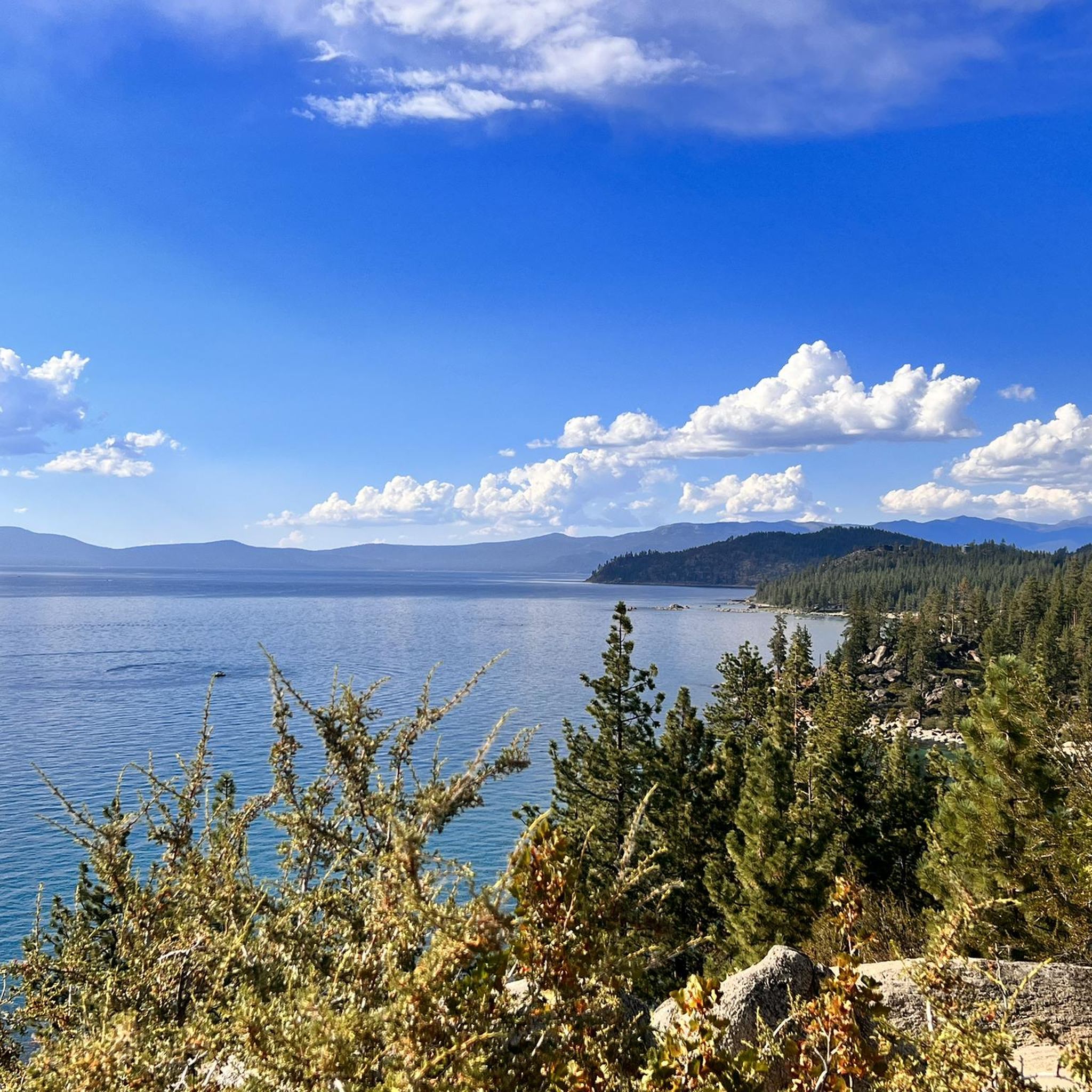
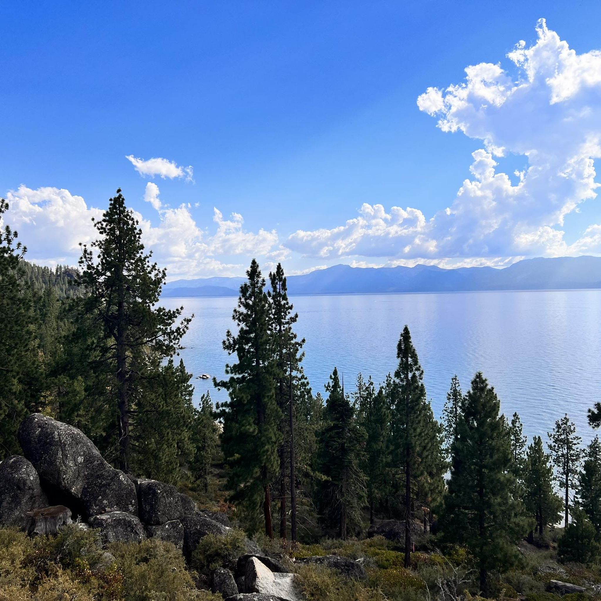
Hiking around Logan Creek is defined by lakeside paths, forested trails, and ascents to notable viewpoints overlooking Lake Tahoe. The region's geography includes varied terrain within state parks, offering both easy loops and more demanding routes. Hikers can explore paths with minimal elevation change or undertake trails with significant climbs. The trail network provides a range of options for different abilities.
Best hiking trails around Logan Creek
- The most popular hiking route is Spooner Lake Trail, a 2.7 miles (4.3 km) trail that takes 1 hour 9 minutes to complete. This easy route features minimal elevation change, suitable for a wide range of abilities.
- Another top favourite among local hikers is Tahoe Rim Trail: Spooner Summit to Snow Valley Peak, a moderate 6.1 miles (9.8 km) path. This trail involves ascents to viewpoints with expansive vistas.
- Local hikers also love the Tahoe Rim Trail: Spooner Summit to South Camp Peak, a 7.0 miles (11.2 km) trail leading through Lake Tahoe Nevada State Park, often completed in about 3 hours 23 minutes.
- Hiking around Logan Creek is defined by lakeside trails, forested paths within state parks, and routes with views over Lake Tahoe. The trail system includes both easy, flat loops and more challenging routes with considerable elevation.
- The routes in Logan Creek are highly rated by the komoot community with an average score of 4.5 stars from more than 35 reviews. More than 400 hikers have used komoot to explore Logan Creek's varied terrain.
Last updated: July 9, 2026
5.0
(6)
93
hikers
4.34km
01:09
40m
50m
The Spooner Lake Trail offers a wonderfully accessible and scenic escape into the Lake Tahoe Nevada State Park. This easy 2.7-mile (4.3 km) loop takes you around the tranquil Spooner Lake, with a barely noticeable 137 feet (42 metres) of elevation gain, typically completed in just over an hour. You'll wander through fragrant pine forests and groves of aspens, enjoying continuous views of the lake, especially vibrant with wildflowers in spring or golden leaves in autumn. It's a perfect, gentle hike for all ages and fitness levels.
Planning your visit is straightforward, but remember there's an entrance fee to the state park. Dogs are welcome on the trail, provided they are on a leash. Beyond hiking, the lake is a popular spot for picnicking and fishing, though a Nevada fishing license is required for anglers. Spring and fall are particularly beautiful times to experience the trail, offering distinct seasonal charms.
More than just a simple loop, Spooner Lake Trail is a significant access point to a broader network of trails within the Lake Tahoe Basin. It connects to more challenging routes like sections of the Tahoe Rim Trail and the renowned Flume Trail, making it a versatile starting point for various adventures. Keep an eye out for local wildlife, including deer and various bird species, and learn about the area's natural history from informational signs along the path.
5.0
(1)
3
hikers
9.78km
03:04
620m
20m
Embark on a rewarding journey along the Tahoe Rim Trail from Spooner Summit to Snow Valley Peak, a moderate 6.1-mile (9.8 km) hike that delivers stunning vistas. You'll climb through fragrant Jeffrey Pine and Red Fir forests, with Lake Tahoe views gradually emerging as you ascend. The trail culminates at Snow Valley Peak, offering truly panoramic viewpoints of the entire Lake Tahoe basin, Marlette Lake, and the distant Sierra Crest.
This route involves a significant 2020 feet (616 metres) of elevation gain over approximately 3 hours and 4 minutes, so come prepared for a steady workout. Parking at the Spooner Summit trailhead can be limited, especially during peak season, so an early start is recommended. Remember to carry all your water, as there are no resupply points along the way.
Snow Valley Peak holds the distinction of being the highest point in Carson City, Nevada, making this a notable regional hike. While the summit views are spectacular, it does host a telecommunications site. This section of the Tahoe Rim Trail is popular for its challenging yet accessible nature, and dogs are permitted, making it a great option for a day out with your canine companion.

Sign up for free
2
hikers
11.2km
03:23
530m
140m
Embark on a moderate hike along the Tahoe Rim Trail, covering 7.0 miles (11.2 km) with a significant elevation gain of 1743 feet (531 metres). This route, estimated to take 3 hours and 22 minutes, leads you through diverse landscapes. You will pass through ancient aspen groves and forests of fir and Jeffrey Pine. As you ascend, the trail offers increasingly open views of Lake Tahoe. Reaching South Camp Peak rewards you with panoramic vistas, including a clear sight of Emerald Bay. You can also pause at "The Bench" for exceptional views along the way.
The Spooner Summit trailhead serves as your starting point, offering ample parking for visitors. Be aware that this area can become quite busy, especially during weekend peak times. You will find convenient amenities like vault toilets and picnic areas right at the trailhead. This section of the trail is known for being one of the drier stretches, so plan to carry enough water for your entire hike.
This segment of the Tahoe Rim Trail offers a rewarding experience within the Humboldt-Toiyabe National Forest. South Camp Peak itself provides a great spot for a break, featuring a rustic bench tucked among the rocks. The journey combines a solid workout with the natural beauty of the Lake Tahoe basin, making it a notable option for hikers seeking both challenge and scenic rewards.
1
hikers
5.15km
01:25
70m
100m
Embark on an easy hike along the Five Valleys Viewpoint via Clear Creek Trail, a route that transitions from dense forest into open sage country. As you ascend, look for interesting granite rock formations and, in autumn, the vibrant yellow of aspen groves. The highlight is the Five Valleys Viewpoint, offering expansive panoramic views across Jacks Valley, Carson Valley, Eagle Valley, Dayton Valley, and Stagecoach Valley. This pleasant journey covers 3.2 miles (5.2 km) with a gentle elevation gain of 231 feet (71 metres), typically taking around 1 hour and 24 minutes to complete.
Before you head out, know that this trail is part of a multi-use network, so you might share the path with mountain bikers and equestrians. While generally accessible, be prepared for potential mud if you visit in early spring or after heavy rains. Snow can also be present on the trail during certain times of the year. Your canine companions are welcome to join you, but please remember to keep them on a leash throughout your visit.
This trail offers a unique opportunity to experience a fascinating ecological transition, moving from dense forest into the high desert's open sage environment. It's a great way to appreciate the diverse landscapes of the Humboldt-Toiyabe National Forest. The route is particularly notable for its panoramic vista, providing a comprehensive look at five distinct valleys from a single vantage point. Consider this trail if you are seeking a relatively gentle outdoor experience with significant scenic rewards.
638m
00:13
20m
20m
Embark on the Cave Rock Overlook hike, a challenging 0.4 miles (0.6 km) route that climbs 81 feet (25 metres) in just 12 minutes. From the moment you step onto the trail, you are greeted with stunning views of Lake Tahoe's vibrant blue waters. As you ascend, you'll catch glimpses of the iconic volcanic Cave Rock formation itself, leading you towards a saddle that opens up to expansive vistas of the shoreline stretching both north and south, with the majestic Sierra Nevada Mountains in the distance. The final push involves a short scramble over granite outcroppings to reach the summit, rewarding you with sweeping panoramic views of the entire lake. This short but difficult hike offers a truly memorable experience for its length.
When planning your visit, be aware that parking at the trailhead is very limited, typically accommodating only about four to six vehicles. To ensure you find a spot and avoid crowds, consider visiting during off-peak hours. There are no restrooms, trash cans, or water sources available along the route, so come prepared with everything you need. It is highly recommended to wear stable shoes, especially if you intend to tackle the final scramble to the summit, as the terrain can be uneven.
This trail is notable for its unique geological features, particularly the volcanic Cave Rock formation, which adds a dramatic element to the landscape. The hike provides an excellent opportunity to experience the natural beauty of Lake Tahoe Nevada State Park, offering some of the most comprehensive views of the lake and surrounding mountains. Its short duration makes it an accessible option for those looking for a quick, impactful outdoor adventure with a significant reward at the top.
Get access to more routes and recommendations from other explorers.
Sign up for free
Already have an account?
Our route recommendations are based on thousands of hikes, rides, and runs completed by other people on komoot.
Start today with a free account
Your next adventure awaits.
Login or Signup
Tips from the Community

Both the TRT and Genoa Peak Road offer beautiful scenery and a chance to get deep into nature near Lake Tahoe. Genoa Peak Road takes you up to Genoa Peak, and crosses the Tahoe Rim Trail in several spots.
0
0


There are parking lots where you can pull over on either side of the summit. A historic marker on a large rock on the south side tells the story of how Spooner Summit played a role in 1800s mining history and served as a source of lumber for prospecting industries.
0
0

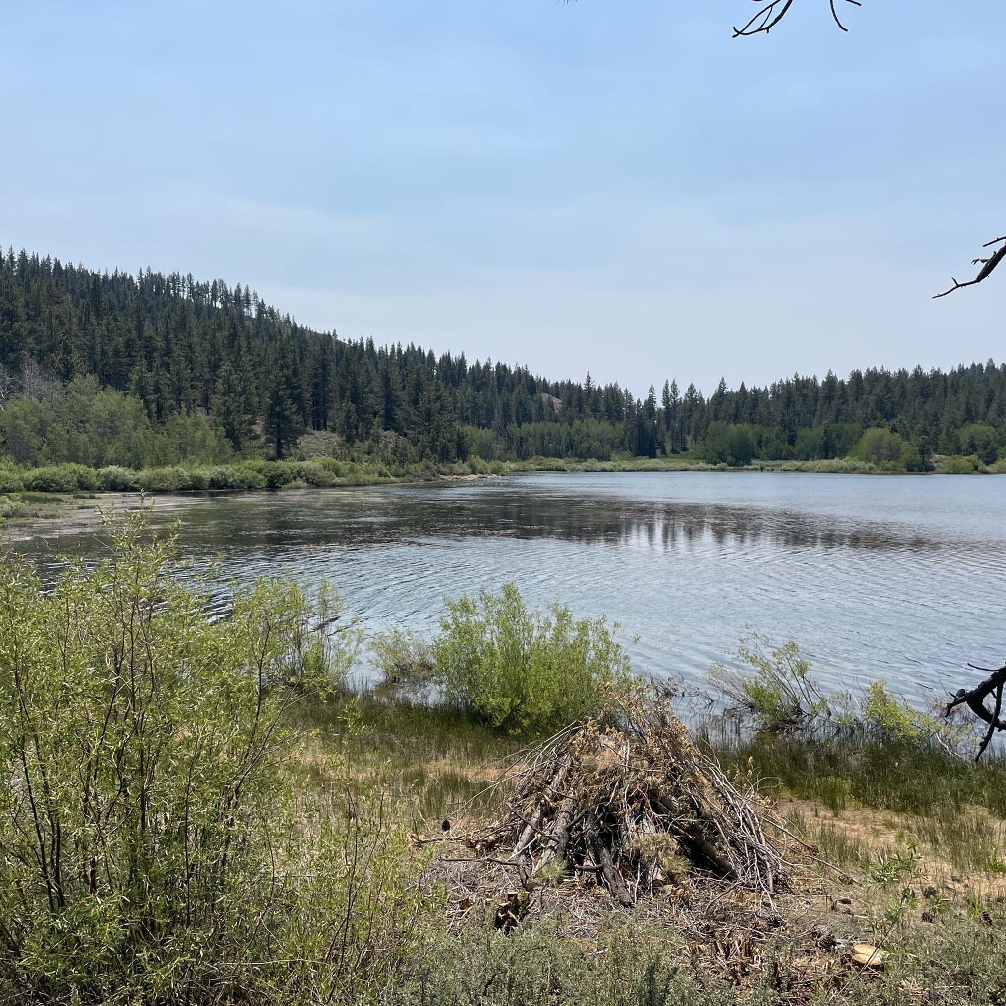
This is a pretty little lake, nestled in the heart of a dense poplar forest. A small quiet corner where it is good to take a break.
0
0
This is a pretty little lake, nestled in the heart of a dense poplar forest. A small quiet corner where it is good to take a break.
0
0

At "only" 7,146 feet in elevation Spooner Summit is much lower than its closest neighbor Mt Rose Summit, which is just a shade under 10,000 feet. From here you can cruise mostly downhill on Hwy 50 to South Lake Tahoe or Carson City. You can also turn on to Hwy 28 and ride along North Lake Tahoe to Incline Village, Kings Beach and the rest of the north shore.
1
0

Southwestern access to the trail system around Spooner Lake
1
0
Frequently Asked Questions
Are dogs allowed on the trails around Logan Creek?
Policies regarding dogs can vary between different parks and trails in the Logan Creek area. For instance, dogs are generally permitted on leash in many parts of Lake Tahoe Nevada State Park, but it's always best to check the specific regulations for the trail you plan to hike, as rules can change.
What are the trail conditions like in the Logan Creek area?
The trails around Logan Creek offer a mix of conditions. You'll find well-maintained lakeside paths, forested dirt trails, and some rocky sections on ascents to viewpoints. Routes like the Spooner Lake Trail – Spooner Lake loop from Glenbrook are generally flat and easy to navigate, while others involve more rugged terrain and elevation gain.
Are there any easy, family-friendly hikes available?
Yes, there are several easy hikes suitable for families. The area features 9 easy-rated trails. A great option is the Tahoe Rim Trailhead – Spooner Lake Trail loop from Spooner Summit, which is a relatively short and flat walk that's perfect for a casual outing with children.
How do I get to the trailheads and is there parking?
Most trailheads in the Logan Creek and Spooner Lake area are accessible by car. Major trailheads, such as those within Lake Tahoe Nevada State Park, typically have designated parking areas. Be aware that these lots can fill up quickly, especially on weekends, and some may require an entrance or parking fee.
What is the best time of year to hike around Logan Creek?
Summer and early fall are ideal for hiking around Logan Creek, offering pleasant weather and clear trails. Spring can also be beautiful, though some higher elevation paths may still have snow. Winter hiking is possible on some lower-elevation trails, but requires proper gear for snow and ice.
What kind of scenery can I expect on the trails?
The scenery is defined by the stunning landscape of the Lake Tahoe area. Hikers can expect beautiful views of the lake's clear blue water, trails that wind through pine and aspen forests, and ascents that lead to panoramic vistas of the surrounding Sierra Nevada mountains.
Are there any long-distance hiking options?
Yes, for those seeking a more challenging, full-day hike, the Marlette Lake Trail from Spooner Lake is an excellent choice. This 10.5-mile (16.9 km) route takes you deep into the state park and offers a rewarding experience for seasoned hikers.
What do other hikers think of the trails in Logan Creek?
The hiking routes in the area are highly regarded by the komoot community, with an average rating of 4.4 out of 5 stars. Reviewers frequently praise the breathtaking views of Lake Tahoe and the well-maintained trail network within the state parks.
How many hiking trails are there to choose from?
There are over 25 designated hiking routes to explore around Logan Creek. These range from easy lakeside loops to difficult mountain ascents, offering plenty of options for all skill levels.
Are there any circular or loop trails?
Yes, there are several loop trails available. For a moderate challenge with rewarding views, the Zephyr Cove loop is a popular 4.7-mile (7.6 km) circular route that provides great overlooks of the cove.
What should I pack for a day hike in this area?
For any hike, it's essential to bring plenty of water, especially at altitude. Also pack snacks, sunscreen, and a hat. Weather can change quickly, so wearing layers and carrying a light waterproof jacket is recommended. A map or a navigation app like komoot is also a good idea.
Most popular attractions around Logan Creek

Get inspired with the komoot mobile app


Explore more
Browse the best Hikes in other regions.
