The best road cycling routes around Sicklerville
4.0
(10)
136
riders
10
rides
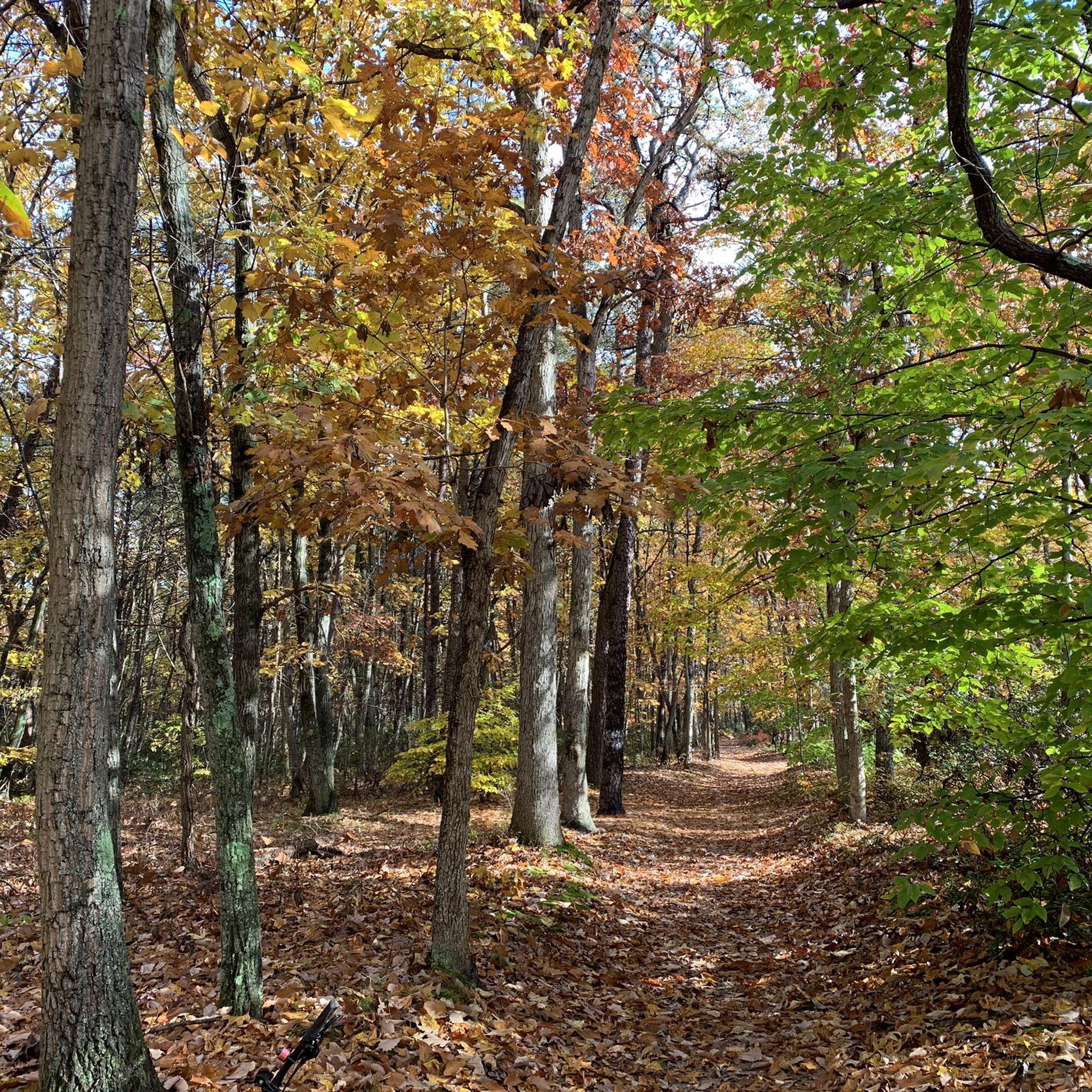
Road cycling routes around Sicklerville traverse a landscape characterized by pine and hardwood woodlands, particularly within the Pinelands National Reserve and Wharton State Forest. The region offers a mix of relatively flat, well-paved roads and routes with moderate elevation changes. Prominent natural features include Atsion Lake, which is integrated into several cycling paths. Additionally, former rail lines have been converted into paved multi-use trails, providing accessible cycling options.
Best road cycling routes around Sicklerville
- The most popular road cycling route is Atsion Lake – Atsion Lake loop from Braddock, a 28.8 miles (46.4 km) trail that takes 1 hour 50 minutes to complete. This easy route offers scenic views around Atsion Lake within Wharton State Forest.
- Another top favourite among local road cyclists is Roadbike loop from Williamstown, an easy 12.0 miles (19.3 km) path. This route features minimal elevation, making it suitable for various fitness levels.
- Local road cyclists also love the Roadbike loop from Pitman, a 35.9 miles (57.9 km) trail leading through varied terrain, often completed in about 2 hours 16 minutes.
- Road cycling around Sicklerville is defined by pine and hardwood woodlands, the Pinelands National Reserve, and converted rail-trails. The network offers options for different ability levels, from easy, flat rides to routes with more significant elevation.
- The routes in Sicklerville are highly rated by the komoot community with an average score of 4.2 stars from over 6 reviews. More than 100 road cyclists have used komoot to explore Sicklerville's varied terrain.
Last updated: July 12, 2026
3.0
(1)
17
riders
46.4km
01:50
90m
90m
Easy road ride. Great for any fitness level. Mostly well-paved surfaces and easy to ride.
4.0
(2)
28
riders
16.7km
00:39
30m
30m
Easy road ride. Great for any fitness level. Mostly well-paved surfaces and easy to ride.

Sign up for free
11
riders
57.9km
02:16
120m
120m
The Roadbike loop from Pitman offers a delightful spin through the rural landscapes of Pitman, New Jersey, providing a refreshing escape on two wheels. You'll pedal past local farmlands and through charming small towns, with the highlight being a stretch on First Avenue that's closed to motor traffic, ensuring a peaceful and safe ride. This route is perfect for those who appreciate a scenic, consistent pace over challenging climbs, allowing you to soak in the countryside atmosphere.
Planning your ride is simple, as the loop starts and finishes in downtown Pitman, at West Jersey Avenue and South Broadway, where you'll find convenient on-street parking. This 36.0-mile (57.9 km) road cycling route is rated moderate, with a gentle 400 feet (122 metres) of elevation gain, and typically takes around 2 hours and 15 minutes to complete. It's an accessible option for most road cyclists, and starting earlier in the day is always a good idea to enjoy the quiet roads.
This Pitman NJ road cycling loop is a fantastic way to experience the region's agricultural beauty and small-town charm without venturing too far from urban amenities. Its relatively flat profile makes it an excellent choice for building endurance or enjoying a relaxed long ride, distinguishing it from more strenuous routes. The dedicated car-free section adds a unique safety feature, enhancing the overall enjoyment of this local gem.
5.0
(2)
27
riders
19.3km
00:53
40m
40m
Easy road ride. Great for any fitness level. Mostly well-paved surfaces and easy to ride.
5.0
(1)
6
riders
75.4km
03:10
190m
190m
Embark on a journey through the heart of the Pine Barrens with the Red Trail – Atsion Lake loop from Lindenwold, a road cycling route that promises diverse scenery and a rewarding challenge. This moderate 46.8-mile (75.4 km) loop, with 615 feet (187 metres) of elevation gain, guides you past the tranquil Atsion Lake and through the distinctive pine-oak woodlands and cedar swamps of Wharton State Forest. Expect to spend around 3 hours and 9 minutes on this ride, navigating both well-paved roads and some unpaved segments that add an element of adventure.
Starting from Lindenwold, this route requires good fitness and bike handling skills, especially for the unpaved sections. While there are no specific warnings about permits or closures, it's always wise to check local conditions before heading out. Make sure your bike is equipped for varied surfaces and carry enough water and snacks for the duration of this substantial ride.
This loop offers a deeper dive into the historic Pinelands National Reserve, an area rich in natural and cultural heritage. The name Atsion itself has Lenni Lenape origins, referring to a cedar-colored stream, reflecting the unique ecosystem you'll encounter. Unlike the shorter, dedicated hiking trails around Atsion Lake, this 46.8-mile (75.4 km) cycling route provides a comprehensive exploration of the region's natural beauty and is a distinct, more demanding experience for road cyclists.
Get access to more routes and recommendations from other explorers.
Sign up for free
Already have an account?
Our route recommendations are based on thousands of hikes, rides, and runs completed by other people on komoot.
Start today with a free account
Your next adventure awaits.
Login or Signup
Popular around Sicklerville


Tips from the Community

This paved, six-mile trail connects the towns of Glassboro and Williamstown. It follows an old railbed from what used to be the Williamstown Railroad.
0
0

From this spot you get lovely views over the scenic Atsion Lake. This man-made lake is located in Wharton State Forest, in the Pine Barrens region of Atsion, New Jersey. The name "Atsion" originates from the Lenni Lenape Unami language, referring to the cedar-colored stream called Atsayunk or Atsiunc.
0
0

Atsion Lake is a man-made lake in Wharton State Forest, formed by a dammed portion of the Mullica River, covering close to 100 acres. It's a popular place for boating, fishing, swimming, and camping.
0
0

Atsion Lake is a man-made lake in Wharton State Forest, formed by a dammed portion of the Mullica River, covering close to 100 acres. It's a popular place for boating, fishing, swimming, and camping.
1
0
Frequently Asked Questions
What types of road cycling routes can I find around Sicklerville?
Sicklerville and its surroundings offer a diverse range of road cycling routes. You'll find everything from easy, well-paved paths with minimal elevation to more moderate rides with significant elevation changes, catering to various fitness levels. The region is characterized by pine and hardwood woodlands, particularly within the Pinelands National Reserve and Wharton State Forest, providing scenic backdrops.
Are there any easy road cycling routes suitable for beginners or families?
Yes, there are several easy options. The Roadbike loop from Williamstown is an easy 19.3 km (12 miles) path with minimal elevation, perfect for a relaxed ride. Another great choice is the Monroe Township Bikepath loop from Glassboro, which is 16.7 km (10.4 miles) and also rated easy. These routes are generally well-paved and suitable for families or those new to road cycling.
What are some scenic viewpoints or natural attractions along the road cycling routes?
Many routes offer scenic views, especially those traversing Wharton State Forest. The Atsion Lake – Atsion Lake loop from Braddock provides beautiful vistas around Atsion Lake. You can also explore highlights like the Black Run Preserve or the Ceres Park and Nature Preserve, which are nearby and offer natural beauty.
Are there any paved multi-use trails for cycling in the area?
Yes, the region features several paved multi-use trails, often converted from old rail lines. The Gloucester Township Health and Fitness Trail (formerly Blackwood Railroad Trail) is a notable example, providing a flat, easy surface. Additionally, a paved six-mile trail connects Glassboro and Williamstown, following an old railbed, offering another accessible option for cyclists.
What is the best time of year for road cycling around Sicklerville?
The best time for road cycling in South Jersey, including Sicklerville, is typically during spring and fall. These seasons offer pleasant temperatures and less humidity, making for more comfortable rides. Summer can be enjoyable, but be prepared for warmer weather, especially during midday. Winter cycling is possible but requires appropriate gear for colder conditions.
Are there any routes that feature Atsion Lake?
Absolutely. Atsion Lake, located within Wharton State Forest, is a prominent feature in several cycling routes. The Atsion Lake – Atsion Lake loop from Braddock is a popular 46.4 km (28.8 miles) route that circles the lake, offering scenic views and a relatively easy ride. Another option is the more challenging Red Trail – Atsion Lake loop from Lindenwold.
What is the typical elevation gain on road cycling routes in Sicklerville?
The elevation gain varies across routes. Many easy routes, like the Roadbike loop from Williamstown, feature minimal elevation. However, more moderate routes, such as the Roadbike loop from Pitman, can have more significant climbs, with around 120 meters (390 feet) of elevation gain over 57.9 km (36 miles), requiring good fitness.
Are there any specific regulations or permits needed for cycling in Wharton State Forest?
While general road cycling on paved roads within Wharton State Forest typically doesn't require special permits, it's always advisable to check the official New Jersey State Park Service website for the most current regulations, especially if you plan to venture onto unpaved trails or use specific recreation areas like Atsion Recreation Area, which may have fees or specific rules.
Where can I find parking for cycling routes around Atsion Lake?
For routes around Atsion Lake, parking is generally available at the Atsion Recreation Area within Wharton State Forest. This area provides access to the lake and surrounding trails. It's recommended to arrive early, especially on weekends or holidays, as parking can fill up during peak seasons.
What do other road cyclists enjoy most about road cycling in Sicklerville?
The road cycling routes around Sicklerville are highly rated by the komoot community, with an average score of 4.2 stars. Reviewers often praise the region's mix of quiet, well-paved roads, the scenic beauty of the Pinelands and Wharton State Forest, and the variety of routes available for different skill levels, from easy loops to more challenging rides.
Are there any longer, more challenging road cycling routes for experienced riders?
Yes, for experienced riders seeking a longer and more challenging ride, the Red Trail – Atsion Lake loop from Lindenwold is a moderate 75.4 km (46.8 miles) route with more significant elevation changes, requiring good fitness. The Roadbike loop from Pitman is another moderate option at 57.9 km (36 miles) that leads through varied terrain.
Can I find cafes or places to stop for refreshments along the cycling routes?
While many routes traverse natural areas, towns like Williamstown and Pitman, where some loops originate, offer cafes and pubs. It's a good idea to plan your route and check for amenities in advance, especially for longer rides, as options might be sparse in the more remote sections of the Pinelands or Wharton State Forest.
Most popular routes around Sicklerville
Most popular attractions around Sicklerville

Get inspired with the komoot mobile app


Explore more
Browse the best Road cycling routes in other regions.
