The best walks and hikes around Paa-Ko
4.8
(22)
335
hikers
35
hikes
Hiking around Paa-Ko, New Mexico, is set at the eastern base of the Sandia Mountains, transitioning from high-desert terrain to forested mountain slopes. The landscape features piñon and juniper trees at lower elevations, which give way to dense ponderosa pine forests higher up. Many trails are located within the Cibola National Forest, providing access to mountain wilderness and views across the Rio Grande Valley. The region offers varied ecological zones and considerable elevation changes, particularly within the Sandia Mountain Wilderness.
Best hiking trails around Paa-Ko
- The most popular hiking route is South Mesa Trail loop — Golden Open Space, a 7.9 miles (12.7 km) trail that takes around 3 hours 27 minutes to complete. This moderate hike is located in the Golden Open Space.
- Another top favourite among local hikers is Tree Spring Trail, a difficult 4.1 miles (6.7 km) path. The route involves a significant amount of ascent within the Sandia Mountain Wilderness.
- Local hikers also love the Sandia Peak loop – Sandia Mountain Wilderness, a 3.1 miles (5.0 km) trail leading through the mountains, often completed in about 1 hour 41 minutes.
- Hiking around Paa-Ko is defined by high-desert landscapes, forested mountain slopes, and trails within the Cibola National Forest. The trail network provides options for different ability levels, from easier walks to more strenuous mountain hikes.
- The routes in Paa-Ko are highly rated by the komoot community with an average score of 4.8 stars from over 15 reviews. More than 300 hikers have used komoot to explore Paa-Ko's varied terrain.
Last updated: July 1, 2026
10
hikers
5.73km
01:57
200m
210m
The Sulphur Canyon, Faulty, and Bill Spring Trails Loop offers a delightful mix of landscapes within the Sandia Mountains. You'll traverse cool canyon bottoms, dense ponderosa forests, and juniper-piñon woodlands, with the Bill Spring section revealing unique limestone rock formations and a small, often flowing spring. The Faulty Trail provides incredible views of the surrounding mountains, making for a scenic and engaging hike. Wildflowers add splashes of color along the Sulphur Canyon portion, especially in season.
This moderate 3.6-mile (5.7 km) loop, with 647 feet (197 metres) of elevation gain, typically takes around 1 hour and 56 minutes. It starts and ends near the Doc Long Picnic Area, which has picnic tables and pit toilets, and is easily accessible from paved roads. The trail is largely shaded, making it a good choice for summer, but be mindful of muddy conditions after rain or ice in winter.
This route is notable for combining three distinct trails into one comprehensive experience, showcasing the diverse natural features of the Sandia Mountains without requiring high-elevation trekking. Keep an eye out for wildlife, as the Faulty Trail is known for sightings of mule deer, horned lizards, and even black bears. It's a popular choice for experiencing varied forest types and geological formations in a single outing.
9
hikers
7.60km
02:25
240m
240m
The Armijo Trail and Faulty Trail Loop offers a delightful journey through the varied ecosystems of the Cibola National Forest. You'll wind through thick piñon-juniper forests and past impressive old-growth firs, with the path featuring everything from bedrock steps to chunky switchbacks. Keep an eye out for the unique travertine formations around Toro Spring, a true gem of the Sandia Mountains, and admire the alligator junipers and wildflowers that dot the landscape. It's a hike that truly immerses you in nature's beauty.
This moderate 4.7-mile (7.6 km) loop, with its 775 feet (236 metres) of elevation gain, is a great choice for a roughly 2-hour and 24-minute outing. For the best experience, aim to hike in the spring or fall, as these seasons offer ideal conditions and vibrant foliage. Remember that a parking permit is usually needed at the trailhead, so plan ahead. The trail is also dog-friendly, provided your furry friend stays on a leash.
Beyond the scenic beauty, this trail is notable for its diverse wildlife, including Albert's squirrels and chipmunks, and the presence of Medallion Trees, part of a local identification project. The route provides a fantastic

Sign up for free
2
hikers
3.32km
01:14
0m
300m
Embark on the Tree Spring Trail, a moderate hiking route spanning 2.1 miles (3.3 km) with no elevation gain, making it a gentle journey that takes about 1 hour and 14 minutes to complete. You'll wander through shaded sections of conifer, oak, and aspen trees, enjoying the cool canopy. The path can be rocky in spots, so wear sturdy boots. Look for vibrant wildflowers during spring and summer, and notice the unique vanilla scent from the ponderosa pines. The highlight is the Tree Spring Viewpoint, where you can take in wide views of Albuquerque and the surrounding landscape.
The trailhead for Tree Spring Trail offers convenient amenities like picnic tables and restrooms, making it an easy place to begin your hike. This is a multi-use path, so you will share it with mountain bikers and horseback riders. While the trail is generally smooth during warmer months, be aware that shaded areas can turn icy in winter. Spring often brings muddy conditions, so plan your visit accordingly. It's a good idea to check local conditions before heading out.
Located within the Cibola National Forest, Tree Spring Trail is a popular choice for anyone seeking a straightforward outdoor experience near Albuquerque. The diverse mix of trees provides a pleasant environment throughout the seasons. This trail stands out for its accessibility and the rewarding views from the viewpoint, offering a quick escape into nature. It's a great option if you're looking for a relatively easy hike with scenic payoffs.
3
hikers
8.67km
02:29
190m
190m
The Sandia Vista, Doe Run, Canyon, and Sierra Vista Loop offers a delightful journey through varied canyon terrain near Cedar Crest, New Mexico. You'll wind through forested areas, keeping an eye out for local wildlife, and navigate sections with uneven ground, rocks, and roots. The trail provides a dynamic experience, especially with the tight switchbacks on the Sandia Vista section as it descends, making for an engaging hike.
This moderate hiking route covers 5.4 miles (8.7 km) with 626 feet (191 metres) of elevation gain, typically completed in about 2 hours and 28 minutes. It's a multi-use trail, so expect to share the path, and it's notably dog-friendly, making it a great option if you want to bring your canine companion. Parking is generally available near the trailhead, and starting earlier in the day is always a good idea.
This loop is a fantastic way to explore the diverse landscapes around Cedar Crest, offering a blend of forest and scenic vistas. It's a popular choice for those seeking a solid workout with plenty of visual interest, without committing to an all-day trek. The combination of accessible location and varied scenery makes it a local favorite.
2
hikers
16.1km
06:28
680m
650m
The Tree Spring, South Crest, Cienega, Faulty, and Oso Corredor Loop offers a challenging 10.0-mile (16.1 km) hiking experience through the Sandia Mountains. You'll traverse varied terrain, from rocky, technical sections with exposed roots on the Tree Spring Trail to pleasant rambles through leafy canyon bottoms on the Sulphur Canyon Trail. Expect to climb 2235 feet (681 metres) over approximately 6 hours and 27 minutes, passing through mixed conifer, oak, and aspen forests that burst with color in the fall and wildflowers in warmer months, with panoramic views of Albuquerque from the upper sections.
Planning your visit means preparing for a difficult route that requires good stamina. A fee may be required for day use at the Tree Spring trailhead, so have cash or a pass ready. Amenities like picnic tables and pit toilets are available at the Doc Long and Sulphur Canyon picnic areas. Hiking poles are highly recommended, especially for the steep 1200-foot descent on the Faulty Trail, ensuring a safer and more comfortable journey.
This extensive loop is notable for connecting several popular routes, including the Tree Spring Trail, South Crest Trail, and Oso Corredor Trail, whose name translates to "Running Bear." The Tree Spring Trail is a popular multi-user area, so you'll share the path with mountain bikers and horseback riders. Keep an eye out for local wildlife like Abert's squirrels, particularly around the picnic grounds, adding to the natural charm of this demanding Sandia Mountains adventure.
Get access to more routes and recommendations from other explorers.
Sign up for free
Already have an account?
Our route recommendations are based on thousands of hikes, rides, and runs completed by other people on komoot.
Start today with a free account
Your next adventure awaits.
Login or Signup

Tips from the Community

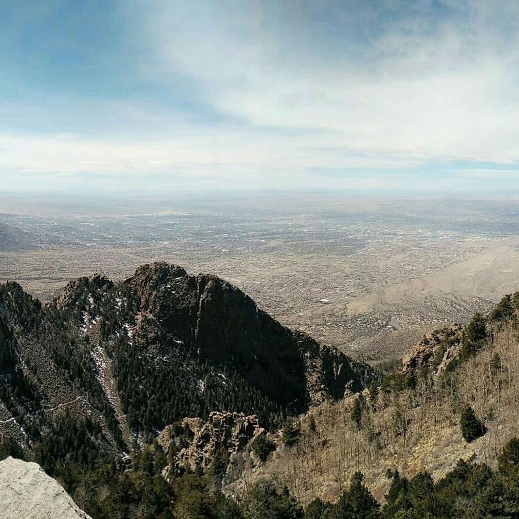
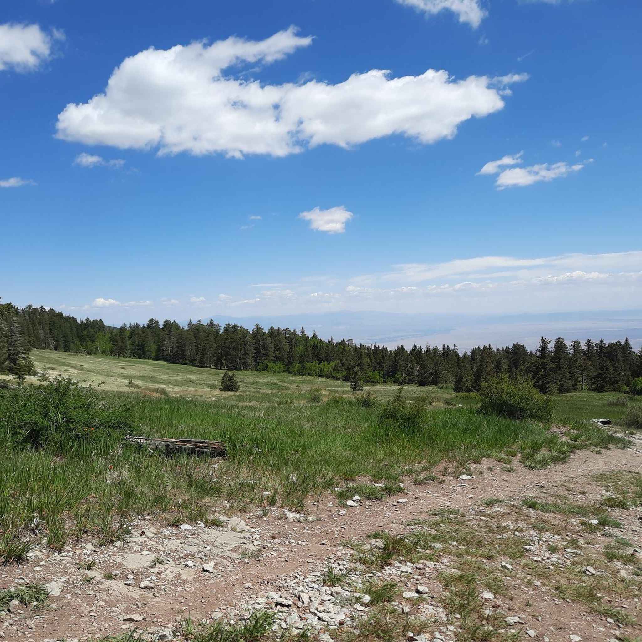
The Tree Spring Trail ends at a viewpoint that offers a great panoramic of the canyons and pine tree forests around.
0
0
Frequently Asked Questions
Where exactly is Paa-Ko located?
Paa-Ko is situated at the eastern base of the Sandia Mountains in New Mexico, near the town of Sandia Park. It serves as a gateway to the extensive trail systems within the Cibola National Forest.
What is the landscape like on the trails around Paa-Ko?
The trails offer a diverse high-desert and mountain environment. You'll experience a transition from lower elevations with piñon and juniper trees to cooler, shaded ponderosa pine forests as you climb higher into the Sandia Mountains.
Are there any easy, family-friendly hikes near Paa-Ko?
Yes, there are several options suitable for families. For a shorter outing with a unique destination, consider the Sandia Man Cave Trail. It's a relatively easy walk leading to a fascinating archaeological site.
What's a good option for a challenging hike?
For a more strenuous workout with significant elevation gain, the Tree Spring Trail is a difficult route within the Sandia Mountain Wilderness. It rewards hikers with excellent views and a true mountain experience.
Can I bring my dog on the trails?
Many trails in the Cibola National Forest and surrounding open spaces are dog-friendly, but they must be kept on a leash. Always check the specific regulations for the trail you plan to hike, as rules can vary, especially within designated wilderness areas.
What do other hikers think of the trails in Paa-Ko?
The area is highly regarded by the komoot community. Hikers often praise the stunning panoramic views across the Rio Grande Valley and the well-maintained trails that wind through both high-desert and forested landscapes.
How many hiking trails are there around Paa-Ko?
You can explore over 20 designated hiking routes around Paa-Ko. The network includes a mix of easy walks, moderate loops, and difficult mountain climbs, providing plenty of options for all skill levels.
Are there any circular hikes available?
Yes, there are several loop trails. The Sandia Peak loop is a popular moderate option that takes you through the high-altitude scenery of the Sandia Mountain Wilderness without requiring you to backtrack.
What kind of wildlife might I see while hiking?
The diverse ecosystems support a variety of wildlife. Keep an eye out for mule deer, coyotes, and various bird species, including Steller's jays in the pine forests. In more remote areas, you might also spot black bears or mountain lions, so it's always wise to be aware of your surroundings.
Can I hike in the Paa-Ko area during winter?
Yes, winter hiking is possible, but conditions vary greatly with elevation. Lower-elevation desert trails may be clear, while trails in the Sandia Mountains will likely have snow and ice. It's essential to have appropriate gear, such as microspikes or snowshoes, and to check weather and trail conditions before you go.
Are the hiking trails also used for mountain biking?
Some multi-use trails in the area are open to both hikers and mountain bikers, particularly in the Cibola National Forest. However, trails within designated wilderness areas, like the Sandia Mountain Wilderness, are generally off-limits to bikes. Always check trail signage to confirm permitted uses.
What is the Turquoise Trail and can I hike along it?
The Turquoise Trail is a National Scenic Byway (NM 14) that connects Santa Fe and Albuquerque, passing through the Paa-Ko area. While it is primarily a driving route, it provides access to numerous trailheads, including those for the Tecolote Peak Trail and the Golden Open Space.
Most popular routes around Paa-Ko
Most popular attractions around Paa-Ko

Get inspired with the komoot mobile app


Explore more
Browse the best Hikes in other regions.
