The best road cycling routes around Williamsville
4.6
(31)
471
riders
30
rides
Road cycling around Williamsville, New York, features a network of paved multi-use paths and dedicated bike trails, often following waterways and former rail lines. The terrain is generally flat, with minimal elevation gain, making it suitable for various skill levels. Key features include the Ellicott Creek Trailway, the historic Erie Canalway Trail, and connections to other regional paths. The area offers accessible routes through parks and along serene creekside paths.
Best road cycling routes around Williamsville
- The most popular road cycling route is Erie Canalway and Tonawanda Rails-to-Trails Loop, a 30.8 miles (49.6 km) trail that takes 1 hour 56 minutes to complete. This easy route combines sections of the historic Erie Canalway Trail with paved rails-to-trails.
- Another top favourite among local road cyclists is Clarence Akron Peanut Line Bike Pathways and Tonawanda Rails-to-Trails loop, a moderate 47.8 miles (76.9 km) path. This route offers a longer journey by linking two distinct rail-trail systems.
- Local road cyclists also love the Aqua Lane Park – Isle View Park loop from University at Buffalo, a 26.0 miles (41.8 km) trail leading through parks and along Ellicott Creek, often completed in about 1 hour 41 minutes.
- Road cycling around Williamsville is defined by paved multi-use paths, historic canal trails, and accessible park routes. The network offers options for different ability levels, from easy loops to longer, moderate journeys.
- The routes in Williamsville are highly rated by the komoot community with an average score of 4.6 stars from over 30 reviews. More than 500 road cyclists have used komoot to explore Williamsville's varied terrain.
Last updated: July 25, 2026
3
riders
49.6km
01:56
60m
60m
The Erie Canalway and Tonawanda Rails-to-Trails Loop offers a delightful road cycling experience, tracing historic waterways and repurposed rail lines. You'll pedal alongside the scenic Erie Canal, enjoying water views and glimpses of wildlife, before transitioning to the tree-lined Tonawanda Rails-to-Trails, which weaves through local parks and residential areas. This easy 30.8 miles (49.6 km) route, with only 210 feet (64 metres) of elevation gain, is perfect for a relaxed ride that takes just under 2 hours.
Planning your visit is simple, as both trails are well-maintained and easily accessible with ample parking options along the way. The Tonawanda Rails-to-Trails features modern safety signals at road crossings, making it a stress-free ride for all ages. It's an ideal choice for family-friendly cycling, especially during the warmer months when the paths are dry and the scenery is lush.
What makes this one of the popular cycling trails in the Erie Canalway and Tonawanda area is its blend of historical significance and modern accessibility. You're riding on paths that once served as vital transportation arteries, offering a unique connection to New York's past. The mostly off-road, flat terrain ensures a pleasant outing, whether you're looking for a quick spin or a longer, leisurely exploration of the region's natural features.
1
riders
The Clarence Akron Peanut Line Bike Pathways and Tonawanda Rails-to-Trails loop offers a delightful road cycling experience through Western New York's flat, paved rail-trail network. You'll pedal through a diverse landscape, from the dense wooded sections and agricultural fields of the Peanut Line to the pleasant residential areas and town parks along the Tonawanda Rails-to-Trails. Keep an eye out for wildlife like deer and various bird species, especially in the more secluded sections, making for a scenic and engaging ride.
This moderate 47.8-mile (76.9 km) route, with a gentle 379 feet (116 metres) of elevation gain, typically takes around 3 hours and 31 minutes to complete. The trails are well-maintained, clearly marked, and offer amenities like benches, gazebos, and access to restrooms in parks. You'll also find cafes and restaurants conveniently located near the trails, perfect for a mid-ride break or a post-ride treat.
These trails are part of a significant regional effort to convert former railroad corridors into recreational pathways, preserving historical routes for public enjoyment. The

Sign up for free
5.0
(7)
48
riders
41.8km
01:38
60m
60m
Easy road ride. Great for any fitness level. Mostly well-paved surfaces and easy to ride.
5.0
(1)
30
riders
41.1km
02:12
110m
110m
Moderate road ride. Good fitness required. Mostly well-paved surfaces and easy to ride.
5.0
(9)
28
riders
Easy road ride. Great for any fitness level. Mostly well-paved surfaces and easy to ride.
Get access to more routes and recommendations from other explorers.
Sign up for free
Already have an account?
Our route recommendations are based on thousands of hikes, rides, and runs completed by other people on komoot.
Start today with a free account
Your next adventure awaits.
Login or Signup
Popular around Williamsville

Tips from the Community

A beautiful little gem! Beautiful views, plenty of picnic tables, restrooms, a playground, informative signs, and two pairs of binoculars. I'm already looking forward to more picnics there! Beware of a wasp nest in the ground and the strong smell of dead fish among the rocks.
0
0

The UB Path Bridge, officially known as the Ralph Wilson Park Bridge, is a striking new pedestrian and cyclist crossing in Buffalo, New York. Spanning 266 feet over Interstate 190 and a CSX rail line, the enclosed steel arch bridge connects the Lower West Side neighborhood to the revitalized 100-acre Ralph C. Wilson Jr. Centennial Park, formerly LaSalle Park.
0
0

This little point looks out over the outlet of Tonawanda Creek, where it first merges into the Little River and then, together, the two waters merge into the Tonawanda Channel of the Niagara River. From here you have your choice of two different riverwalks: The Eerie Canalway Trail to the east, which runs upstream along Tonawanda Creek; and the Shoreline Trail which runs southwest along the Niagara River.
0
0

Anyone who cycles in and around Buffalo will eventually have a route that takes them over the Grand Island Bridges. Luckily there is a dedicated pathway for non-motorized travel. You'll also have great views along the way.
1
0
This 1.2-mile-long riverside park is popular for bikers, but that's just a tithe on the activity you can see here: People-watching opportunities include rollerblades, boaters, waterskiers, sunbathers, fisher, birdwatchers and many more.
0
0

The Ellicott Creek Trailway is a multiuse trail that follows the waterway of the same name. The trail is paved and takes you through several parks and to the outskirts of the University of Buffalo.
0
0
Ellicott Creek Park is a popular park on the banks of the Niagara River. The park is popular for walking, cycling and picnicking in one of the covered picnic areas.
1
0

This is an important historical site in Buffalo. In this cemetery, on the west side you can visit Philip Knoche House and the Tonawanda-Kenmore Historical Society Museum.
0
0
Frequently Asked Questions
How many road cycling routes are available around Williamsville?
Williamsville offers a diverse selection of road cycling routes, with over 30 routes available on komoot. These routes cater to various skill levels, from easy loops to more moderate journeys.
What kind of terrain can I expect on road cycling routes in Williamsville?
The road cycling routes around Williamsville are generally flat, featuring minimal elevation gain. They primarily consist of paved multi-use paths, dedicated bike trails, and historic canal trails, often following waterways and former rail lines through serene landscapes.
Are there easy road cycling routes suitable for beginners or families in Williamsville?
Yes, Williamsville is well-suited for beginners and families, with 19 easy routes available. A great option is the Erie Canalway and Tonawanda Rails-to-Trails Loop, which is 30.8 miles long and combines sections of the historic Erie Canalway Trail with paved rails-to-trails, offering an enjoyable ride with minimal elevation.
Can I find longer or more challenging road cycling routes in the area?
For those seeking a longer journey, Williamsville offers 13 moderate routes. The Clarence Akron Peanut Line Bike Pathways and Tonawanda Rails-to-Trails loop is a popular moderate option, spanning 47.8 miles by linking two distinct rail-trail systems.
Are there any circular road cycling routes around Williamsville?
Many of the routes in Williamsville are designed as loops, allowing you to start and end at the same point. For example, the Aqua Lane Park – Isle View Park loop from University at Buffalo is a 26.0-mile route that takes you through parks and along Ellicott Creek.
What scenic attractions or landmarks can I see while road cycling in Williamsville?
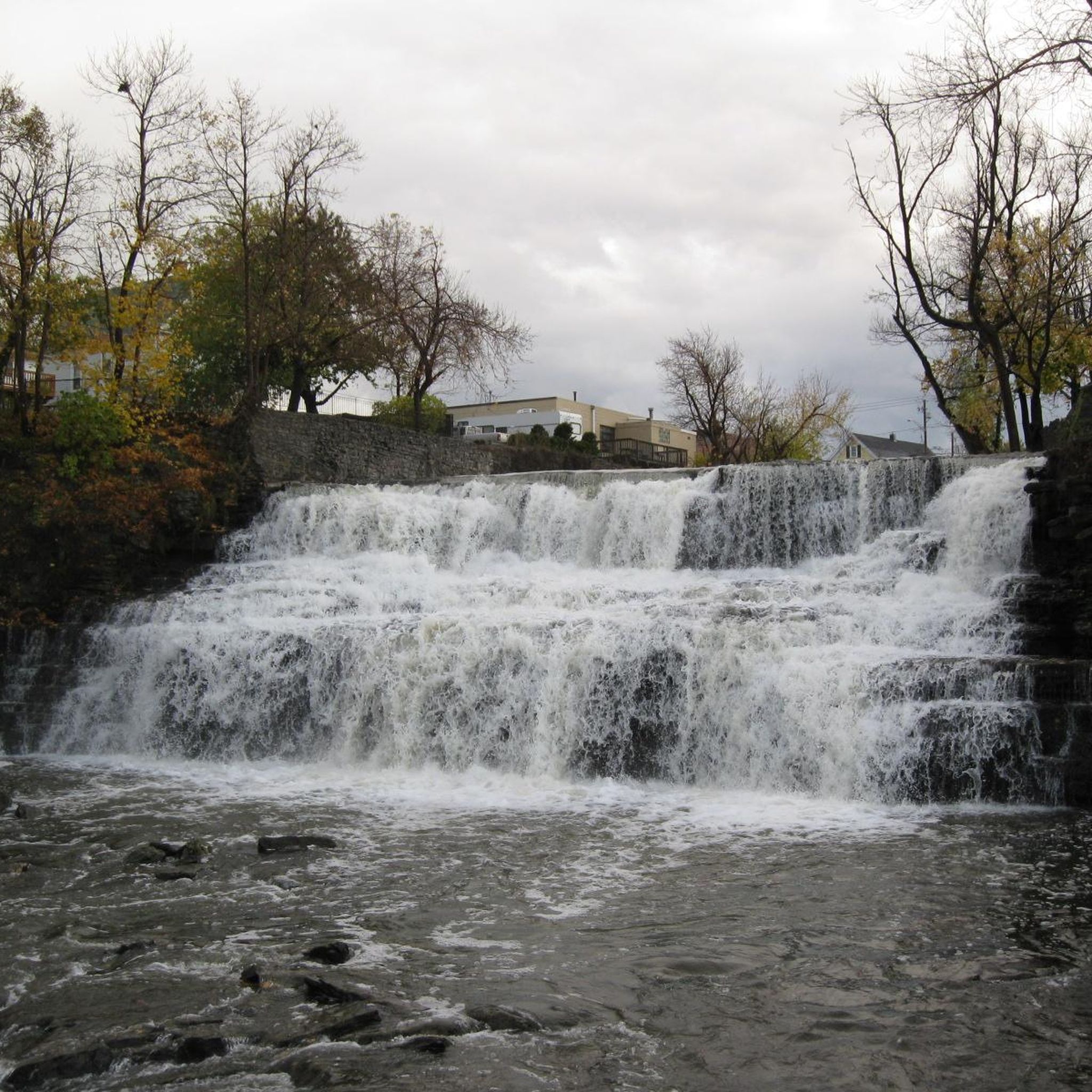
Road cycling in Williamsville offers access to various scenic and historic points of interest. You can ride along the Tonawanda Rails-to-Trails, explore areas near Flattail Lake, or pass by the UB Path Bridge. The region also features Glen Park with its picturesque Glen Falls, and the historic Erie Canalway Trail.
Are there any routes that follow historic waterways or rail lines?
Yes, Williamsville's road cycling routes frequently utilize historic infrastructure. The Erie Canalway and Tonawanda Rails-to-Trails Loop is a prime example, combining sections of the historic Erie Canalway Trail with paved rails-to-trails. The Ellicott Creek Trailway also offers serene creekside paths.
What do other cyclists say about road cycling in Williamsville?
The road cycling routes in Williamsville are highly rated by the komoot community, with an average score of 4.6 stars from over 30 reviews. Cyclists often praise the well-maintained paved paths, the generally flat terrain, and the scenic beauty of the creekside paths and historic canal routes.
Where can I find parking for road cycling routes in Williamsville?
Many road cycling routes in Williamsville are accessible from various points, including parks and trailheads that often provide parking. For routes originating from areas like Harris Hill or near the University at Buffalo, designated parking areas are typically available. Specific parking details can often be found on individual route pages.
Are there opportunities to combine cycling with exploring local towns or amenities?
Absolutely. The region's routes, particularly those along the Erie Canalway Trail, pass through charming canal towns. Williamsville itself boasts a historic village charm with downtown shops and a nineteenth-century water mill, making it easy to combine your ride with exploring local amenities and cafes.
What is the best time of year for road biking in Williamsville?
The best time for road biking in Williamsville is generally from spring through fall, when the weather is mild and the trails are clear. The picturesque landscapes are particularly vibrant during these seasons, offering pleasant conditions for cycling along the paved paths and historic routes.
Are there any routes that explore parks or nature preserves?
Yes, several routes provide access to natural settings. The Ellicott Creek Trailway offers diverse scenery through parks and along Ellicott Creek. Additionally, areas like Amherst State Park and Reinstein Woods Nature Preserve feature well-maintained paths through quiet woodlands, suitable for various skill levels.
Most popular routes around Williamsville
Most popular attractions around Williamsville

Get inspired with the komoot mobile app


Explore more
Browse the best Road cycling routes in other regions.
