The best walks and hikes around Niverville
4.0
(1)
12
hikers
6
hikes
Hiking around Niverville, Manitoba, offers access to trails traversing fertile agricultural land, remnants of Tall Grass Prairie, and unique wetlands. The region's terrain is generally flat, a legacy of the ancient glacial Lake Agassiz, with slight elevation changes primarily found along the Red River. Surfaces vary from natural paths and gravel to paved sections, providing diverse hiking experiences. The area is characterized by open landscapes and the Niverville Wetlands Project, which transformed a former industrial site into a natural habitat.
Best hiking trails around Niverville
- The most popular hiking route is Albany-Hudson Electric Trail, a 14.1 miles (22.7 km) trail that takes 5 hours 48 minutes to complete. This difficult route features varied terrain suitable for longer excursions.
- Another top favourite among local hikers is Albany-Hudson Electric Trail, a moderate 6.4 miles (10.3 km) path. This trail offers a balanced experience through the region's flat landscapes.
- Local hikers also love the Martin Van Buren Outer Loop (White), a 1.7 miles (2.8 km) trail leading through open areas, often completed in about 44 minutes.
- Hiking around Niverville is defined by its flat agricultural lands, the Crow Wing Trail, and the Niverville Wetlands. The network offers options for various ability levels, from easy walks to more challenging, longer routes.
- The guide includes highly-rated routes that showcase the best of the region's landscape. More than 10 hikers have used komoot to explore Niverville's varied terrain.
Last updated: July 12, 2026
4.0
(1)
3
hikers
2.81km
00:45
30m
30m
The Martin Van Buren Outer Loop (White) offers a delightful and easy stroll through a mix of landscapes, from quiet forests to open mowed meadows and active farm fields. You'll find yourself on comfortable gravel paths, passing by serene marshland and a charming glen with a small stream, perfect for a moment of reflection. This 1.7-mile (2.8 km) route with just 94 feet (29 metres) of elevation gain is designed for a relaxing experience, showcasing the natural beauty of the Kinderhook area.
Planning your visit is straightforward, as the trail is open year-round from dawn to dusk, accommodating various schedules. Leashed dogs are welcome, making it a great option for pet owners, and there's ample parking available at the trailhead. This accessible route is ideal for a quick escape into nature, offering a peaceful setting without the need for extensive planning.
This easy 44-minute hike provides a unique connection to history, located directly across from the Martin Van Buren National Historic Site. It's part of the larger Dutch Farming Heritage Trail, linking historical sites and showcasing agricultural methods through areas like Roxbury Farm. The Martin Van Buren Outer Loop (White) terrain elevation difficulty is minimal, making it a perfect family-friendly option for all ages and skill levels.
18.1km
04:37
40m
90m
The Albany-Hudson Electric Trail offers a moderate hiking experience, stretching 11.2 miles (18.1 km) with a gentle elevation gain of 137 feet (42 metres). You can expect to spend about 4 hours and 36 minutes exploring its diverse landscapes. As you hike, you will pass through natural woodlands, serene wetlands, and open agricultural fields. Keep an eye out for picturesque views of Kinderhook Lake and multiple crossings of the scenic Valatie Kill, which add to the route's charm. The terrain is generally easy, making for an enjoyable journey.
The off-road sections of the trail are open year-round, from dawn to dusk, allowing you to hike in any season, weather permitting. You will find convenient access points as the route connects to various communities. These towns often provide amenities like food and restrooms, making it easy to plan your stops. If you bring your dog, remember they are welcome but must be kept on a leash, and you should clean up after them. This accessibility makes the trail a flexible option for a day out.
Beyond its natural beauty, the trail winds through charming historic towns and villages, blending nature with local culture. This route showcases a diverse landscape that transitions from dense woodlands to open fields. It offers a unique perspective on New York's Hudson Valley, highlighting both its natural environment and its historical settlements. The trail's design allows you to experience a mix of serene natural settings and glimpses into the region's past.

Sign up for free
4
hikers
2.88km
00:46
30m
30m
The Sutherland Pond Trail Loop offers an easy hike through pleasant natural settings. You'll wind through well-maintained paths, enjoying views of Sutherland Pond. This 1.8-mile (2.9 km) loop is generally easy, with only 111 feet (34 metres) of elevation gain. Most hikers can complete it in about 46 minutes, making it a perfect quick outdoor experience. The terrain is hard-packed and stable, suitable for a relaxed walk.
Accessing the Sutherland Pond Trail Loop is straightforward, as the Ooms Conservation Area provides accessible parking. This makes it easy to start your hike without any hassle. You won't need permits or worry about fees for this trail. It's a great option for a quick outing, so consider visiting during off-peak hours for a more tranquil experience. Always remember to check local conditions before you head out to ensure a smooth trip.
The Sutherland Pond Trail Loop is located within the Ooms Conservation Area, offering a valuable natural escape in Columbia County, New York. This route is known for its stable and well-maintained paths, making it suitable for beginners and families. It provides an accessible way to enjoy the outdoors, especially if you are looking for a short and undemanding activity. The trail's focus on Sutherland Pond makes it a peaceful destination.
1
hikers
22.7km
05:49
90m
90m
Embark on a challenging hike along the Albany-Hudson Electric Trail, a demanding route stretching 14.1 miles (22.7 km). You will experience diverse scenery, moving through farmlands, orchards, and peaceful pine forests. The trail also offers views of wetlands and glimpses of historic towns, providing a varied backdrop for your journey. With an elevation gain of 304 feet (93 metres), this difficult hike is estimated to take around 5 hours and 48 minutes to complete. Keep an eye out for streams like Valatie Kill as you explore the rural Hudson Valley.
The Albany-Hudson Electric Trail welcomes you year-round, from dawn until dusk, for non-motorized activities. While the path is not plowed during winter months, you can still enjoy hiking, cross-country skiing, or snowshoeing, depending on snow conditions. Remember to keep your dog on a leash if you bring them along for the adventure. Plan your start time carefully to ensure you have ample daylight for this extensive route.
This trail offers a unique opportunity to connect with the rural Hudson Valley, passing through varied landscapes that include both natural beauty and historic elements. You will encounter picturesque streams such as Kinderhook Creek and enjoy views of Kinderhook Lake along the way. The route provides a distinct perspective on the region's environment, blending agricultural areas with wilder sections.
10.3km
02:41
70m
70m
Embark on the Albany-Hudson Electric Trail for a moderate hike spanning 6.4 miles (10.3 km) with an elevation gain of 228 feet (69 metres). This route offers diverse and picturesque scenery, winding through lush hills, expansive farmlands, and orchards. You will pass through woods, wetlands, and open fields, enjoying views of Kinderhook Creek and Kinderhook Lake along the way. Expect to complete this journey in about 2 hours and 41 minutes at a steady pace. The trail provides a refreshing escape into nature.
This accessible trail is open year-round, welcoming activities like hiking, cross-country skiing, and snowshoeing. Much of its length features mostly flat terrain with surfaces of paved asphalt or compacted stone dust, meeting ADA accessibility standards. Dogs are permitted but must be kept on a leash to ensure everyone's safety and enjoyment. Be aware that approximately 15% of the route includes short on-road connections where you will share space with vehicle traffic.
The Albany-Hudson Electric Trail offers a unique blend of nature and history, as it is located within the Martin Van Buren National Historic Site. This historical context adds another layer of interest to your outdoor adventure. The trail's path through varied landscapes, from open fields to dense woods, makes it a notable feature in the region, providing a pleasant experience for those seeking both exercise and a connection to the past.
Our route recommendations are based on thousands of hikes, rides, and runs completed by other people on komoot.
Start today with a free account
Your next adventure awaits.
Login or Signup
Popular around Niverville
Tips from the Community

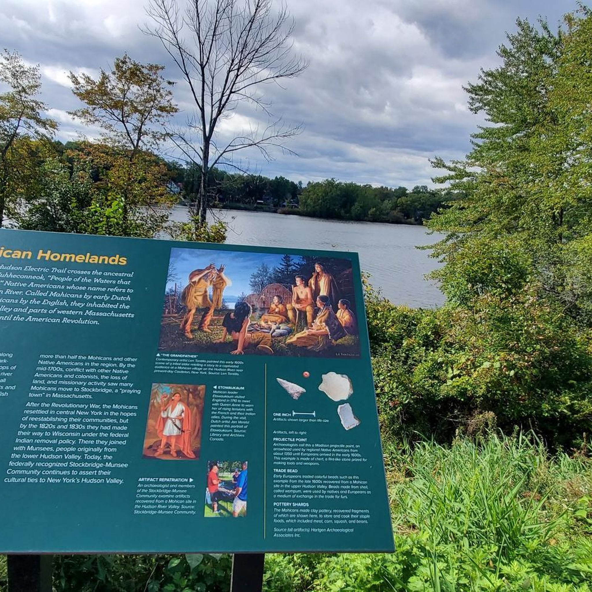
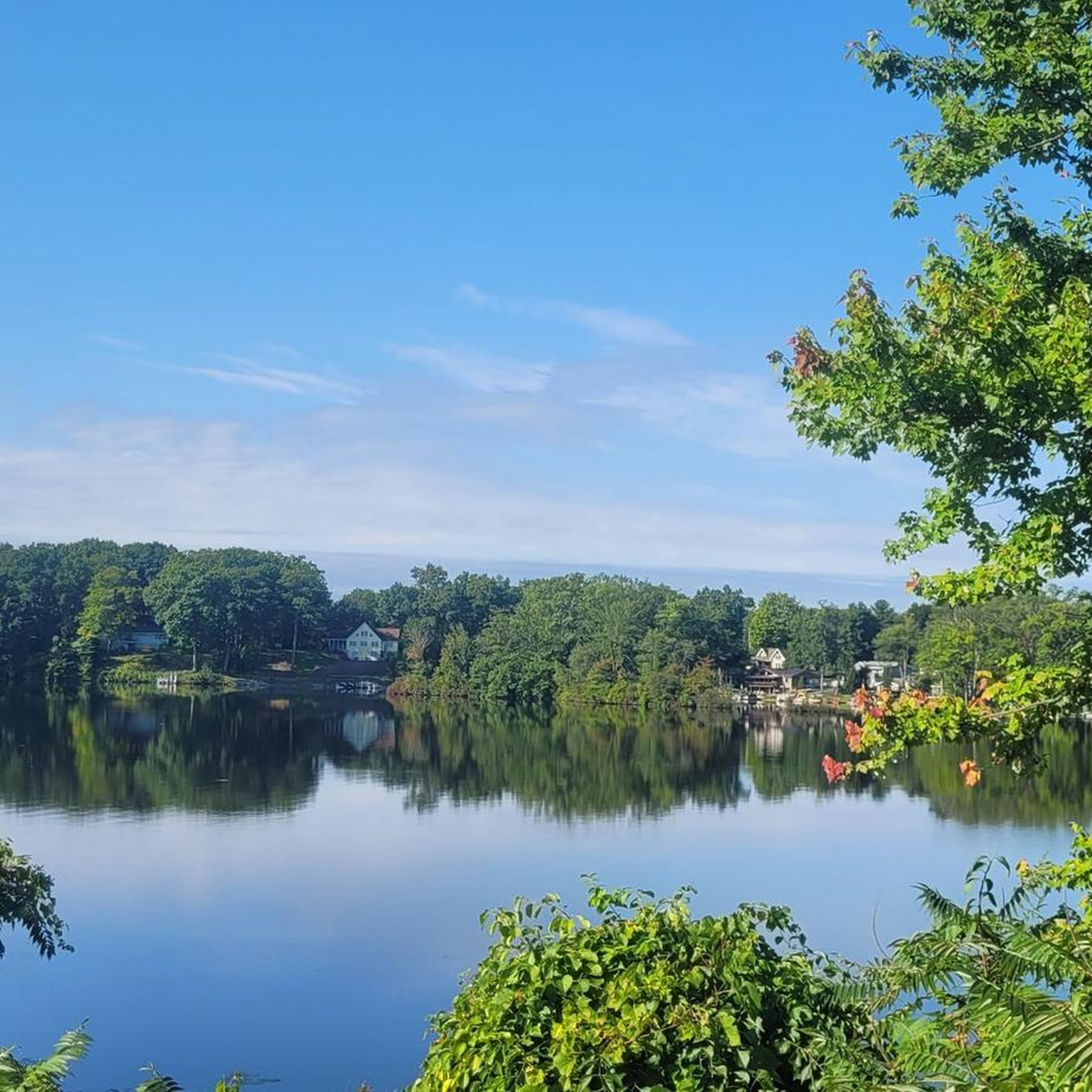
Great views of Kinderhook Lake from the road. There are house and trees around the lake, so at times the view is obstructed, but there are enough spots where you can see the lake to make it worth the trip.
0
0
Great views of Kinderhook Lake from the Albany-Hudson Electric Trail. There are house and trees around the lake, so at times the view is obstructed, but there are enough spots where you can see the lake to make it worth the trip. There are some benches and an information board along the banks for the lake.
0
0

The Albany-Hudson Electric Trail passes by Kinderhook Lake, and there are actually some great views of the lake whenever there are breaks in the trees. There are some residential houses and neighborhoods around the lake, but so many trees are growing right up next to the edges of the water that it is sometimes hard to spot the buildings. There are a few informational signs and benches along the portion of the trail that borders the lake.
0
0
Totaling right around 36 miles in total distance, the Albany-Hudson Electric Trail (AHET) one of the most popular trails in New York. Some portions of the trail pass through urban areas, cross streets, and travel next to roads. This particular section is through the New York countryside and has virtually no noise pollution or car noises.
0
0
The Albany Hudson Electric Trail is open to non-motorized bikes and foot-traffic and is one of the most popular paths for exercising in the area. Parts of the path are paved, parts are crushed gravel, and parts are smooth dirt. This is a fairly flat trail that actually slowly goes downhill as you walk with the river and then goes gradually uphill as you walk against the flow of the water.
0
0
Sutherland Pond is a small body of water in the Ooms Conservation Area. There is a trail that circles around the lake and travels through nearby wetland environments. Beavers, birds, and fish are common sightings, especially once you get on the southern side of the pond away from the road.
1
0

Frequently Asked Questions
How many hiking trails are available around Niverville?
Niverville offers a selection of 6 hiking routes, catering to various skill levels. You'll find 3 easy trails, 2 moderate options, and 1 more challenging route to explore the local landscape.
What kind of terrain can I expect on Niverville's hiking trails?
The terrain around Niverville is generally flat, a legacy of the ancient Lake Agassiz. You'll encounter a mix of surfaces, including gravel, grass, paved sections, and dirt roads. While mostly easy, some areas can become muddy after heavy rains, so appropriate footwear is recommended.
Are there any family-friendly hiking options in Niverville?
Yes, Niverville is well-suited for family outings. Many of the local paths, especially within Hespeler Park and along the Crow Wing Trail, are relatively flat and easy to navigate. The Martin Van Buren Outer Loop (White), for example, is an easy 2.8 km trail perfect for a leisurely family walk.
Can I bring my dog on the hiking trails in Niverville?
Many of Niverville's trails, particularly those within Hespeler Park and sections of the Crow Wing Trail, are dog-friendly. It's always best to keep your dog on a leash and ensure you clean up after them to maintain the natural beauty for everyone.
What natural features or landmarks can I see while hiking in Niverville?
Niverville's trails offer glimpses of unique natural features. The Sutherland Pond is a notable highlight, and the Niverville Wetlands Project in Hespeler Park provides a unique opportunity to observe local flora and fauna in a rehabilitated natural setting. You can also enjoy the agricultural landscapes that were once part of glacial Lake Agassiz.
Are there any circular hiking routes in Niverville?
Yes, there are circular options available. The Sutherland Pond Trail Loop is an easy 2.8 km circular route that allows you to experience the area without retracing your steps.
What is the best time of year to go hiking in Niverville?
Niverville offers year-round outdoor opportunities. Spring and fall provide pleasant temperatures and vibrant scenery. In winter, sections of the Crow Wing Trail are suitable for snowshoeing and skiing. Summer is also great, but be prepared for potentially muddy conditions after heavy rains, especially on dirt sections.
Is there parking available at Niverville trailheads?
Yes, Hespeler Park, a central hub for outdoor activities in Niverville and home to the Niverville Wetlands, offers parking facilities. Many other trailheads along the Crow Wing Trail also have designated parking areas, making access convenient for hikers.
Are there any longer, more challenging hikes near Niverville?
For those seeking a longer challenge, sections of the Albany-Hudson Electric Trail offer more extensive distances. One such route is a difficult 22.6 km segment, providing a significant endurance test for experienced hikers.
What is the Niverville Wetlands Project?
The Niverville Wetlands Project, located in Hespeler Park, is a significant natural feature transformed from the town's old lagoon. It's a unique example of bioremediation, creating a beautiful and sustainable wetlands area with pathways, native grasses, and a pavilion for the community to enjoy and explore Manitoba's nature.
What do other hikers enjoy most about hiking in Niverville?
Hikers often praise Niverville for its accessible and well-maintained paths, particularly the integration with the scenic Crow Wing Trail. The unique Niverville Wetlands and the peaceful atmosphere of Hespeler Park are frequently highlighted as enjoyable aspects of the local hiking experience.
Most popular routes around Niverville
Most popular attractions around Niverville

Get inspired with the komoot mobile app


Explore more
Browse the best Hikes in other regions.
