The best walks and hikes around Saugerties South
4.9
(7)
119
hikers
12
hikes
Hiking around Saugerties South offers diverse landscapes, blending the foothills of the Catskill Mountains with the Hudson River. This region features a variety of terrain, including riverside paths, forested routes, and trails leading to waterfalls. Hikers can explore wetlands, meadows, and areas with views of the Catskill Mountains.
Best hiking trails around Saugerties South
- The most popular hiking route is South Trail, Schoeder Trail, Meadow, and Wetland Trail Loop, an easy 4.5 miles (7.2 km) trail that takes 1 hour 54 minutes to complete. This loop explores varied terrain including meadows and wetlands.
- Another top favourite among local hikers is Turkey Point from Ulster Landing, an easy 1.5 miles (2.5 km) path. This route offers views of the Hudson River from Ulster Landing County Park.
- Local hikers also love the Clermont Historic Site Loop, a 1.2 miles (2.0 km) trail leading through historic grounds, often completed in about 32 minutes.
- Hiking around Saugerties South is defined by Hudson River frontage, Catskill Mountain views, and varied ecosystems including wetlands and forests. The network offers options for different ability levels, with many easy trails available.
- The routes in Saugerties South are highly rated by the komoot community with an average score of 4.9 stars from over 6 reviews. More than 70 hikers have used komoot to explore Saugerties South's varied terrain.
Last updated: October 11, 2026
5.0
(1)
4
hikers
7.20km
01:55
70m
80m
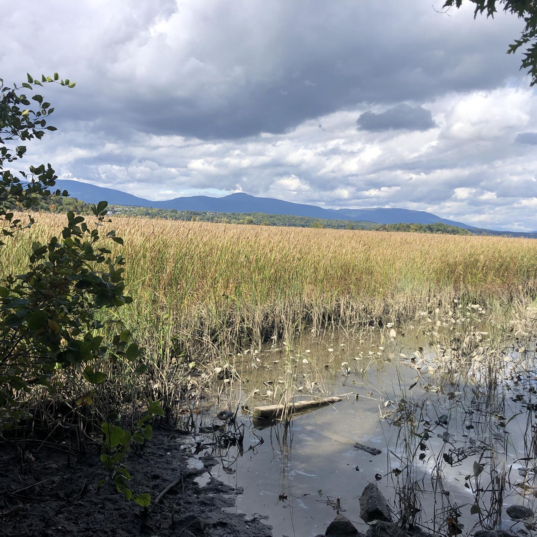
The South Trail, Schoeder Trail, Meadow, and Wetland Trail Loop offers an easy hiking experience through a varied landscape. You will cover 4.5 miles (7.2 km) with a gentle elevation gain of 241 feet (73 metres), which typically takes around 1 hour and 54 minutes to complete. As you hike, expect to pass through open meadows that give way to rich wetland areas, where you can observe diverse flora and fauna. The route also guides you through sections of hardwood forest, providing a pleasant mix of environments. This loop is designed for hikers of all levels, ensuring a comfortable and engaging journey.
Before you head out, it is a good idea to check for a detailed map of Esopus Bend Nature Preserve to help plan your specific route. Parking is generally available at the preserve, making access straightforward for visitors. Consider starting your hike earlier in the day to enjoy the tranquility and avoid potential crowds, especially on weekends. Always ensure you have enough water and appropriate footwear for the varied terrain.
This trail stands out for its unique combination of natural features, allowing you to explore different ecosystems within a single outing. Keep an eye out for remnants of old farm roads and stone walls that add a historical touch to your journey through the preserve. The marshy sections are particularly rich in wildlife, offering excellent opportunities for nature observation. It is a great option if you are looking for a gentle yet engaging outdoor adventure.
1
hikers
2.47km
00:43
70m
70m
The Turkey Point from Ulster Landing trail offers a charming and accessible outdoor experience, perfect for a quick nature fix. This easy 1.5-mile (2.5 km) hike, with a modest 232 feet (71 metres) of elevation gain, typically takes around 43 minutes to complete. You'll wander through diverse habitats, from quiet woodlands to open fields, all while enjoying scenic views of the Hudson River and discovering the historical remains of an old ice house along the bank.
Planning your visit is simple, as the trail is easily accessed from Ulster Landing County Park. The park provides convenient parking, picnic areas, and playgrounds, making it a great spot for families. It's a fantastic option for a leisurely stroll or a dedicated birdwatching excursion, offering a convenient and rewarding outdoor experience.
What makes this trail particularly special is its blend of natural beauty and historical intrigue. Beyond the picturesque Hudson River frontage, the area is a significant natural feature, serving as a unique marsh bird breeding ground and an important staging area for migrating waterfowl. The historical ice house remains add a layer of interest, connecting you to the region's past.

1.96km
00:32
30m
20m
Explore the easy 1.2-mile Clermont Historic Site Loop, a hike offering Hudson River views, historic ruins, and diverse woodlands.
1.10km
00:17
10m
0m
Enjoy an easy 0.7-mile hike through the active Greig Farm, offering scenic views of the Catskill Mountains and farm landscapes.
2
hikers
1.35km
00:20
0m
0m
The Saugerties Lighthouse Trail is an easy 0.8-mile hike through wetlands to a historic lighthouse on the Hudson River, perfect for families
Get access to more routes and recommendations from other explorers.
Already have an account?
Our route recommendations are based on thousands of hikes, rides, and runs completed by other people on komoot.
Start today with a free account
Your next adventure awaits.
Popular around Saugerties South

Tips from the Community

Originally built in the 1860s, the Saugerties Lighthouse played an important role in safe travel and navigation for vessels traveling the Hudson River. Today, it stands as a restored structure that was restored in a way to maintain its "look" and history. There is a gift shop and bed and breakfast located within the building.
0
0
The trail leading to the Saugerties Lighthouse crosses a handful of boardwalks and bridges while navigating the wetlands separating the dry shore from the lighthouse. The trail is easy to follow and open every day from sun-up to sun-down.
0
0
Originally built in the 1860s, the Saugerties Lighthouse played an important role in safe travel and navigation for vessels traveling the Hudson River. Today, it stands as a restored structure that was restored in a way to maintain its "look" and history. There is a gift shop and bed and breakfast located within the building.
0
0
Frequently Asked Questions
How many hiking trails are available in Saugerties South?
Saugerties South offers a variety of hiking experiences, with over 10 distinct trails to explore. These routes cater to different preferences, from riverside paths to forested areas and historic grounds.
Are there any trails with waterfalls in Saugerties South?
Yes, the region features trails where you can encounter waterfalls. Notably, the Waterfall at Falling Waters Preserve is a beautiful natural feature within the preserve, which also offers streams and rock ledges.
What kind of views can I expect on hikes in Saugerties South?
Hikers in Saugerties South can enjoy diverse scenic views. Many trails offer expansive vistas of the Hudson River, while others provide picturesque views of the Catskill Mountains. Preserves like Falling Waters also feature meadows and wetlands, adding to the varied landscapes.
Are there family-friendly hiking options in Saugerties South?
Absolutely. Many trails in Saugerties South are suitable for families, offering easy paths with minimal elevation changes. The Falling Waters Preserve, for example, has three miles of easy trails perfect for family outings, exploring streams, meadows, and river frontage.
Are dogs allowed on the hiking trails in Saugerties South?
While many outdoor areas in the region are dog-friendly, specific rules can vary by preserve or park. It's always best to check the regulations for each specific trail or preserve you plan to visit to ensure a pleasant experience for you and your dog.
Are there any circular hiking routes in Saugerties South?
Yes, Saugerties South offers several circular routes. A popular option is the South Trail, Schoeder Trail, Meadow, and Wetland Trail Loop, which allows you to experience varied terrain. Another is the Clermont Historic Site Loop, which takes you through historic grounds.
What are some notable landmarks or points of interest to see while hiking?
The region is rich in landmarks. You can hike to the historic Saugerties Lighthouse, explore the grounds of the Clermont State Historic Site, or discover the Waterfall at Falling Waters Preserve. These offer a blend of natural beauty and historical significance.
Are there accessible trails for all abilities in Saugerties South?
Ulster Landing County Park, which features the Turkey Point from Ulster Landing route, offers trails that include handicap accessible sections, ensuring that more people can enjoy the beautiful views of the Hudson River and opportunities for birdwatching.
What is the best time of year to go hiking in Saugerties South?
Saugerties South is enjoyable for hiking throughout much of the year. Spring and fall offer pleasant temperatures and beautiful scenery, with autumn foliage being particularly stunning. When hiking the Saugerties Lighthouse Trail, it's advisable to check tide schedules, as parts of the trail may experience tidal flooding.
What do other hikers enjoy most about hiking in Saugerties South?
The hiking experiences in Saugerties South are highly regarded by the komoot community, with an average rating of 4.9 stars. Hikers frequently praise the diverse landscapes, including the Hudson River frontage, Catskill Mountain views, and varied ecosystems like wetlands and forests. The availability of many easy trails is also a highlight for many.
Are there opportunities for wildlife viewing on the trails?
Yes, preserves like Esopus Bend Nature Preserve are known for their diverse flora and fauna. Hikers often spot eagles, blue herons, red foxes, and coyotes, making it an excellent location for wildlife enthusiasts.
Where can I find parking for trailheads in Saugerties South?
Many of the popular hiking areas and preserves in Saugerties South, such as Falling Waters Preserve and Ulster Landing County Park, offer designated parking facilities for visitors. It's generally recommended to check specific trailhead information for parking availability before your visit.
Are there any challenging hikes in the Saugerties South area?
While Saugerties South itself features many easy to moderate trails, its location at the foothills of the Catskill Mountains means that more challenging hikes, such as those to Kaaterskill High Peak or along the Devil's Path, are within reasonable driving distance for experienced hikers seeking strenuous adventures and significant elevation changes.
Most popular routes around Saugerties South
Most popular attractions around Saugerties South

Get inspired with the komoot mobile app


Explore more
Browse the best Hikes in other regions.
