The best road cycling routes around Independence
5.0
(33)
943
riders
32
rides
Road cycling routes around Independence traverse a landscape characterized by river valleys, canal paths, and established parklands. The region features a mix of flat sections along waterways and gentle hills, offering varied terrain for road cyclists. These routes often follow historical canals and connect various green spaces, providing a blend of natural scenery and accessible pathways.
Best road cycling routes around Independence
- The most popular road cycling route is Lock 39, Ohio & Erie Canal – Wendy Park loop from Canal Exploration Center, a 31.6 miles (50.9 km) trail that takes 2 hours 24 minutes to complete. This moderate route features canal-side riding and connects to park areas.
- Another top favourite among local road cyclists is Ohio & Erie Canal Reservation – Steelyard Heritage Center loop from Rockside, an easy 20.8 miles (33.5 km) path. This route offers scenic views along the Ohio & Erie Canal and through urban green spaces.
- Local road cyclists also love the Bedford Reservation – Bridal Veil Falls loop from Walton Hills, a 31.5 miles (50.8 km) trail leading through reservation parkland, often completed in about 2 hours 21 minutes.
- Road cycling around Independence is defined by canal paths, park trails, and gentle hills. The network offers options for easy rides, as well as more moderate routes with greater distances and elevation changes.
- The routes in Independence are highly rated by the komoot community with an average score of 4.8 stars from over 10 reviews. More than 600 road cyclists have used komoot to explore Independence's varied terrain.
Last updated: July 15, 2026
5.0
(2)
103
riders
Moderate road ride. Good fitness required. Mostly well-paved surfaces and easy to ride.
5.0
(1)
35
riders
53.0km
02:21
220m
220m
Moderate road ride. Good fitness required. Mostly well-paved surfaces and easy to ride.

Sign up for free
23
riders
42.4km
01:56
440m
440m
This moderate 26.4-mile (42.4 km) road cycling loop, the Brecksville-Northfield Bridge – Deer Lick Cave, offers a fantastic workout with 1439 feet (438 metres) of elevation gain, typically completed in just under two hours. You'll pedal through rolling woodlands and deep forested ravines, enjoying views of the Cuyahoga River and encountering the unique Deer Lick Cave, a sandstone overhang that often boasts a seasonal waterfall. It's a dynamic ride for cyclists who appreciate varied terrain and a good climb.
While specific parking details aren't provided, planning your ride for spring or late fall can enhance the experience, as views are less obstructed by summer foliage, particularly around the cave. Be aware that some segments of this route may be unpaved and difficult to ride, so ensure your bike is equipped for varied surfaces and you're ready for a challenge. Good fitness is definitely required for this engaging loop.
The route integrates extensive park systems, including the Cleveland Metroparks' Brecksville Reservation and Cuyahoga Valley National Park, showcasing diverse geographical features. Deer Lick Cave itself is named for the salt deposits that attract deer, making it a notable natural landmark. This loop is highly rated by the Komoot community, making it a popular choice for advanced road cycling routes near Brecksville.
5.0
(1)
12
riders
33.3km
01:34
300m
300m
Moderate road ride. Good fitness required. Some segments of this route may be unpaved and difficult to ride.
22
riders
27.7km
01:27
180m
180m
Easy road ride. Great for any fitness level. Mostly well-paved surfaces and easy to ride.
Get access to more routes and recommendations from other explorers.
Sign up for free
Already have an account?
Our route recommendations are based on thousands of hikes, rides, and runs completed by other people on komoot.
Start today with a free account
Your next adventure awaits.
Login or Signup


Tips from the Community

From this trailhead you can access several miles of mountain biking trails. The main trail, Lamb Loop runs about 5 miles with some fun curves and mixed terrain. There are a couple other connector trails offering shorter loops or different terrain as well.
0
0

The Exploration Center is well worth a visit if you are venturing out on the O&E Towpath. The center is small, but holds a lot of history from mid-19th century America. There are restrooms at the trailhead which remain open, even when the center is closed.
0
0
The now-overgrown lock was once an integral part of the Ohio & Erie Canal. A sign by on the towpath tells the history of the old lock.
0
0
There is a small parking lot here which grants access to the Bedford Reservation mountain biking trails. You have a range of trails to choose from, some of which feature lots of roots and rocks, and others which make for easier riding.
0
0

This 147-acre packs a lot of fun and beauty, given its size: It has about 9,000 feet of shoreline, dog beaches, swimming beaches, a fishing pier, picnic facilities and a boat launch.
0
0

The Frazee House, or the Stephen Frazee House, is a historic building constructed between 1825 and 1826. It is one of the oldest surviving buildings in the Cuyahoga Valley. Visitors to Cuyahoga Valley National Park can explore the house's exterior and learn about its history through informational signage located around it.
2
0

Tinker’s Creek Gorge Scenic Overlook offers a breathtaking view of the gorge and its cascading waterfalls. Whether you're cycling, hiking, or simply enjoying the scenery, the overlook provides panoramic views of the lush landscape and the deep, winding gorge below. The area is accessible and offers a quiet, serene atmosphere, ideal for those looking to connect with nature.
1
0

From 1827 to 1913, this path was used for mules to pull canal boats with passengers along the Ohio & Erie Canal. The trail follows the path as closely as possible, with plenty of trails and areas to explore.
1
0
Frequently Asked Questions
How many road cycling routes are available around Independence?
There are over 35 road cycling routes around Independence, offering a diverse range of options for cyclists. These include 15 easy routes and 22 moderate routes, ensuring choices for various skill levels.
What kind of terrain can I expect on road cycling routes in Independence?
Road cycling routes in Independence feature a varied landscape, characterized by river valleys, historical canal paths, and established parklands. You'll find a mix of flat sections along waterways and gentle hills, providing both relaxed rides and more challenging terrain.
Are there easy road cycling routes suitable for beginners in Independence?
Yes, Independence offers 15 easy road cycling routes perfect for beginners or those looking for a relaxed ride. An excellent option is the Ohio & Erie Canal Reservation – Steelyard Heritage Center loop from Rockside, an easy 20.8-mile path with scenic views along the Ohio & Erie Canal.
Can I find challenging road cycling routes with significant climbs in Independence?
While Independence is known for its gentle hills and canal paths, there are moderate routes that offer greater distances and elevation changes. For example, the Coe Lake and Fountain – Berea Falls Scenic Overlook loop from Canal Exploration Center covers 79 km with over 590 meters of elevation gain, providing a more demanding ride.
Are there circular road cycling routes around Independence?
Many of the road cycling routes in Independence are designed as loops, allowing you to start and finish at the same point. A popular circular route is the Lock 39, Ohio & Erie Canal – Wendy Park loop from Canal Exploration Center, which is a 50.9 km moderate trail.
What scenic viewpoints can I discover on road cycling routes near Independence?
The region offers several scenic spots. You can find beautiful views along the Ohio & Erie Canal and through urban green spaces. For a specific highlight, consider visiting the Tinker's Creek Gorge Scenic Overlook, which offers impressive vistas.
Are there any waterfalls visible from road cycling routes in Independence?
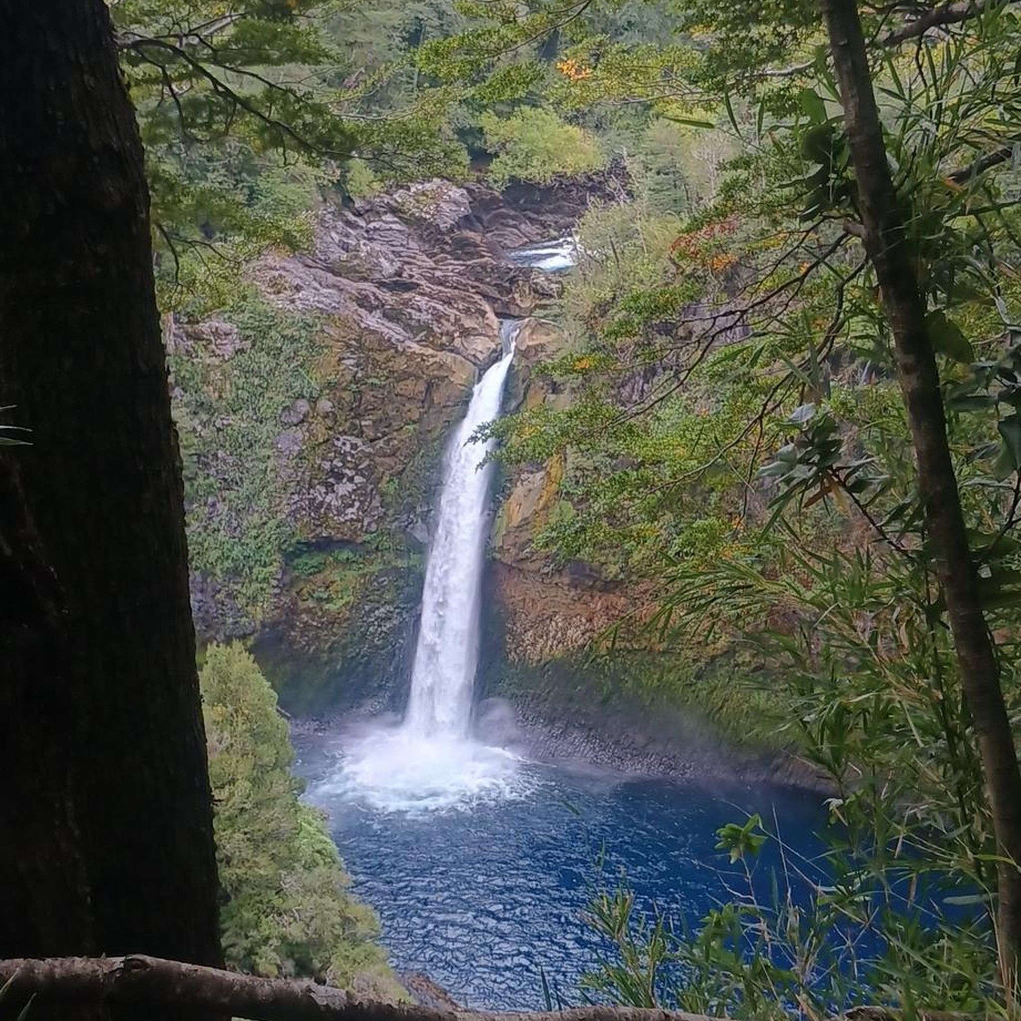
Yes, the area around Independence is home to several beautiful waterfalls. The Bedford Reservation – Bridal Veil Falls loop from Walton Hills will take you near Bridal Veil Falls. Other notable waterfalls in the vicinity include Brandywine Falls and Linda Falls.
What is the best time of year for road cycling in Independence?
The best time for road cycling in Independence is typically during spring, summer, and fall. These seasons offer pleasant temperatures and vibrant scenery, making for enjoyable rides. While winter cycling is possible, be mindful of colder temperatures and potential icy conditions.
Are there long-distance road cycling routes in the Independence area?
Yes, for those seeking longer rides, Independence has several routes that extend for significant distances. The John Brown Tannery Park – Darrow Lake loop from Canal Exploration Center is a moderate route spanning over 82 km, offering a substantial cycling adventure.
What do other road cyclists say about the routes in Independence?
The road cycling routes in Independence are highly rated by the komoot community, with an average score of 4.8 stars from over 10 reviews. Cyclists often praise the blend of natural scenery, accessible pathways, and the well-maintained canal-side riding experiences.
Are there family-friendly road cycling options in Independence?
Many of the easy and moderate routes along the canal paths and through parklands are suitable for families. These routes often feature relatively flat sections and scenic environments, providing a safe and enjoyable experience for cyclists of all ages. Look for routes marked as 'easy' for the most family-friendly options.
Most popular attractions around Independence

Get inspired with the komoot mobile app


Explore more
Browse the best Road cycling routes in other regions.
