The best running trails around Clayton
106
runners
7
runs
Jogging around Clayton offers access to a diverse landscape, from the extensive trail systems at the base of Mount Diablo to varied local terrain. The region features rolling grassy hills, some forested areas, and rugged trails within Mount Diablo State Park, providing significant elevation changes. Beyond the state park, Clayton's own trail system includes flat, paved routes along city creeks and steeper paths through surrounding hills. This network connects directly to Mount Diablo State Park, offering a wide range of…
Last updated: October 1, 2026
1
runners
7.35km
00:45
10m
10m
The Stillwater River Recreation Trail offers a pleasant and varied jogging experience along the banks of the designated Ohio Scenic River. You'll pass through lush corridors shaded by Sycamore, Maple,…
10
runners
Moderate run. Good fitness required. Mostly paved surfaces. Suitable for all skill levels.

9
runners
5.99km
00:44
60m
60m
Moderate run. Good fitness required. Mostly paved surfaces. Suitable for all skill levels.
7
runners
30.9km
03:12
90m
90m
Hard run. Very good fitness required. Mostly paved surfaces. Suitable for all skill levels.
6
runners
9.17km
00:58
100m
100m
Moderate run. Good fitness required. Mostly paved surfaces. Suitable for all skill levels.
Get access to more routes and recommendations from other explorers.
Already have an account?
Our route recommendations are based on thousands of hikes, rides, and runs completed by other people on komoot.


Tips from the Community

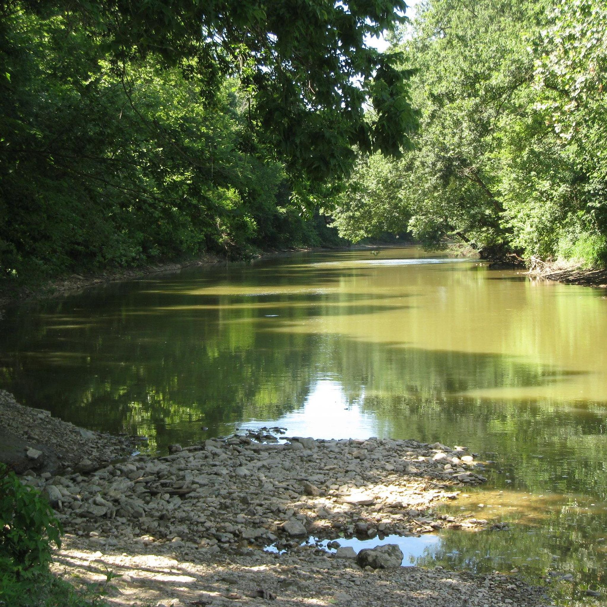
Here the trail passes over the Great Miami River, which runs for a total of 160 miles through southwest Ohio and Indiana.
0
0

No matter the season, Englewood Metropark offers something for everyone. Hike or bike on over 12 miles of scenic trails, cast a line and try your luck fishing in the Stillwater River, or paddle the calm waters on a canoe or kayak. In winter, the park transforms into a winter wonderland, perfect for cross-country skiing or sledding.
1
0
Trails along the banks of the Stillwater River offer a delightful way to explore the park. Listen to the sounds of nature, and soak up the beauty of the river and surrounding woodlands. Calm stretches of the Stillwater River are ideal for kayaking and canoeing.
0
0
A moderately sized waterfall, Patty Falls boasts an 8-foot drop. The water cascades down a rocky face, creating a small pool at the bottom. Lush greenery surrounds the falls, and a lovely wooden bridge above, making it a picture-perfect spot.
1
0
Oak Falls, while not the grandest waterfall in the park, it has its own charm. Standing at a modest 7 feet tall with a 4-foot crest, it offers a delightful cascade down a rock face. The trail leading to it is considered easy, making it a perfect destination for a casual stroll or a family outing with all ages.
1
0

Poplar Creek Fishing Pond is a small pond with some decent sized fish. Shore fishers can expect to find a variety of species in the pond, including Largemouth Bass, Smallmouth Bass, Channel Catfish, and Flathead Catfish. The pond provides an opportunity for a relaxed and enjoy the day.
0
0

The Stillwater River Recreation Trail is a paved multi-use path that follows along the banks of the Stillwater River and connects the towns of Dayton and Englewood. The path has a number of different trailheads and parking areas so that you can start your run at different points along the trail.
0
0

Orange Trail makes for a great relaxing hike in a well-maintained environment. This hike is especially enjoyable on hot days as the trees offer some shade and the nature looks beautiful under the light of a bright sunny day.
1
0
Frequently Asked Questions
How many running routes are available around Clayton?
Clayton offers an extensive network for runners. Beyond the specific routes highlighted in this guide, the town features 27 miles of trails across approximately 515 acres of open space. Additionally, it provides direct access to Mount Diablo State Park, which alone boasts 79 miles of trails, ranging from easy to expert difficulty.
What kind of terrain can I expect on jogging trails in Clayton?
You'll find a diverse range of terrain. Clayton's local trail system includes flat, paved routes along city creeks, as well as steeper, more rugged paths through the surrounding hills. Within Mount Diablo State Park, expect rolling grassy hills, some forested areas, and challenging trails with significant elevation changes. The well-draining geology in higher parts of the park also means trails are less prone to muddiness after winter storms.
Are there any family-friendly running routes in Clayton?
Yes, Clayton offers options suitable for families. While some trails involve substantial elevation gain, the local trail system includes flat, paved routes along city creeks that are ideal for a more leisurely family run. For specific routes, consider exploring areas with minimal elevation gain, such as parts of the Clayton Trail System.
Can I bring my dog on the running trails in Clayton?
Many trails in the Clayton area are dog-friendly, but it's always best to check specific park and trail regulations before heading out. Generally, dogs are permitted on leash in most open space areas and many trails within Mount Diablo State Park, though some wilderness areas may have restrictions.
What are some scenic spots or landmarks I can see while running in Clayton?
Running in Clayton offers access to stunning natural beauty. From the trails, you can enjoy panoramic vistas from Mount Diablo, which on clear days can extend almost 200 miles. The area is also known for its diverse wildlife and vibrant wildflowers, especially in early spring. Within the broader region, you might encounter highlights like the Five Rivers Fountain of Lights or the peaceful Wegerzyn Gardens Metropark.
Are there any loop running routes in Clayton?
Yes, there are several loop running routes available. For example, the Five Rivers Fountain of Lights – First Baptist Church loop from Dayton is a moderate 3.9-mile path offering a pleasant urban and riverside experience. Another option is the Mad River Recreation Trail loop from Dayton, which is a longer 7.2-mile trail through varied terrain.
What is the best time of year for jogging in Clayton?
The spring and fall seasons are generally ideal for jogging in Clayton, offering mild temperatures and beautiful scenery, especially with wildflowers blooming in spring. While summer can be warm, early mornings or evenings are pleasant. Winter running is also possible, as the well-draining geology in higher parts of Mount Diablo State Park means trails are less prone to muddiness after rain.
Are there running routes suitable for beginners in Clayton?
Absolutely. While the region offers challenging trails, beginners can find suitable routes within Clayton's local trail system, which includes flat, paved paths along city creeks. These provide a gentler introduction to running. For a moderate option, the Stillwater River Recreation Trail is a 4.6-mile route with minimal elevation gain.
What do other runners enjoy most about jogging in Clayton?
The komoot community highly rates the running experience in Clayton. With over 100 runners having explored the area using komoot, many praise the diverse terrain, from paved paths to rugged hills, and the access to natural features like Mount Diablo. The variety of routes catering to different ability levels is also frequently highlighted.
Are there any longer running routes for experienced runners?
Yes, experienced runners will find plenty of challenging options. The extensive trail network within Mount Diablo State Park features 79 miles of trails, including rugged paths with significant elevation changes, perfect for longer, more demanding runs. The Mad River Recreation Trail loop from Dayton, at 7.2 miles, is a good example of a longer route with varied terrain.
Where can I find parking for running trails in Clayton?
Parking is generally available at various access points to the trail systems. For trails within Mount Diablo State Park, there are designated parking areas, such as near the Mitchell Canyon Visitor Center. For Clayton's city trails, you can often find parking near community parks or specific trailheads. It's advisable to check local park websites for detailed parking information.
Are there any running groups or events in Clayton?
Yes, Clayton has a vibrant running community. The 'Clayton Area Runners' is a local association that organizes weekly runs for all paces and distances, from 5K to ultra-marathons. This provides a great opportunity to connect with other runners and explore the trails together.
Most popular routes around Clayton
Most popular attractions around Clayton

Get inspired with the komoot mobile app


Explore more
Browse the best Running Trails & Routes in other regions.
