The best road cycling routes around Mcdonald
5.0
(1)
221
riders
39
rides
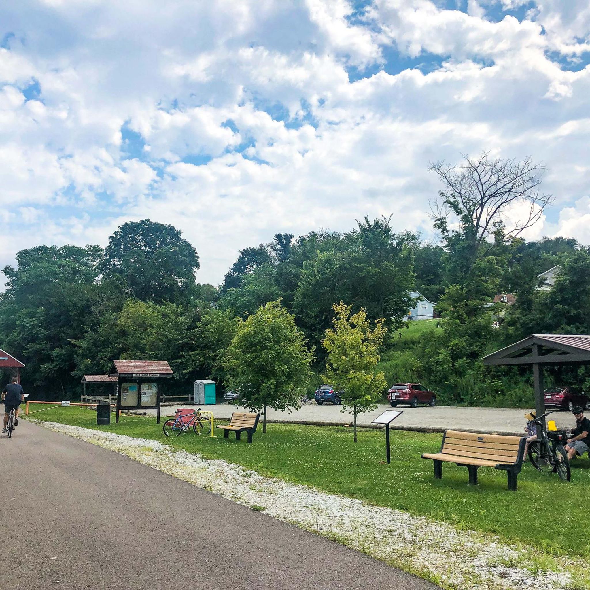
Road cycling routes around Mcdonald feature a landscape characterized by rolling hills and converted rail trails, offering varied terrain for cyclists. The region includes wooded sections and open areas, providing a mix of environments for rides. Elevations on routes indicate a dynamic topography with gradual climbs and descents. This area provides options for road cyclists seeking both longer distance rides and shorter loops.
Best road cycling routes around Mcdonald
- The most popular road cycling route is Panhandle Trail, a…
Last updated: July 15, 2026
88
riders
84.8km
03:32
500m
500m
Moderate road ride. Good fitness required. Mostly well-paved surfaces and easy to ride.
60
riders
89.3km
04:03
710m
710m
Moderate road ride. Good fitness required. Some segments of this route may be unpaved and difficult to ride.

Sign up for free
11
riders
21.3km
00:56
190m
190m
Easy road ride. Great for any fitness level. Mostly well-paved surfaces and easy to ride.
8
riders
37.2km
01:49
330m
330m
Moderate road ride. Good fitness required. Some segments of this route may be unpaved and difficult to ride.
6
riders
115km
06:09
990m
990m
Hard road ride. Very good fitness required. Some segments of this route may be unpaved and difficult to ride.
Get access to more routes and recommendations from other explorers.
Sign up for free
Already have an account?
Our route recommendations are based on thousands of hikes, rides, and runs completed by other people on komoot.
Start today with a free account
Your next adventure awaits.
Login or Signup



Tips from the Community

Great ride along the river with several places to pull off and enjoy the view.
0
0


The bridges of Pittsburgh are just magnificent
0
0


If You need water, don't count on public water fountains in Pittsburgh because they barely ever get turned on.
1
0
This is where the Allegheny River and the Monongahela River meat to form the Ohio River.
1
0
Frequently Asked Questions
How many road cycling routes are available around Mcdonald?
There are over 40 road cycling routes available around Mcdonald, offering a variety of distances and difficulty levels for cyclists to explore.
What kind of terrain can I expect on road cycling routes around Mcdonald?
The road cycling routes around Mcdonald feature a landscape characterized by rolling hills and converted rail trails. You'll find a mix of wooded sections and open areas, with dynamic topography including gradual climbs and descents. The Panhandle Trail, for instance, follows a converted rail trail with a generally consistent grade, while routes like the Raccoon Presbyterian Church loop from Cecil Township feature significant elevation gain through rural and wooded areas.
Are there routes suitable for beginners or less experienced road cyclists in Mcdonald?
Yes, Mcdonald offers a few routes suitable for beginners. While most routes are moderate, there are at least 2 easy routes available, providing options for those looking for a less strenuous ride.
Are there challenging road cycling routes for experienced riders around Mcdonald?
For experienced riders seeking a challenge, Mcdonald has at least 3 difficult road cycling routes. The Raccoon Presbyterian Church loop from Cecil Township, for example, is a moderate route that features significant elevation gain over its 56.9 miles, providing a good workout through rural and wooded areas.
What scenic features can I expect to see along the road cycling routes?
Along the road cycling routes around Mcdonald, you can discover several interesting features. The Enlow Tunnel – Forestbrooke Conservation Area loop from McDonald takes you through the notable Enlow Tunnel. Other highlights in the area include the National Tunnel, the McDonald Trestle Bridge, and the picturesque Settler’s Cabin Waterfall.
Are there any tunnels or unique landmarks on the routes around Mcdonald?
Yes, several routes feature unique landmarks. The Enlow Tunnel – Forestbrooke Conservation Area loop from McDonald specifically leads through the Enlow Tunnel. You can also find the National Tunnel and the historic McDonald Trestle Bridge in the vicinity of the cycling paths.
What are the main characteristics of the Panhandle Trail for road cycling?
The Panhandle Trail is a popular choice for road cyclists, stretching 52.7 miles (84.8 km). It follows a converted rail trail, which means it generally offers a consistent and relatively flat grade, making it suitable for longer distance rides. It's often completed in about 3 hours and 32 minutes.
Are there any loop routes available for road cycling around Mcdonald?
Yes, Mcdonald offers several loop routes. Examples include the Raccoon Presbyterian Church loop from Cecil Township, the Enlow Tunnel – Forestbrooke Conservation Area loop from McDonald, and the Westland Junction loop from McDonald. These routes provide varied distances and experiences, allowing you to start and end your ride in the same location.
Is parking available near the road cycling routes in Mcdonald?
Yes, parking is generally available. For instance, the McDonald Panhandle Trail trailhead is a designated facility where you can typically find parking to access the Panhandle Trail and other nearby routes.
Can I reach the road cycling routes around Mcdonald by public transport?
Information regarding specific public transport options directly to the trailheads around Mcdonald is not readily available in the guide data. It's advisable to check local public transportation schedules and routes for the McDonald, Pennsylvania area if you plan to use public transport.
Are there any permits required for cycling on the trails around Mcdonald?
Based on the available information, there are no specific permits mentioned as being required for cycling on the Panhandle Trail or Montour Trail, or other routes around Mcdonald. However, it's always a good practice to check for any local regulations or trail-specific requirements before your ride.
What do other road cyclists think about the routes around Mcdonald?
The road cycling routes in Mcdonald are highly rated by the komoot community, with an average score of 5.0 stars from 1 review. More than 200 road cyclists have used komoot to explore Mcdonald's varied terrain, indicating a positive experience among those who have ridden here.
Most popular attractions around Mcdonald

Get inspired with the komoot mobile app


Explore more
Browse the best Road cycling routes in other regions.
