The best road cycling routes around Mount Pleasant
4.8
(14)
822
riders
18
rides
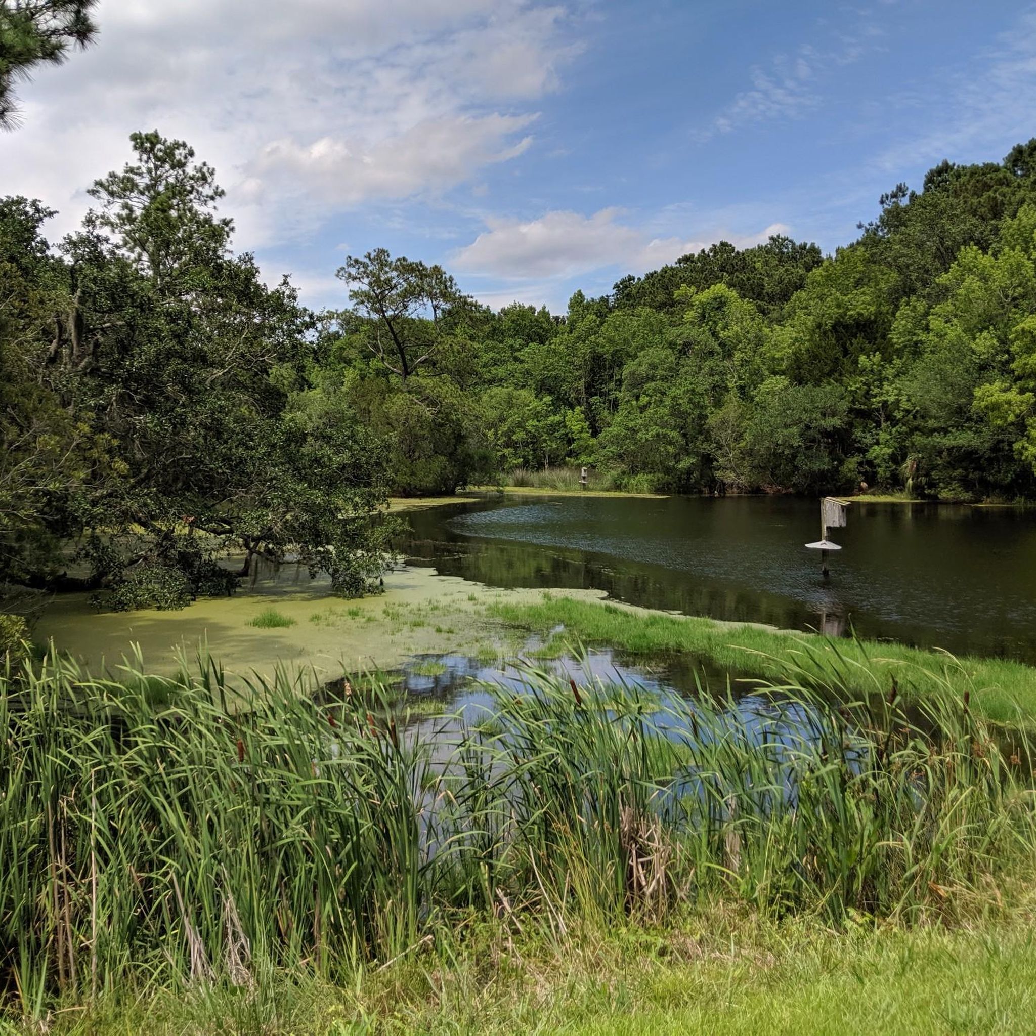
Road cycling routes around Mount Pleasant are characterized by a generally flat terrain, offering diverse landscapes for cyclists. The region features extensive coastal beauty, shimmering marshlands, and waterfront areas along Charleston Harbor and the Cooper River. Cyclists can expect routes framed by live oaks and views of the Lowcountry's natural features.
Best road cycling routes around Mount Pleasant
- The most popular road cycling route is East Coast Greenway (SC), a 31.5 miles (50.7 km) trail that takes 2 hours…
Last updated: October 10, 2026
4.5
(2)
67
riders
50.7km
02:07
50m
50m
The East Coast Greenway (SC) offers a unique road cycling adventure through the state's picturesque Lowcountry, blending coastal charm with rural landscapes. You'll pedal past historic sites like Charleston's iconic…
4
riders
39.1km
01:33
30m
30m
Embark on the Wando River loop for an easy road cycling experience, covering 24.3 miles (39.1 km) with a gentle elevation gain of just 113 feet (34 metres). This route,…

3
riders
68.1km
02:35
100m
100m
The Little Wambaw Swamp loop is a 42.3-mile, moderate mountain bike or OHV trail in Francis Marion National Forest, not suitable for road cy
111
riders
Moderate road ride. Good fitness required. Mostly well-paved surfaces and easy to ride.
5.0
(1)
93
riders
Easy road ride. Great for any fitness level. Mostly well-paved surfaces and easy to ride.
Get access to more routes and recommendations from other explorers.
Already have an account?
Our route recommendations are based on thousands of hikes, rides, and runs completed by other people on komoot.
Start today with a free account
Your next adventure awaits.
Popular around Mount Pleasant
Tips from the Community

A truly historic place worth visiting. This is where the Civil War began
0
0

Sullivan's Island, located off the South Carolina coast, is a barrier island with a layered history that extends beyond military events. Not only has it played a pivotal role in conflicts like the American Revolution and Civil War - Fort Sumter on the western tip of the island is where the first shots of the Civil War were fired - but it also holds profound significance in Black history. Serving as a major entry point during the transatlantic slave trade, the island witnessed the arrival of thousands of enslaved Africans throughout the 18th century. Amidst its scenic beauty, Sullivan's Island has a complex history, that visitors can learn more about when they visit.
0
0
Charleston Light, also known as Sullivan's Island Lighthouse, is on Sullivan's Island, South Carolina, and marks the northern gateway to Charleston Harbor. Constructed in 1960, this 140-foot tall structure replaced the eroding Morris Island Light. Its triangular, steel frame can withstand winds of 125 mph. The unique lighthouse has been in operation since1962 and boasts an elevator and air conditioning. It is also the last federally-built onshore manned beacon. Despite its current role in the Coast Guard Historic District, structural issues prevent public access. Visitors can, however, explore the scenic surroundings and nearby public beach.
1
0
The Fort Sumter & Fort Moultrie National Historical Park Visitor Center serves as a gateway to two significant Civil War sites in Charleston, South Carolina. Focused on preserving the region's history, the center provides an immersive experience into the events leading to the Civil War. Fort Sumter is particularly significant because it was where the first shots of the Civil War were fired on1861. The Visitor Center offers educational exhibits, artifacts, and guided tours, allowing visitors to explore the pivotal moments that shaped the nation's history during this tumultuous period.
1
0
The Morgan Creek Docks is a saltwater "lake" surrounded by marsh and coast that ebbs and flows with the tides, as it is fed by the Atlantic Intracoastal Waterway. This is a very pretty spot on the unique Isle of Palms near Charleston.
0
0

The Fort Sumter and Fort Moultrie National Historical Park Visitor Center is a brilliant historical visit. Fort Moultrie comprises a series of citadels that were constructed with the purpose of protecting the city of Charleston. This famed and historical site offers a unique insight into the defensive strategies and architectural designs of the past.
0
0
Charleston Light, or otherwise known as Sullivan’s Island Lighthouse, has guided mariners into the harbor since 1962. It is a very distinctive lighthouse with an unusual design. It is part of the United States Coast Guard Historic District that includes historic buildings dating back to 1894. It is still a working lighthouse but it is surrounded by a fence. However, members of the public are more than welcome to walk around the perimeter as the lighthouse is a favorite photo opportunity location.
1
0
Battery Thomson Fort is an interesting historic artillery battery here on Sullivan's Island. It is one of three batteries stretching from Fort Moultrie to the eastern end of the Island. It is listed on the National Register of Historic Places.
0
0
Frequently Asked Questions
How many road cycling routes are available in Mount Pleasant?
Mount Pleasant offers a diverse selection of over 20 road cycling routes, catering to various skill levels. You'll find a good mix of easy and moderate rides to explore the region's unique landscapes.
What is the best time of year for road cycling in Mount Pleasant?
The best time for road cycling in Mount Pleasant is typically during the spring and fall months. The weather is milder, making for more comfortable rides. While winter can also be pleasant, summers can be hot and humid, so early morning or late afternoon rides are recommended during those months.
Are there road cycling routes suitable for beginners in Mount Pleasant?
Yes, Mount Pleasant has several easy road cycling routes perfect for beginners. For instance, the Wando River loop is an easy 24.3-mile path offering scenic views through marshlands. The generally flat terrain of the Old Village District also provides leisurely cruising opportunities.
Are there any challenging road cycling routes in Mount Pleasant?
For those seeking a challenge, the iconic Arthur Ravenel Jr. Bridge (Wonders Way) offers a vigorous workout with spectacular panoramic views of Charleston Harbor. Routes like the East Coast Greenway (SC) and the Little Wambaw Swamp loop are also rated as moderate, providing varied Lowcountry terrain over longer distances.
What natural features or landmarks can I see while road cycling in Mount Pleasant?
Road cycling in Mount Pleasant offers stunning views of coastal beauty and marshlands. You can ride along routes framed by live oaks draped in Spanish moss, with shimmering marshlands as a backdrop. Notable landmarks include the Arthur Ravenel Jr. Bridge (Wonder's Way), the Mount Pleasant Memorial Waterfront Park, and the scenic Pitt Street Bridge, which offers views of Charleston Harbor and Sullivan's Island.
Are there any historical sites accessible by road bike in Mount Pleasant?
Yes, several historical sites are within cycling distance or can be incorporated into your rides. You can explore the historic homes in the Old Village District or cycle towards areas near Fort Moultrie Cannons and Battery Thomson. The Boone Hall Plantation is also a significant historical property nearby.
Where can I find parking for road cycling routes in Mount Pleasant?
Many popular cycling areas in Mount Pleasant offer convenient parking. The Mount Pleasant Waterfront Park is a common starting point for group rides and offers parking. Additionally, various public parks and access points along routes like the Ben Sawyer Bikeway provide parking options.
Are there family-friendly road cycling options in Mount Pleasant?
Absolutely. The Old Village District, with its charming, tree-lined streets and flat terrain, is ideal for leisurely family rides. Palmetto Islands County Park also features paved trails suitable for families, including the scenic Osprey Trail.
Can I bring my dog on road cycling trails in Mount Pleasant?
While many road cycling routes are on public roads or paved paths, it's generally not recommended to bring dogs on bikes, especially on busier routes, for safety reasons. However, some parks like Palmetto Islands County Park offer nature trails where leashed dogs are permitted, but these might not be suitable for road bikes.
What do other road cyclists enjoy the most about road cycling in Mount Pleasant?
The road cycling routes in Mount Pleasant are highly rated by the komoot community, with an average score of 4.1 stars. Cyclists often praise the diverse landscapes, from coastal paths and marshlands to charming historic districts, and the generally flat terrain that makes many areas accessible for all abilities.
Are there any loop road cycling routes in Mount Pleasant?
Yes, Mount Pleasant offers several excellent loop routes. The Wando River loop and the Little Wambaw Swamp loop are popular choices that allow you to start and end in the same location, providing a convenient and scenic cycling experience.
Are there cafes or pubs near the road cycling routes in Mount Pleasant?
Mount Pleasant has a vibrant local scene, and you'll find numerous cafes and pubs, especially around areas like Shem Creek and the Old Village District. These spots are perfect for a refreshment stop during or after your ride, offering a chance to enjoy local cuisine and views.
Most popular attractions around Mount Pleasant

Get inspired with the komoot mobile app


Explore more
Browse the best Road cycling routes in other regions.
