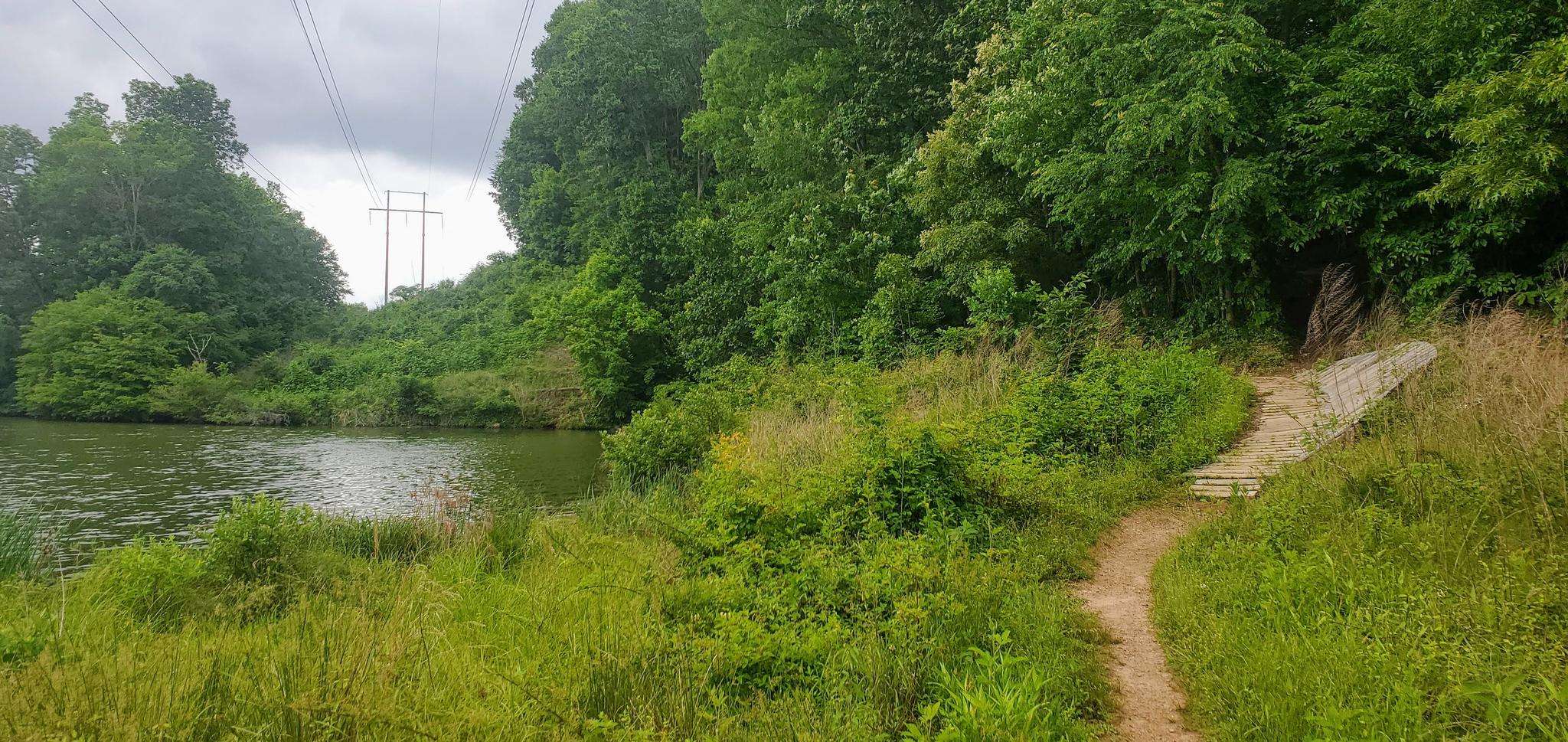
The best walks and hikes around Oak Ridge
5.0
(2)
23
hikers
15
hikes
Hiking around Oak Ridge offers a diverse outdoor experience across its extensive network of trails. The region features lush forests, varied elevations, and riverfront paths along the Clinch River. Hikers can explore landscapes characterized by century-old hardwoods, greenways, and natural corridors. The terrain ranges from mostly flat sections to routes with moderate climbs, roots, and rocks.
Best hiking trails around Oak Ridge
- The most popular hiking route is University of Tennessee Arboretum Loop, a 3.0 miles (4.9 km) trail that takes about 1 hour 20 minutes to complete, winding through the arboretum's diverse plant collections.
- Another top favourite among local hikers is Black Oak Ridge Trail, a moderate 6.2 miles (9.9 km) path. This trail features varied terrain with an elevation gain of over 500 feet (150 meters).
- Local hikers also love the Melton Lake Greenway, a 5.7 miles (9.1 km) trail leading through scenic riverfront areas, often completed in about 2 hours 25 minutes.
- Hiking around Oak Ridge is defined by extensive greenways, riverfront paths along the Clinch River, and lush forested hills. The network offers options for various ability levels, from easy strolls to more challenging routes.
- The routes in Oak Ridge are highly rated by the komoot community with an average score of 5.0 stars from a few reviews. More than 20 hikers have used komoot to explore Oak Ridge's varied terrain.
Last updated: July 8, 2026
2
hikers
4.86km
01:20
80m
80m
Explore the University of Tennessee Arboretum Loop, an easy hiking route that offers a diverse landscape as you wind through wooded areas and extensive plant collections. This 3.0-mile (4.9 km) trail, with a gentle 275 feet (84 metres) of elevation gain, provides a varied experience for hikers. You can expect to complete the loop in about 1 hour and 20 minutes at a steady pace. From sections like the Cemetery Ridge Trail, you will enjoy unique views of the Oak Ridge Memorial Park and the highway below, adding an interesting perspective to your journey. Many of the shrubs and trees along the way are labeled, offering an educational element to your hike.
When planning your visit, you will find parking generally available near the Arboretum's entrance. A visitor center is also located there, providing educational information to enhance your experience. The trails are well-maintained and suitable for families looking for an accessible outdoor activity. However, be aware that some sections of the route may not be suitable for strollers or wheelchairs due to varied terrain, so plan accordingly if you have specific accessibility needs. This makes the University of Tennessee Arboretum Loop a great option for beginner hikers.
The University of Tennessee Arboretum is notable for its extensive plant collections, which you will encounter throughout your hike. Many of the shrubs and trees are clearly labeled, transforming your walk into an engaging educational experience about local flora. This unique feature sets the Arboretum Loop apart, allowing you to learn as you explore the natural environment. It's a perfect trail if you appreciate a blend of outdoor activity and botanical discovery, making it a distinctive destination in the region.
1
hikers
1.03km
00:16
0m
10m
Embark on the East Quarry Road Trail for a brief and easy hike, perfect for a quick escape into nature. This route spans 0.6 miles (1.0 km) with a minimal elevation gain of just 3 feet (1 metres), making it a very accessible option. You can expect to complete this pleasant walk in about 15 minutes, enjoying a mostly level path that was once a gravel road.
When planning your visit, you will find that the trail is open from sunrise to sunset, offering flexibility for your schedule. Parking is generally available right at the trailhead, making access straightforward. This path is known for draining well, so you can comfortably hike here even after a period of rain without encountering muddy conditions.
As you follow the trail, keep an eye out for glimpses of the quarry lake, a notable feature that hints at the area's industrial past. You will also pass by old homesites, inviting you to imagine the history of the "Secret City" that once thrived here. This section serves as a gentle introduction to the larger North Boundary Trail system, offering a unique blend of natural beauty and historical intrigue.

Sign up for free
1
hikers
4.02km
01:05
50m
40m
Explore the Gallaher Bend Greenway, an easy 2.5-mile (4.0 km) hike that gently rolls through peaceful wooded areas. You will gain 178 feet (54 metres) in elevation, and the route typically takes about 1 hour and 4 minutes to complete. The trail primarily features a gravel surface, offering a quiet experience as you walk. Keep an eye out for lovely vistas of Melton Lake, especially near the beginning and end of your journey, providing serene views over the water.
Before you head out, remember that the Gallaher Bend Greenway is situated on federal land. This means you need to stay strictly on the marked trail and follow all posted regulations. Be aware that the area experiences seasonal closures on certain weekends in the fall for deer hunts and in the spring for turkey hunts. Always check local advisories before your visit to ensure the trail is open and accessible.
This tranquil route offers a peaceful escape within Clark Center Park, allowing you to immerse yourself in a forested setting. The trail's location on Department of Energy (DOE) reservation land contributes to its unique, regulated environment. It provides a distinct opportunity to enjoy nature while adhering to specific guidelines designed to protect the area.
1
hikers
9.93km
02:43
160m
160m
Embark on a moderate hike along the Black Oak Ridge Trail, a 6.2-mile (9.9 km) route that winds through diverse ridge-top woodlands and past striking karst bluffs adorned with mountain laurel. You will experience a mix of oak-hickory hardwoods and pine forests, gaining 511 feet (156 metres) in elevation over an estimated 2 hours and 43 minutes. As you traverse the Dyllis Orchard Road Hiking Trail section, you can catch glimpses of the East Tennessee Technology Park, offering a unique visual landmark on your journey.
Before you head out, be aware that the Black Oak Ridge Trail is subject to seasonal closures for spring turkey and fall deer hunts, so always check the schedule beforehand. The trail generally boasts excellent drainage, keeping conditions largely mud-free throughout the year, which makes for a pleasant experience in most weather. You can find convenient parking and the trailhead access point at latitude 35.949526, longitude -84.411141, making it easy to start your adventure.
This trail offers a rich outdoor experience within the Black Oak Ridge Conservation Easement, an area known for its varied natural features. Keep an eye out for local wildlife, including woodland birds such as the Yellow-billed Cuckoo and the Wood Thrush, which add to the natural charm of the route. The conservation easement provides a vital habitat and a wonderful opportunity to connect with the region's natural environment.
14.3km
04:10
370m
390m
Embark on the North Ridge Trail, a moderate hiking route spanning 8.9 miles (14.3 km) with an elevation gain of 1201 feet (366 metres). You can expect a rewarding experience over approximately 4 hours and 9 minutes, navigating hilly terrain with manageable climbs and descents. As you hike, you will find a mix of forested sections and open views, particularly from the powerline swaths around Mississippi and Illinois Avenues, offering glimpses of distant mountains.
Planning your visit is straightforward, as the North Ridge Trail is generally accessible and can be hiked in segments or its full length. Parking is available at various access points, including near the North Walker Access. Be aware that an extremely steep section exists just west of the North Walker Access, which might require extra caution during your hike.
This trail offers a varied natural experience, especially in spring when the area near the creek around the North Walker Access comes alive with abundant wildflowers. The route follows the northern side of Black Oak Ridge, providing a dynamic landscape for your outdoor adventure.
Get access to more routes and recommendations from other explorers.
Sign up for free
Already have an account?
Our route recommendations are based on thousands of hikes, rides, and runs completed by other people on komoot.
Start today with a free account
Your next adventure awaits.
Login or Signup

Frequently Asked Questions
How many hiking trails are there in Oak Ridge?
Oak Ridge offers a fantastic selection of hiking opportunities. Our guide features 15 curated routes, ranging from easy strolls to more challenging moderate hikes. In total, the city boasts over 85 miles of trails within its limits, providing options for all skill levels.
Are there easy hiking trails suitable for beginners or families in Oak Ridge?
Absolutely! Oak Ridge has several easy trails perfect for families and those seeking a relaxed walk. For instance, the University of Tennessee Arboretum Loop is an easy 4.8 km path through diverse plant collections. Another great option is the short East Quarry Road Trail, which is just over 1 km and very flat.
What are the best trails for scenic views or natural features in Oak Ridge?
Oak Ridge is rich in natural beauty. The Melton Lake Greenway offers picturesque views of the Clinch River and the Cumberland Mountain Tennessee Valley Divide. For a deeper immersion into nature, the UT Arboretum, which includes the University of Tennessee Arboretum Loop, features wetlands with bald cypress trees and over 2,500 plant specimens.
Are there any trails in Oak Ridge that are dog-friendly?
Many trails in Oak Ridge are dog-friendly, but it's always best to keep your canine companion on a leash. Haw Ridge Park, which includes the Haw Ridge Lake Trail, is a popular spot for dog walkers, offering over 30 miles of trails along the Clinch River.
Can I find any loop trails in Oak Ridge?
Yes, loop trails are a great way to experience the diverse landscapes of Oak Ridge. The University of Tennessee Arboretum Loop is a popular circular route. Additionally, many trails within Haw Ridge Park, such as the Haw Ridge Lake Trail, can be combined to form various loop configurations.
What historical landmarks or points of interest can I find along the hiking trails?
Oak Ridge's trails are uniquely intertwined with its history. In Haw Ridge Park, you can discover the remnants of a large-scale cattle and dairy ranch, including the Haw Ridge Silo. The Worthington cemetery trail at Elza Gate Park marks the site where materials for the Manhattan Project were first staged. The Cedar Hill Greenway passes by significant city landmarks like the Manhattan Project Guest House hotel, Chapel on the Hill, and Jackson Square.
What is the best time of year to go hiking in Oak Ridge?
Oak Ridge offers enjoyable hiking experiences throughout the year. Spring brings beautiful wildflowers, while autumn showcases vibrant fall foliage. Summer is great for shaded trails, and even winter hiking can be pleasant, especially on less strenuous routes. Always check local weather conditions before heading out.
Are there any challenging hiking trails for experienced hikers in Oak Ridge?
While Oak Ridge has many easy and moderate options, some trails offer more challenge. The Black Oak Ridge Trail, at nearly 10 km with over 150 meters of elevation gain, provides a moderate challenge. Haw Ridge Park also contains trails with varied terrain, including steeper sections and rocky paths, for those looking for a more strenuous workout.
What do other hikers enjoy most about hiking in Oak Ridge?
The komoot community highly rates the hiking experiences in Oak Ridge, with an average score of 5.0 stars. Reviewers often praise the region's diverse landscapes, the well-maintained trails, and the unique blend of natural beauty with historical significance. The peaceful riverfront paths and extensive greenways are frequently highlighted as favorites.
Where can I find parking for the hiking trails in Oak Ridge?
Many of Oak Ridge's parks and greenways offer designated parking areas. For example, Haw Ridge Park and the University of Tennessee Arboretum have visitor parking. The Melton Lake Greenway also provides convenient access points with parking. For specific trailhead parking information, it's advisable to check the details for your chosen route.
Are there opportunities for wildlife spotting while hiking in Oak Ridge?
Yes, Oak Ridge's diverse ecosystems provide excellent opportunities for wildlife spotting. The TVA wetlands along the Worthington cedar barrens hiking trail are known for birdwatching, with over 100 varieties of songbirds recorded. Hikers might also encounter deer, squirrels, and various other small mammals and birds throughout the region's extensive greenways and forests.

Get inspired with the komoot mobile app


Explore more
Browse the best Hikes in other regions.
