The best walks and hikes around Valley Forge
5.0
(15)
144
hikers
13
hikes
Hiking around Valley Forge offers a variety of trails within a historical landscape. The region is characterized by its rolling hills, woodlands, and riverine areas, providing diverse settings for outdoor activity. Paths often follow historical routes or wind through natural preserves. The terrain generally includes moderate elevation changes, suitable for various hiking abilities.
Best hiking trails around Valley Forge
- The most popular hiking route is Appalachian Trail: Dennis Cove to US 19E, a 24.4 miles (39.3 km) trail that…
Last updated: July 2, 2026
20
hikers
39.3km
11:45
1,270m
1,180m
Hard hike. Very good fitness required. Easily-accessible paths. Suitable for all skill levels.
13
hikers
14.2km
04:36
550m
710m
Moderate hike. Good fitness required. Easily-accessible paths. Suitable for all skill levels.

Sign up for free
7
hikers
3.77km
01:02
100m
0m
Easy hike. Great for any fitness level. Easily-accessible paths. Suitable for all skill levels.
4
hikers
1.90km
00:33
10m
100m
Easy hike. Great for any fitness level. Easily-accessible paths. Suitable for all skill levels.
1
hikers
4.62km
01:17
90m
90m
Easy hike. Great for any fitness level. Easily-accessible paths. Suitable for all skill levels.
Get access to more routes and recommendations from other explorers.
Sign up for free
Already have an account?
Our route recommendations are based on thousands of hikes, rides, and runs completed by other people on komoot.
Start today with a free account
Your next adventure awaits.
Login or Signup
Popular around Valley Forge

Tips from the Community

US-19E is one of the most convenient access points to the Appalachian Trail near Roan Mountain. The road connects directly to both Roan Mountain, TN, and Elk Park, NC, it is a good spot to start, end, or resupply a section hike. Parking is available at the trailhead, but it’s best to coordinate with a shuttle if you’re leaving your car for more than a day. You can book with Roan Mountain Shuttle directly on their website: roanmountainshuttle.setmore.com.
0
0


The Appalachian Trail passes right over the top of Watauga Dam and looks over Watauga Lake. With the Pond Mountain Wilderness to the south and the Big Laurel Branch Wilderness to the north, this is a wild and secluded part of the AT. Once you get away from the boaters at the marina, you'll have a lot of solitude in either direction.
0
0
The Appalachian Trail passes right over the top of Watauga Dam and looks over Watauga Lake. With the Pond Mountain Wilderness to the south and the Big Laurel Branch Wilderness to the north, this is a wild and secluded part of the AT. Once you get away from the boaters at the marina, you'll have a lot of solitude in either direction.
0
0
The Appalachian Trail passes right over the top of Watauga Dam and looks over Watauga Lake. With the Pond Mountain Wilderness to the south and the Big Laurel Branch Wilderness to the north, this is a wild and secluded part of the AT. Once you get away from the boaters at the marina, you'll have a lot of solitude in either direction.
0
0
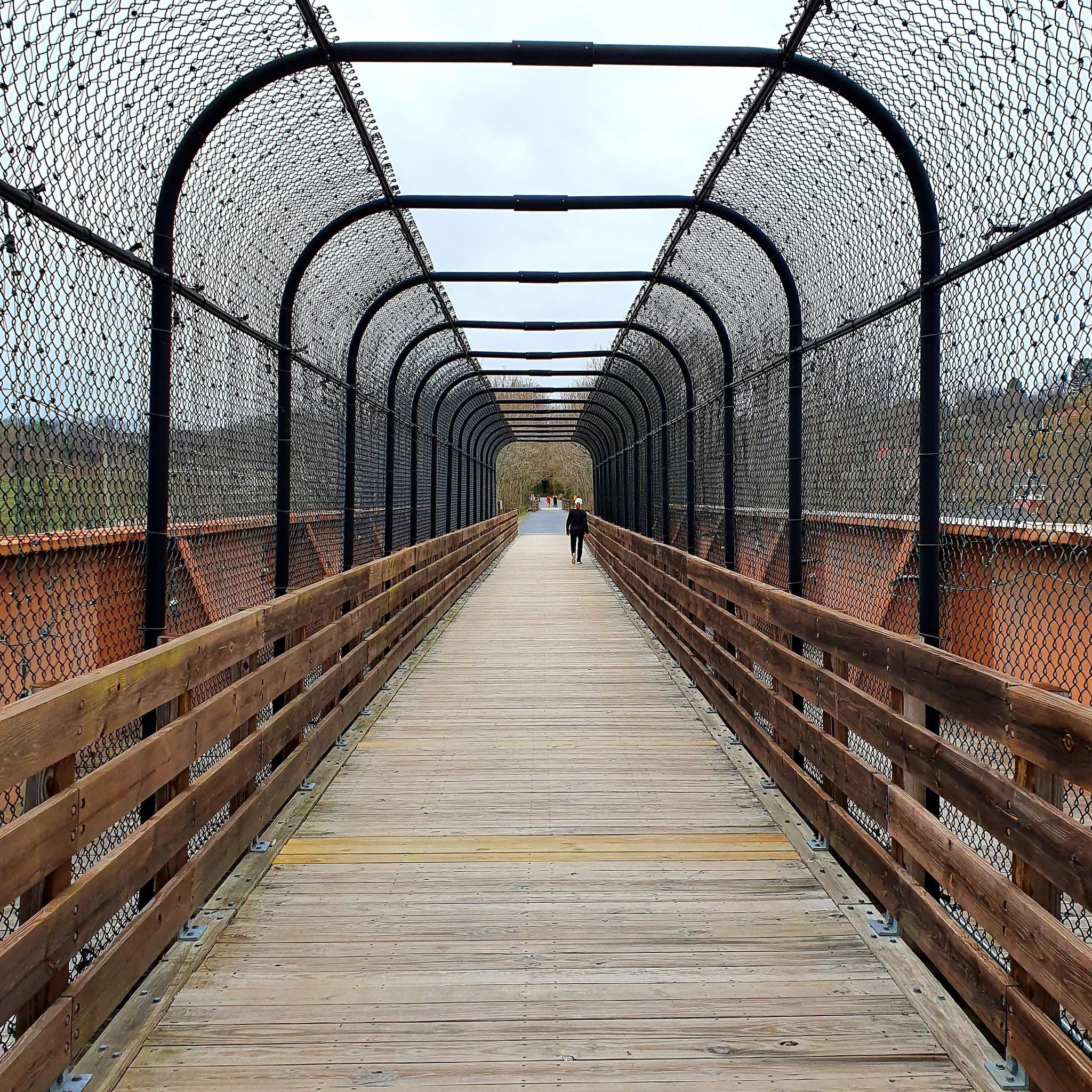
This bridge crosses over the Laurel Fork waterway, which gets pretty full in the spring and summer months. You actually have to cross the water a handful of times between here and Laurel Falls.
0
0
Laurel Falls is a really popular hiking destination. You can get there by taking the Appalachian Trail from Dennis Cove or by starting over in Hampton on the Blueline Trail. Note while out here that the white blazes on the trees and rocks are for the Appalachian Trail and the blue blazes are for the Blueline Trail. There is a super steep set of rock stairs for the final 200 meters down to the water. Be prepared to get in a workout once you leave the falls area!
0
0
Frequently Asked Questions
How many hiking trails are available in the Valley Forge area?
Based on komoot data, there are over 10 hiking routes in the Valley Forge area, offering a diverse range of experiences from easy strolls to challenging long-distance treks.
What types of trails can I expect in the Valley Forge region?
The Valley Forge region, as defined by these routes, features trails primarily through forested areas, with some offering views of Watauga Lake and passing by waterfalls. You'll find paths with moderate elevation changes, characteristic of the Appalachian landscape.
Are there any easy hiking trails suitable for beginners or families?
Yes, there are several easy trails. For a relatively short and scenic option, the Laurel Falls Trail is an excellent choice, leading through forested terrain to a waterfall. Another easy option is the Appalachian Trail: Oliver Hollow Road to Watauga Dam.
Are there any trails with waterfalls in the Valley Forge area?
Absolutely! The Laurel Falls Trail is a popular choice specifically for its waterfall destination. You can also experience Laurel Falls via the Laurel Falls via Appalachian Trail route.
What do other hikers enjoy most about hiking in Valley Forge?
The area is highly rated by the komoot community, with an average score of 4.9 stars. Reviewers often praise the diverse terrain, the historical park settings, and the scenic river valleys. The variety of routes, from easy walks to more challenging long-distance options, is also frequently highlighted.
Are there any notable landmarks or attractions along the hiking routes?
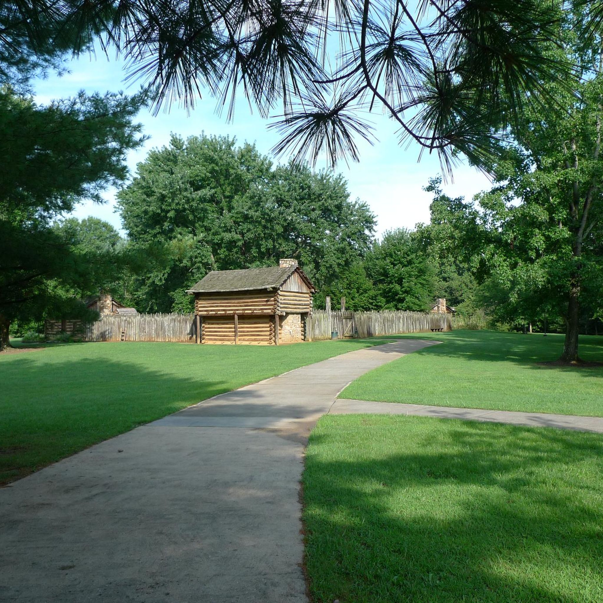
Yes, several points of interest can be found. You might encounter the Bridge over Laurel Fork, or historical sites like Fort Watauga. The Appalachian Trail: Dennis Cove to Watauga Lake route offers views of Watauga Lake itself, and you can also visit the Watauga Dam.
Are there any moderate hiking trails in the Valley Forge region?
Yes, for those looking for a moderate challenge, the Appalachian Trail: Dennis Cove to Watauga Lake is a great option. This 8.8-mile (14.2 km) path offers varied woodland and lake views.
Can I find long-distance or more challenging hikes in this area?
Definitely. For experienced hikers seeking a significant challenge, the Appalachian Trail: Dennis Cove to US 19E is a difficult 24.4-mile (39.3 km) route with substantial elevation gain through forested areas.
Are there any trails that offer views of lakes or rivers?
Yes, the region is characterized by its riverine areas and proximity to Watauga Lake. The Appalachian Trail: Dennis Cove to Watauga Lake provides excellent views of the lake, and the View of Watauga Lake from Big Laurel Branch Wilderness is a notable viewpoint.
What is the best time of year to hike in the Valley Forge area?
While specific seasonal data isn't provided, the region's rolling hills and woodlands suggest pleasant hiking conditions in spring and fall, with vibrant foliage. Summer offers lush greenery, and winter can provide a unique, serene experience, though some trails might be more challenging due to conditions.
Are there any historical sites to explore while hiking?
Yes, the area has historical significance. You can visit Fort Watauga, a historical site, which can be incorporated into your hiking plans or visited separately.
Most popular routes around Valley Forge
Most popular attractions around Valley Forge

Get inspired with the komoot mobile app


Explore more
Browse the best Hikes in other regions.
