The best running trails around Westway
5.0
(1)
125
runners
21
runs
Jogging around Westway offers access to well-maintained paths and diverse terrain. The region features extensive trail networks, providing options for various distances and intensities. Landscapes include wooded areas, open fields, and natural geological formations such as rocky cliffs. These characteristics make Westway a suitable location for outdoor activities and running.
Best jogging routes around Westway
- The most popular jogging route is North Franklin Peak Trail, a 7.7 miles (12.4 km) trail that takes 1 hour 58 minutes to complete.…
Last updated: July 1, 2026
12
runners
12.4km
01:58
710m
710m
Hard run. Very good fitness required. Mostly paved surfaces. Suitable for all skill levels.
3
runners
8.04km
01:02
230m
230m
Moderate run. Good fitness required. Mostly paved surfaces. Suitable for all skill levels.

Sign up for free
1
runners
5.01km
00:38
110m
110m
Moderate run. Good fitness required. Mostly paved surfaces. Suitable for all skill levels.
1
runners
4.76km
00:33
130m
130m
Moderate run. Good fitness required. Mostly paved surfaces. Suitable for all skill levels.
14
runners
22.2km
03:02
770m
770m
Hard run. Very good fitness required. Mostly paved surfaces. Suitable for all skill levels.
Get access to more routes and recommendations from other explorers.
Sign up for free
Already have an account?
Our route recommendations are based on thousands of hikes, rides, and runs completed by other people on komoot.
Start today with a free account
Your next adventure awaits.
Login or Signup



Tips from the Community

The main road leading from the entrance to Tom Mays Unit is completely paved but a pretty popular spot for biking and running. It’s a nice warm-up for some of the steeper trails, too, so a lot of people just run up the road to get to different trailheads.
0
0
Tom Mays Unit Trail is the very first trail on this side of the park. There are several different spots you access the trail from, and it works really well for helping create loops. It just gradually works its way up the canyon next to the main road, but you're separated by some distance and desert floor.
0
0
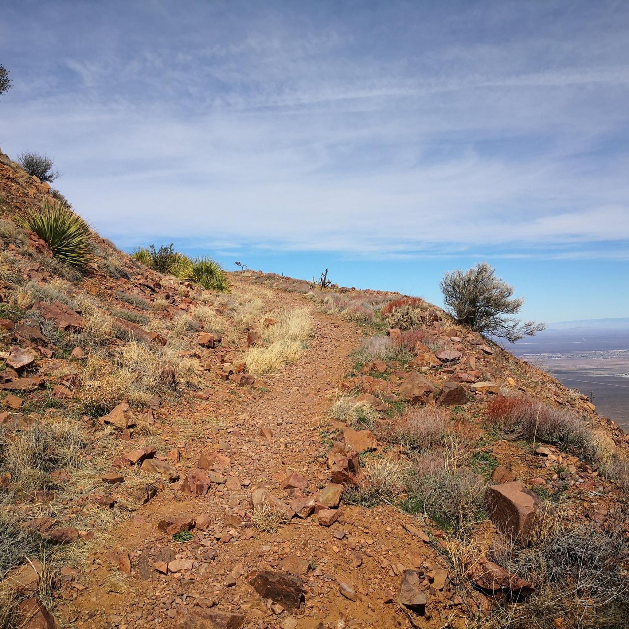
At an elevation of 7,192 feet, North Franklin Mountain is the highest peak in the Franklin Mountains. Couple that statistic with the fact that the route to gain the peak is a little less burly than the route to South Franklin, and you have a recipe for a busier trail. You still probably won't see a ton of other runners and hikers once you make it up to the ridge.
0
0
Like the trails climbing up to the ridge, the summit trail up to North Franklin is pretty rocky. The trail gets steeper the higher you climb, but it's all runnable terrain. There are views off both sides of the trail, but it's probably best to keep your head down so you don't roll an ankle here.
0
0
The caves are pretty cool, and you can even scramble up above them and hop onto other trails in the park. There are sweeping views back behind you the entire climb up.
0
0
The Upper Sunset trail follows a ridge overlooking the park road on one side and the western foothills of the park on the other. There is a pretty cool lookout spot here, and a lot of day hikers just go out and back to this spot from the upper parking lot.
0
0
Lower Sunset trail is one of the best running trails that you can access as soon as you pull into the park entrance. There are open views to the west the entire time, and the downhill back towards the campsites and picnic area is pretty sweet.
0
0

The Aztec Cave Trail includes a short distance and a high payoff. The trail is steep at times, and it is important to be cautious with your footing due to the abundance of loose rocks. Hikers will find native plants such as cacti, agave, and mesquite trees along the trail, as well as birds and desert rodents. Primitive campsites are available at the trailhead and along the trail.
0
0
Frequently Asked Questions
How many running routes are available in the Westway area?
The Westway region offers a good selection of running routes, with over 20 trails to explore. These routes cater to various fitness levels, including moderate and difficult options.
What kind of terrain can I expect on jogging routes around Westway?
Jogging routes in Westway feature diverse terrain. You'll find well-maintained paths, wooded areas, open fields, and even natural geological formations like rocky cliffs. Some trails, such as the North Franklin Peak Trail, include significant elevation gain, while others like the Lower Sunset and Upper Sunset Loop offer a mix of open and wooded sections with moderate changes.
Are there any family-friendly running trails in Westway?
While the guide primarily features moderate to difficult routes, the general characteristics of Westway, with its extensive trail networks and varied landscapes, suggest that some sections could be suitable for families. Look for routes with less elevation change and shorter distances for a more family-friendly experience. The Tom Mays and Upper Sunset Loop is a moderate 3.1-mile option that might be a good starting point.
Can I bring my dog on the running routes in Westway?
Many outdoor spaces with extensive trail networks, like those found in Westway, are generally dog-friendly, especially if dogs are kept on a leash. It's always best to check specific local regulations for each trail or park you plan to visit to ensure a pleasant experience for everyone.
Are there any circular running routes in the Westway area?
Yes, Westway offers several circular running routes. For example, the Lower Sunset and Upper Sunset Loop is a popular moderate 5.0-mile option, and the Tom Mays and Upper Sunset Loop is a 3.1-mile trail that also forms a loop.
What landmarks or natural features can I see while running in Westway?
The Westway area is known for its diverse landscapes, including wooded areas and rocky cliffs. While running, you might encounter interesting natural features. For specific landmarks, consider routes that pass near highlights such as Aztec Cave or the Tin Mines. The Rio Grande Trail is another notable trail in the vicinity.
Are there running routes suitable for beginners in Westway?
While many routes in Westway are rated moderate to difficult, the region's extensive trail networks mean there are likely easier sections or shorter loops suitable for beginners. The Tom Mays and Upper Sunset Loop is a moderate 3.1-mile trail that could be a good starting point for those new to running in the area.
What is the best time of year to go running in Westway?
The Westway region, with its well-maintained paths and diverse landscapes, is generally suitable for running year-round. However, for optimal comfort, spring and autumn often offer milder temperatures. During winter, some trails might be less accessible depending on weather conditions, while summer can be warm, making early morning or late evening runs preferable.
Are there parking facilities available near the running trails in Westway?
Yes, areas like Westway often provide convenient amenities for outdoor enthusiasts. Based on similar outdoor spaces, you can expect to find ample parking facilities near many of the trailheads, making access to the running routes straightforward.
What do other runners enjoy most about jogging in Westway?
The Westway area is highly rated by the komoot community, with an average score of 5.0 stars. Runners often praise the diverse terrain, which includes wooded areas and rocky cliffs, and the extensive trail networks that offer options for various distances and intensities. The well-maintained paths also contribute to a positive running experience.
Are there any longer, more challenging running routes in Westway?
Absolutely. For experienced runners seeking a challenge, the North Franklin Peak Trail is a difficult 7.7-mile route with significant elevation gain. Another demanding option is the Aztec Cave – Lower Sunset Trail loop, which spans over 13 miles and features substantial climbing.
Can I find cafes or places to refuel near the running routes?
While specific cafes directly on the trails are not detailed, outdoor areas like Westway often have amenities nearby. Given its urban context, you can typically find cafes and other establishments in surrounding neighborhoods, especially near popular access points or public transport hubs, for post-run refreshments.
Most popular routes around Westway
Most popular attractions around Westway

Get inspired with the komoot mobile app


Explore more
Browse the best Running Trails & Routes in other regions.
